Earthquake/Fire: Fire
This page follows the progress of the 1906 San Francisco fire as seen in postcards, presented roughly chronologically. A map by palacios in Bronson's The Earth Shook, The Sky Burned (see References below) gives an instructive overview. The location and approximate time of each image are determined from contemporary sources, notably Kennedy's detailed 1906 fire timeline, the 1905 Crocker-Langley city directory, and the 1905 Sanborn insurance map.
The earthquake at 5:13am on Wednesday, 4/18/1906 started 50-60 small fires. Firefighters were hampered by lack of water due to broken mains, poor communications, and inexperienced use of dynamite. Fires north and south of Market Street spread and combined on day 1 of the fire. The westward expansion of the fire was stopped on day 2, but it continued north on day 3 and finally ended at 6am on Saturday, 4/21/1906 (day 4). Except as noted, times cited below are on earthquake day, Wednesday 4/18/1906, day 1 of the fire.
Click on any image to view a full resolution version. Click on a postcard id link (like Weidner 232) to see more information about the card.
 |
 |
 |
 |
 |
 |
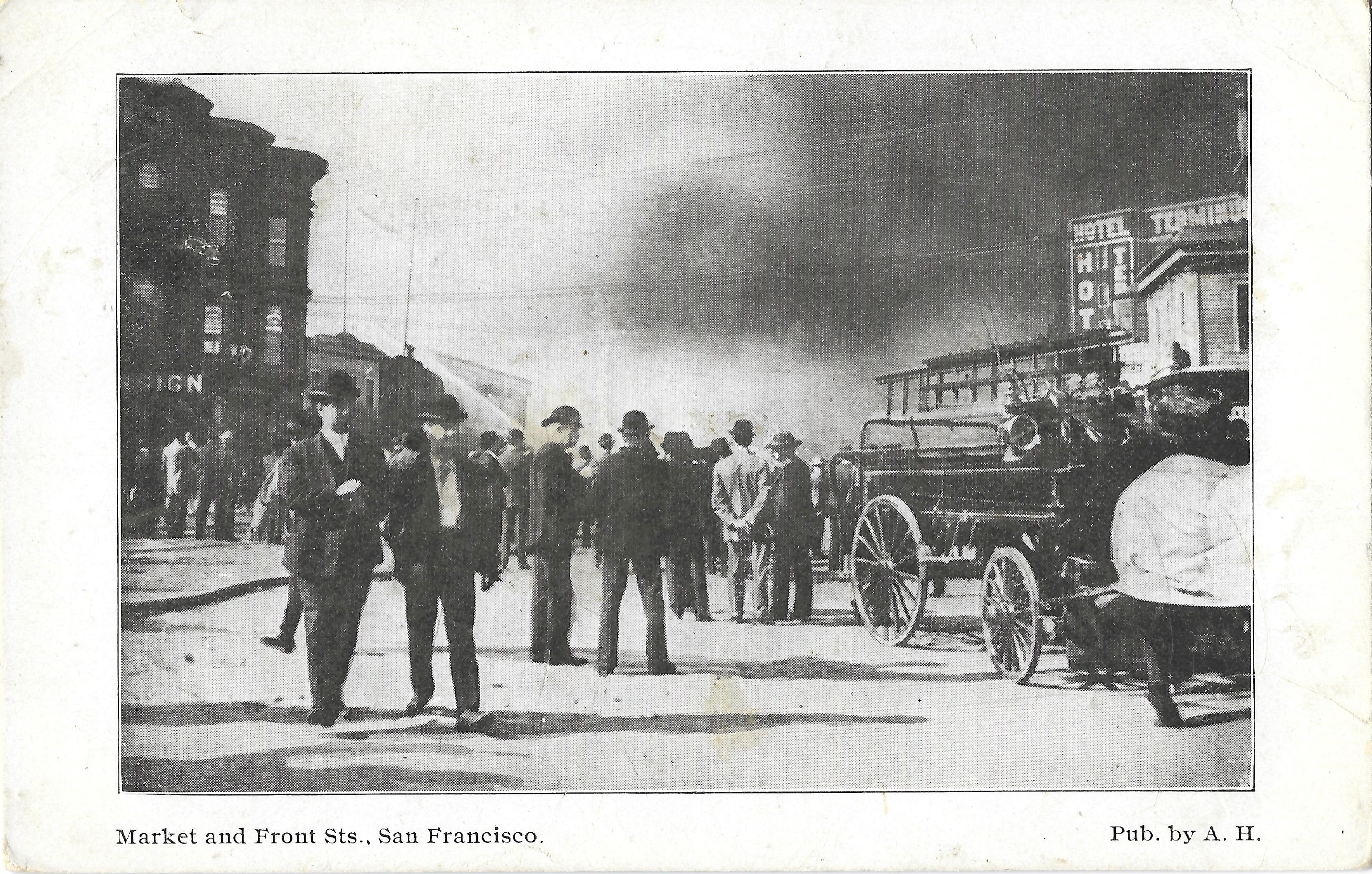
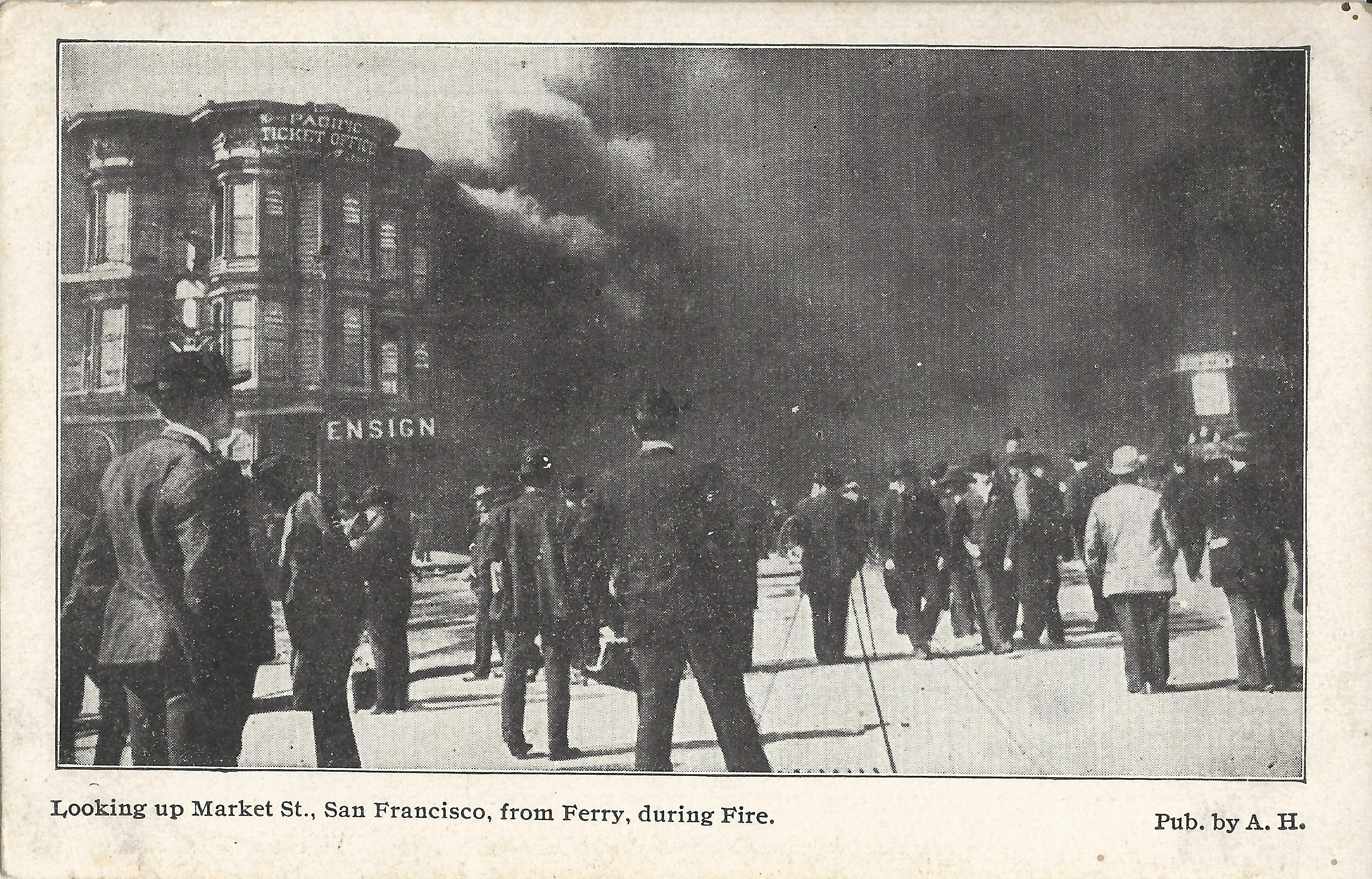
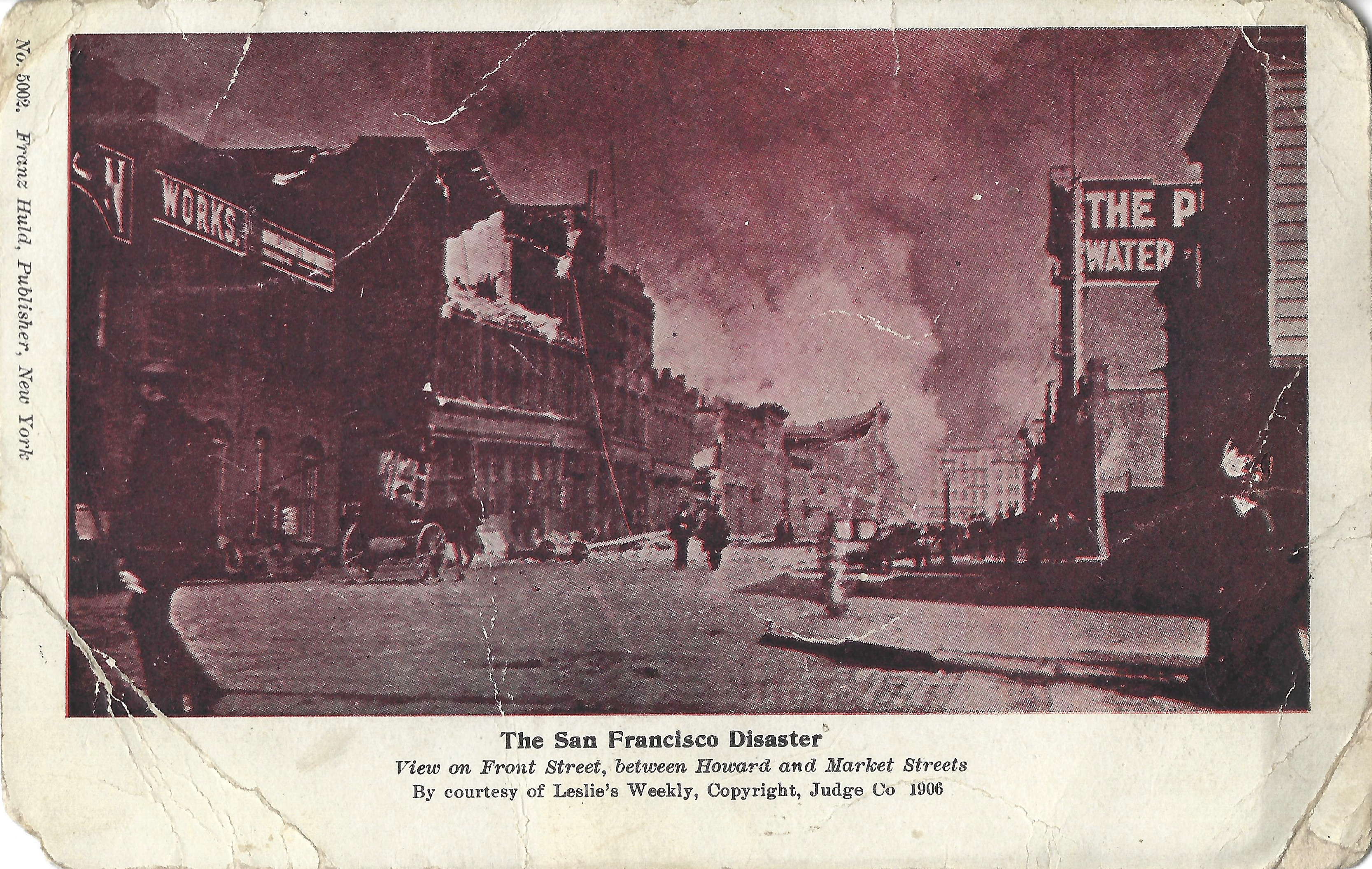
These cards show locations near the Ferry Building during the early hours of the fire. The Ferry Building suffered earthquake damage but did not burn in the fire.
- A.H. looks west on Market from the Ferry Building (at East Street, now Embarcadero; Market/Front per caption is incorrect). A hose from a fireboat at the Ferry Building supplies water sprayed toward a fire near Mission/Steuart.
- A.H. shows the same scene very slightly later, with more smoke. Left: Ensign saloon and Pacific Ticket Office at 2 East. Buildings opposite the Ferry Building burned before noon.
- Huld 5002 looks NE on Main (not Front per caption) from Howard toward Market. It shows rubble and collapsed buildings, smoke in distance, no firefighters. Left: National Iron Works. Right: Pelton Water Wheel Company.
 |
 |
 |
 |
 |
 |
 |
 |
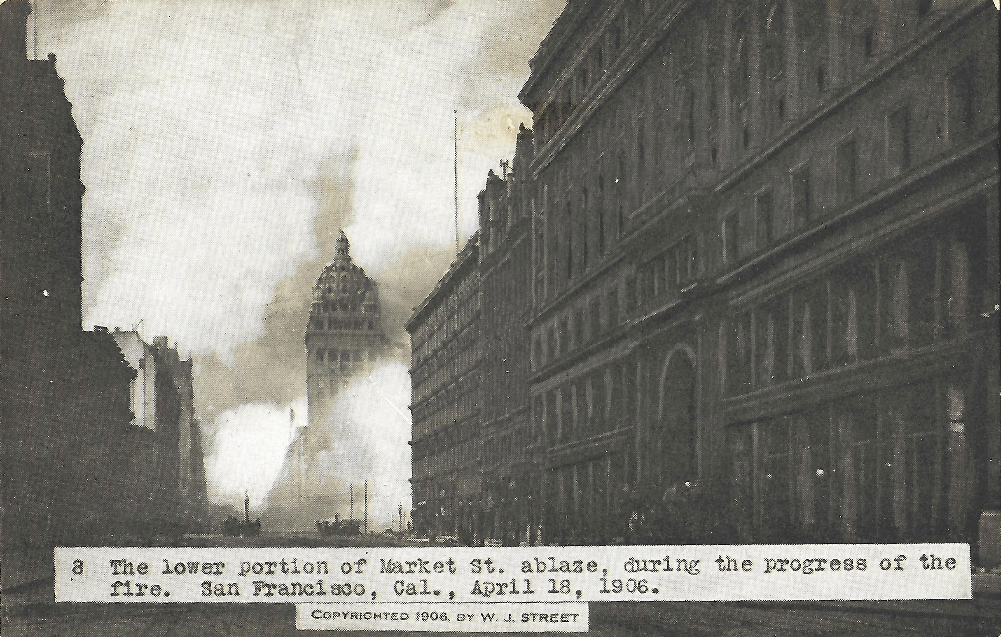
These cards show the fire near the Call Building within a few hours of the 5:13am earthquake.
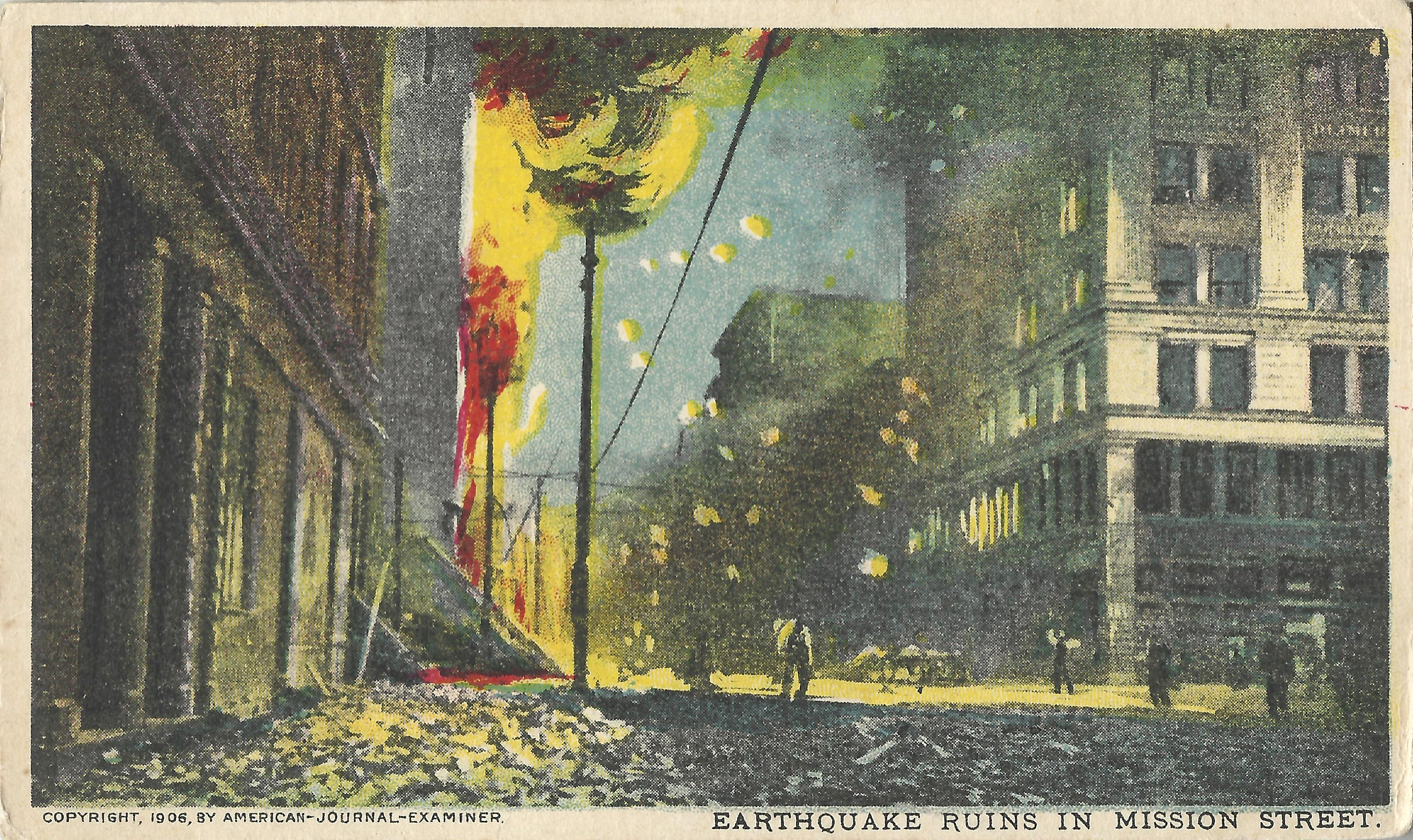
- Huld 5001, postmarked NY 5/13/1906 (about a month after the quake), is captioned "Doomed Grand Opera House in Flames". It credits Leslie's Weekly and indicates © Judge 1906. It looks southwest on Mission from 3rd ca. 9:30am. The Aronson building (west corner 3rd/Mission) is at right, with smoke pouring from the collapsed and burning Grand Opera House just beyond it. Enrico Caruso sang Carmen at the Grand on the previous evening; by the time of this photo, he was at Union Square with other refugees (see below). A fire from 282 Natoma (near 4th) reached the Grand Opera House by 9:30am.
- NY Sunday American shows an awkwardly colorized version of the same image, captioned "Earthquake Ruins in Mission Street" and published in Hearst's NY Sunday American & Journal, © American-Journal-Examiner. Hearst newspapers across the US published poorly printed souvenir cards showing the earthquake and fire.
- is taken a block away from the previous card, looking southeast on 3rd from just below Market. Left: north corner Stevenson/3rd (27 3rd). Right: Winchester Hotel, S corner Stevenson/3rd (44 3rd). The smoke is past Stevenson and Jessie, near Mission. The Grand Opera House, directly behind the Winchester Hotel, is burning but the Winchester is not, so the time must be ca. 10am.
- Weidner 232, postmarked 8/18/1909, is taken a few steps away from the previous card location. Left: Hearst Building; center: Winchester Hotel; right: Call Building. The fire has reached the Winchester Hotel, so this must have been taken soon after the previous card, ca. 10am.
 |
 |
 |
 |
 |
 |
 |
 |
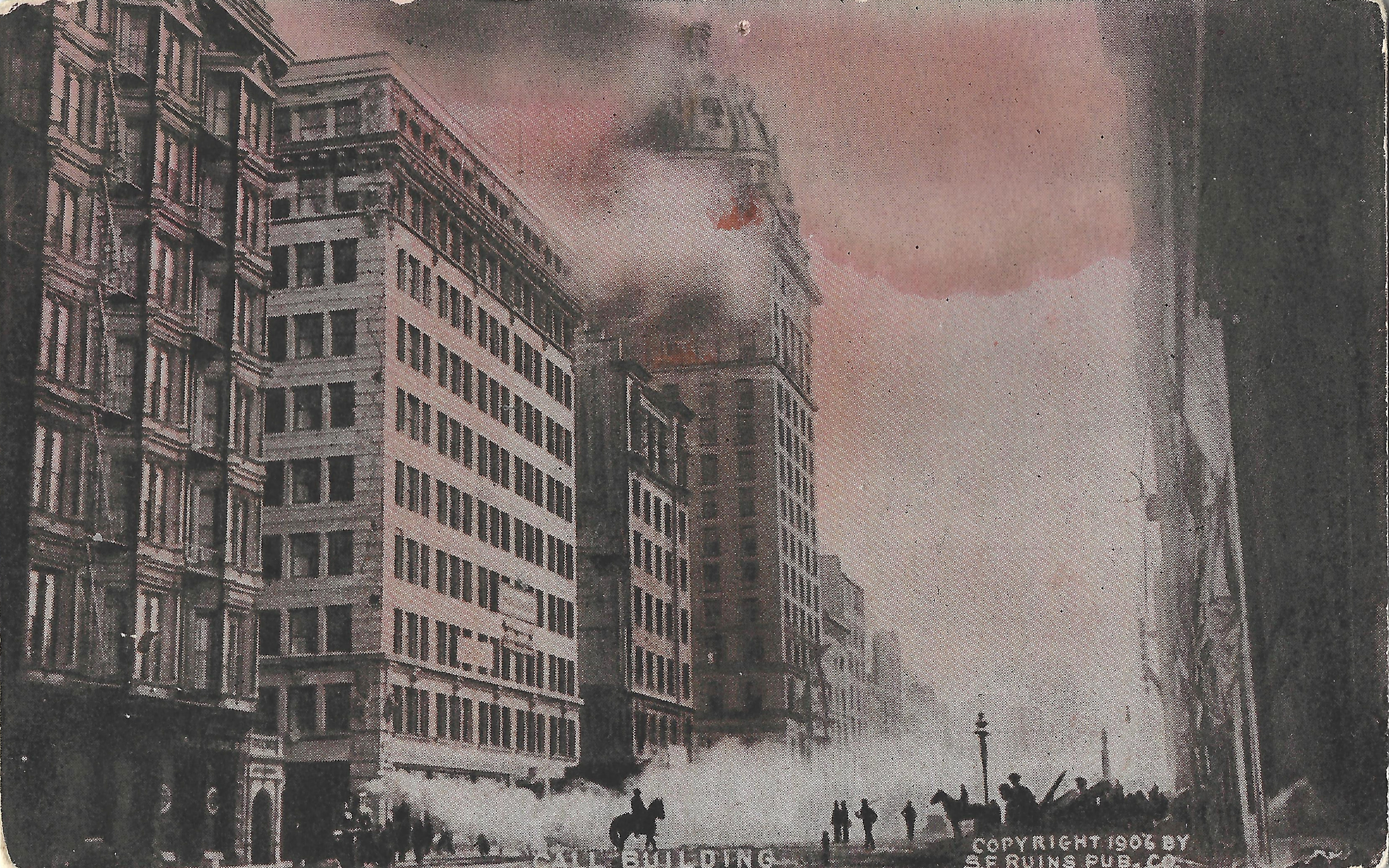
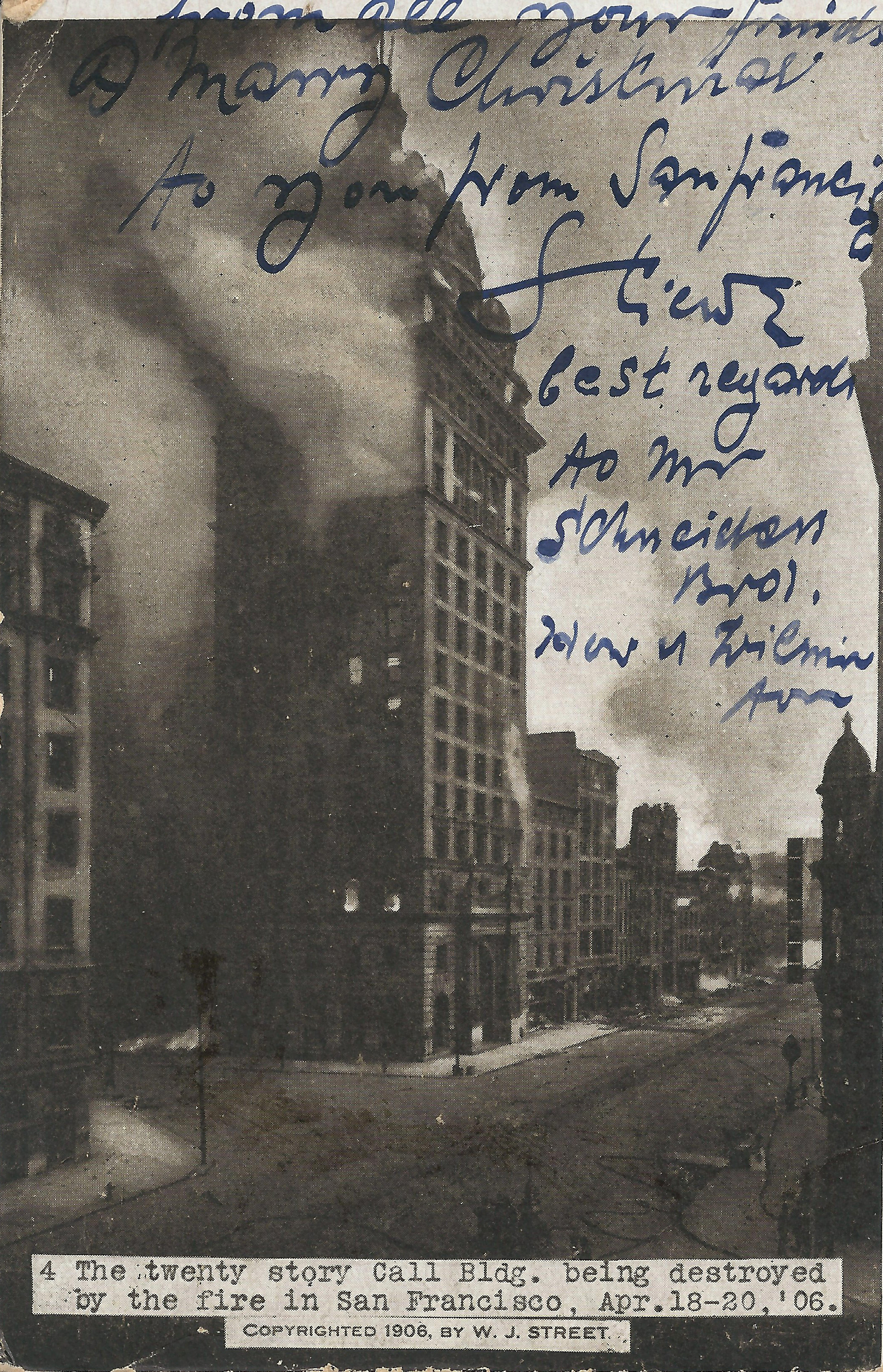
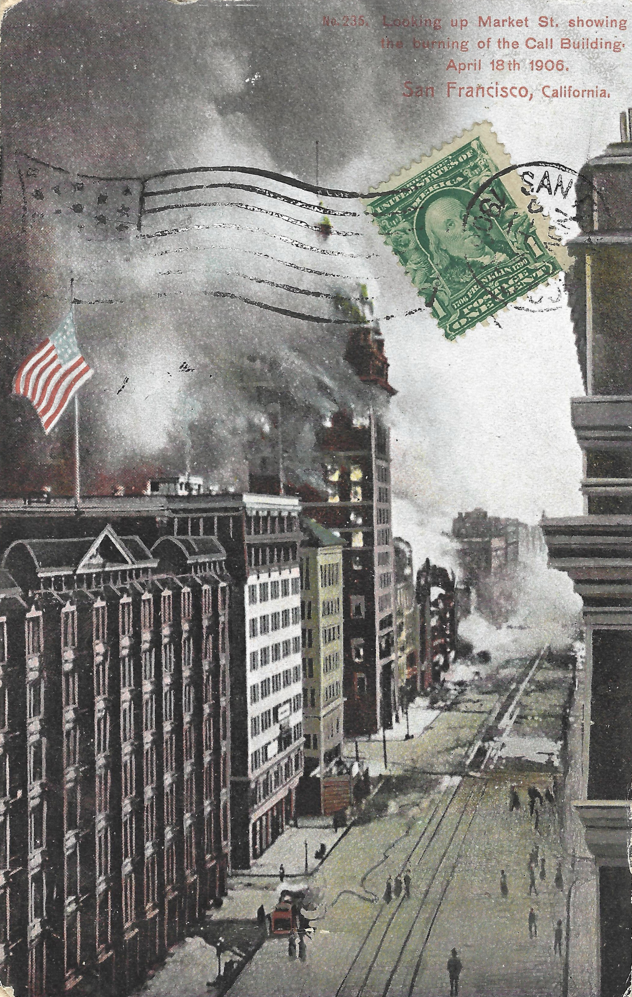
The Call Building burned at about 11am, starting from the upper floors.
- Rotograph looks west on Market from near Geary, with a fire engine at the Palace and dramatic silhouettes of mounted troopers. From left: Palace Hotel, Monadnock, Hearst, and Call buildings, The Palace was defended for hours using a private water supply, but burned by 3:30pm. This shows flames only on the upper floors.
- Rieder 4, postmarked SF 12/24/1906, is taken from closer to 3rd. Fire is visible through several lower windows of the Call. Bottom center: fire engine with nearby hoses, but no visible firefighting is underway; it's hopeless.
- gives a clear view of hoses and firefighters on Market. The card is unaddressed but is postmarked S.F., with postmark date illegible.
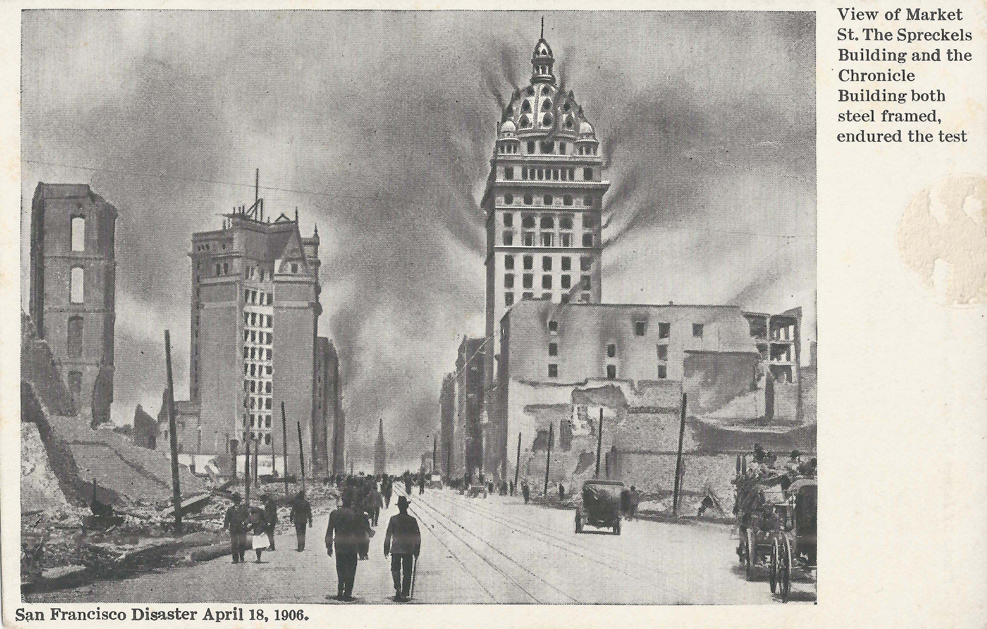
- Doolittle looks east to the Ferry Building from just west of Grant, with smoke added unconvincingly to a post-fire image of pedestrians and cars on rubble-free Market St. Left: ruins of the Phelan Building (still standing in previous). Left center: Mutual Savings Bank near 3rd with the Chronicle Building behind it. The crane atop the Chronicle Annex (next to the Mutual Savings tower) is from construction work in progress pre-quake, not post-quake reconstruction. The Call (a.k.a. Spreckels) and Chronicle both "survived the test", as the caption says, in the sense that they did not collapse, but both suffered major fire damage and the Chronicle had significant structural damage.
 |
 |
 |
 |
 |
 |
 |
 |
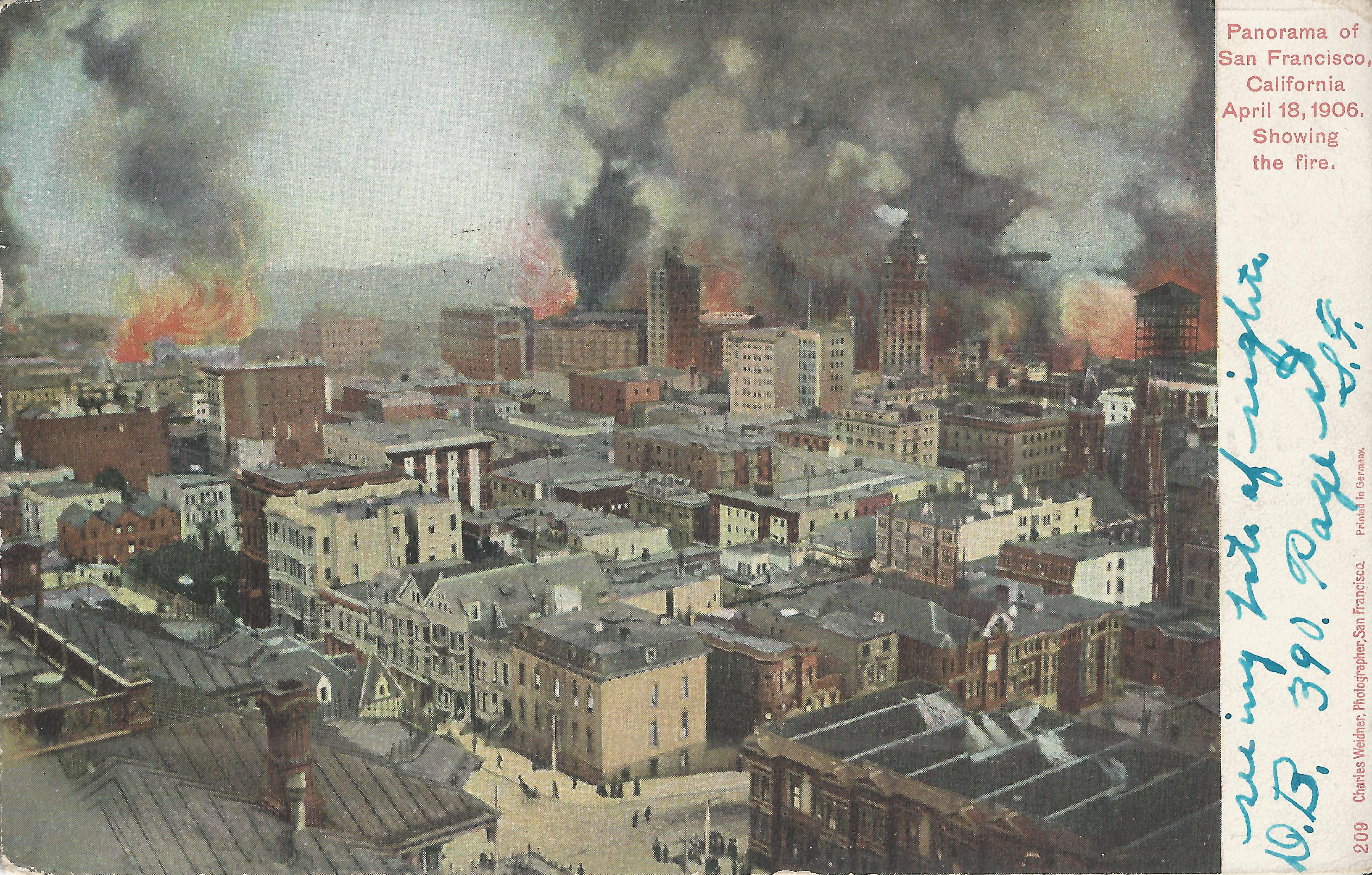
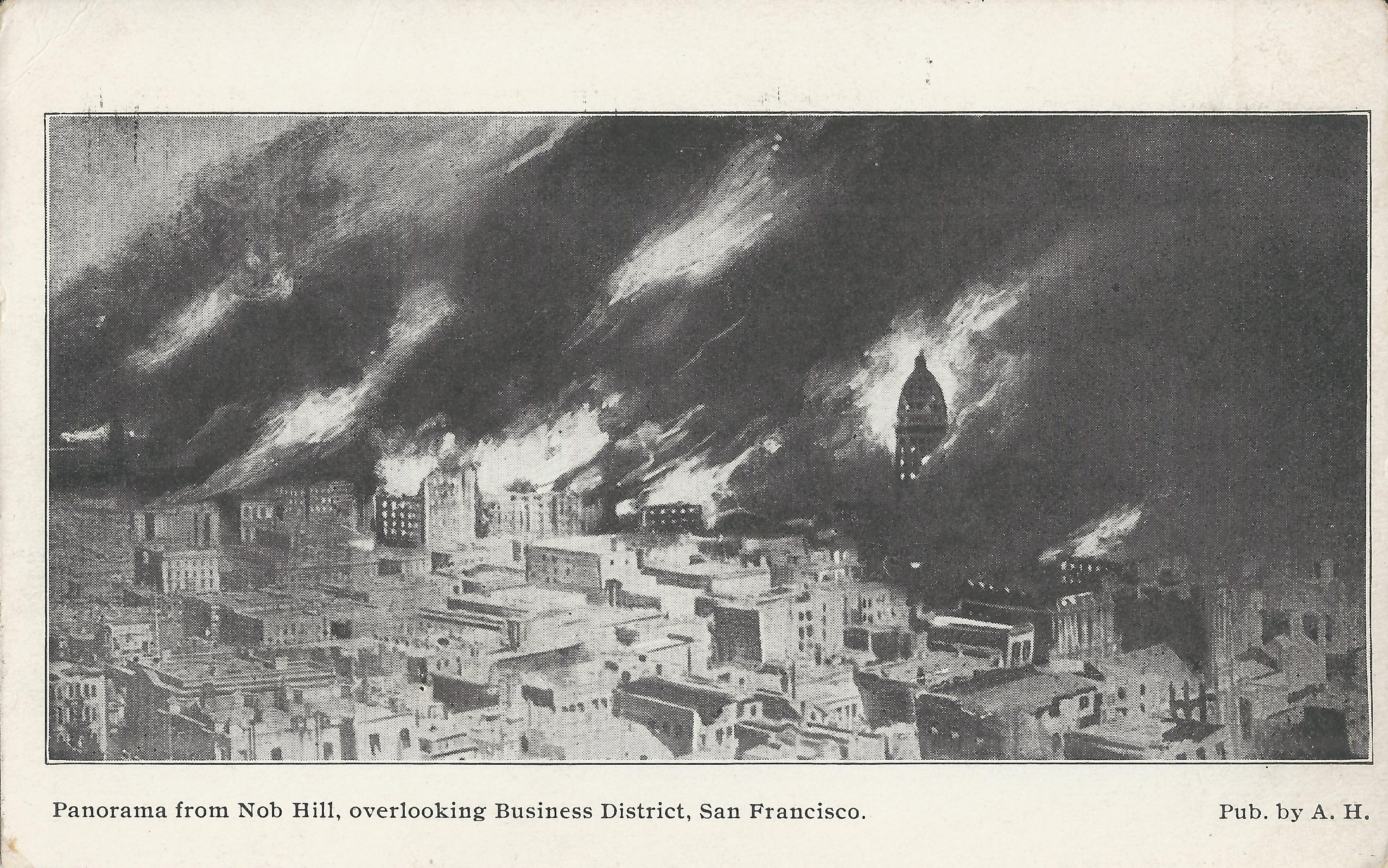
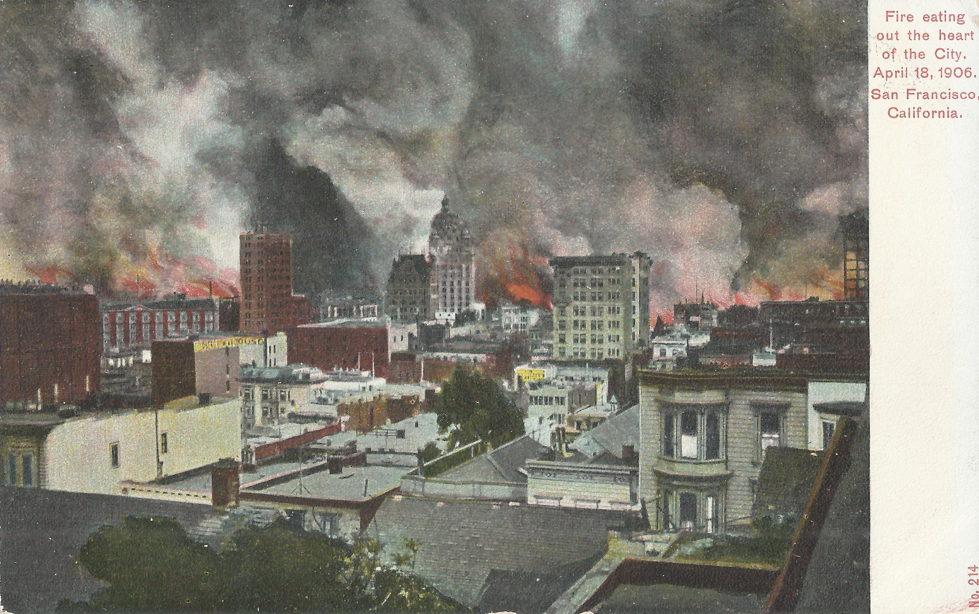
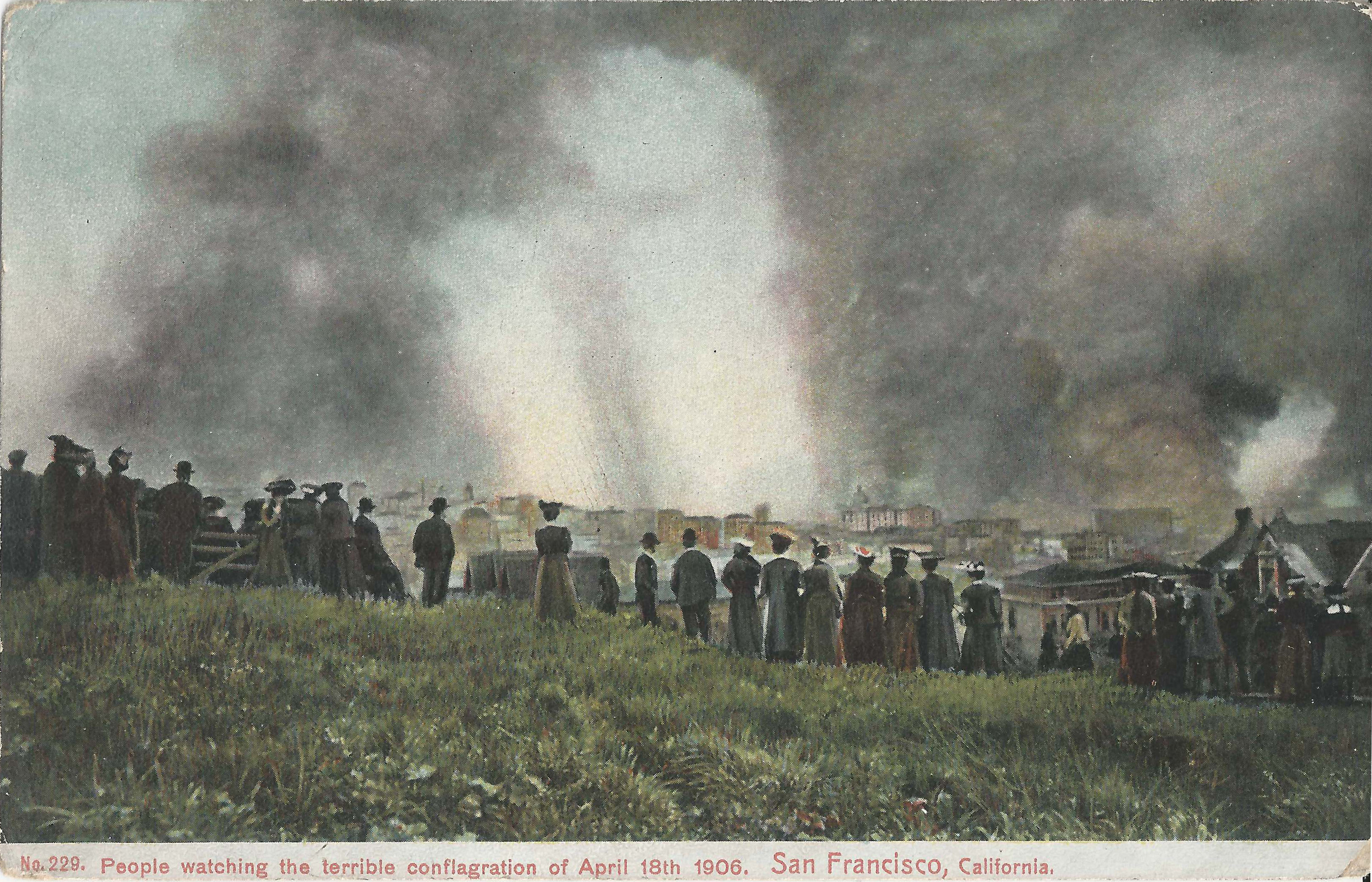
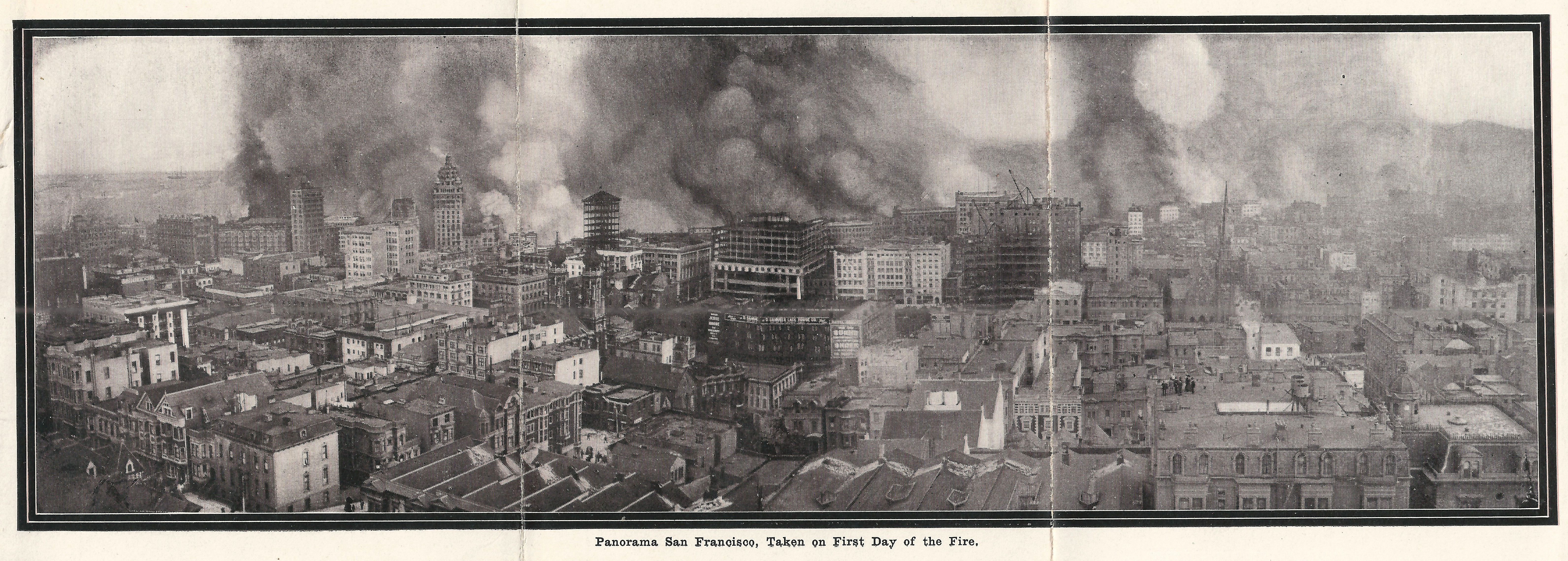
Nob Hill provided spectacular panoramic views of the fires downtown and south of Market. Earthquake/Fire: Nob Hill Panoramas shows more images from Nob Hill, both before and after the fire.
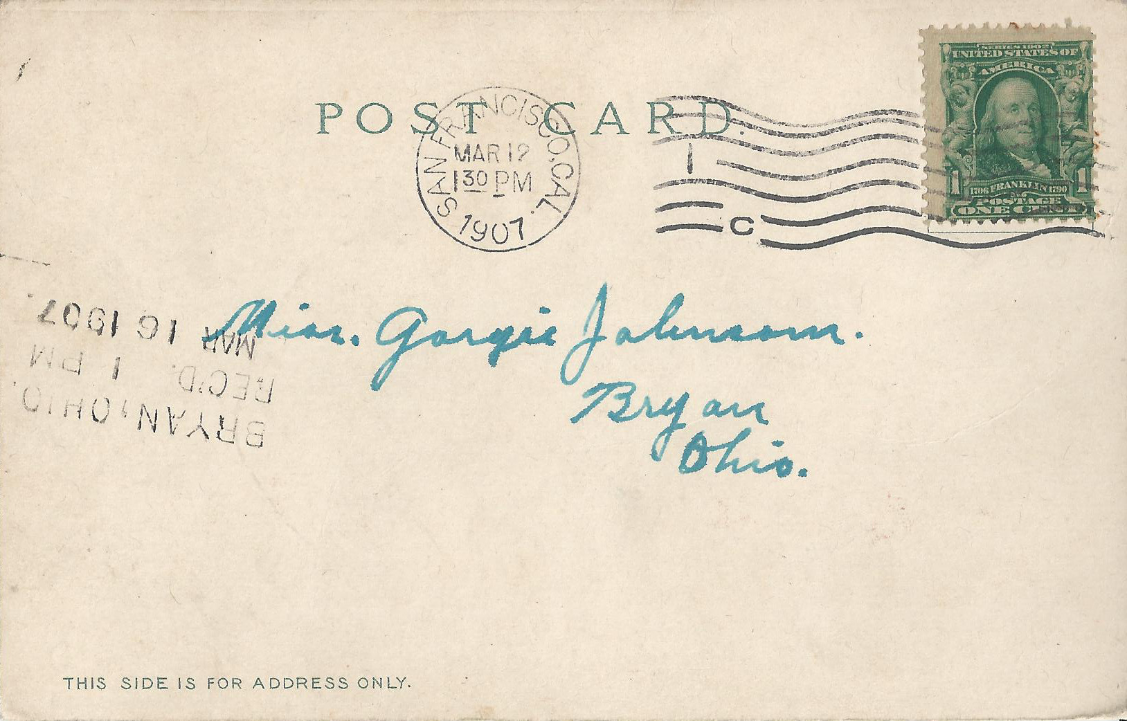
- Weidner 209, postmarked SF 3/12/1907, looks southeast from the terrace of the Mark Hopkins Institute of Art (the Hopkins Mansion, southeast corner of California/Mason) on Nob Hill. Lower left: terrace of the Stanford Mansion (Powell between California/Pine). Bottom center: Pine/Powell, with only a few pedestrians. Right center: Temple Emanuel (Sutter between Stockton/Powell). The image shows multiple separate fires. Fire has not reached the Call building (top right center), so it must be before 11am. Smoke at the left edge is probably from the fire at Mission/Steuart; to its right is the fire at Market/Fremont, with exaggerated flames provided by the postcard artist. The Mission/3rd fire burns behind the Chronicle building, and the Market/4th fire is to the right of the Call.
- A.H. is a drawing showing the distinctive cupola of the Call building dramatically peeking out from the smoke and fire. The postcard artist presumably started from an image resembling the preceding Weidner 209, slightly more tightly cropped. It's doubtful that the artist's smoke and flames correspond to any particular time.
- Weidner 214 looks south to the Call from Sutter between Stockton/Grant. The fire looks more active along Market, but the Call has not burned yet.
- Rieder-Cardinell 6932 shows the same image as Selige 3223, which is the right half of a panorama with Selige 3224; a better quality print appears in a Behrendt postcard folder. Left edge: Powell St. and Union Square. Left center: construction for new wing of the St. Francis Hotel (Powell/Post). Right of St. Francis: spire of First Congregational Church (Mason/Post). Bottom right: mansard roof of The Oliver (southeast corner Pine/Mason), with a half-dozen worried people on the roof watching the fire. Zimmerman shows the same image in more muted colors. The St. Francis burned at 2am on day 2.
 |
 |
 |
 |
 |
 |
 |
 |
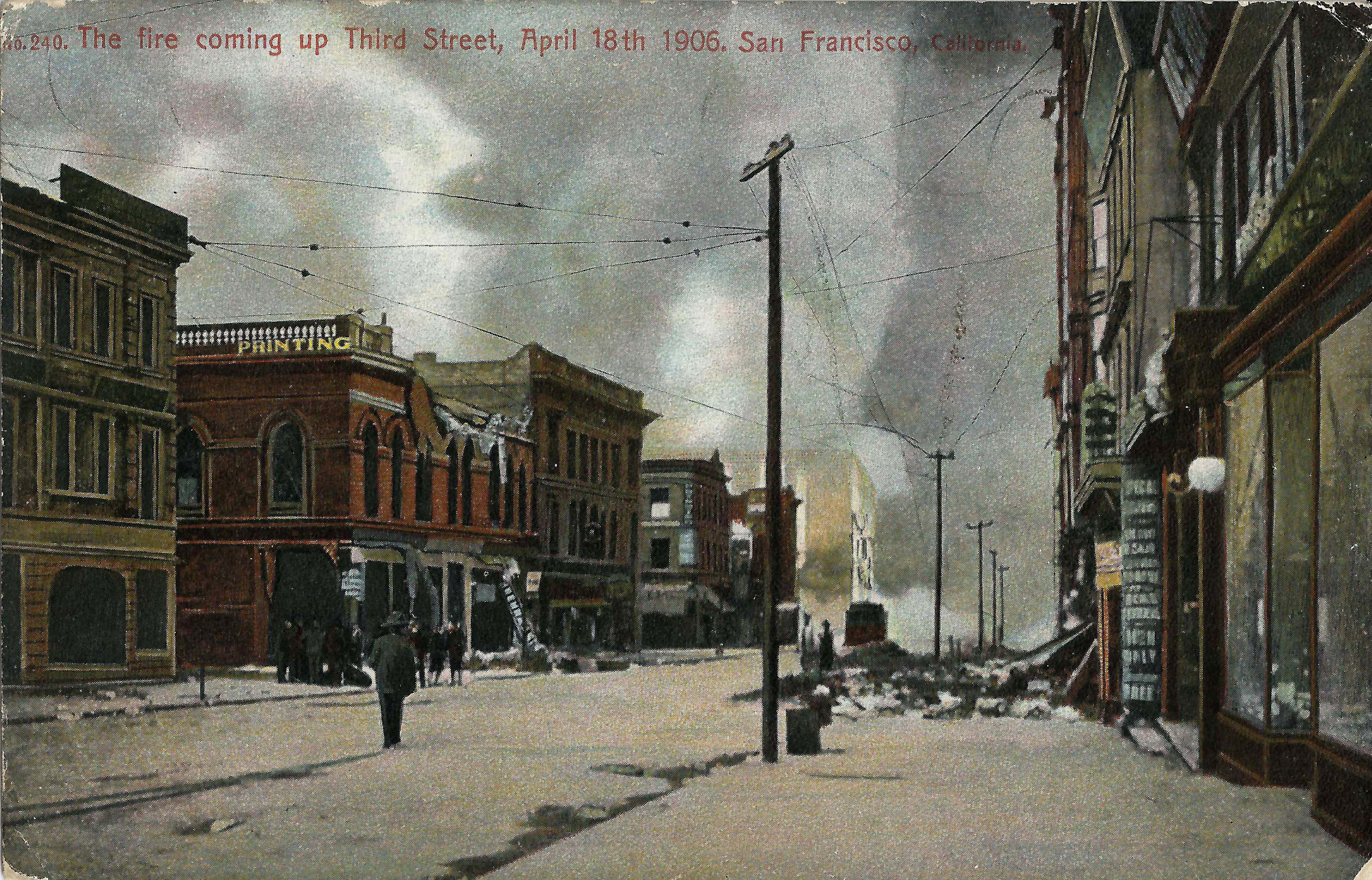
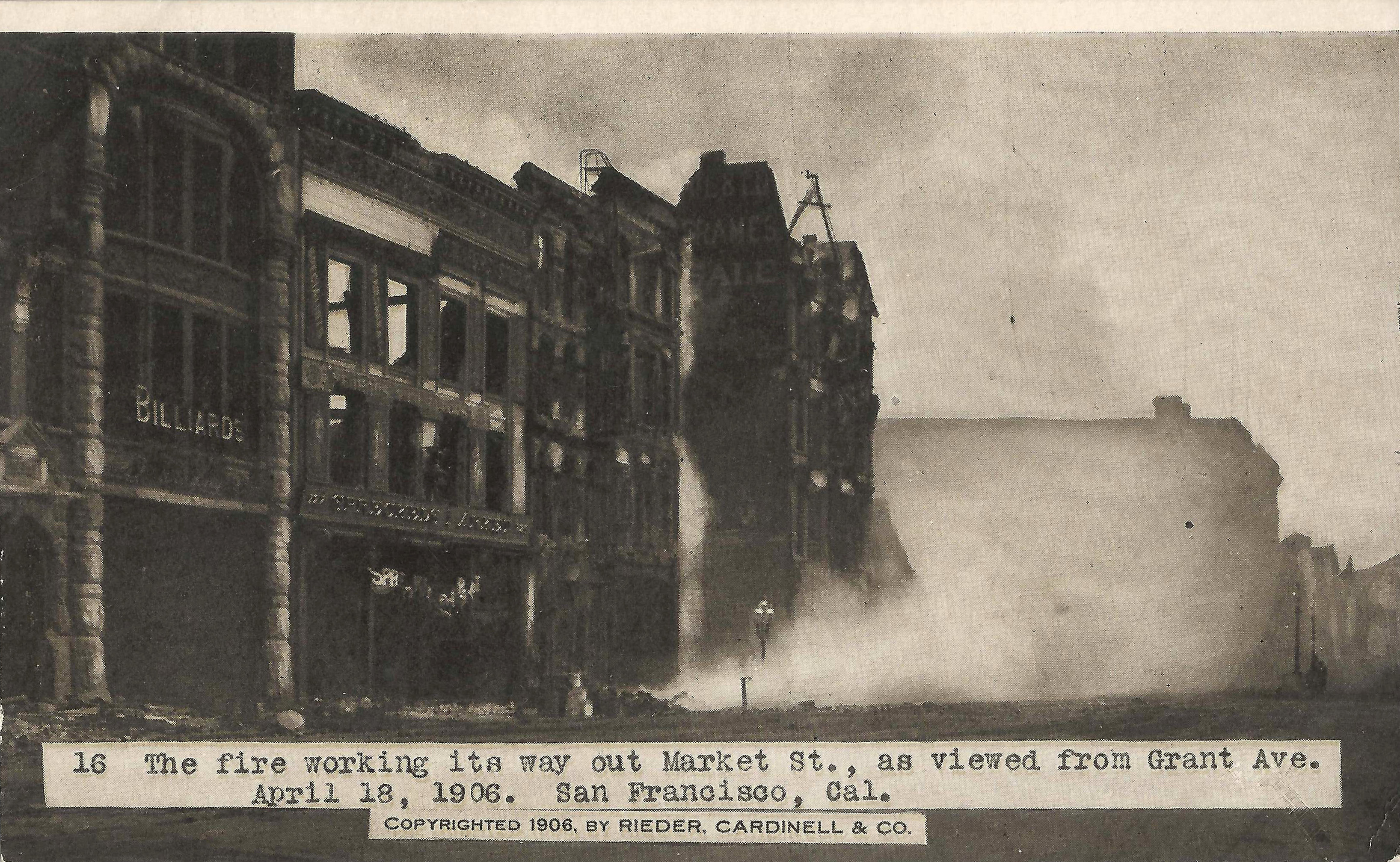
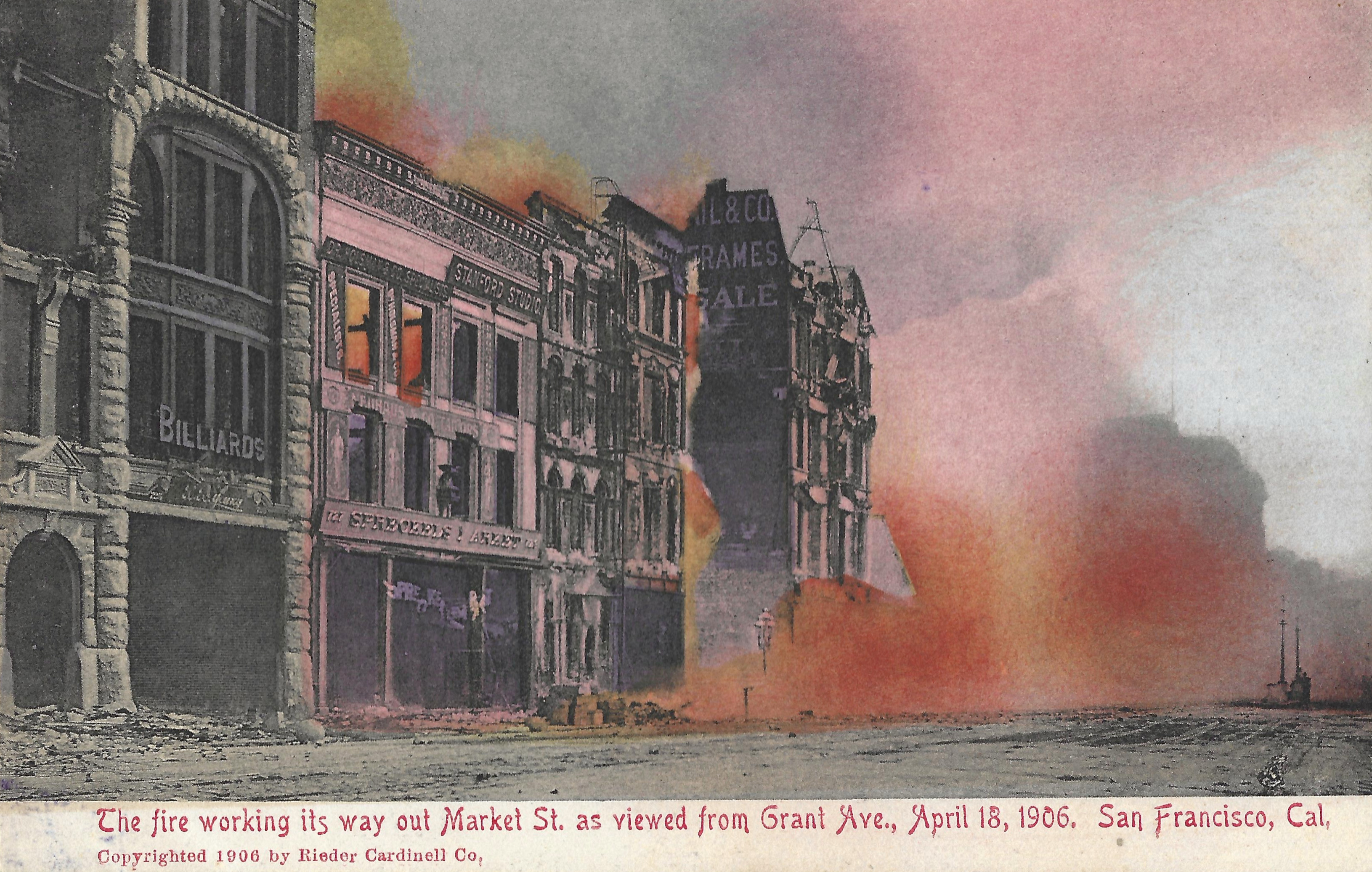
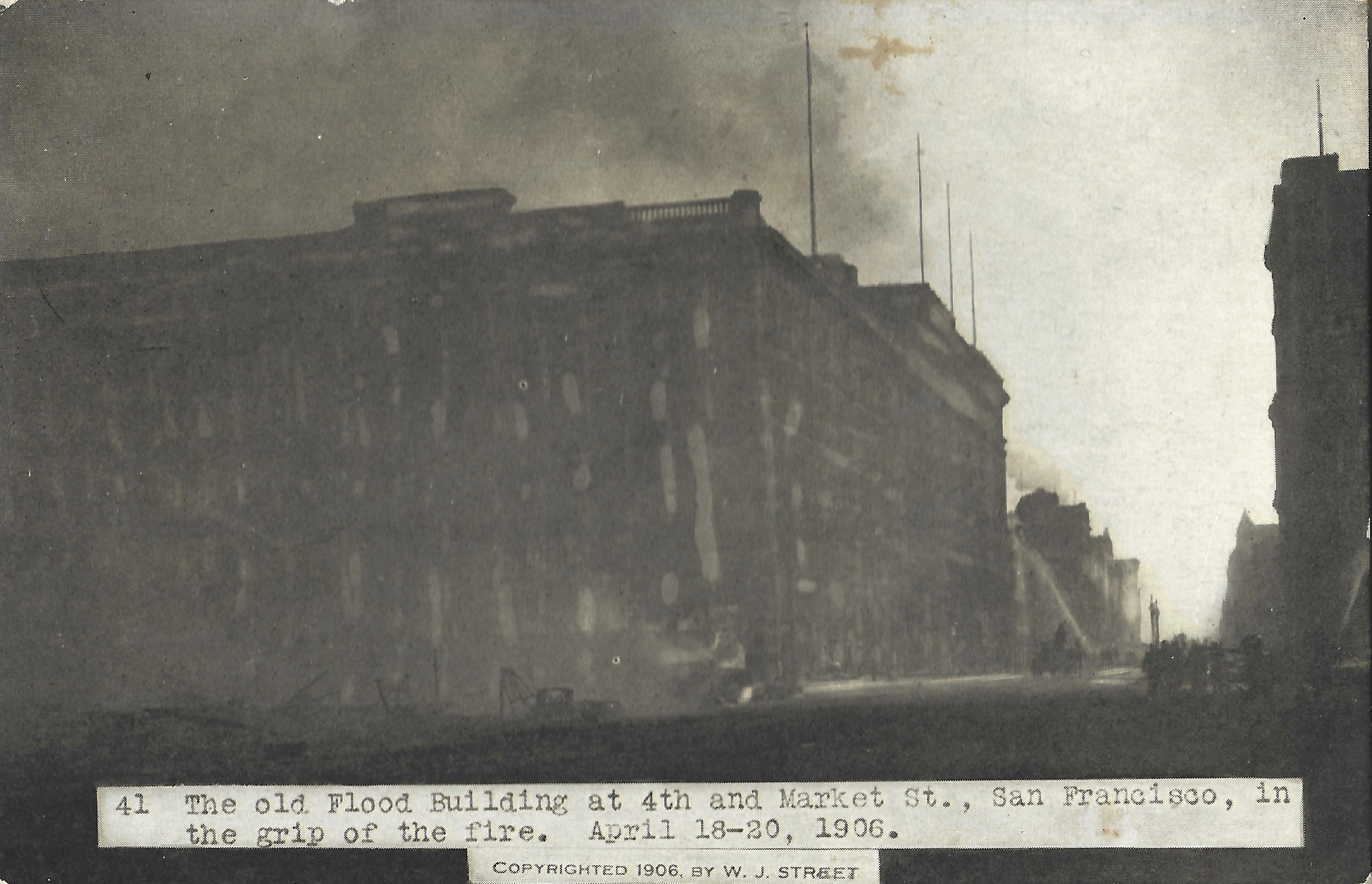
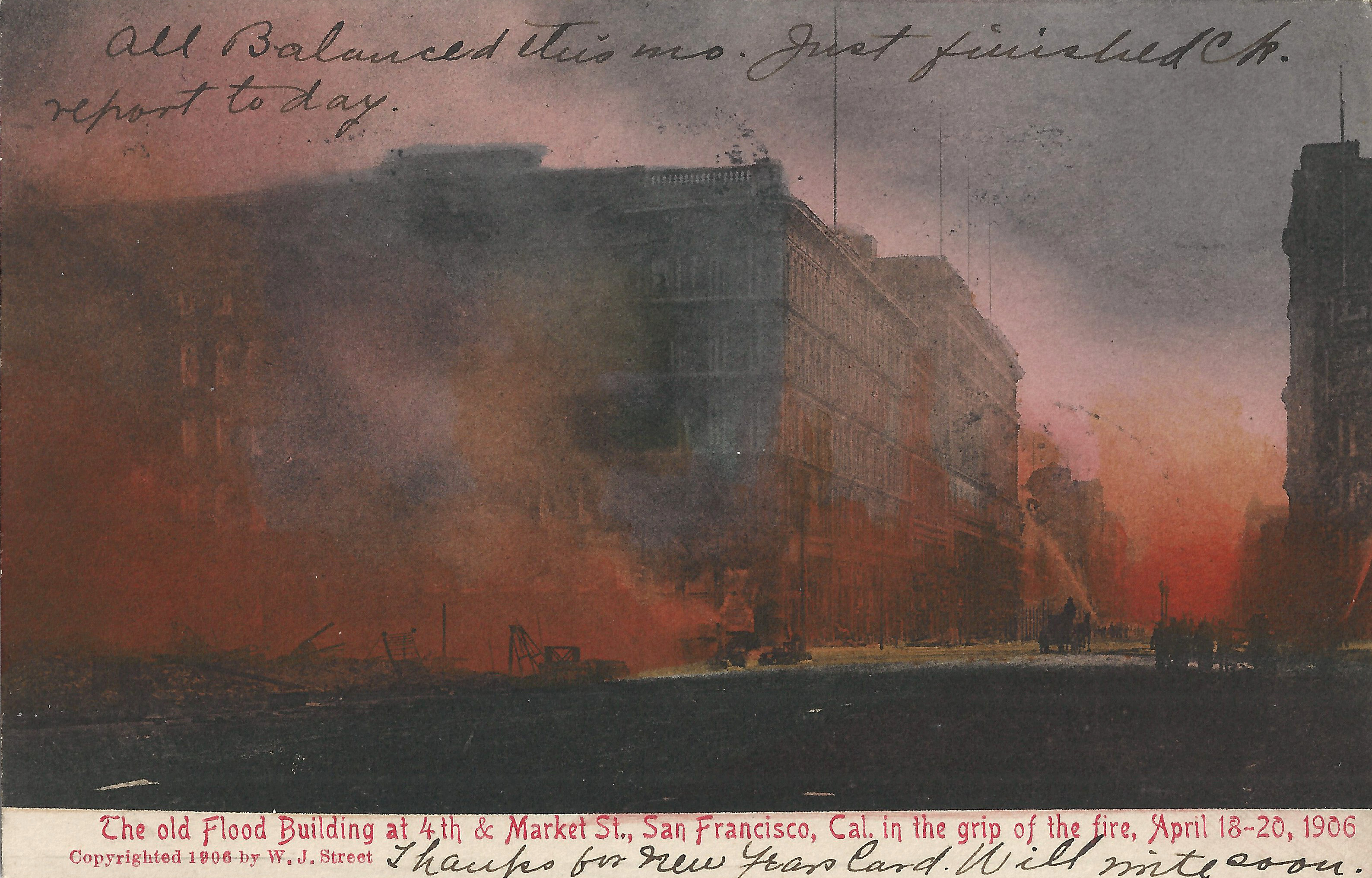
A little further west, these cards by Los Angeles publisher M. Rieder show Market between Grant/5th. The poorly printed b+w cards appeared very soon after the earthquake. Later cards showing the same images were available by early 1907, with added red color and much higher print quality.
- Rieder-Cardinell 16 and
- Rieder 6936 look west on Market toward 4th from Grant, just west of the Call. Left: Morley's Billiard Parlor, 723 Market.
- Rieder 41 and
- Rieder 6950 (postmarked Oakland 1/19/1907) look west on Market from 4th. Center: the Old Flood Building at 4th/Market (not the James Flood Building at Powell/Market). Next to it, a fire engine shoots water at the Academy of Sciences, with the Emporium just beyond, largely obscured by smoke.
 |
 |
 |
 |
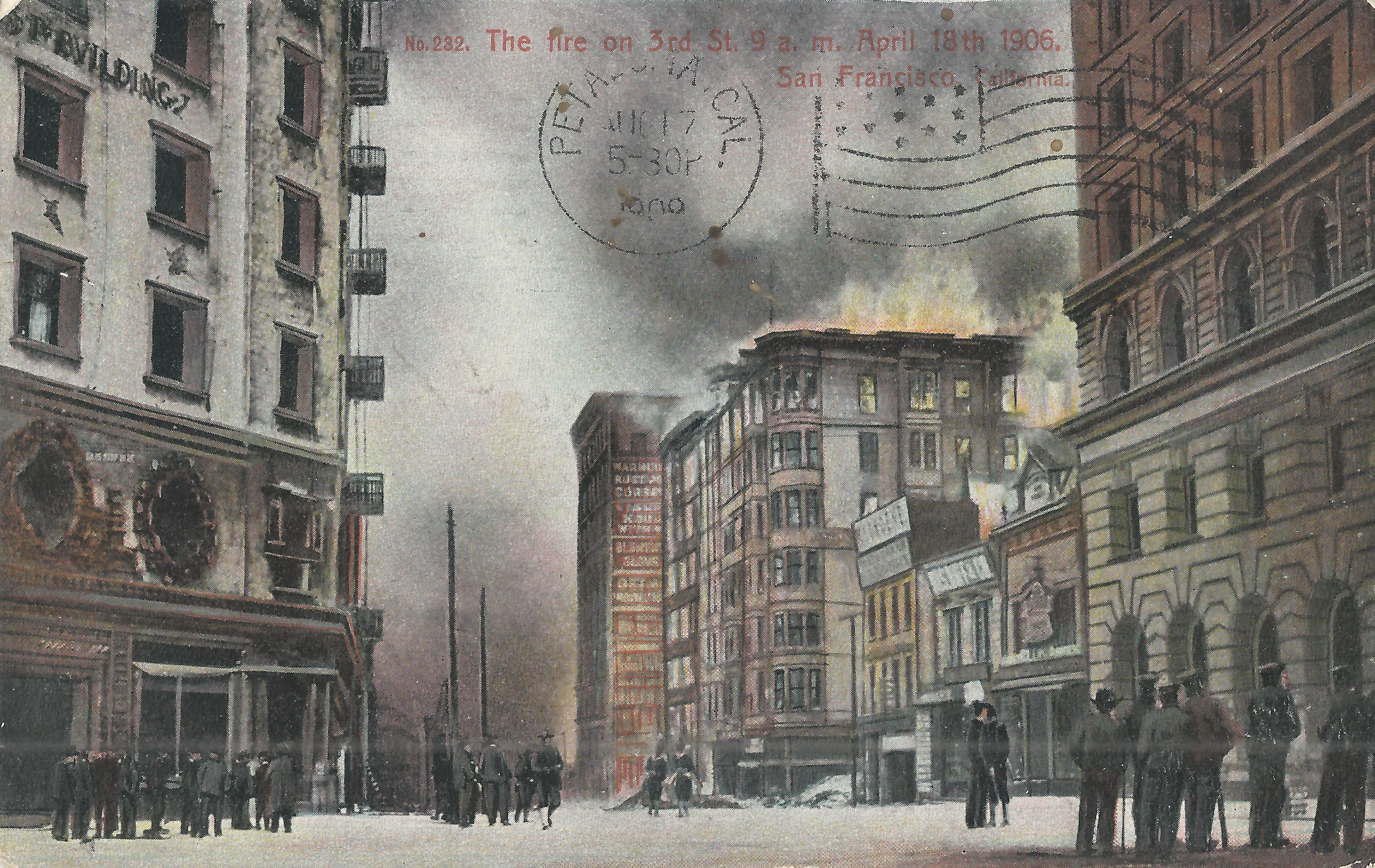
- Rieder 8 looks east on Market toward 4th from between 4th/5th. From center: Call, Old Flood, Academy of Sciences, Emporium. A fire engine is on north side of Market near the Old Flood. The smoke between the Old Flood and the Call looks very much like the smoke in Rieder-Cardinell 16, here seen from the other side. The Call is surrounded by smoke but not burning yet.
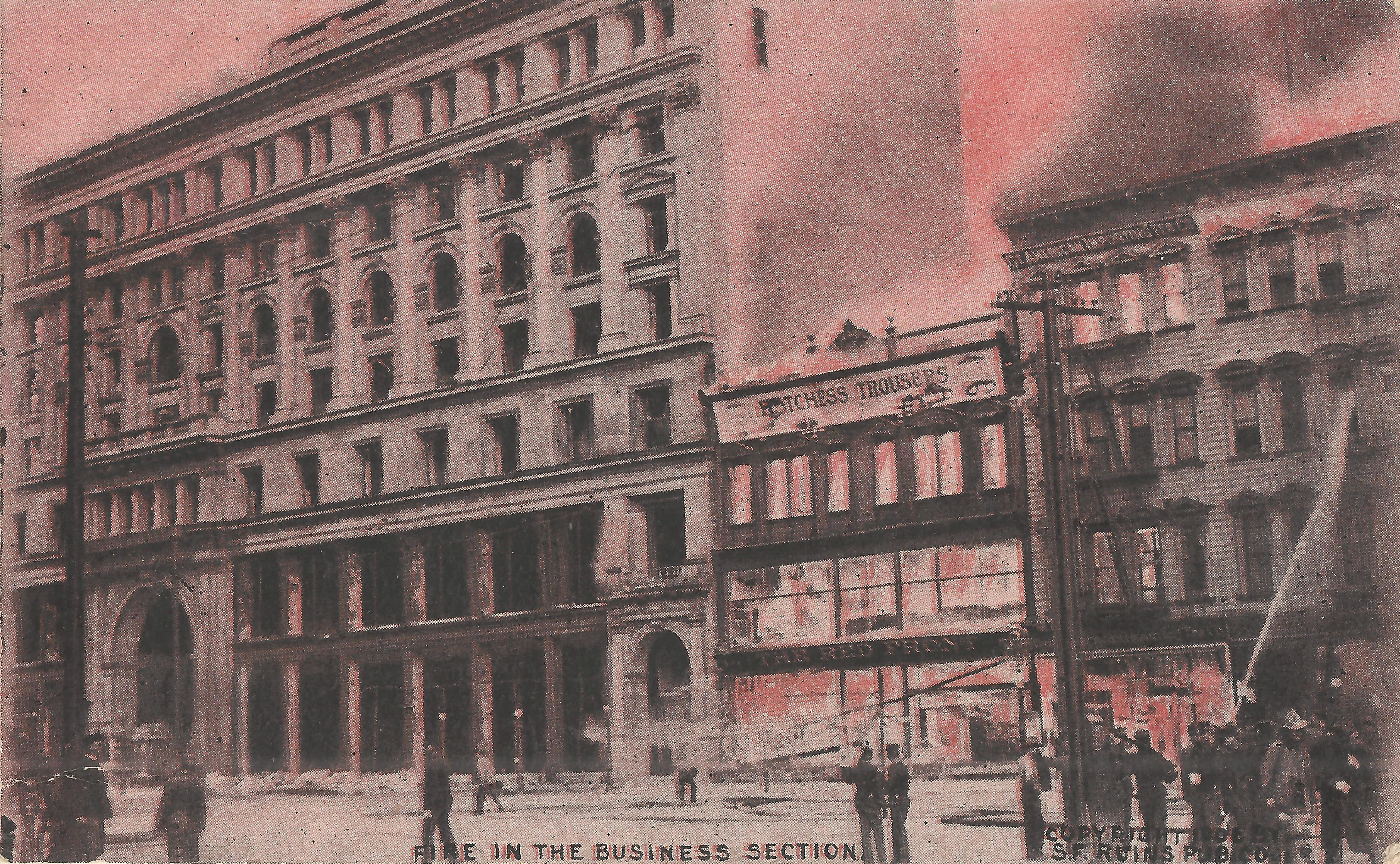
- Rotograph, postmarked Portland ME 6/06/1906, from just past the preceding. Left: Emporium. Center: Red Front ("Matchless Trousers)", 857-859 Market; pants on fire! Right: firefighters spray water on 861/863 Market.
 |
 |
 |
 |
 |
 |
 |
 |
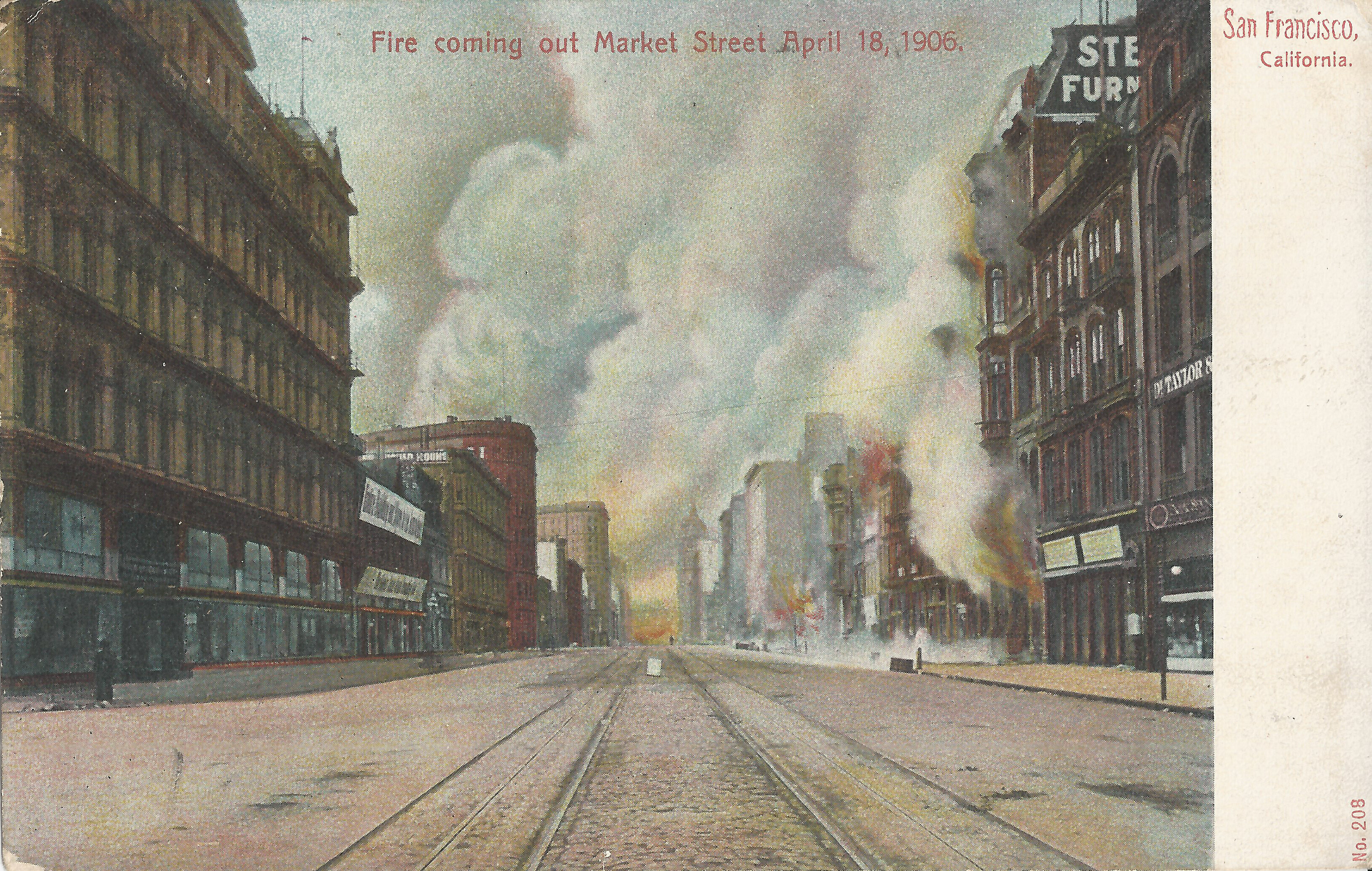
Continuing west on Market, these cards are from between 6th/7th.
- Weidner 208 looks east on Market towards the Ferry Building from Jones (between 6th/7th), Left: Prager's department store (1238-1250 Market), still intact, seen later on Mitchell 146 below. Center: Fire many blocks away obscures the Ferry Building but has not reached the Call yet, so it must be before 11am. Right: Smoke pours out of Sterling Furniture (Rosenthal building, 1039 Market). Market St. is empty: two lonely pedestrians in many blocks, no firefighters.
- Rieder-Cardinell 6935 looks east on Market from slightly west of Mason, probably a few hours later than the previous card. Left: a fire engine with hoses on Market and water spraying in the air. Immediately to its right is the Admission Day Monument (a.k.a. Native Sons Monument, a.k.a. Phelan Fountain) at Market/Turk/Mason with the Flood Building a block past it at Powell. Center: dim outlines of the Call and the Emporium, largely obscured by smoke. Right edge: The Wiley B. Allen Piano Co. (931 Market) has burned already and the frame buildings immediately east of it are gone.
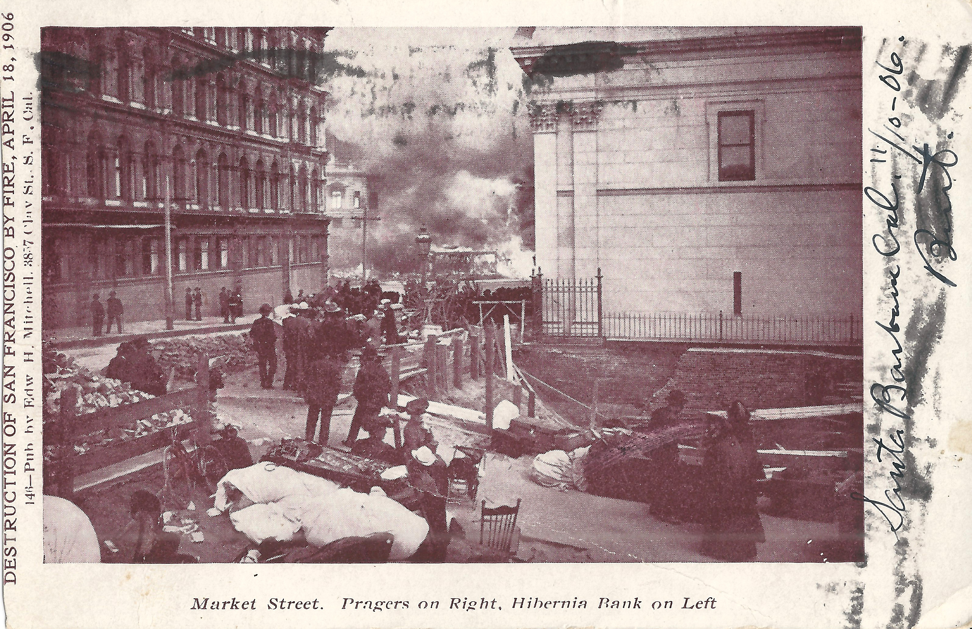
- Mitchell 146, postmarked Santa Barbara 12/09/1906, looks south on Jones toward Market, with the back of the Hibernia Bank at 1 Jones (Market/Jones/McAllister) at right; Pacific Novelty 645 shows a colorized version. The buildings are largely intact after the earthquake and before the fire has reached them. The space directly behind the bank is under excavation to build an adjoining office building, and residents gather with piles of their belongings as the fire consumes the south side of Market. This must be in the afternoon or early evening of day 1. The caption is incorrect: Prager's is on the left, Hibernia Bank is on the right. The south side of Market was burning to 7th by 1pm.
- Unknown publisher shows "Jones Street Burning", though the smoke appears to be supplied by the postcard artist. Compare the post-fire Prager's building to the previous cards; it withstood the earthquake with little damage but was ruined by fire. See Earthquake/Fire: Hibernia Bank for additional details.
 |
 |
 |
 |
In Hayes Valley, on Hayes just east of Gough, the "ham and eggs" fire was started around 9am by a woman cooking breakfast for her husband on a stove damaged by the earthquake.
- Unknown publisher looks east on Grove from the northeast corner Grove/Laguna. This view shows the ham and eggs fire at Grove/Gough ca. 1pm. It progress to the north was stopped at Octavia, but it continued to burn east until it reached Mechanics Pavilion at 1pm and the Larkin wing of City Hall by 8pm. The 4/19/1906 date in the caption is incorrect.
- Mitchell 748 looks northeast from the tower of Sacred Heart Church (southeast corner Fell/Fillmore), with distant Nob Hill far left, Simpson Memorial M.E. Church (southeast corner Hayes/Buchanan) lower center, City Hall dome middle, Fell St. at right. In addition to the distant downtown fires, the image shows a large fire at Buchanan/Golden Gate (left) and the Hayes/Gough ham and eggs fire (right), which has not yet crossed Van Ness.
 |
 |
 |
 |
 |
 |
The ham and eggs fire crossed Van Ness and reached the Larkin wing of City Hall ca. 8pm.
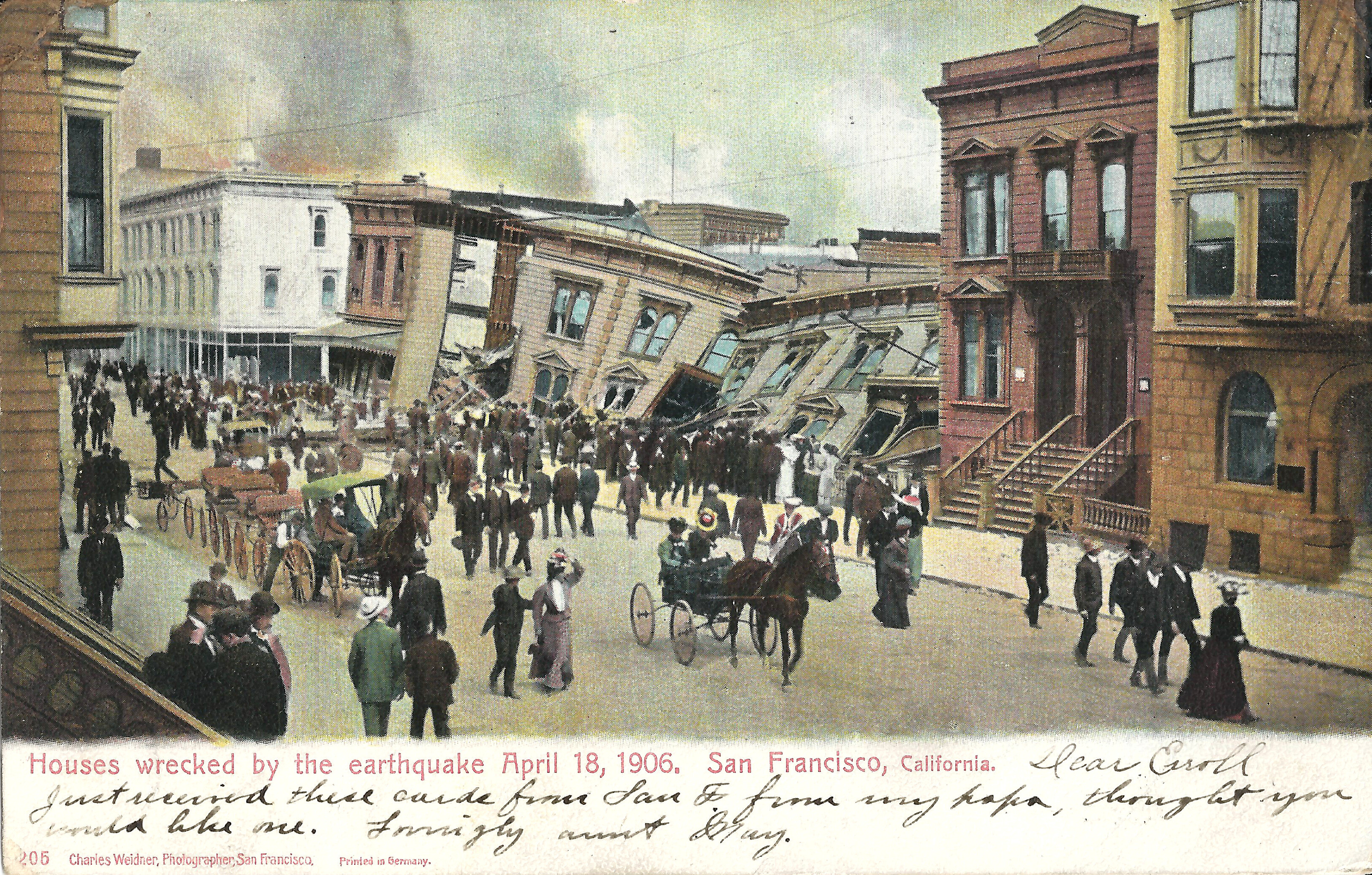
- Weidner 205 shows residents fleeing from the approaching fire while others cluster around the collapsed houses on the south side of Golden Gate (309/311 and 313/315) between Hyde/Larkin, just a block from City Hall. The steeple of the Odd Fellows Hall at 7th/Market peeks out above the white house at left; it shows more clearly in a similar view.
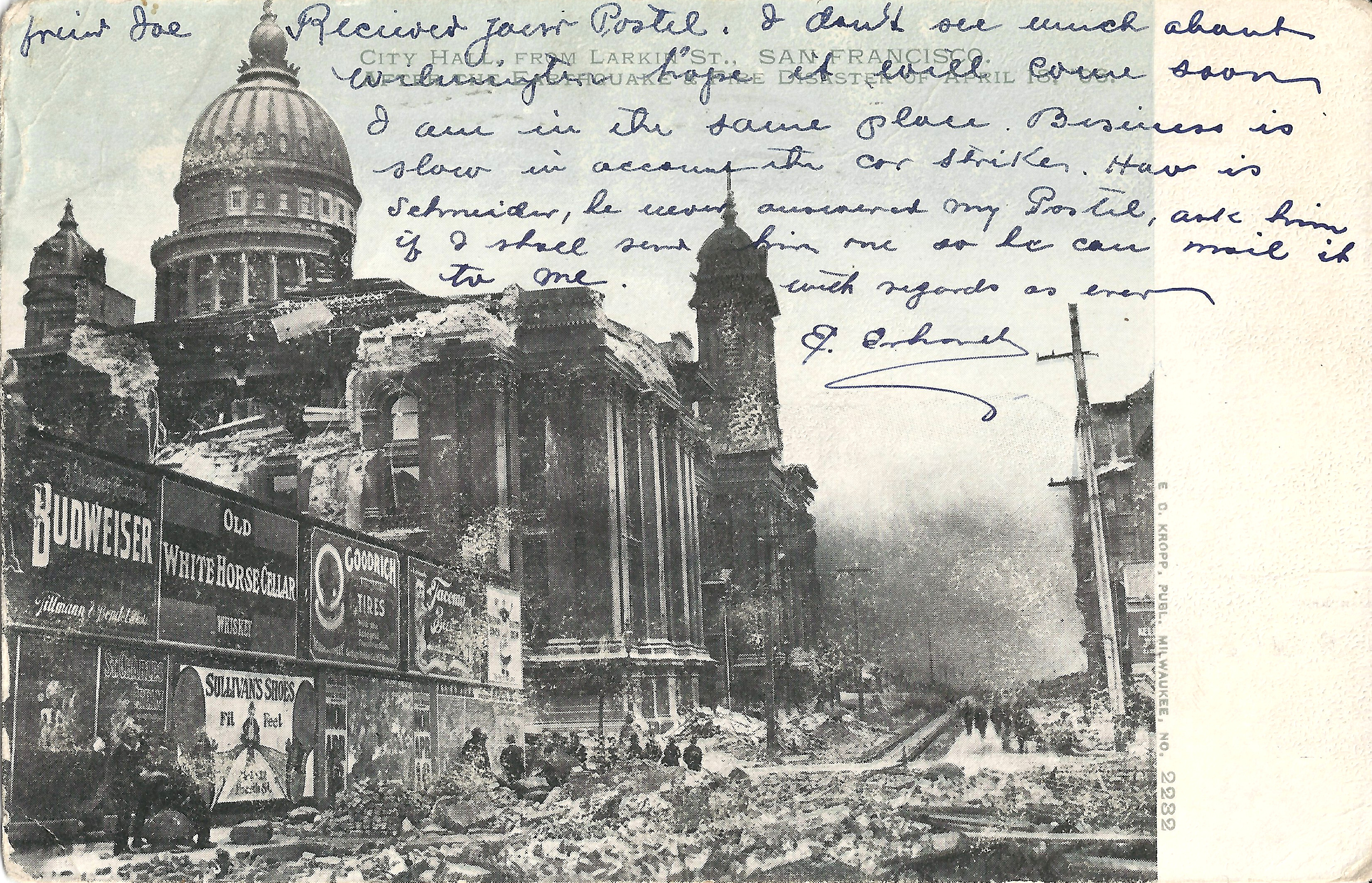
- Kropp 2232 looks south on Larkin from just north of McAllister with smoke billowing near Market. The billboards at left are intact, so the fire has not reached City Hall yet.
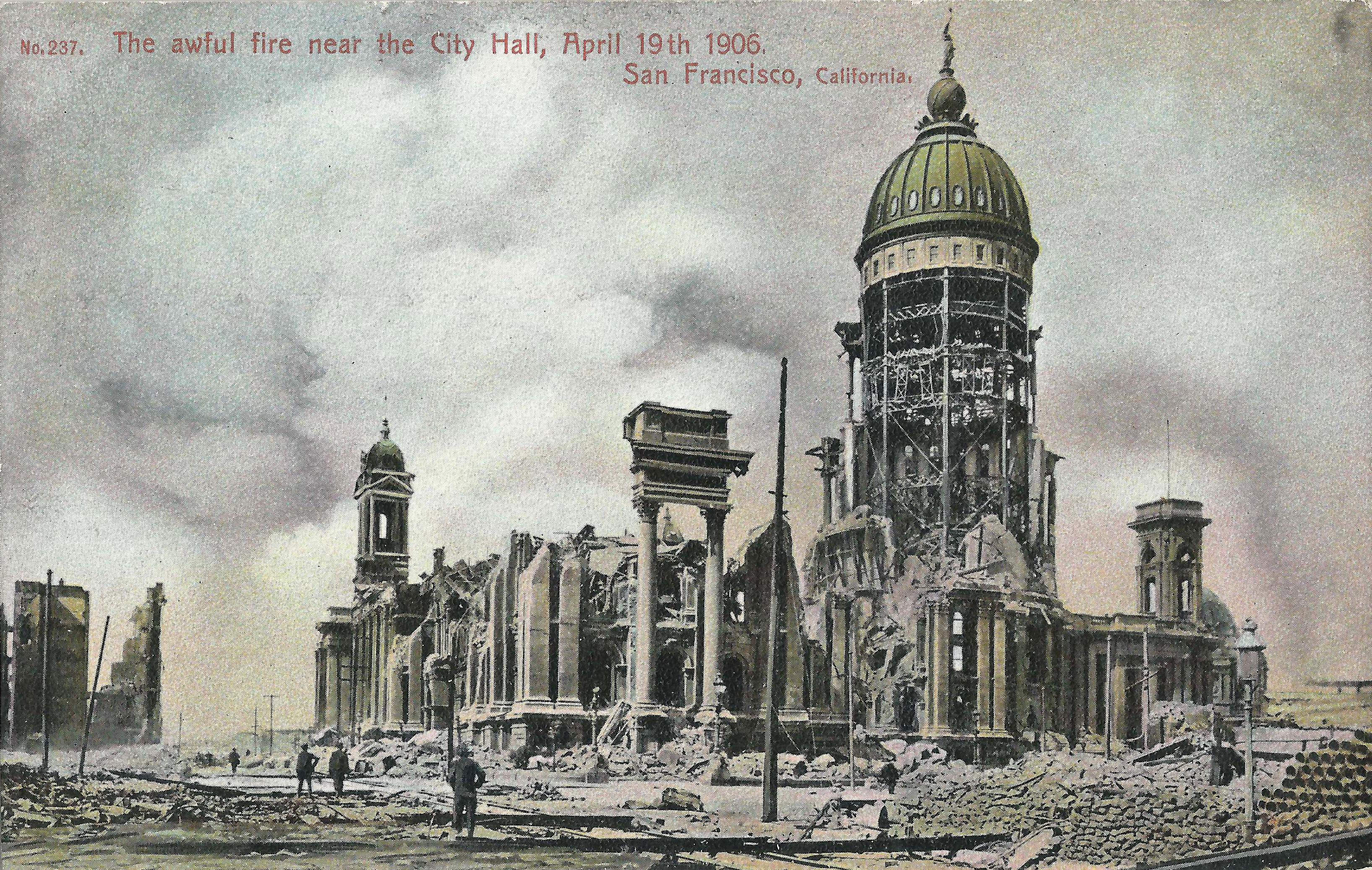
- looks north on Larkin from Grove. The fire has consumed City Hall and continues to burn north on day 2. Unless the photo is doctored, the large stacked pile of pipe at right must be from pre-quake construction at Larkin/City Hall Ave. rather than from post-quake recovery (compare Weidner 202).
 |
 |
 |
 |
 |
 |
 |
 |
North of Market, fires burned west from the waterfront to Nob Hill.
- Unknown publisher (Dutch) looks east down Sacramento (left center) from above Stockton. The fire has not yet reached Montgomery/Kearny/Dupont. On Montgomery, near the horizon, left to right: Montgomery Block (at Washington), Kohl Building and Merchant's Exchange (at California), Mills Building (at Bush). Right center: Old St. Mary's (California/Dupont). The fireline reached Sansome/California at 9am and the Kohl building by late afternoon. Sacramento is filled with people watching the fire, as in a famous Arnold Genthe photo from Miles Place (now Miller Place, near Powell).
- Kendall 3, postmarked 5/18/1906, looks east from ca. California/Dupont. Left: dome of Hall of Justice (Kearny/Washington). Right: fire approaches the Kohl Building (northeast corner California/Montgomery). Foreground: Kearny, not burned yet. The fire reached the Kohl building by late afternoon, Kearny by 9pm, Powell and Old St. Mary's by 3am on day 2.
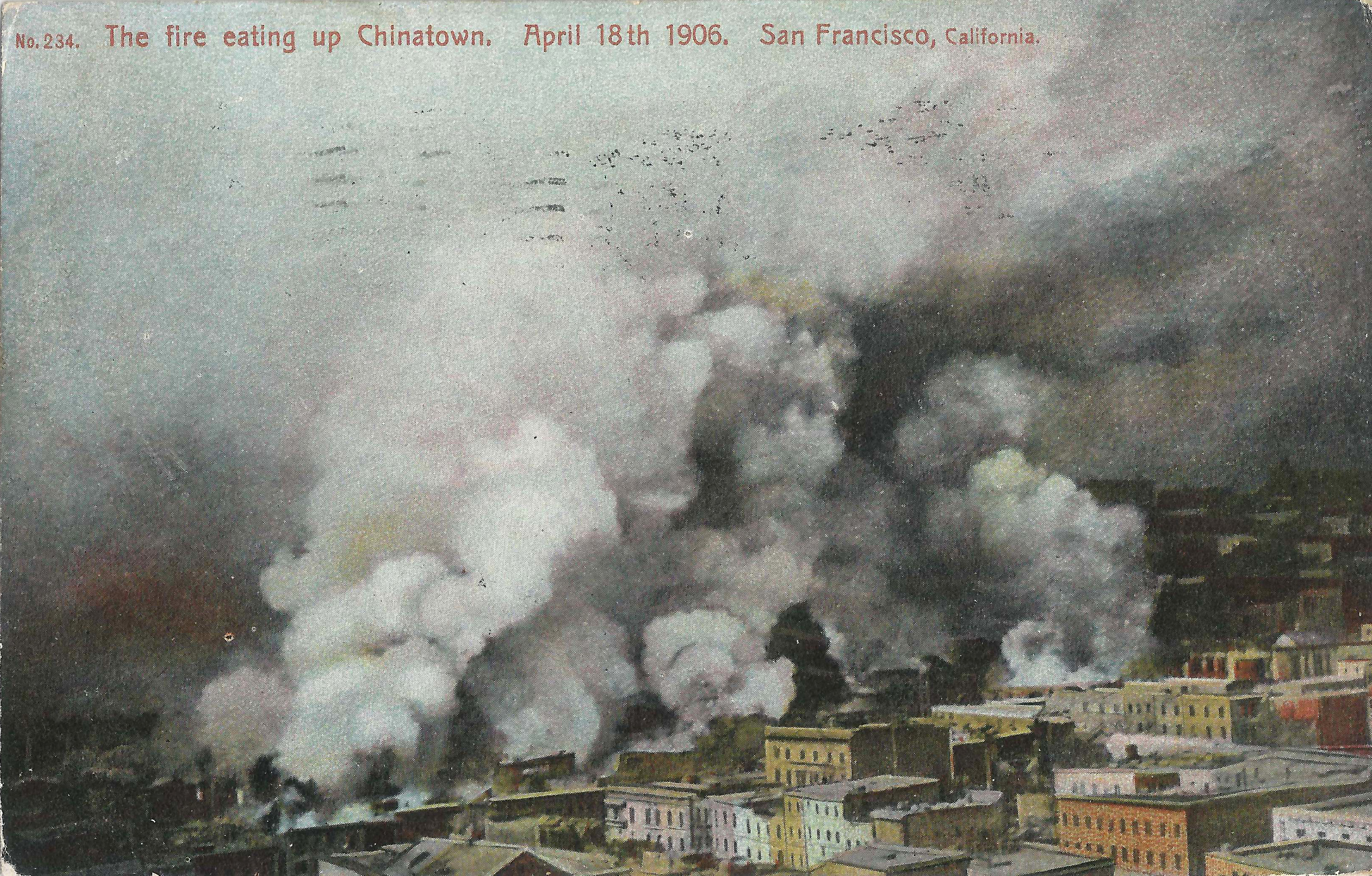
- Weidner 234, captioned "The fire eating up Chinatown".
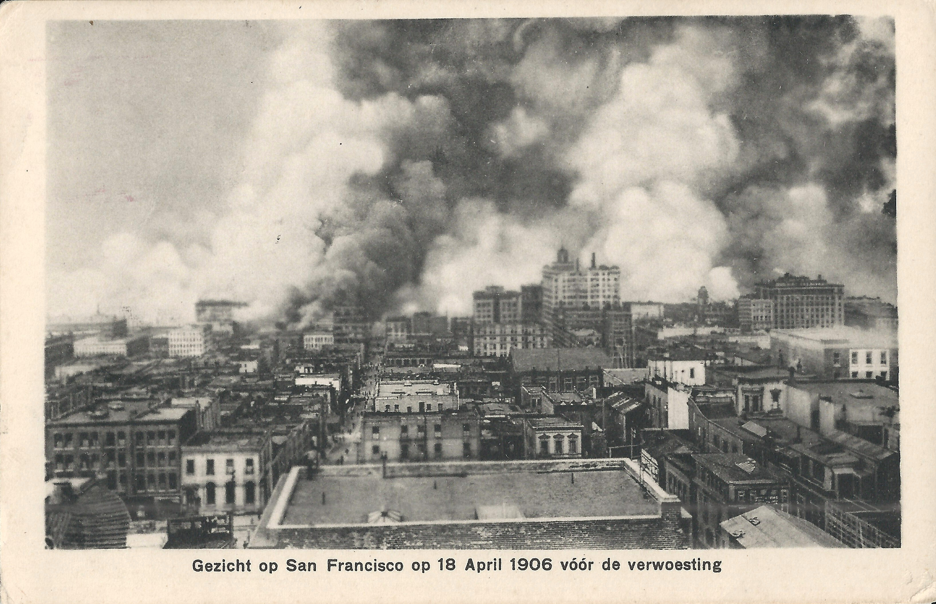
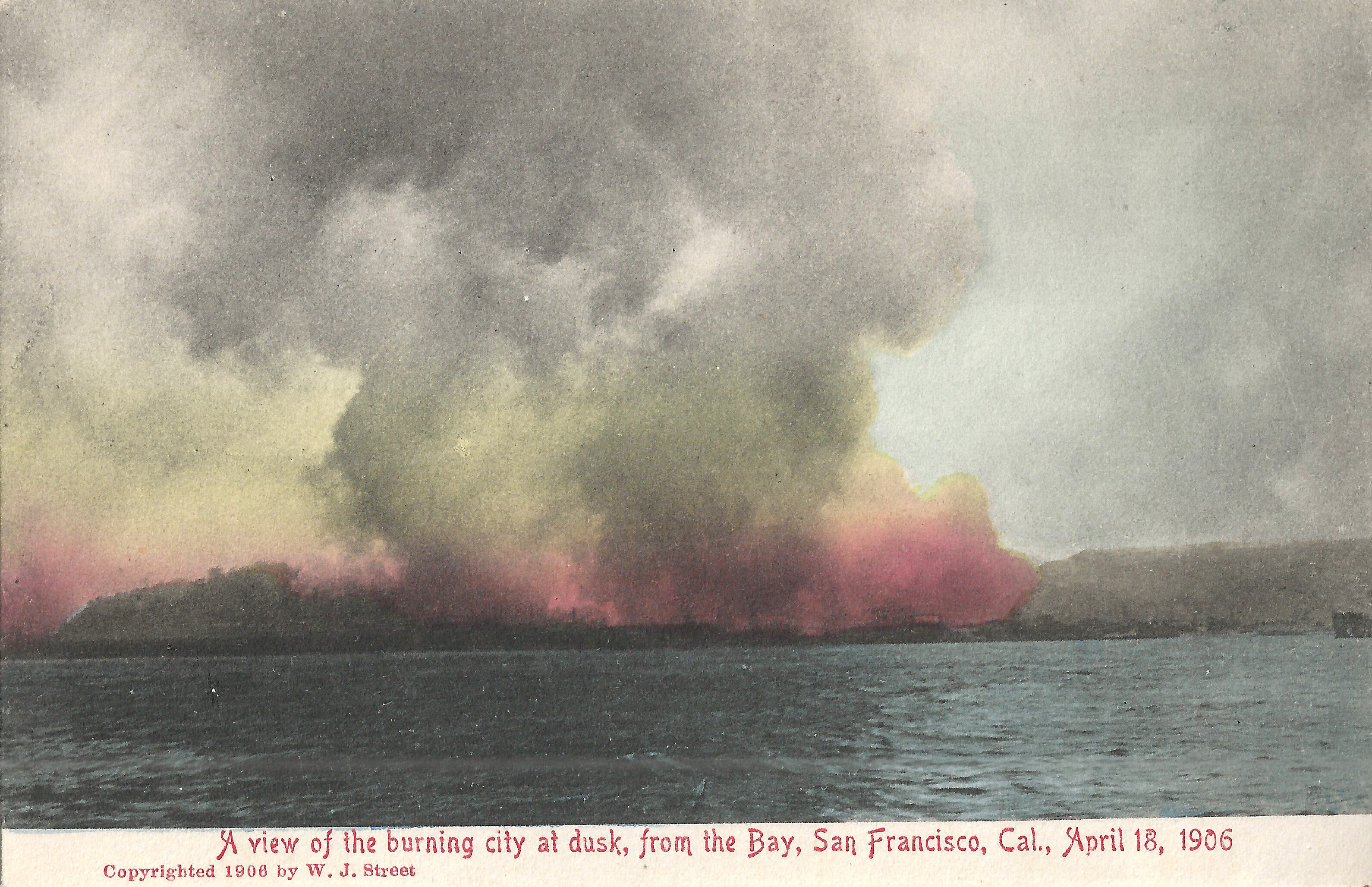
- Rieder 6949 looks west from the bay to the burning city at dusk on earthquake day. Sunset was at 6:48pm.
 |
 |
 |
 |
- shows well-dressed people gathering in Union Square as the fire approaches, looking east toward Stockton and Union Square Ave. (now Maiden Lane). The Union League building, now called the Whitell building (166 Geary), is under construction at center. Its iron framework is a useful landmark in determining the location of post-fire photos. At right, the Butler building (later I. Magnin) on Geary is also under construction, as is a new wing for the St. Francis Hotel, unseen behind the viewer. A trunk on the ground near the Dewey Monument might belong to Enrico Caruso; he and his valet fled to Union Square from the Palace Hotel after the quake. Caruso's narratives at sfmuseum.org and at Morris (pp. 135 ff.) differ in many details.
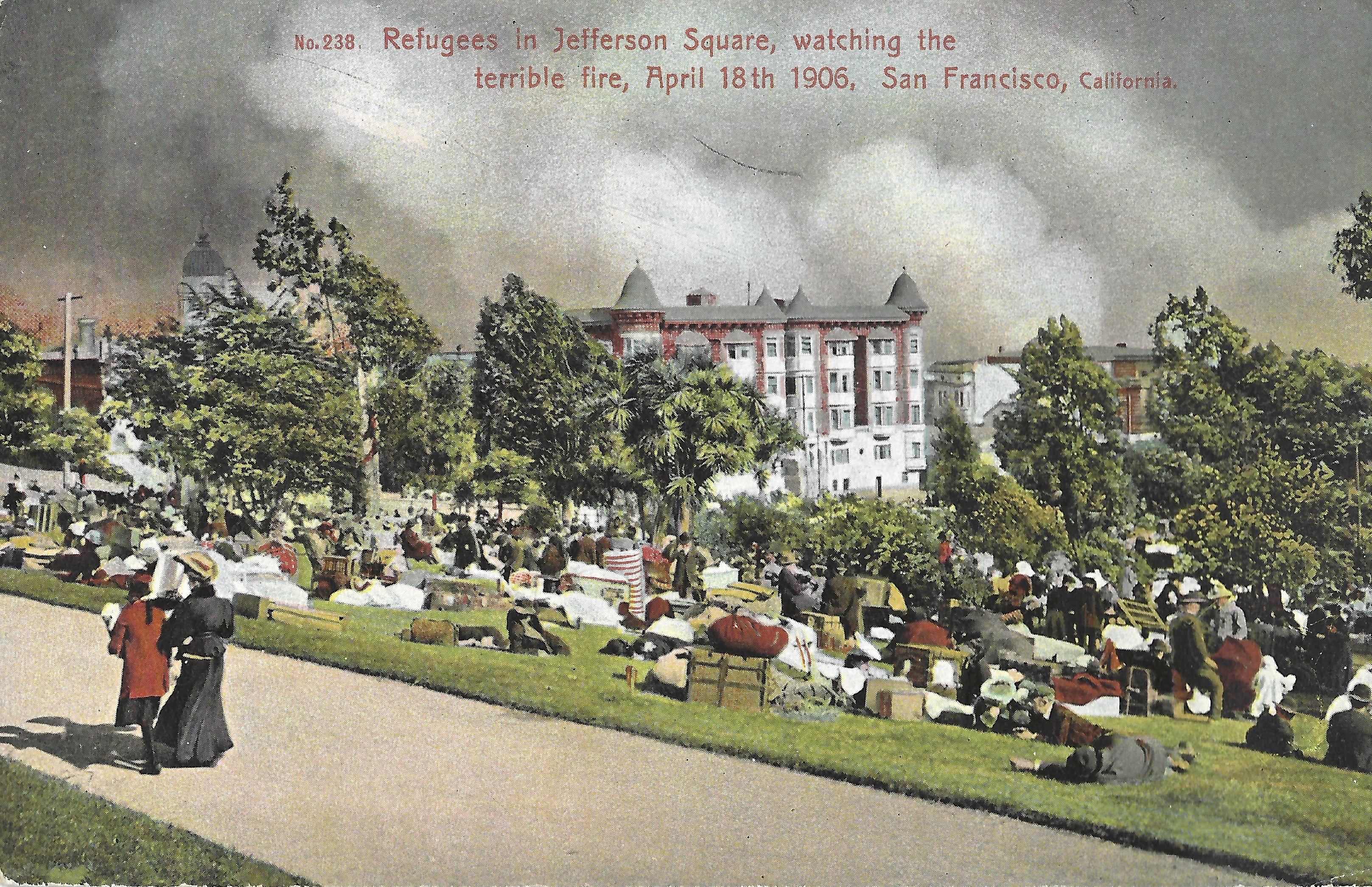
- looks southeast from Eddy/Octavia at Jefferson Square (Eddy/Gough/Golden Gate/Laguna). The square is filled with refugees from the fire and their belongings. Left: The dome of City Hall, a half-dozen blocks away. Smoke from the ham and eggs billows behind the Jefferson Hotel at center (SE corner Turk/Gough). The fire reached the southeast corner of the park (Gough/Golden Gate), but buildings adjacent to the park survived. Earthquake/Fire: Jefferson Square shows post-quake refugee life in the park.
 |
 |
 |
 |
 |
 |
 |
 |
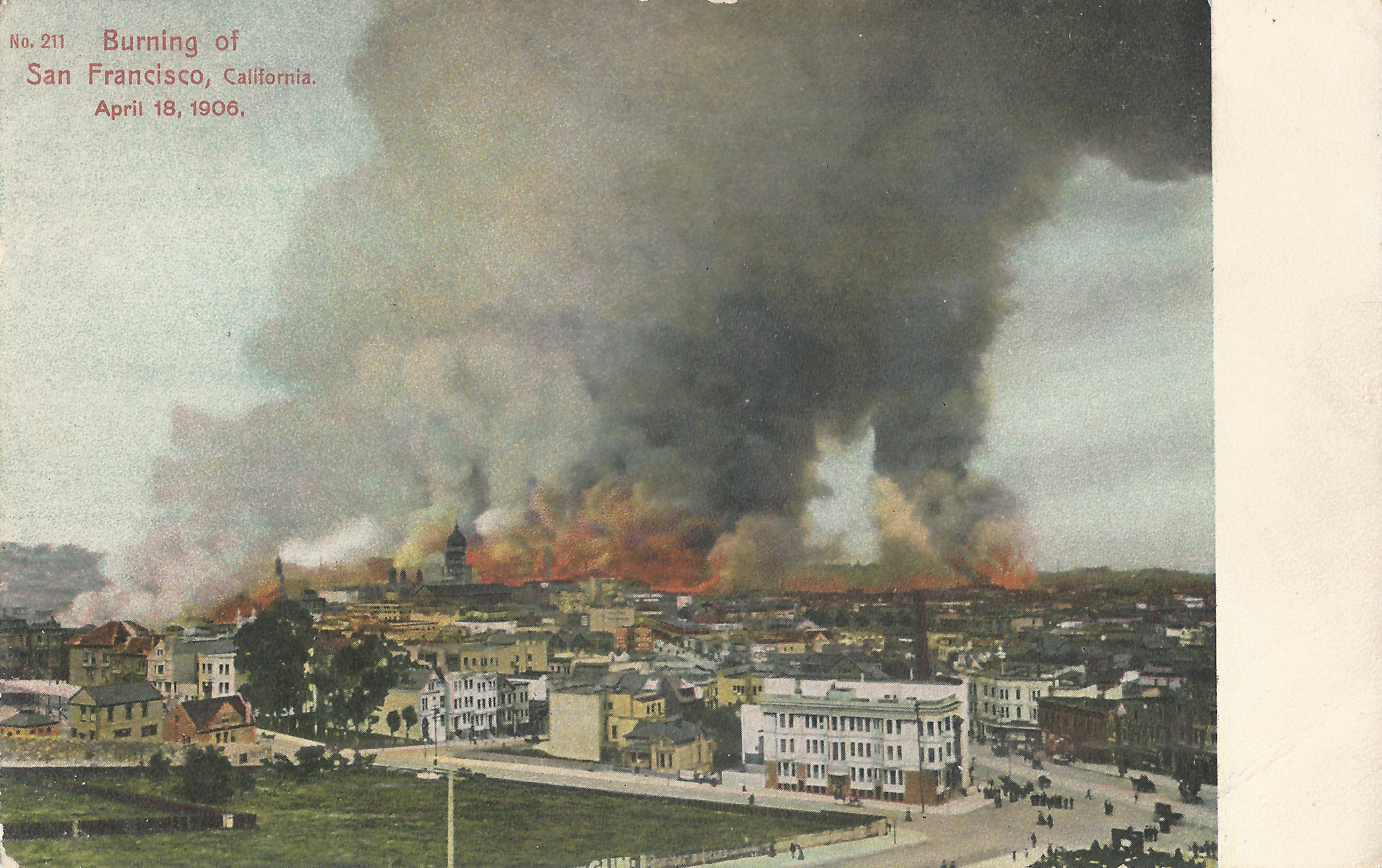
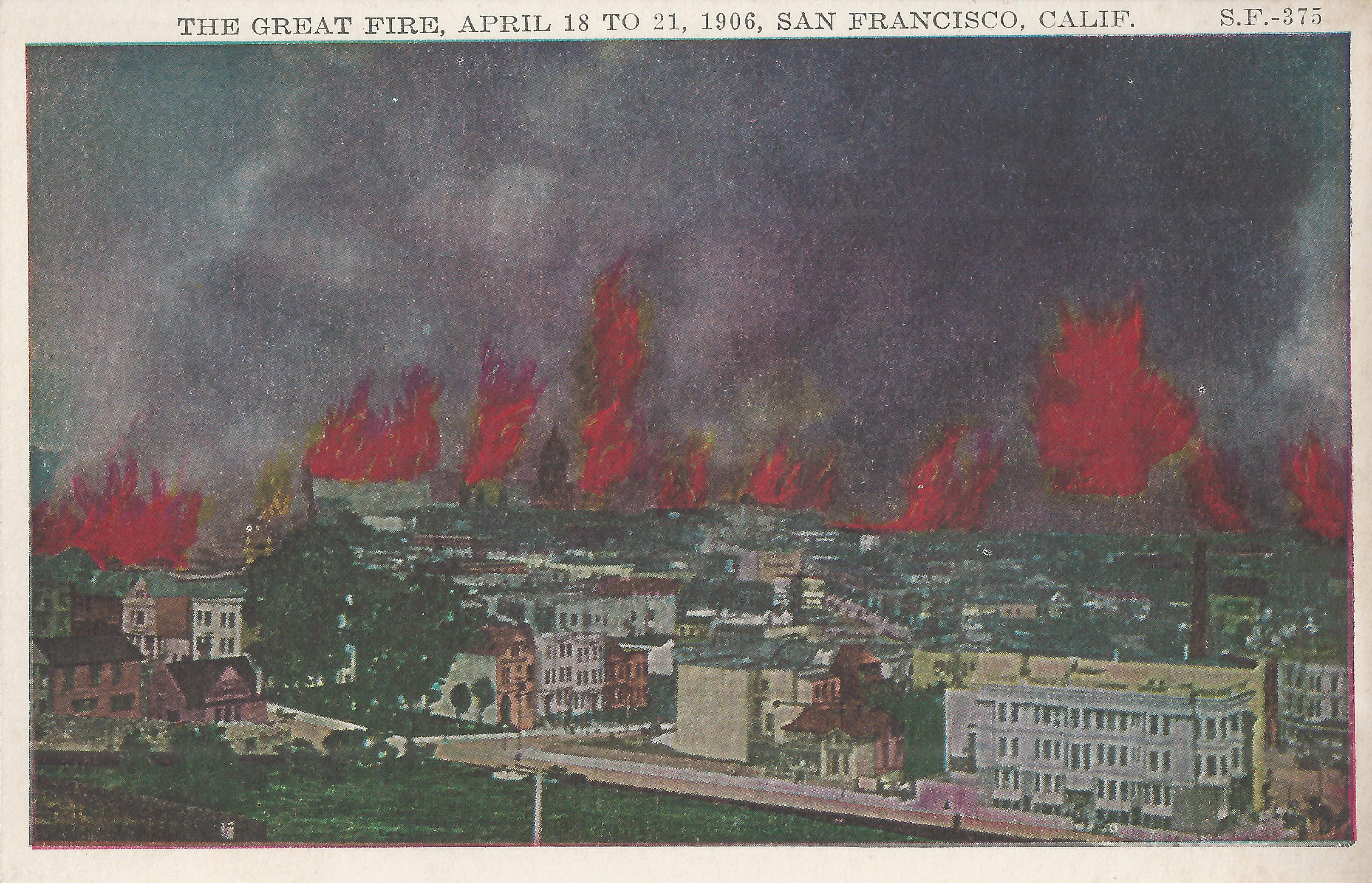
- Weidner 211 looks east toward downtown from Mint Hill (Market/Laguna/Guerrero). Lower right center: 2 Laguna, with Market/Guerrero just behind it. Left: ham and eggs fire. Center: City Hall dome, with flames approaching.
- Pacific Novelty SF 375 is the same image with sensationalized flames added.
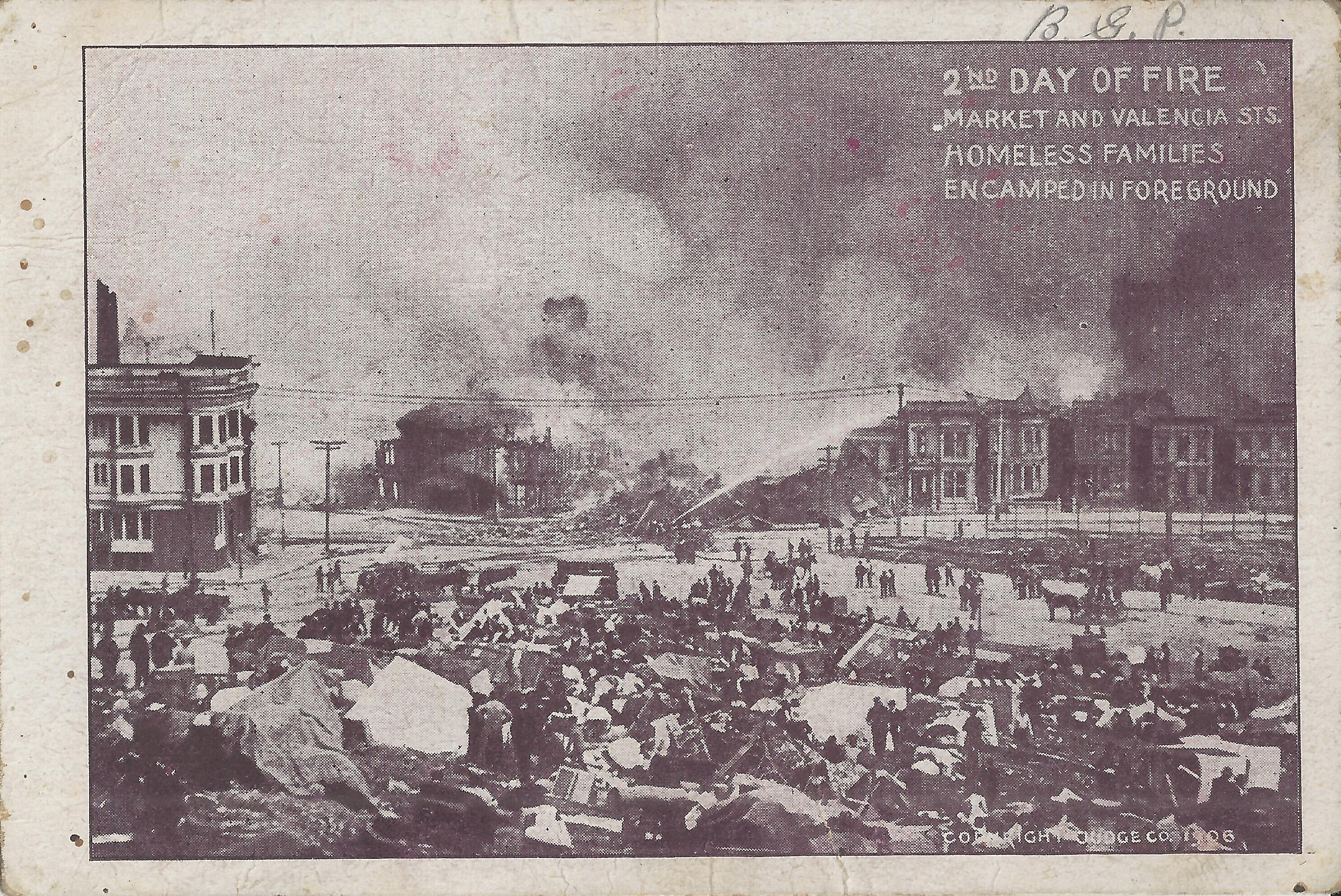
- Judge shows firefighters battling the fire at Market and Guerrero. A house at Market/Guerrero is actively burning (center), the building next to it has just been dynamited as a fire break, and the firefighters are spraying water on the next building. The fire was stopped here: all the buildings south of Market and east of Guererro burned, but 2 Laguna survived. Mint Hill 1906 gives additional details.
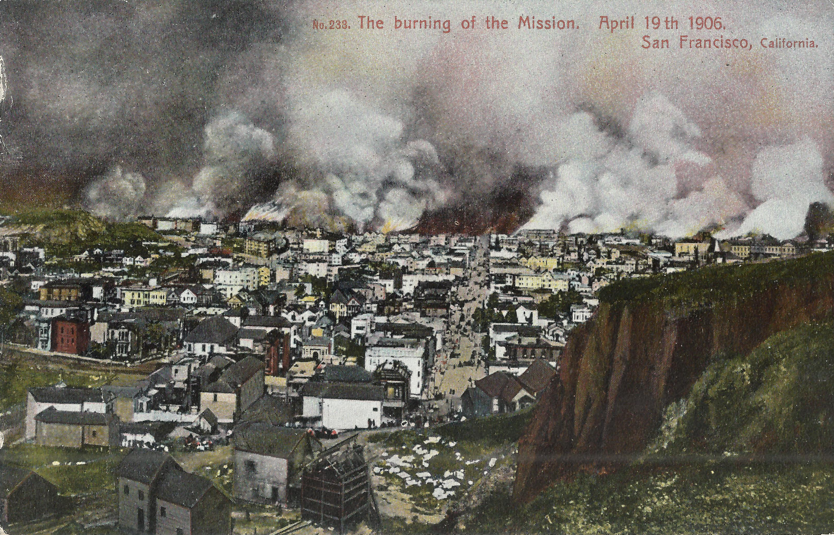
- Weidner 233 looks east up 15th St. from above Beaver (Corona Heights). Notre Dame Convent (17th/Dolores) stands at the right edge; it was dynamited on day 2 to stop the fire at Dolores. Dolores Park 1906 gives a detailed timeline.
 |
 |
 |
 |
 |
 |
 |
 |
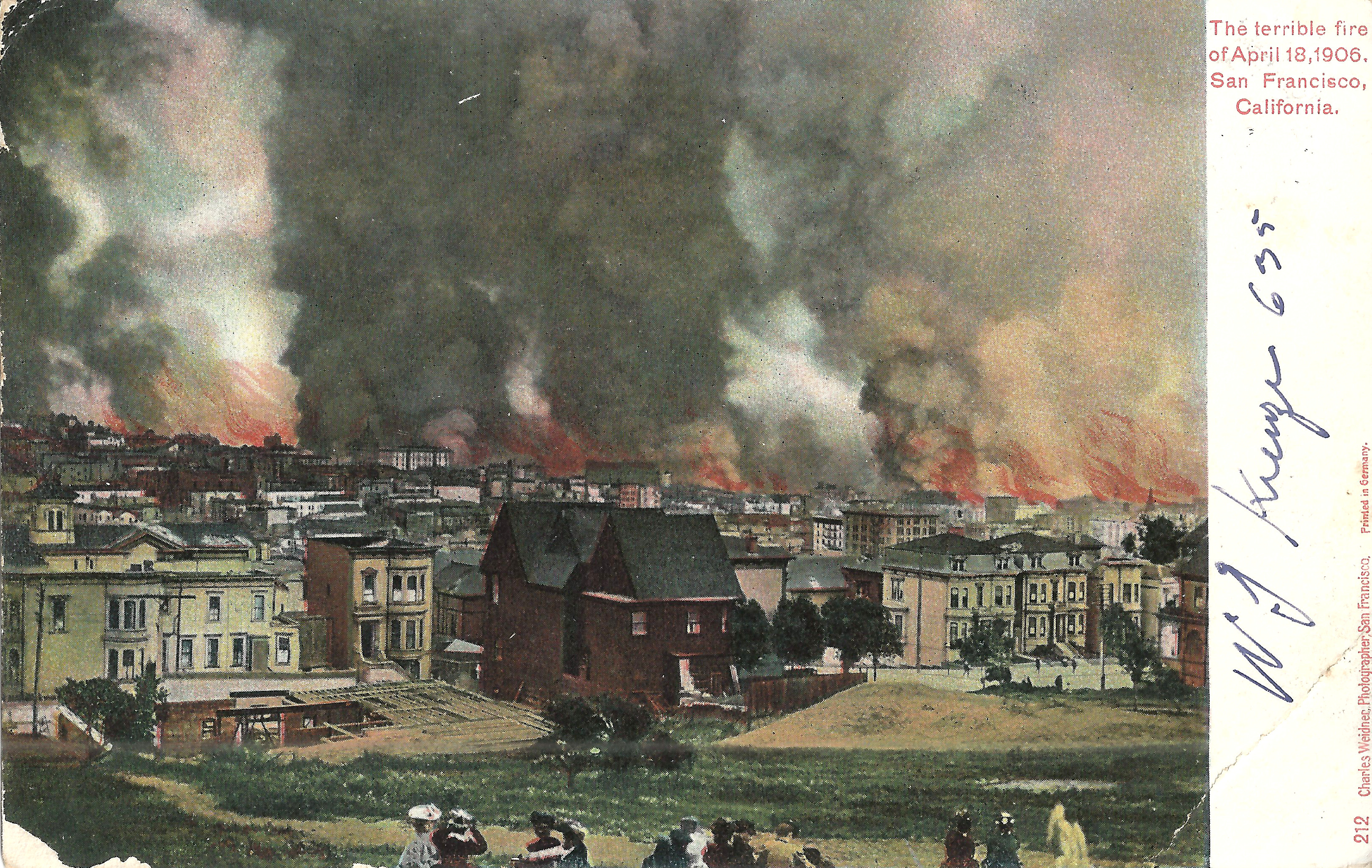
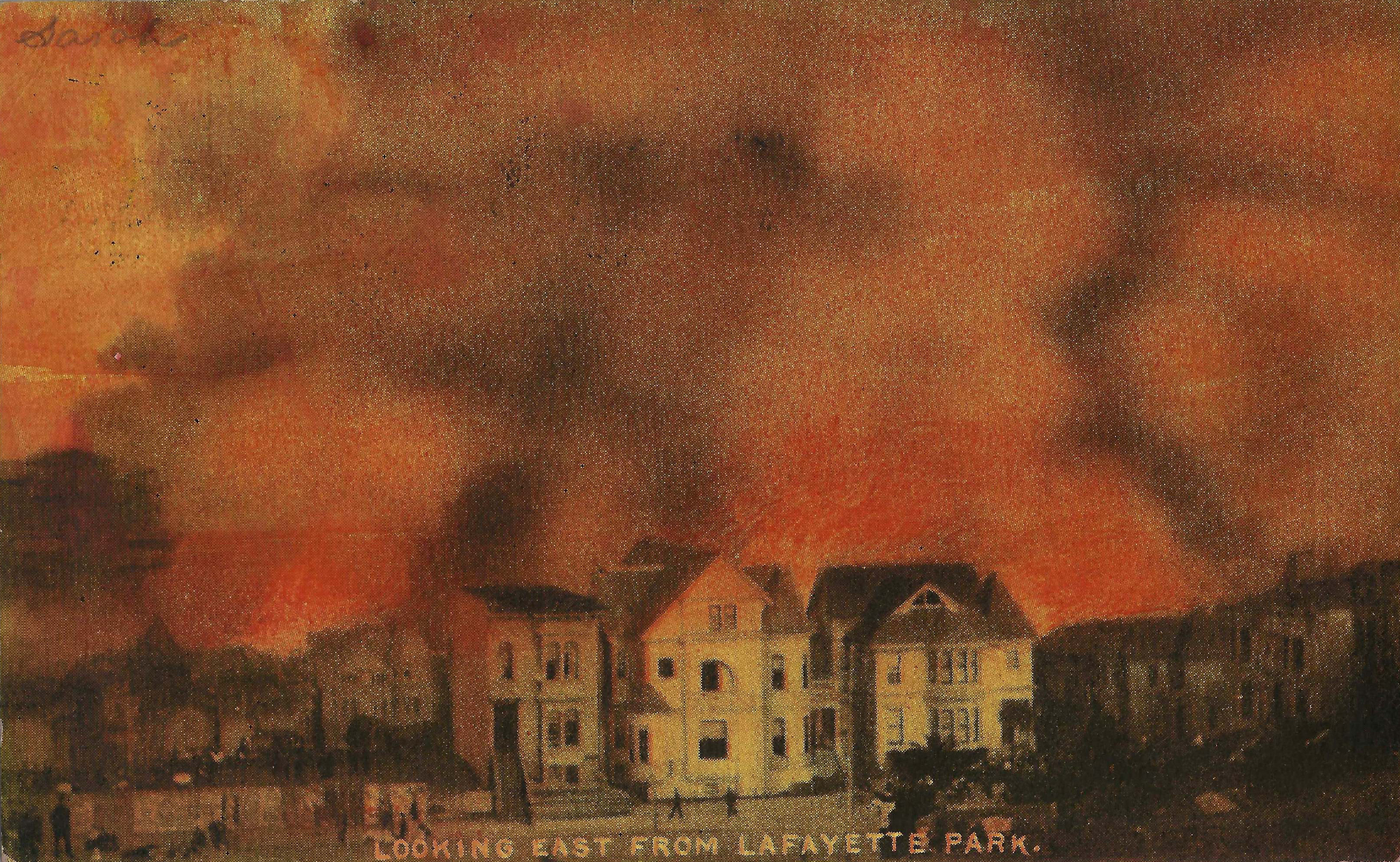
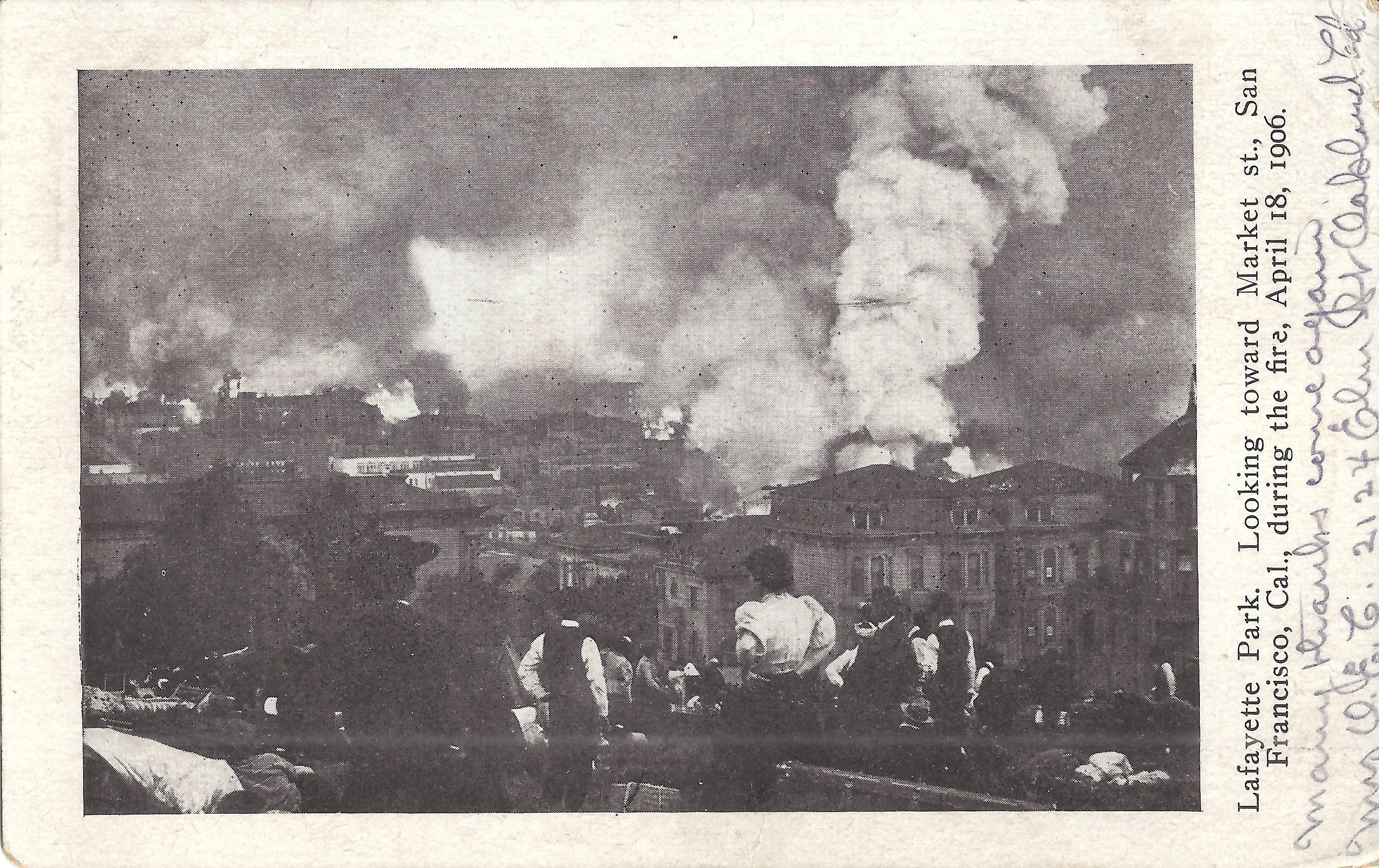
These cards show Lafayette Park (Washington/Gough/Sacramento/Laguna) on day 2. The fire burned to within a block of the park. Earthquake/Fire: Lafayette Park provides further details.
- Weidner 229 looks east toward Polk Gulch. Center, below the people on the ridge: roof of 1915 Gough. Right of center: Fairmont Hotel on Nob Hill. The fire reached the Fairmont around 9am on day 2 and then burned north toward Russian Hill and west toward Van Ness. It crossed Van Ness at Sacramento by 6pm on day 2 but was stopped at Franklin at around 3am on day 3.
- Weidner 212, postmarked SF 4/15/1907, from a lower vantage point in the park. Left edge: 1941 Clay (southeast corner Gough/Clay), with the tower of 1939 Clay just beyond. Center: 1915 Gough, as seen on the previous card. Right edge: the houses on the corner are 1812/1814 Gough.
- Rotograph, postmarked 2/13/1907, looks east across Gough between Washington/Clay. The foreground houses are 2000/2004/2010 Gough.
- Rieder must be later in the day than Weidner 212, as a large tent has been erected, the park is filling with refugees and their belongings, and the fire is much closer. The houses at 1812/1814 Gough again appear at the right edge. Just left of the woman's white blouse is 1919 Sacramento, still standing in 2020.
 |
 |
 |
 |
 |
 |
 |
 |
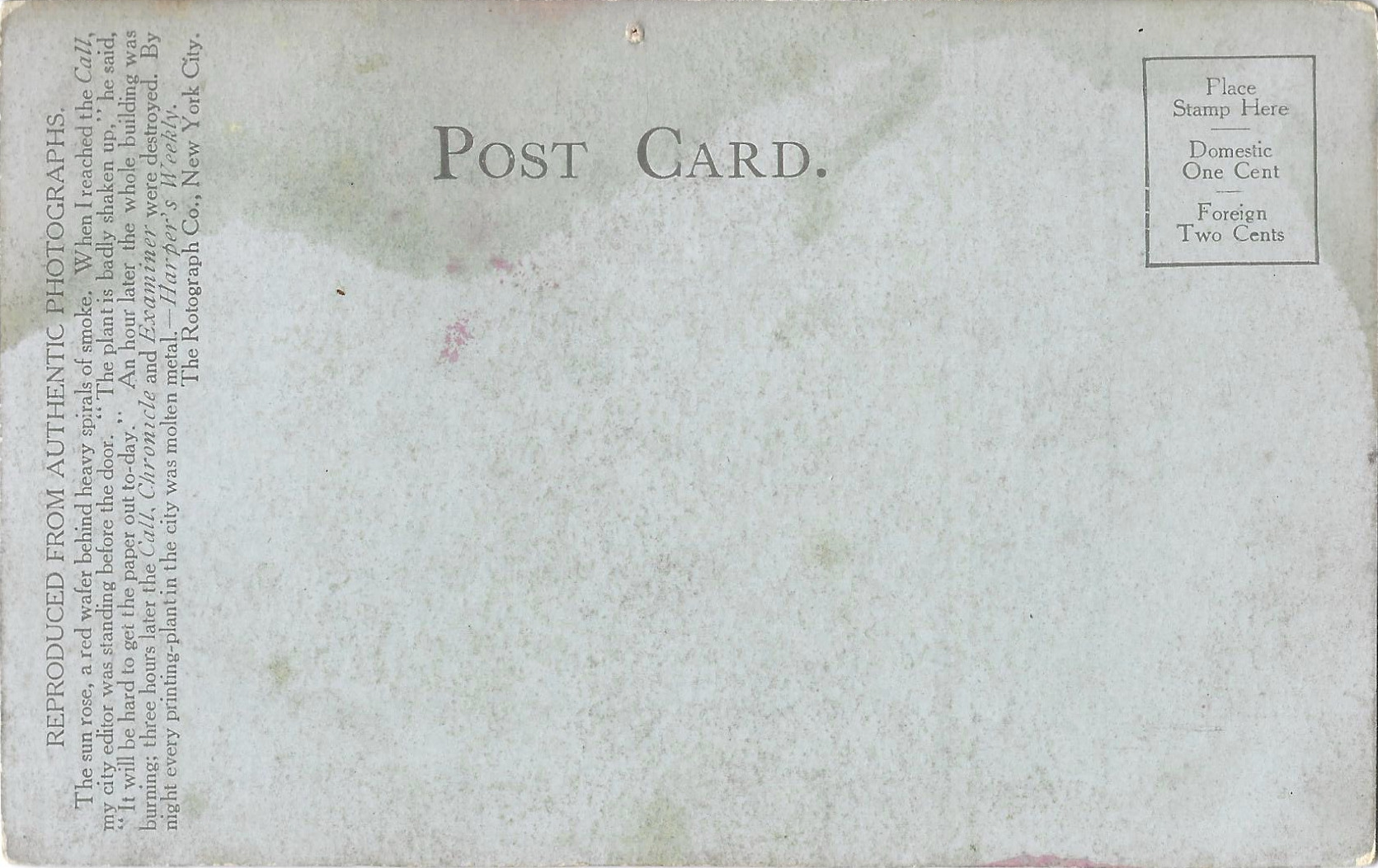
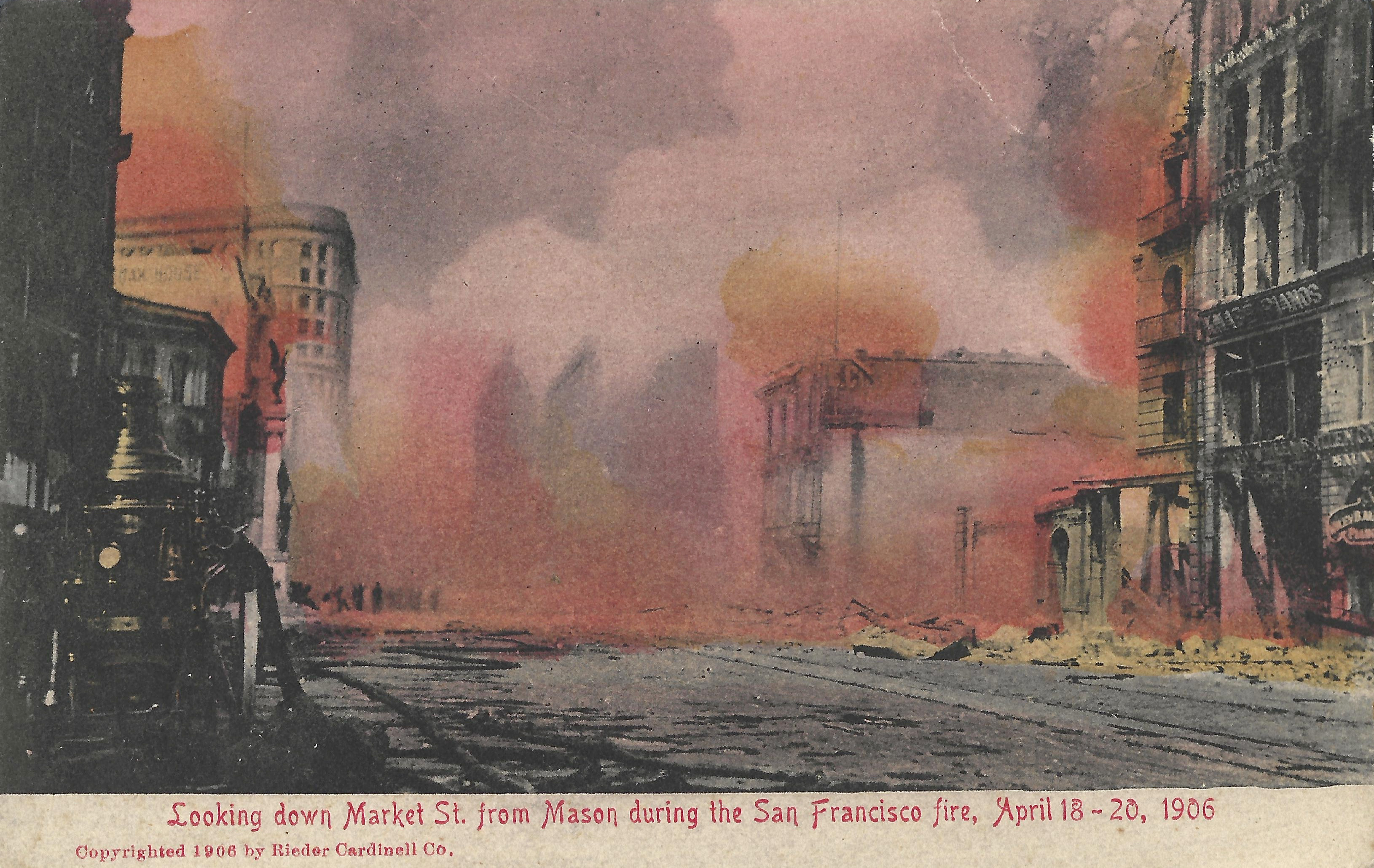
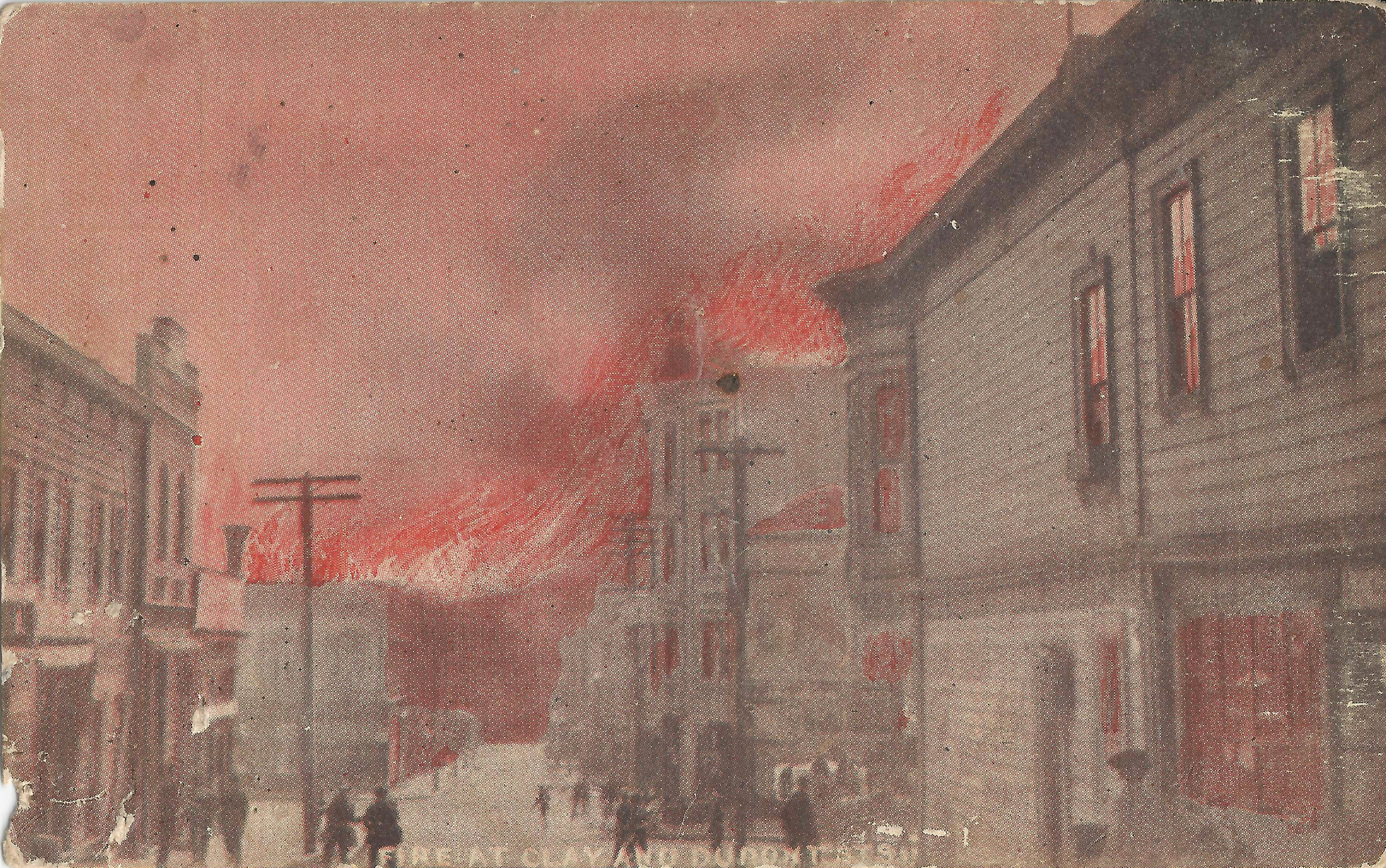
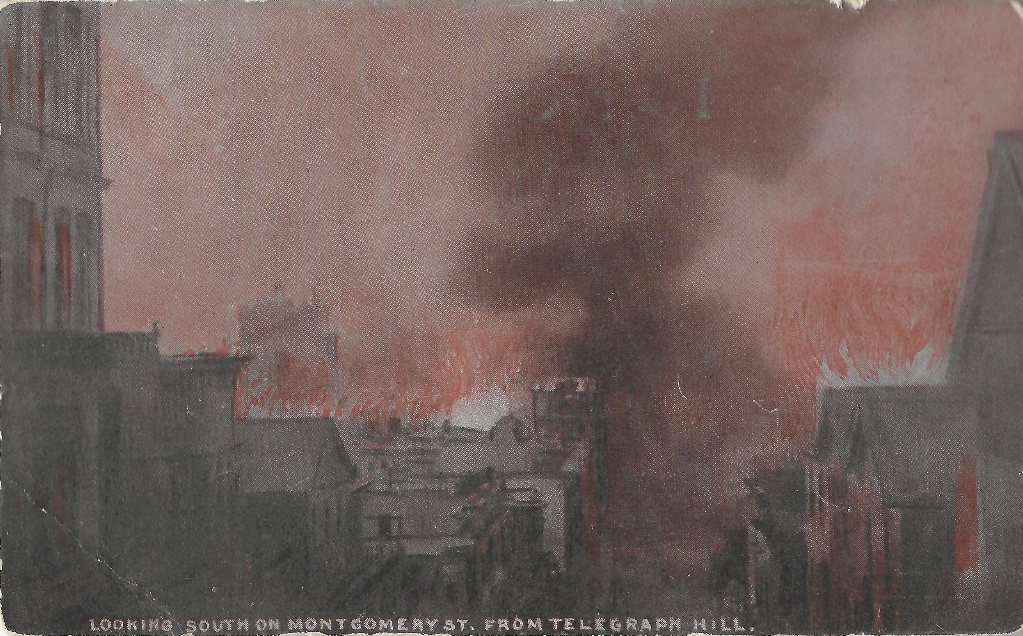
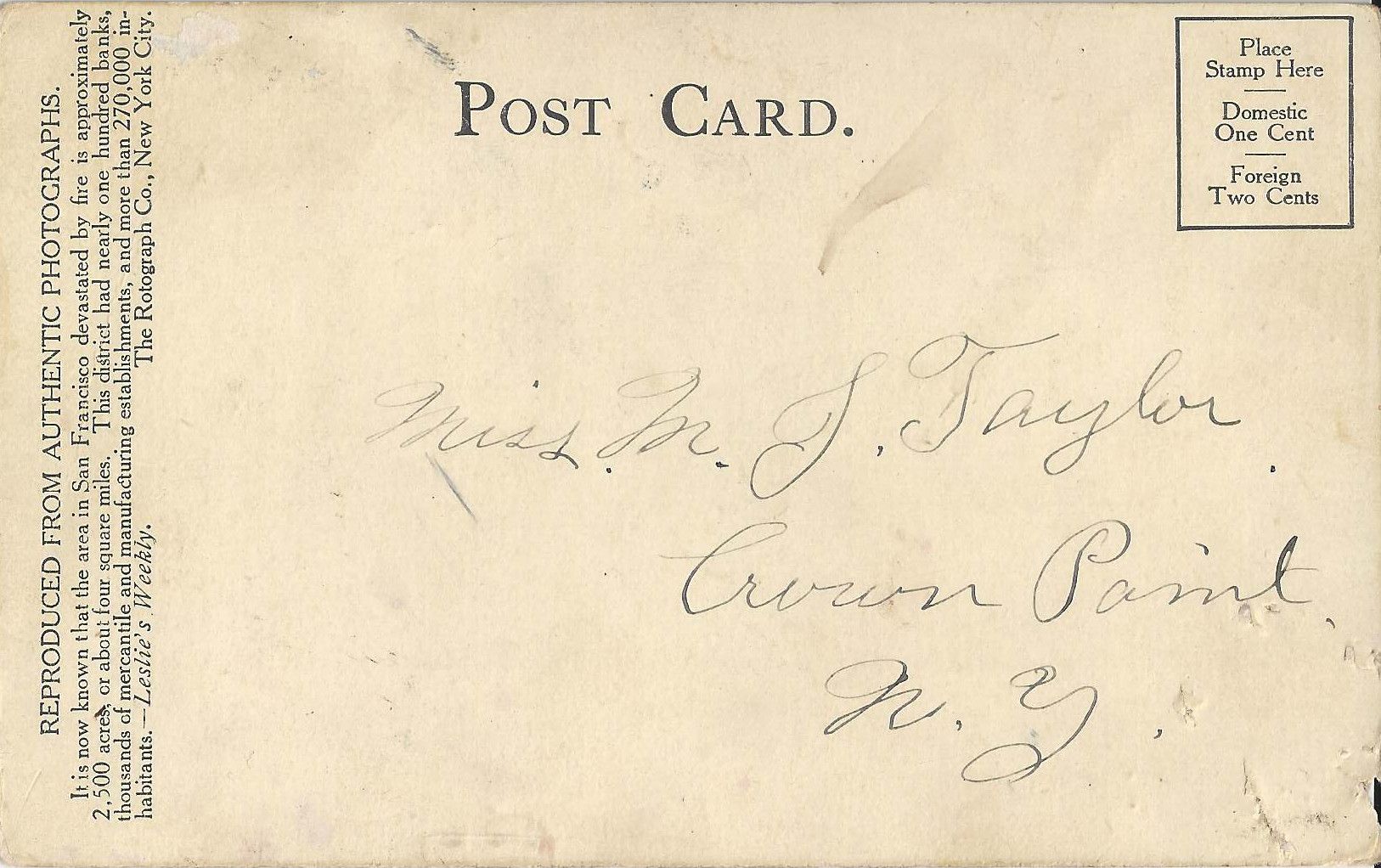
The Rotograph Co. of NYC published a series of cards showing halftone fire images with dramatically colorized flames added. The back of each card includes an evocative short quote about the quake/fire from a magazine (Leslie's, Harper's, Collier's), an unusual touch, and several are printed on tinted stock (yellow, blue, red). The back promotes Rotograph cards as "reproduced from authentic photographs", leading some sellers to label them as reprints, but they were published very soon after the event; the Emporium Rotograph card on this page is postmarked 6/06/1906, just six weeks after the fire. It is difficult to confirm the exact locations of the four cards shown here.
- Rotograph: given location Clay/Dupont seems unlikely.
- Rotograph: given location California/Steiner seems unlikely because of the slope.
- Rotograph: no location given; location uncertain.
- Rotograph: given location looking south on Montgomery from Telegraph Hill (per caption) seems likely, but precise location uncertain.
 |
 |
 |
 |
Sensationized images typically enhanced real scenes with stylized smoke and flames.
- A.H. shows "Fire in the South of Market", but the image details are very non-specifc, so it's hard to determine a precise location in the absense of a similar photo.
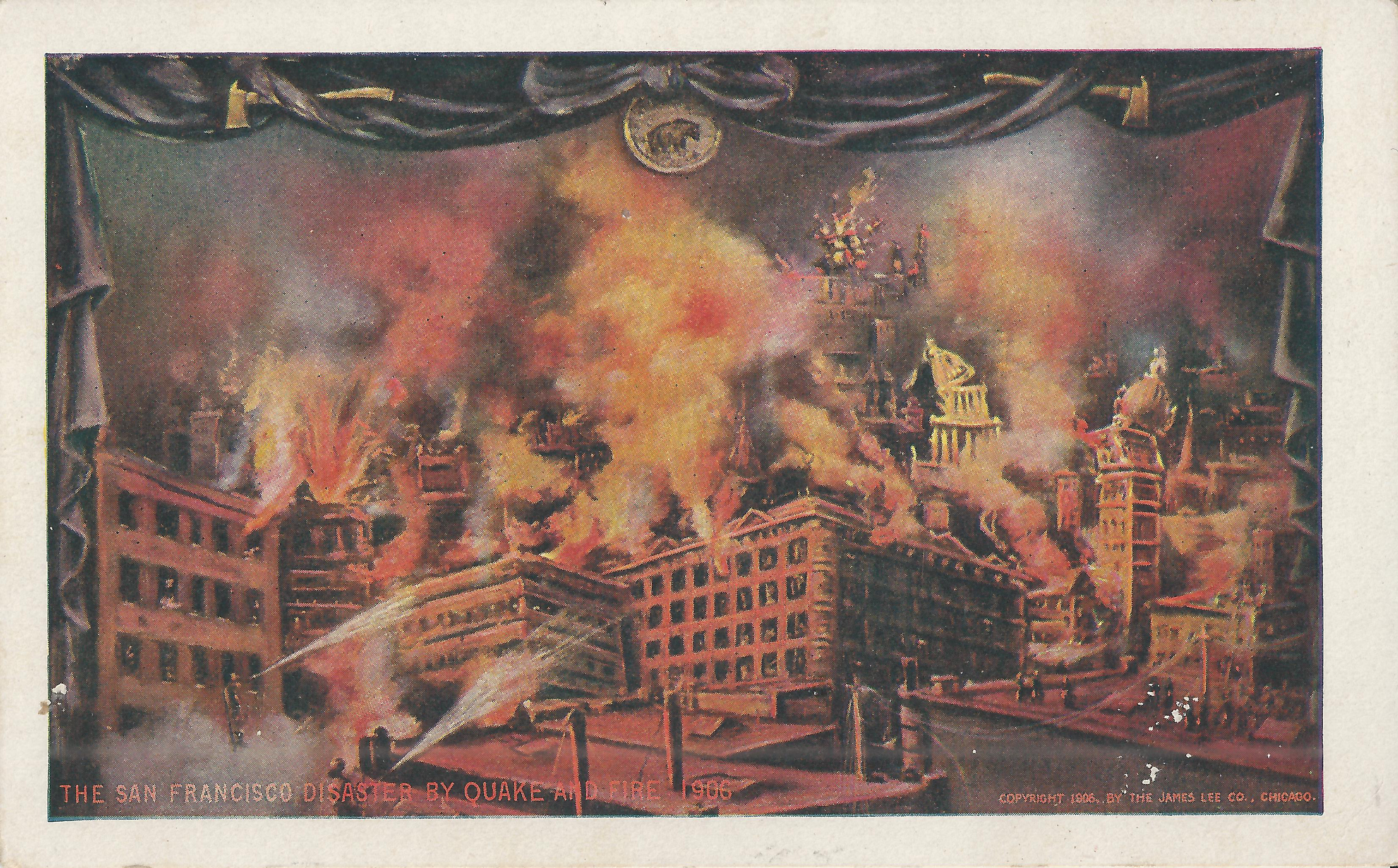
- Douglass is purely an artist's conception; nothing in it resembles an actual earthquake/fire view. Curtains frame the image like a proscenium stage, with a California bear medallion at the top for no discernable reason. Firefighters spray water into the air and smoke billows from several buildings, drawn askew. The towers might be taken for the Hall of Justice or City Hall and the Call, but they only vaguely resemble the actual buildings.
See also:
- Buildings
- Dolores Park 1906
- Earthquake/Fire: Hibernia Bank
- Earthquake/Fire: Lafayette Park
- Hooper 1906
- Mint Hill 1906
- Valencia St. Hotel
Sources:
- Bronson, William: The Earth Shook, The Sky Burned. Doubleday, Garden City, 1959. The front and back endpapers show an instructive map by palacios showing the progress of the fire.
- Crocker-Langley: 1905 Crocker-Langley.
- Hansen, Gladys: 1906 Fire Origins.
- Kennedy, Lawrence J.: The Progress of the Fire in San Francisco April 18th-21st, 1906.
- Morris, Charles: The San Francisco Calamity by Earthquake and Fire.
- Punnett Bros.: Two Years After.
- Sanborn-Perris Map Co.: 1905 Sanborn [at davidrumsey.com].
Steve's SF postcard pages:


