Dolores Park 1906
See my Before Dolores Park page for history of the Dolores Park site before 1906.
Click on any image to see full-resolution version. Click on the map below for a map showing photo locations.
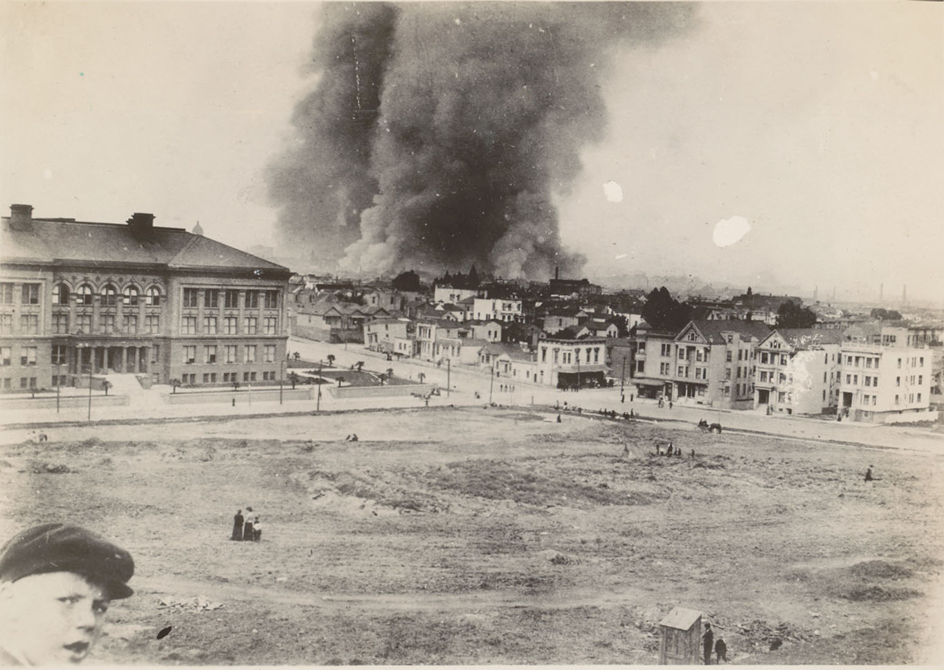
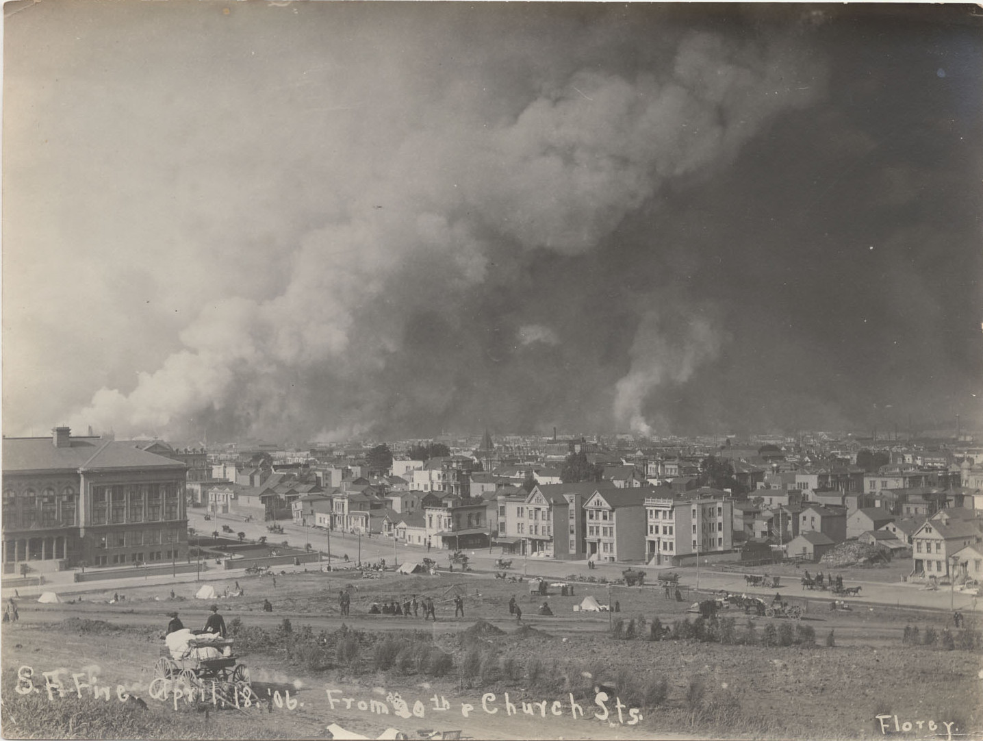
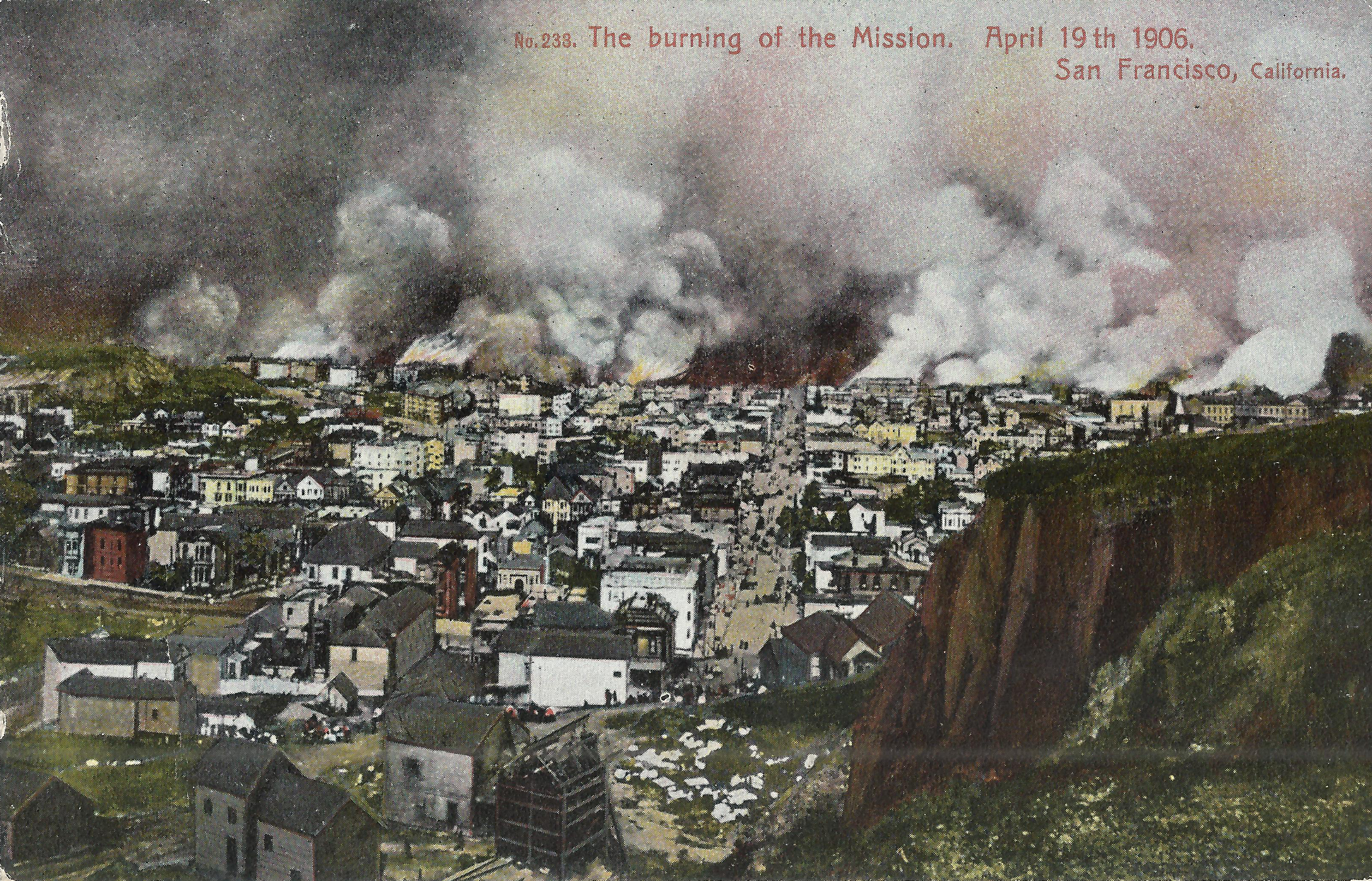
Earthquake day in San Francisco: Wednesday, April 18, 1906. The earthquake struck at 5:12 A.M. A few hours later, this photo looks northeast across Mission Park (now Dolores Park) from Church/19th to Dolores/18th. A large fire burns downtown, but it's still far away. A much closer fire burns at 22nd/Mission, so presumably a smaller smoke plume rises beyond the right edge of this picture. The park is largely uninhabited. The building at left is Mission High School (built 1898, replaced 1927 by the current Mission High building at the same site). Two buildings at Dolores/Dorland (just north of 18th, to the right of the school) have fallen off their foundations. In the next days, the fire will consume all of these buildings except Mission High. I presume the little structure at bottom right is an outhouse; if so, it will soon get lots of traffic.
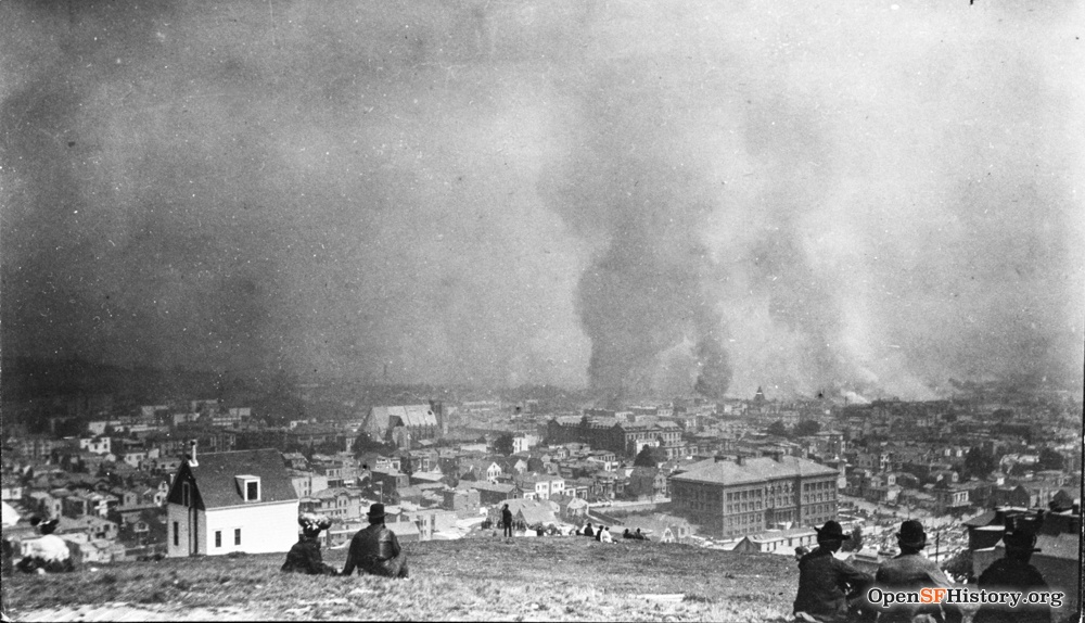
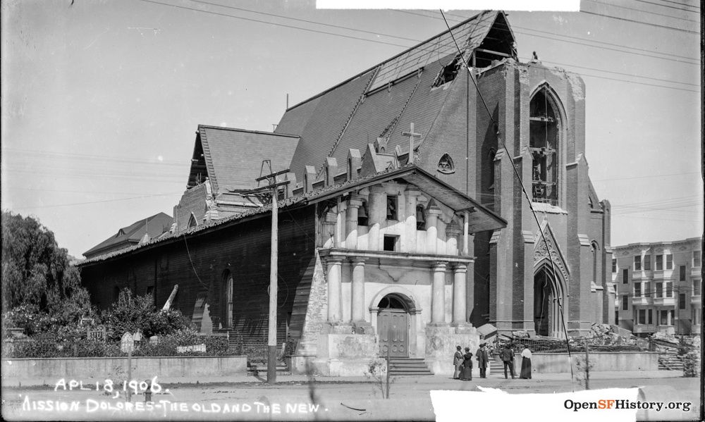
Watching the spreading fire from Dolores Heights at Sanchez/21st. Mission Dolores at Dolores/16th is just left of center; the old Mission survived, but the new church next to it lost its tower in the quake. Notre Dame Convent, on the east side of Dolores between Mission Dolores and Mission High, is still intact here but was dynamited the next day to contain the spread of the fire.

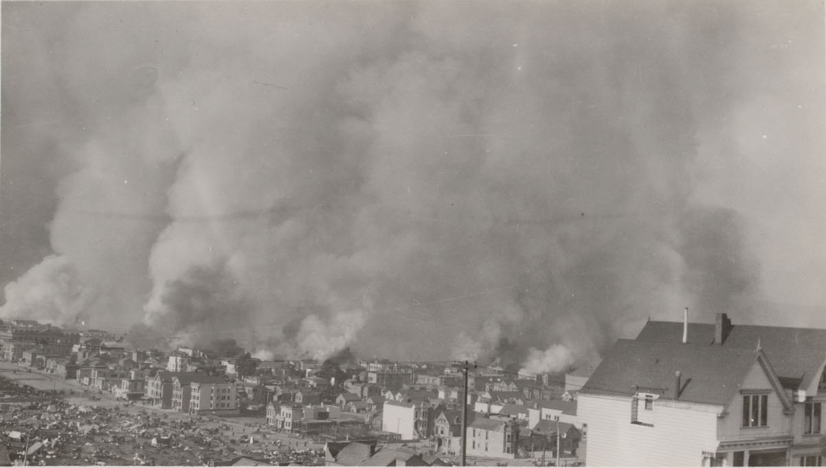
Later the same day, northeast from Sanchez/21st. Mission High is just right of center, and the park is mostly obscured by the houses at bottom right (on Cumberland above Church).
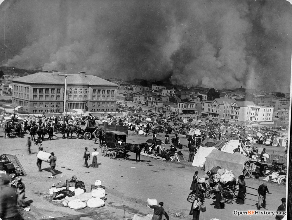
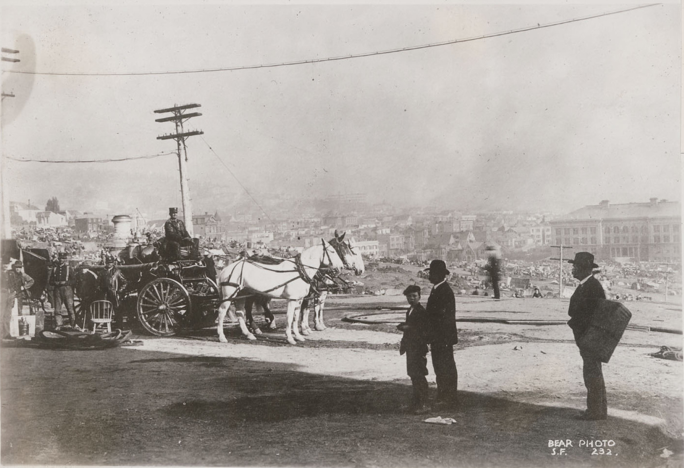
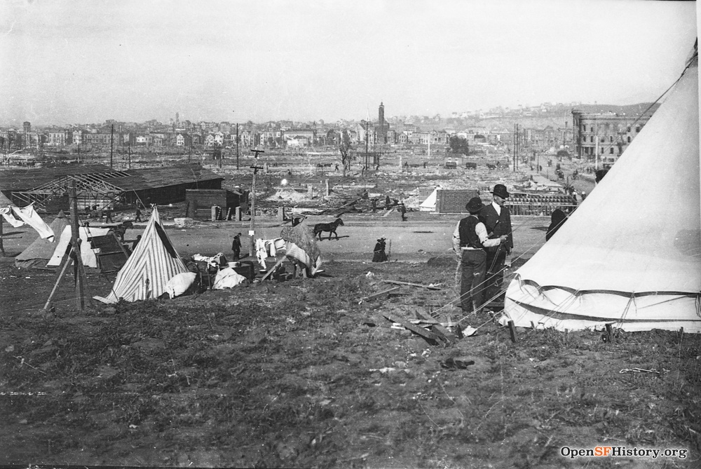
A view of the park at almost the same time (judging by the smoke plume). Refugees pull wagons containing household goods, and a few set up tents in the park.
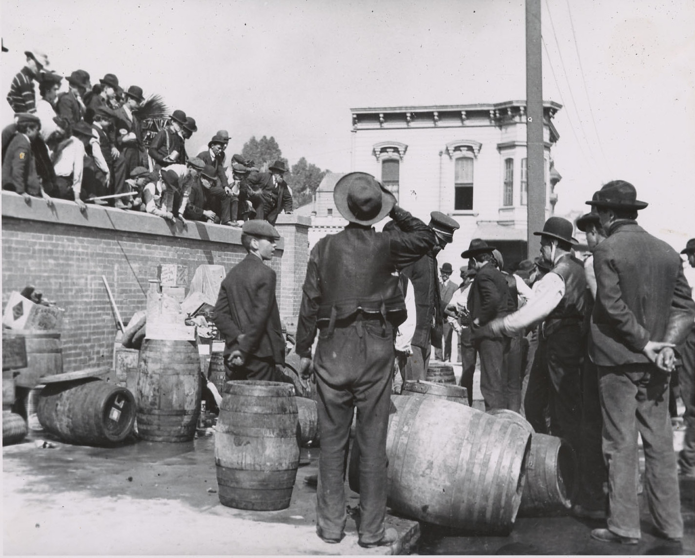
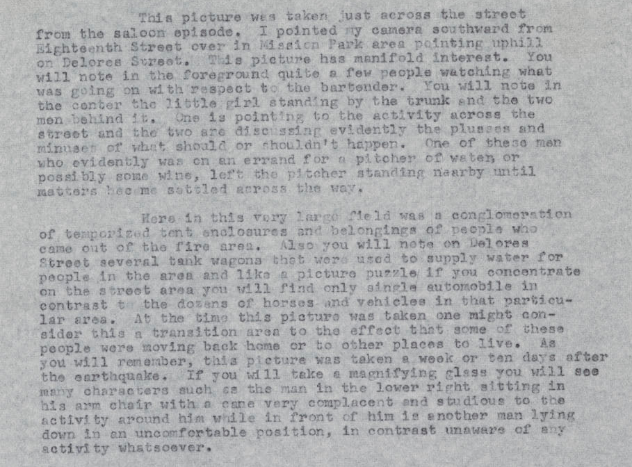
The park fills with refugees as the fire approaches. I'm guessing this is on the second day of the fire, 4/19/1906. The photo's resolution is good, but not quite good enough to see whether the liquor vendor in the first Breer photo below is at 18th/Dolores.
Now the fire directly threatens houses on the east side of the park and the park is crowded with refugees, as seen looking northeast from Liberty Street (house on the right: 264 Liberty, also seen in post-fire photo below). A caption gives the time as 2 P.M. on 4/19/1906. A compelling 1908 UC master's thesis by Lawrence J. Kennedy (excerpt here) provides a detailed timeline of the progress of the fire. Kennedy says that the fire in this part of the city was largely out by the morning of Friday 4/20/1906, though local historian Gladys Hansen says 4/21/1906 (excerpt here). A postcard by Charles Weidner shows the 4/19/1906 fire line running roughly along Guerrero. Kennedy's account would imply this photo must be from Thursday 4/19/1906, confirming the caption. Thursday night through Friday morning must have been terrifying in the park, as buildings right across Dolores burned, huge cinders fell from the sky, and dynamite exploded buildings during the firefight.

Stanford student Carl Breer took dramatic photographs at Stanford and in San Francisco immediately after the earthquake. Awakened at Stanford by the earthquake, he took pictures on campus and then biked to San Francisco on El Camino Real, carrying his Eastman No. 3A Folding Pocket Kodak camera. His detailed narrative, written 1963-1964, says he was in San Francisco on 4/18 and 4/19 and returned about a week later to help with relief work. My Mint Hill page shows photos he took late in the day on 4/18. Breer took this photo at the northwest corner of 18th/Dolores, in front of Mission High. His narrative dates it to his later return trip. But the white Victorian at the northeast corner of Dolores/18th and all the buildings on Dolores up to 20th in the next photo below are gone in post-fire photos. I'm reasonably sure his recollection after 50+ years is faulty: I think he took these photos on 4/19/1906, at the start of his bike trip back to Stanford. He says he took El Camino Real and Mission Street into the city, and I'm guessing the fire on Mission forced him west to Dolores for his return.

Breer took this photo directly across 18th street from the previous photo, looking south down Dolores. See my remarks on previous photo re date.
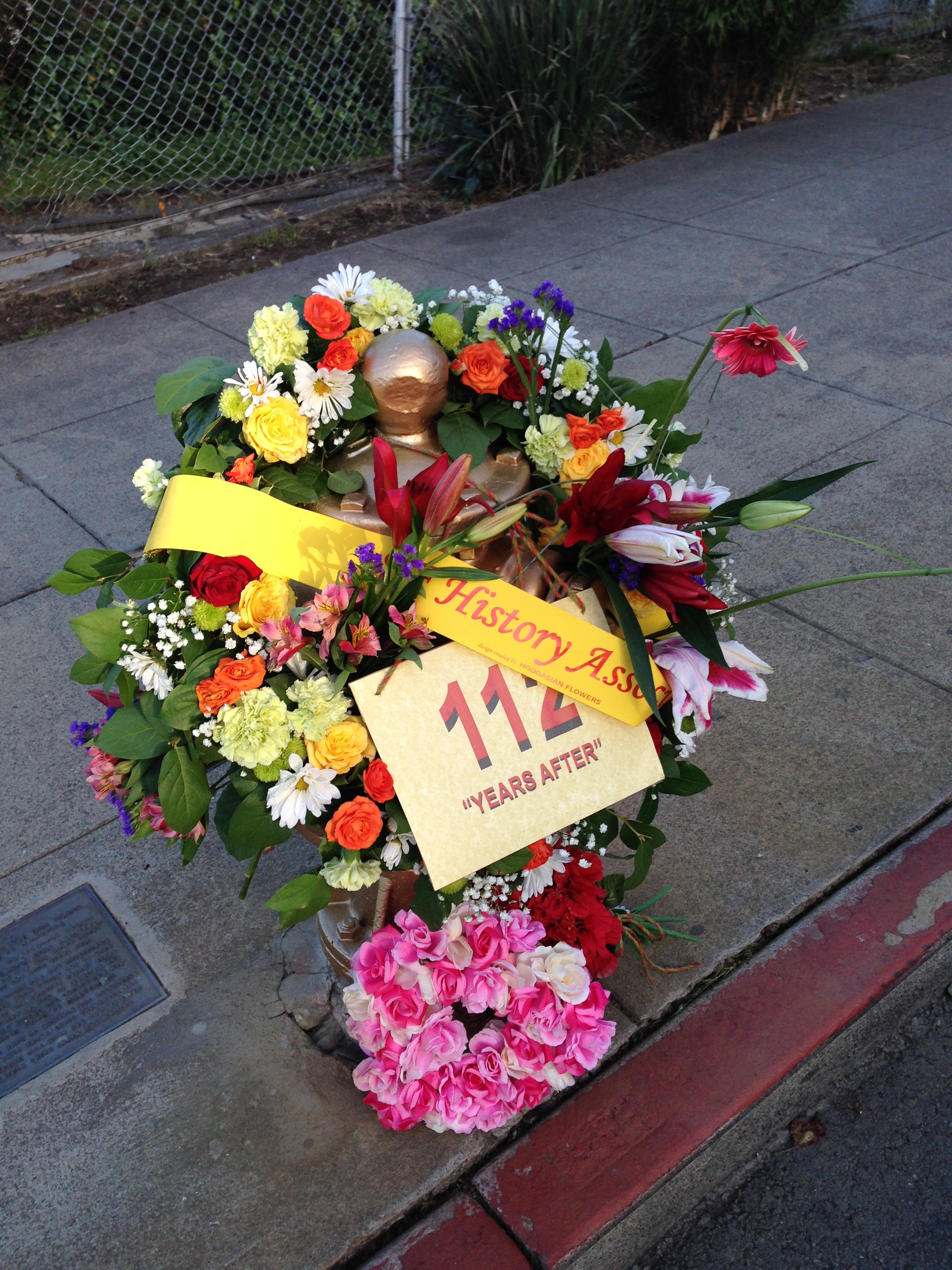
Valient efforts by firefighters and volunteers stopped the fire at Dolores/20th. Firefighting throughout the city was hampered by broken water mains, but a working fire hydrant at 20th/Church was credited with saving the Mission, Eureka Valley and Noe Valley. It's now known as the Golden Hydrant, honored annually on the anniversary of the earthquake, as pictured here on 4/18/2018.
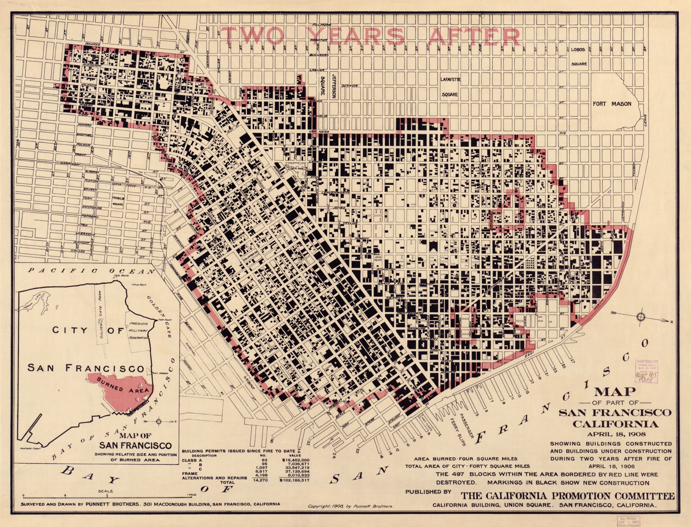
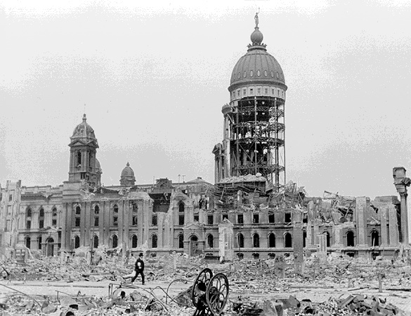
Mission High survived the fire, but buildings on the east side of Dolores did not. A 1908 map shows the burned area quite precisely: in the Mission District, it's roughly a rectangle bounded by Duboce/Howard (now South Van Ness)/20th/Dolores. Here the rubble has been cleared, leaving empty blocks of devastation. Left: from 19th/Sanchez. The three houses in the shade at lower left are on Hancock Street. Right: from Liberty just east of Church, with 296 Liberty (corner Liberty/Church) at left and 264 Liberty (also seen above) at right. The dome of the ruined City Hall is on the horizon at center.

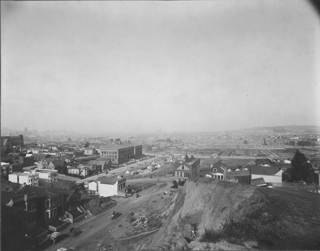
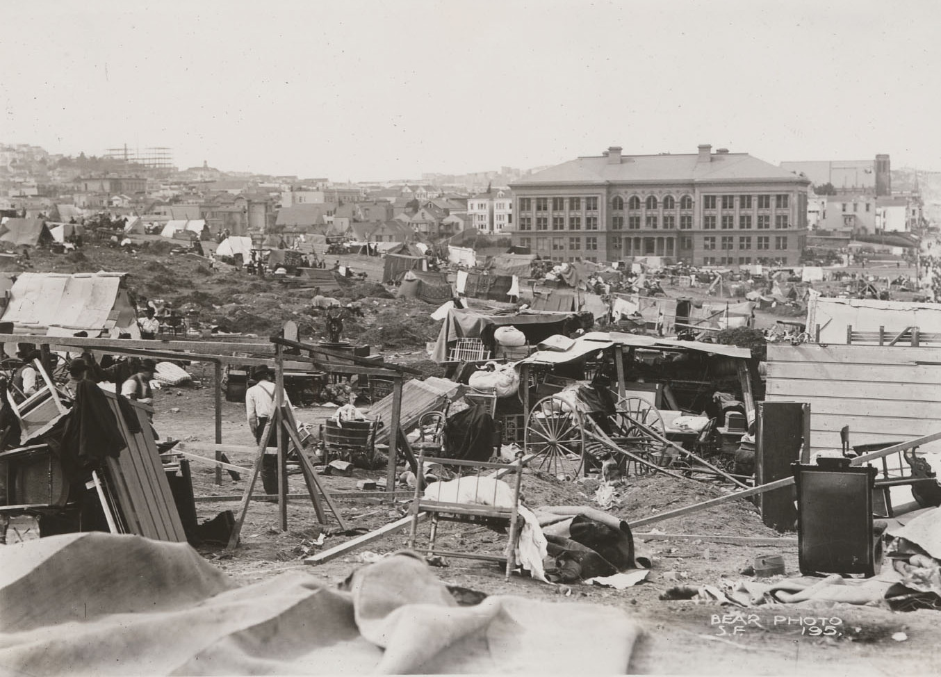
After the fire, between 18th/19th, looking west and east. The first photo looks west from Valencia, with Mission High at left. The second looks east from Dolores, past the foreground tents in the park toward the severely earthquake damaged and fire ravaged Catholic Youth's Directory building at 19th/Guerrero at right. Mission Creek once drained into marshy Lake McCoppin here, and many nearby buildings built on landfill (such as the Valencia Hotel) did not fare well in the quake.

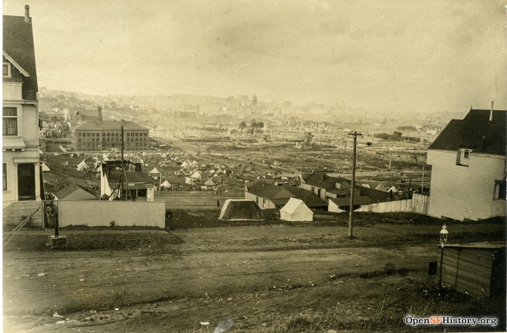
Looking uphill toward Church/20th, from Dolores just north of 18th and from Dolores/Cumberland. The first photo is dated 5/15/1906, a month after the quake; it's one of few pictures on this page with a known date.
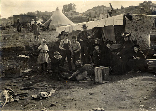
Refugee life in the park after the earthquake. Wikipedia says the quake and fire destroyed 80% of the city, rendering more than half of the population of 410,000 homeless. The photo on the left has great resonance for me vis-a-vis San Francisco's current homelessness. Many San Francisco families were large in 1906; the second photo might be a single family with parents, aunt, grandma, and seven kids, all living in an improvised tent.
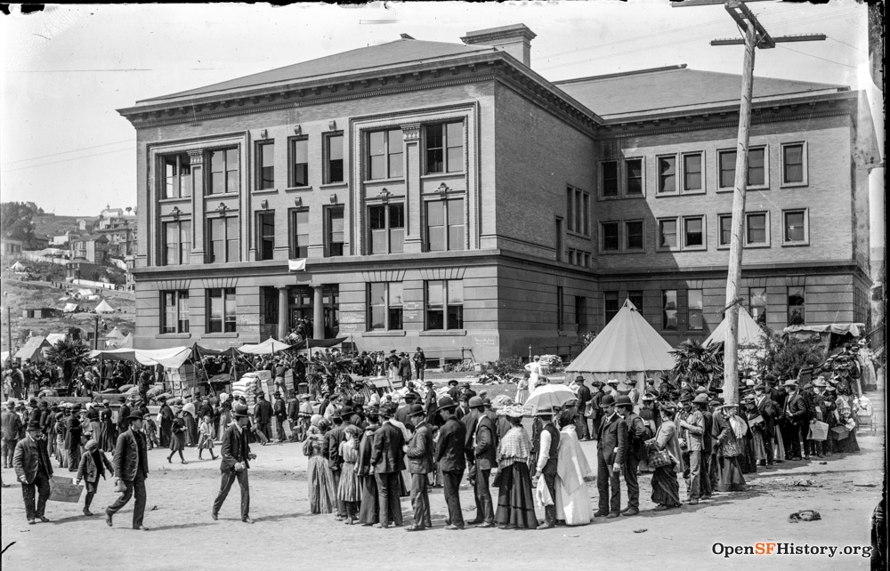
Here's a food line of surprisingly well-dressed people at the east entrance of Mission High, with tents in the park visible at left.
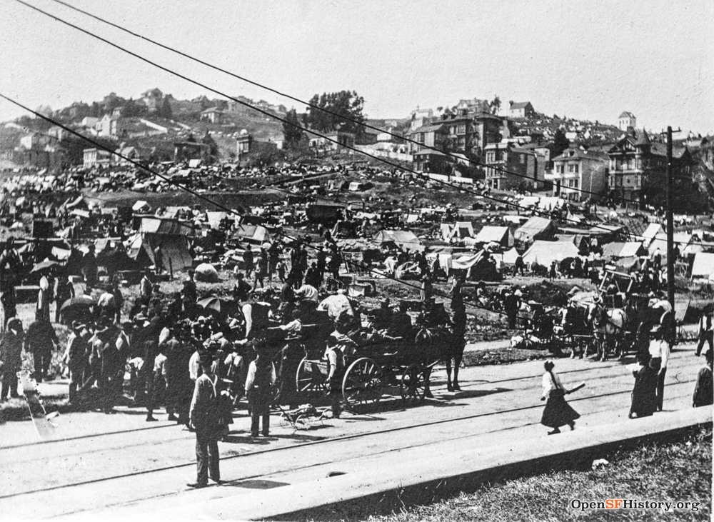
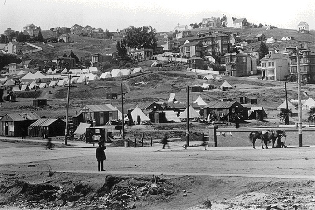
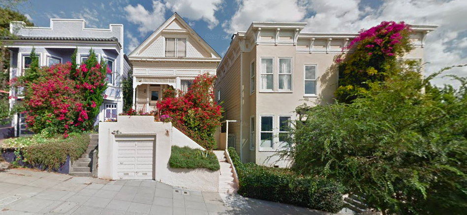
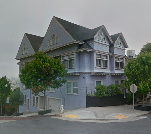
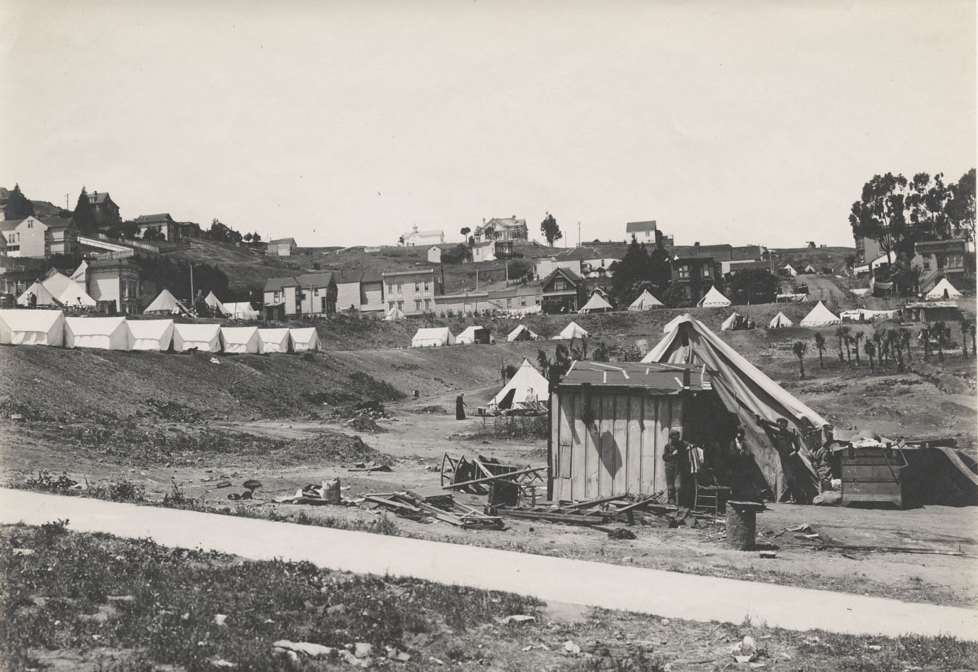
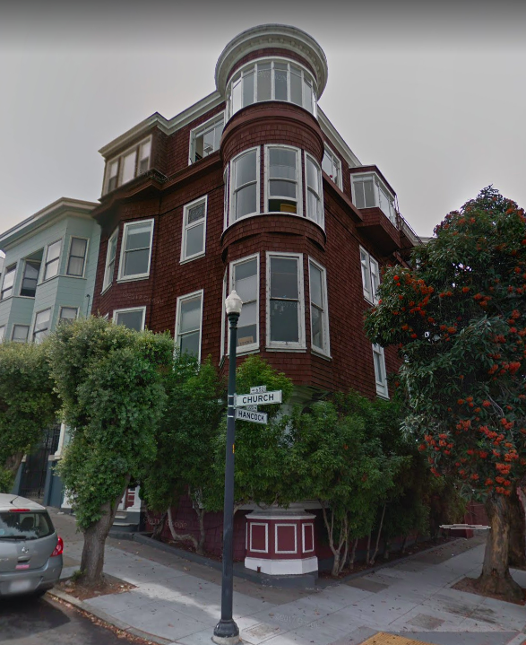
The park fills with refugees and tents. Eventually the city builds shacks in the park for the refugees; the second photo shows a few shacks scattered amid tents. The shacks ("cottages") were rudimentary one-room structures with neither plumbing nor heating. 650 Church (corner Hancock) at the right edge and 662 Church to its left remain today, 650 now with an expanded third floor but without its witches' hat turret.
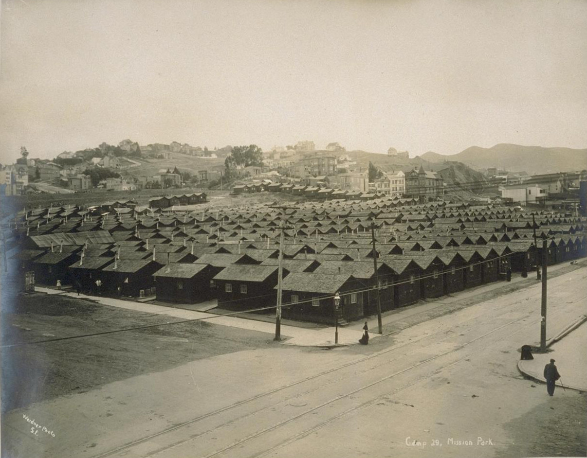

The first photo (undated, presumably late 1906 or 1907) shows a very orderly grid of shacks, though closer inspection reveals that they are not identical: windows differ, dimensions differ, orientation (E/W vs. N/S) differs. The caption identifies this as Camp 29; parks throughout the city hosted similar camps, with about 5,600 shacks in total. Wikipedia says the camp eventually housed over 1600 families, but I think that should read 1600 people; this picture shows a few hundred shacks, and they fill much of the available space. Eventually some earthquake shacks migrated to become tiny homes elsewhere in the city; a few still survive. The last shacks were removed from Mission Park in 1908, two years after the earthquake and fire. These photos (and may more earthquake relief camp photos here) are by San Francisco photographer Charles Weidner.
Sources:
- Breer, Carl: The Earthquake Story of Stanford University and San Francisco, California, Vol. I, Vol. II.
- CurbedSF / Alex Bevk: Remembering Earthquake Shacks.
- FoundSF / Burrito Justice: 18th St. Gulch, The Willows, Valencia St. Hotel.
- Hansen, Gladys: Timeline of the San Francisco Earthquake.
- Kennedy, Lawrence J.: The Progress of the Fire in San Francisco.
- San Francisco City Guides / Dawn Murayama: Where was the Valencia Hotel?