Panoramas
This page shows postcards with panoramic views of San Francisco.
Panoramic views of downtown taken from the Hopkins Mansion before, during, and after the 1906 fire
are on the Earthquake/Fire: Nob Hill Panoramas page, not here.
-
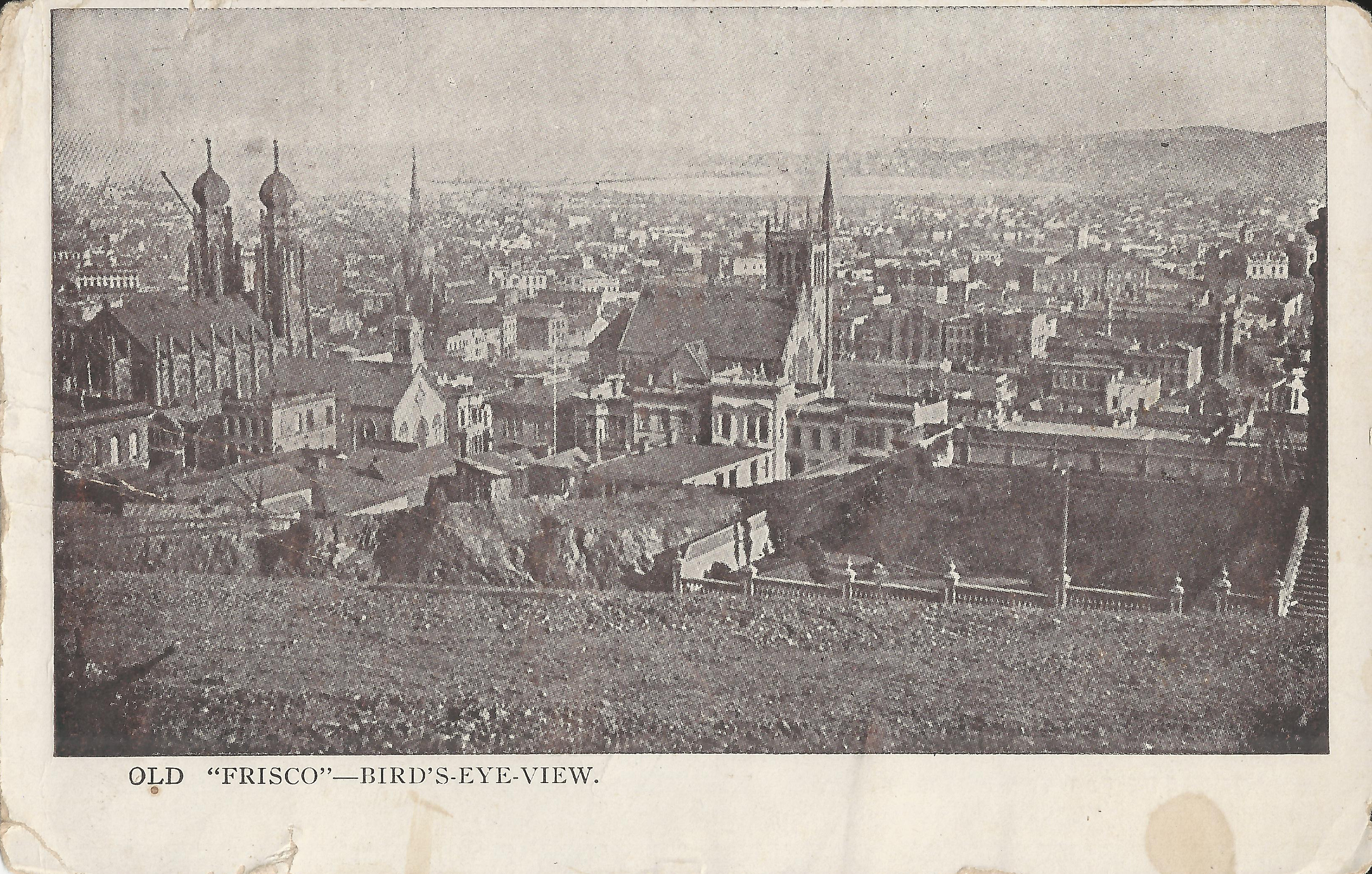
Unknown publisher (b+w) is a 19th image looking southeast from California/Mason;
the postcard dates from many decades later.
OpenSFHistory.org dates the image as 1867, probably because it shows
Trinity Episcopal Church at center (built 1867, NE corner Post/Powell).
Left: Emanu-El Synagogue (Sutter btw. Stockton/Powell).
Union Square is just past Trinity Church.
-
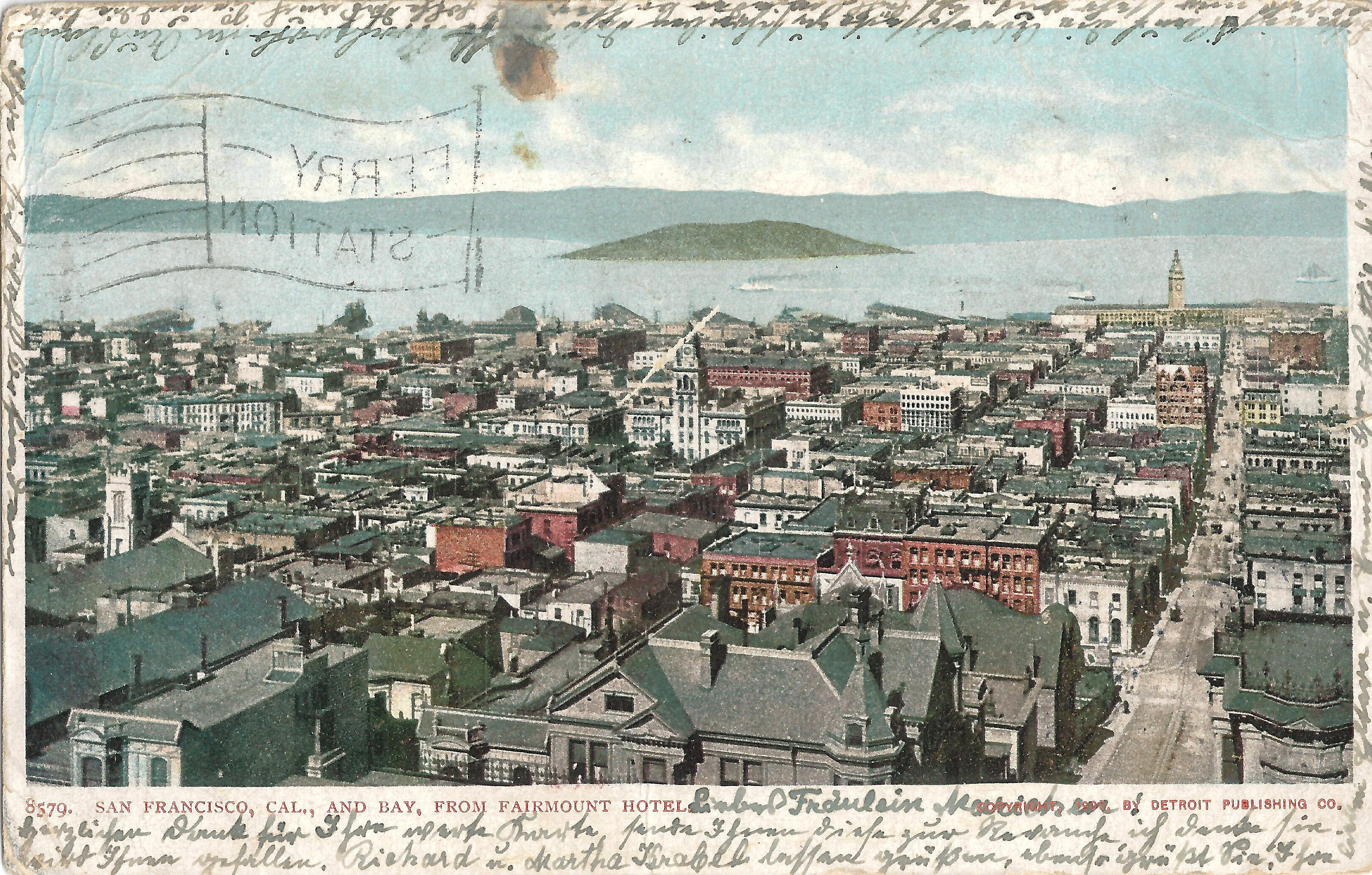
Detroit 8579, postmarked 11/09/1905, looks east on Sacramento from just above Powell.
Left: tower of Chinese Presb. Church (Stockton/Clay) with Commercial Hotel (Columbus/Kearny) above it.
Center: Hall of Justice.
Right: Sacramento leading to the Ferry Building.
-
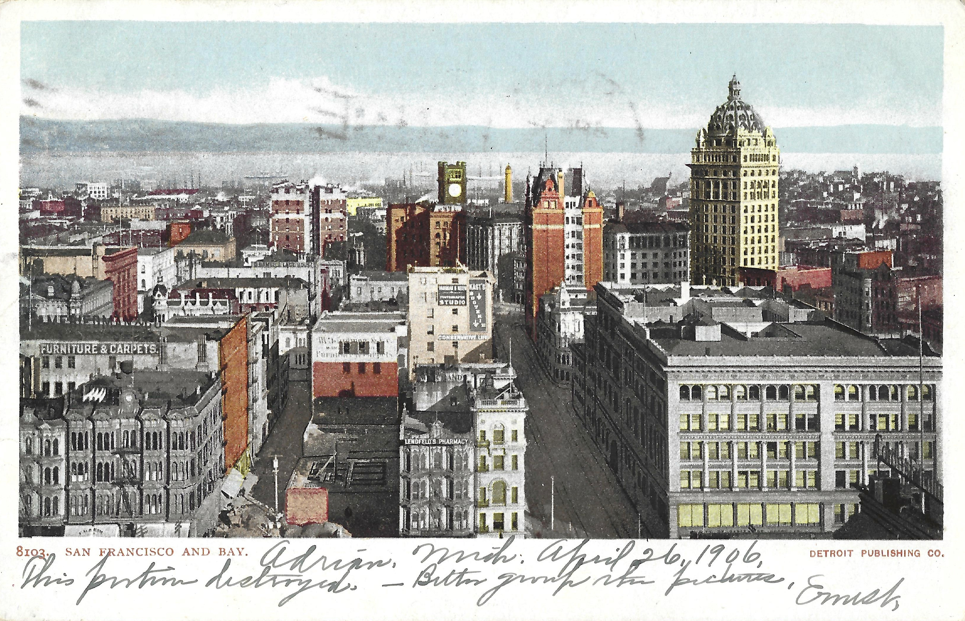
Detroit 8103, postmarked 4/26/1906, is an uncommon view:
it looks east on Geary from a high floor of the St. Francis Hotel.
Union Square is below the bottom edge (not shown),
the buildings at bottom are on Stockton,
lower right is City of Paris,
Selby Shot Tower (Howard/1st) is between the Chronicle clock tower and the Mutual Savings tower.
-
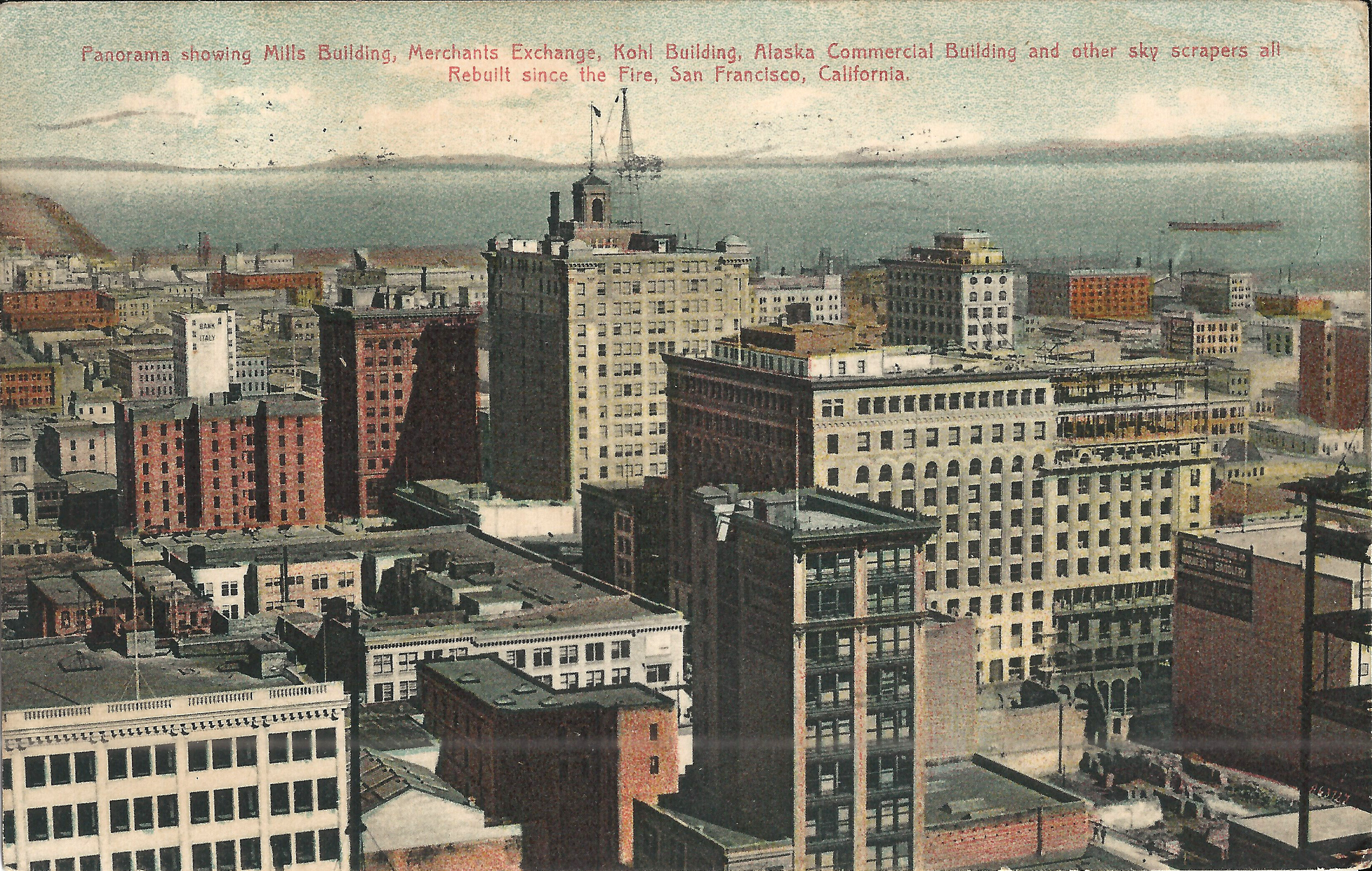
Goeggel & Weidner 53, b+w, postmarked 1/02/1904, looks north on Kearny to Telegraph Hill from the Call Building.
Left edge: turret of California Hotel (Bush between Grant/Kearny).
Bottom left: Chronicle clock tower.
Right: Mills Building at northeast corner Bush/Montgomery, built 1892.
The image predates the Kohl Building (1901) and the Merchant's Exchange (1904).
-
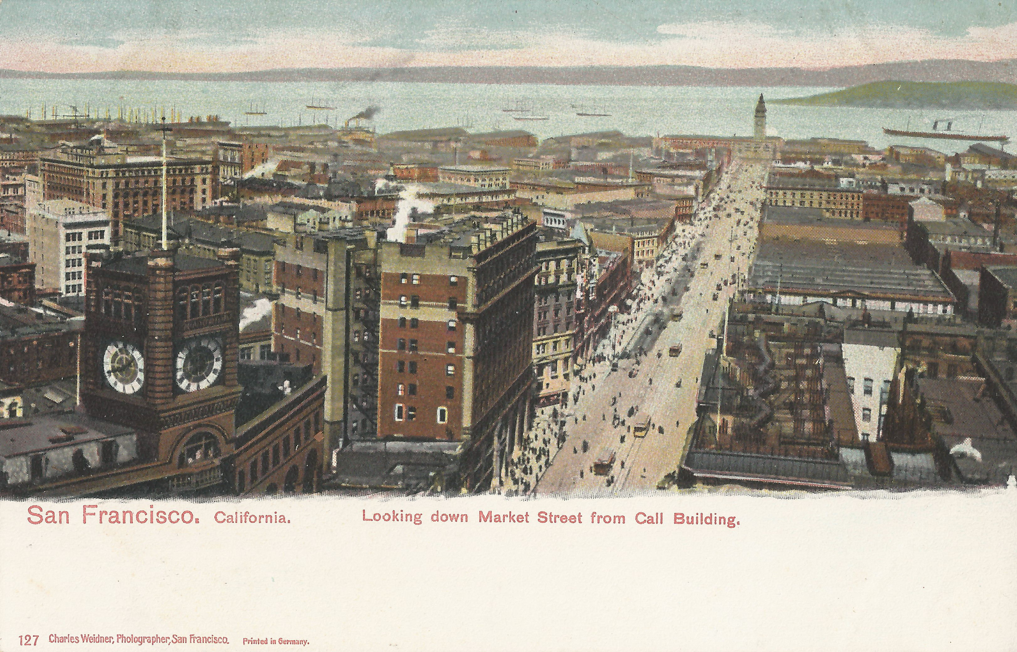
Weidner 127 looks east to the Ferry Building from the Call.
The Chronicle clock tower at left burned in late 1905 and was never replaced.
-
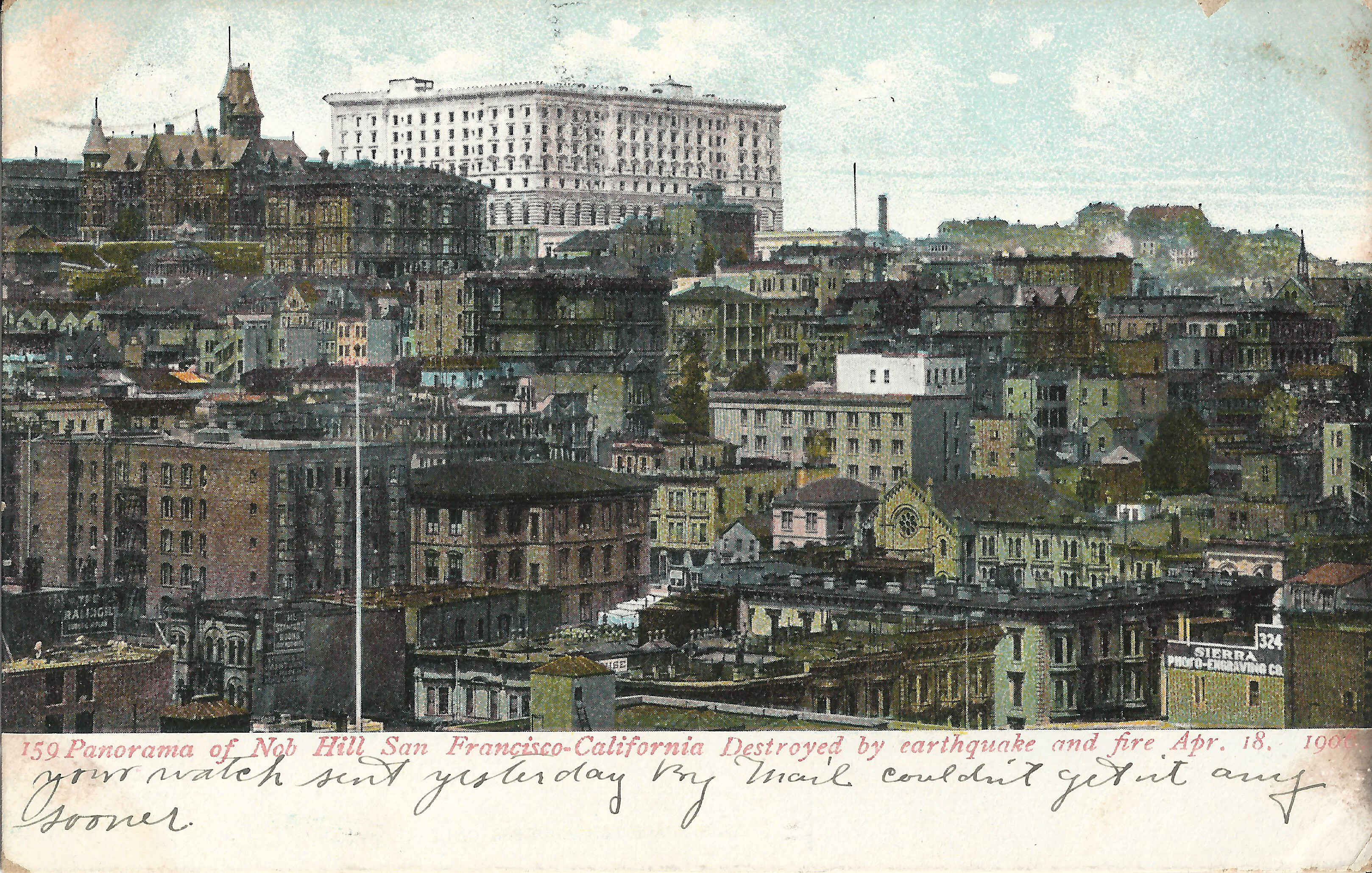
Weidner 159, postmarked 10/05/1907, looks northeast to the Hopkins Mansion and Fairmont Hotel on Nob Hill,
probably from the Mechanic's Institute (Post between Kearny/Montgomery).
-
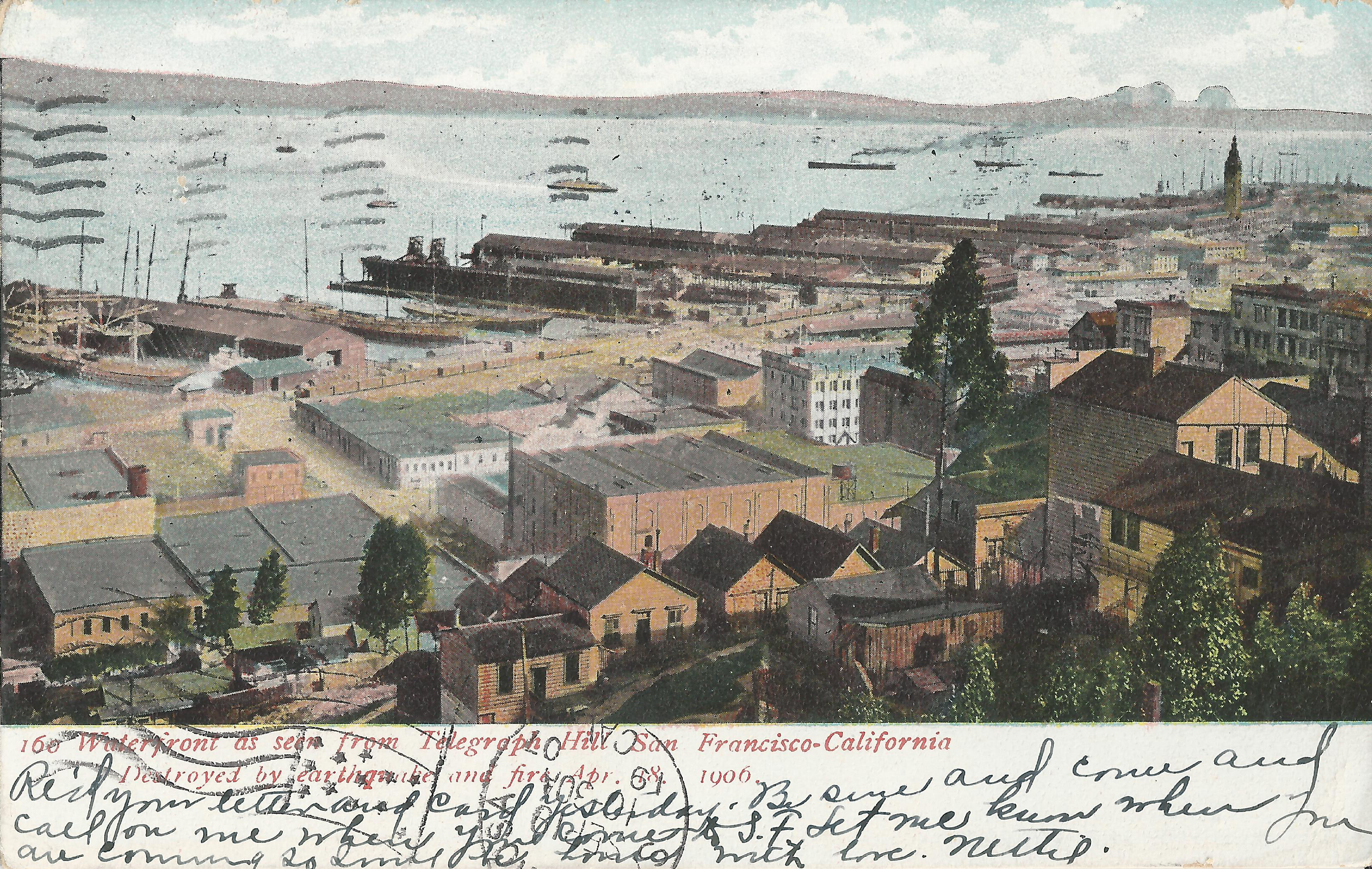
Weidner 160, postmarked 9/19/1907, is a pre-quake image with an added post-quake caption.
It looks southeast from Telegraph Hill (Montgomery just north of Filbert)
to the waterfront and the Ferry Building (top right).
Filbert runs diagonally at left center.
The added "Destroyed by earthquake and fire" caption is inaccurate.
The fire destroyed most of San Francisco north of Market and east of Van Ness,
but several pockets escaped, including many of the buildings shown here.
Still standing today (in 2025):
five houses at bottom center, 28/22/16/10/8 Napier Lane
(off the Filbert Steps between Sansome/Montgomery);
houses at right edge center on Alta, including 25 Alta;
low building with odd roof at center, 1075 Front (SW corner Union/Front).
The four story warehouse at center (SE corner Filbert/Sansome) was the Gibralter warehouse;
its block is now part of Levi's Plaza.
These cards show views from the Call Building.
-
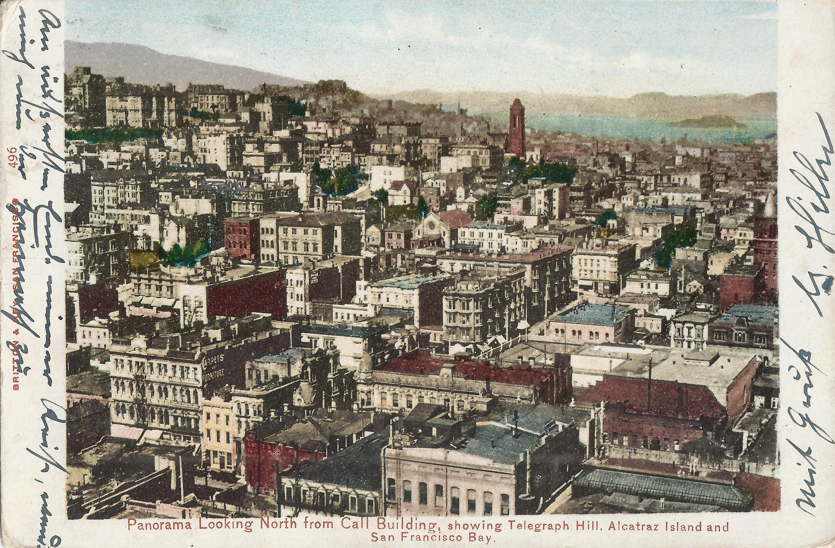
Britton & Rey 496: postmarked 11/06/1903, looks northwest from the Call.
Dupont (Grant) runs lower left to upper right;
Grace Church (California/Stockton) center top;
California Theatre tower right edge (Bush between Kearny/Dupont).
The top of the Hopkins Mansion tower (left edge top) seems to be missing.
-
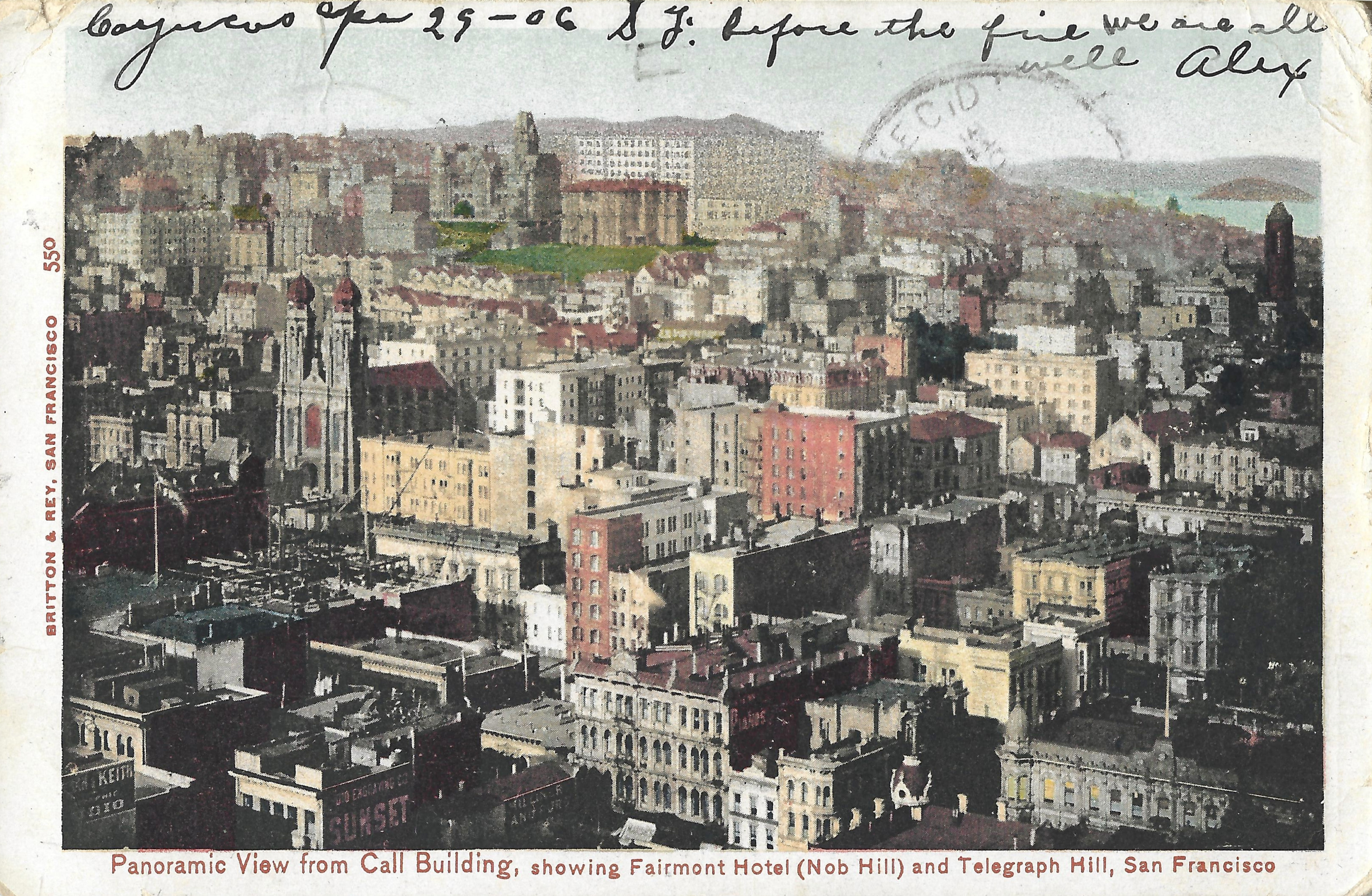
Britton & Rey 550, postmarked 4/30/1906, looks northwest from the Call,
a slightly more westerly view than the preceding Britton & Rey 496.
The position of Alcatraz has shifted vs. 496 (note its position relative to Grace Church),
presumably an enhancement by the postcard artist.
The Fairmont Hotel on Nob Hill, shown here but not in 496, might also be an artist's rendering.
Construction of the Fairmont began in 1903.
-
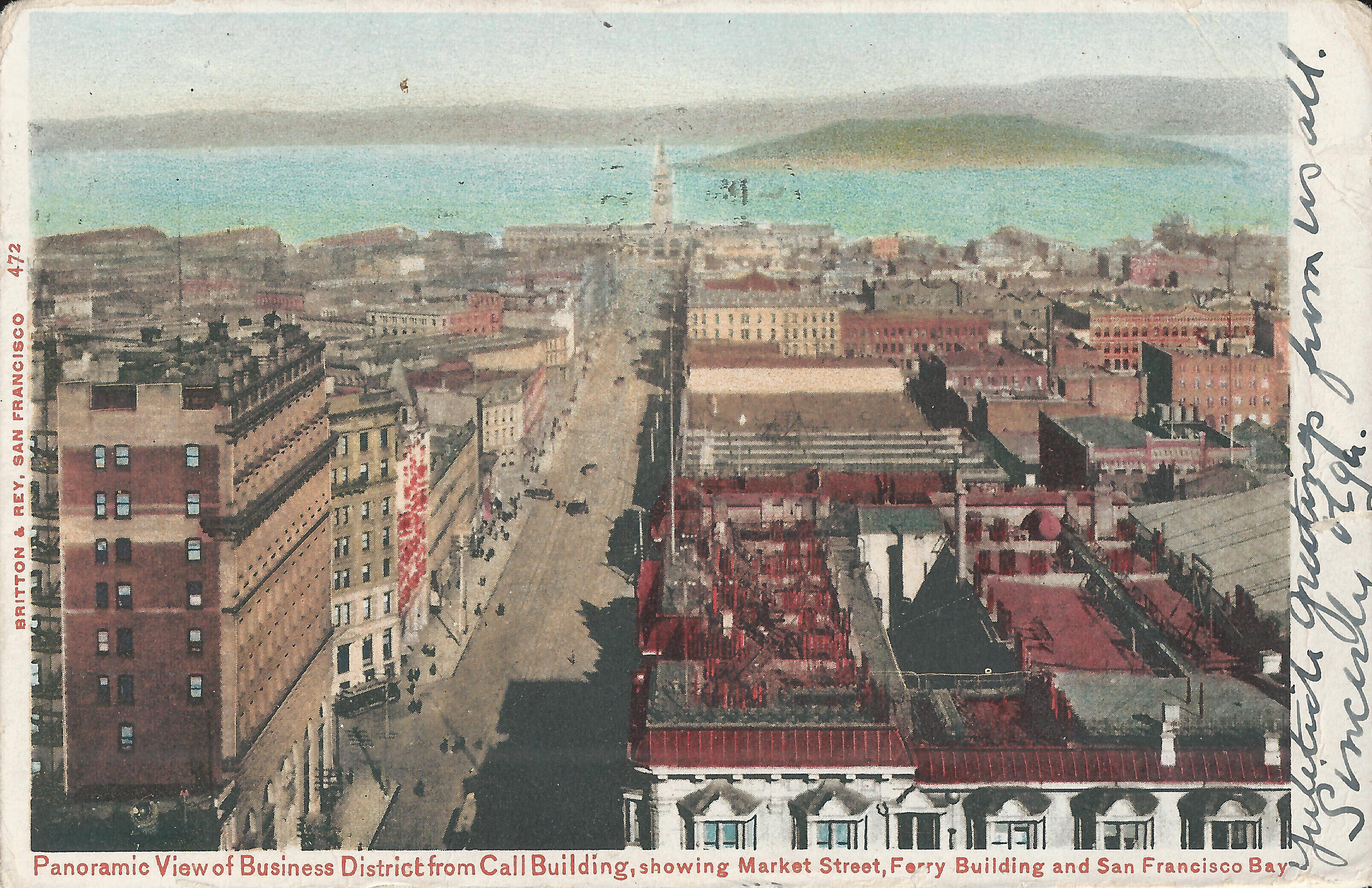
Britton & Rey 472, postmarked 12/18/1905, looks northeast on Market to the Ferry Building.
Left: Crocker Building. Bottom right: Palace Hotel.
-
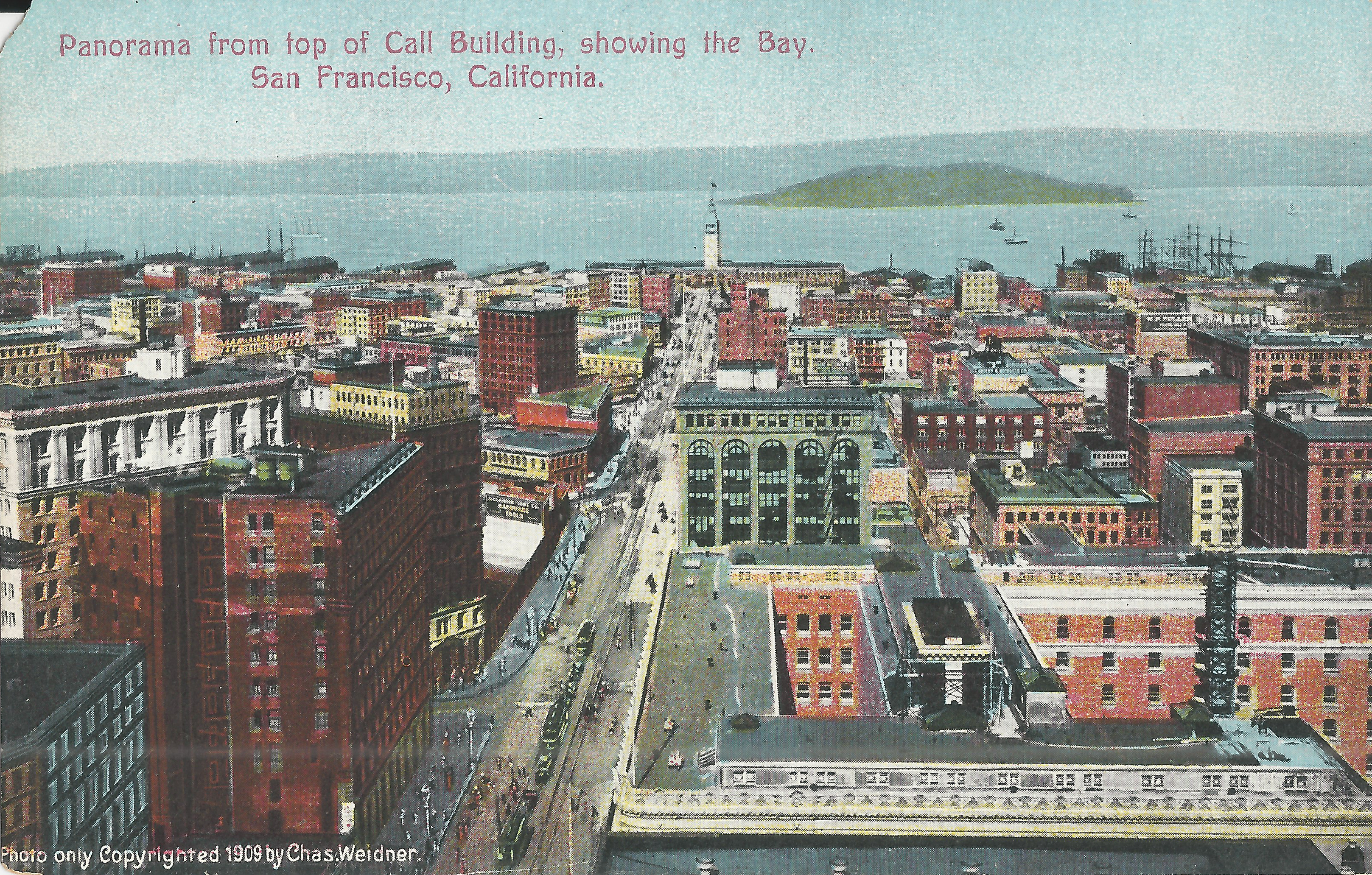
Newman V198, ca. 1909, shows a post-fire view from the same spot as the preceding card.
The Crocker Building (left) and Palace Hotel (bottom right) are newly built
post-fire replacements on the same sites as their predecessors.
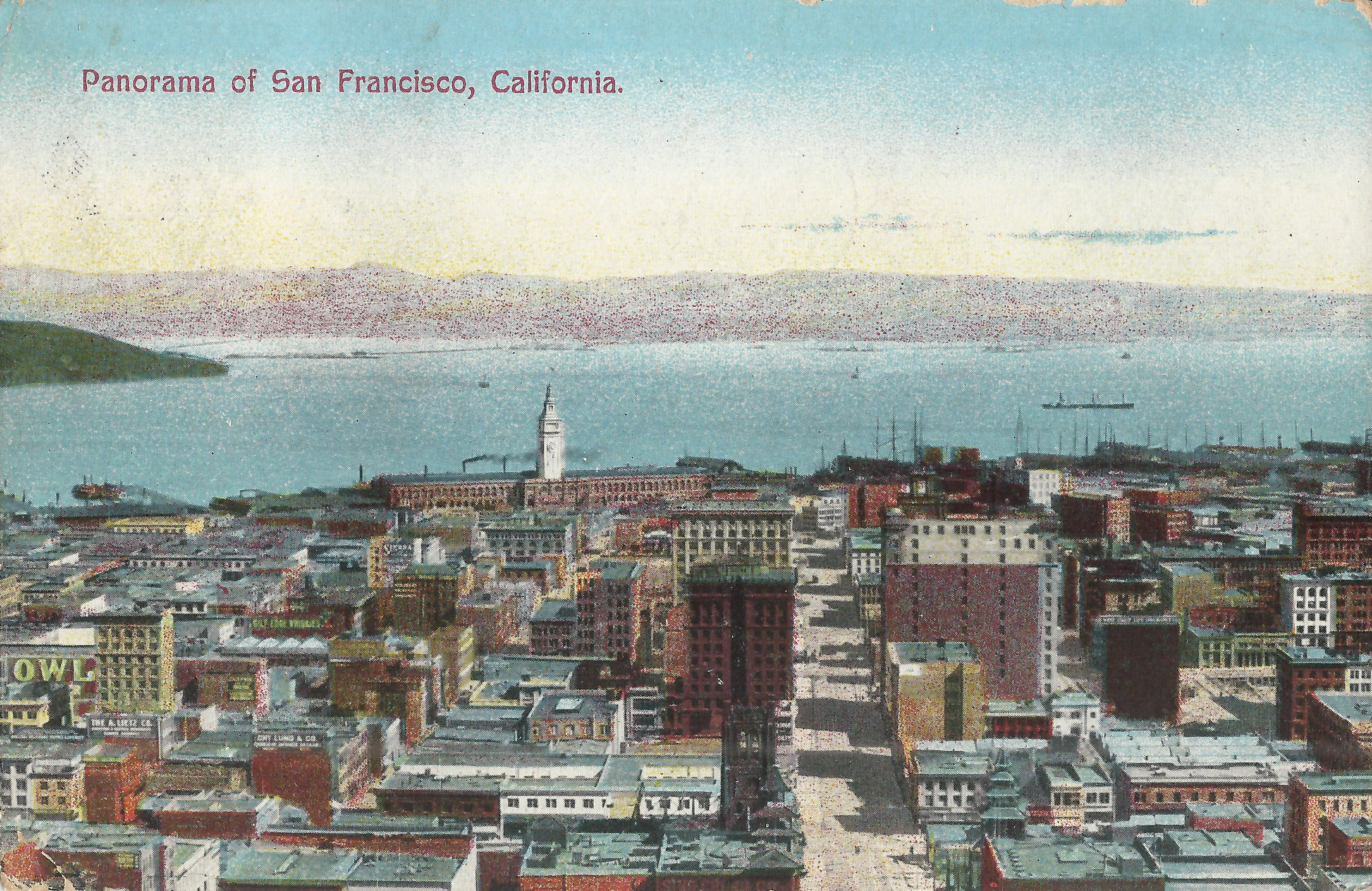
These Weidner cards show the post-fire rebuilt city.
-
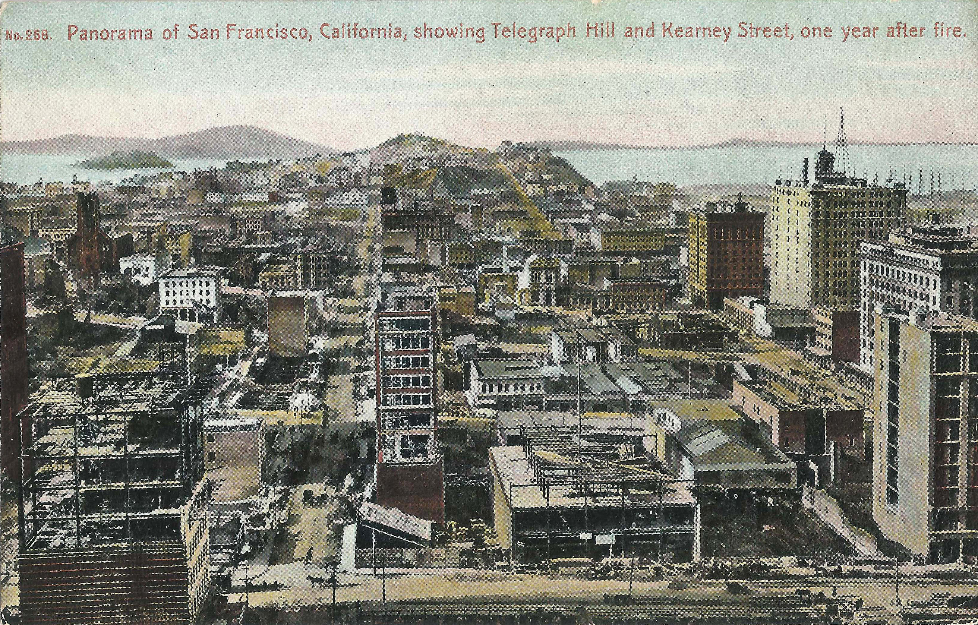
looks north to Telegraph Hill,
probably from First National Bank building at Post/Montgomery (a.k.a. Crocker Bank Building, now 1 Montgomery).
Bottom: Sutter; center: Kearny; right: Montgomery.
Left edge middle: Old St. Mary's, California/Grant.
Middle right: Kohl Building and Merchant's Exchange, California/Montgomery; Mills Building (Bush/Montgomery).
The caption says "one year after fire"; much rebuilding is in progress.
-
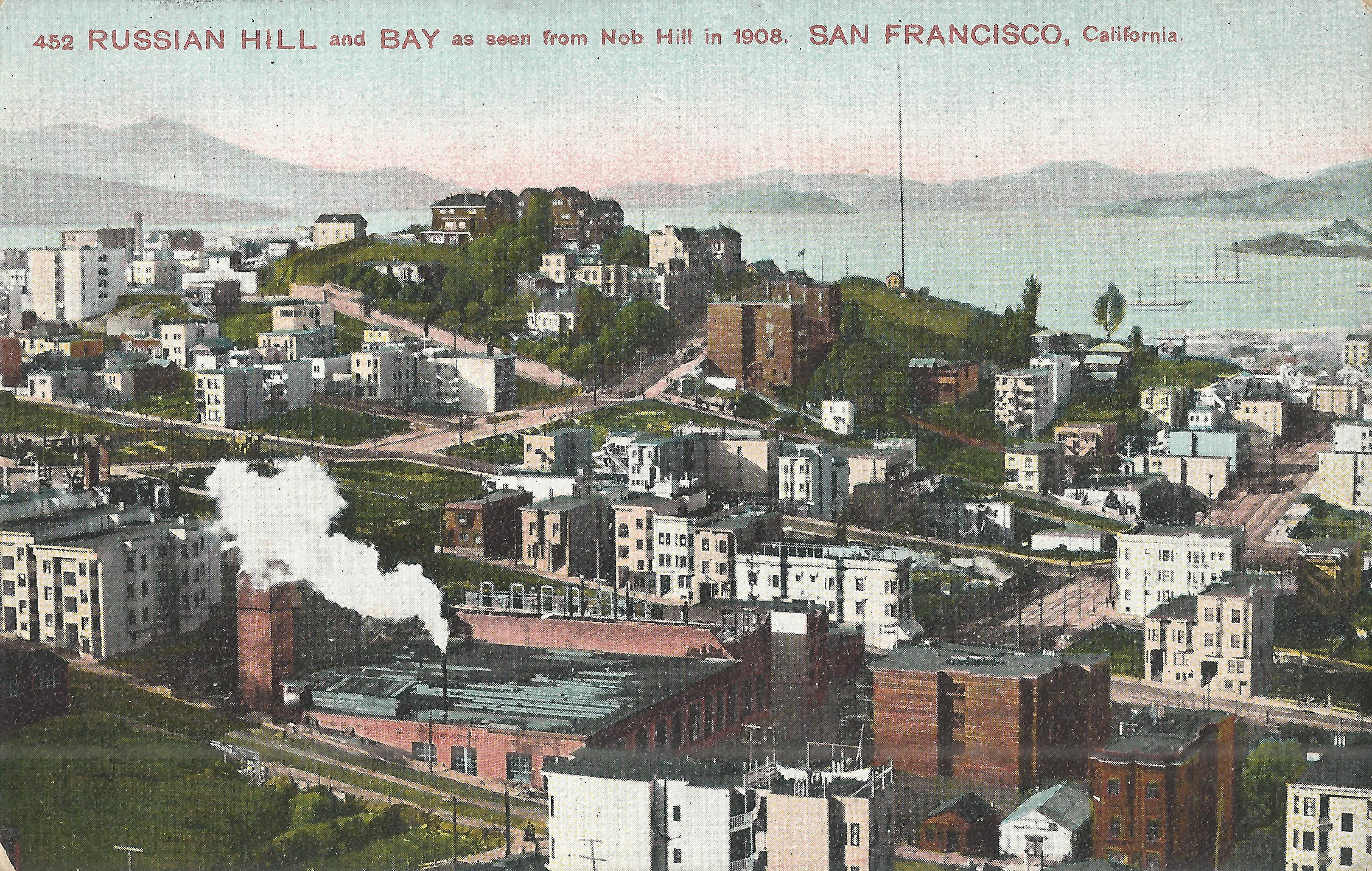
looks northwest to Russian Hill and the bay from Washington/Mason.
The low building at bottom center is the cable car barn at the northwest corner of Washington/Mason.
Taylor/Broadway is just below the peak of Russian Hill;
a small pocket of buildings there survived the fire, but everything else here burned on day 3 (4/20/1906).
-
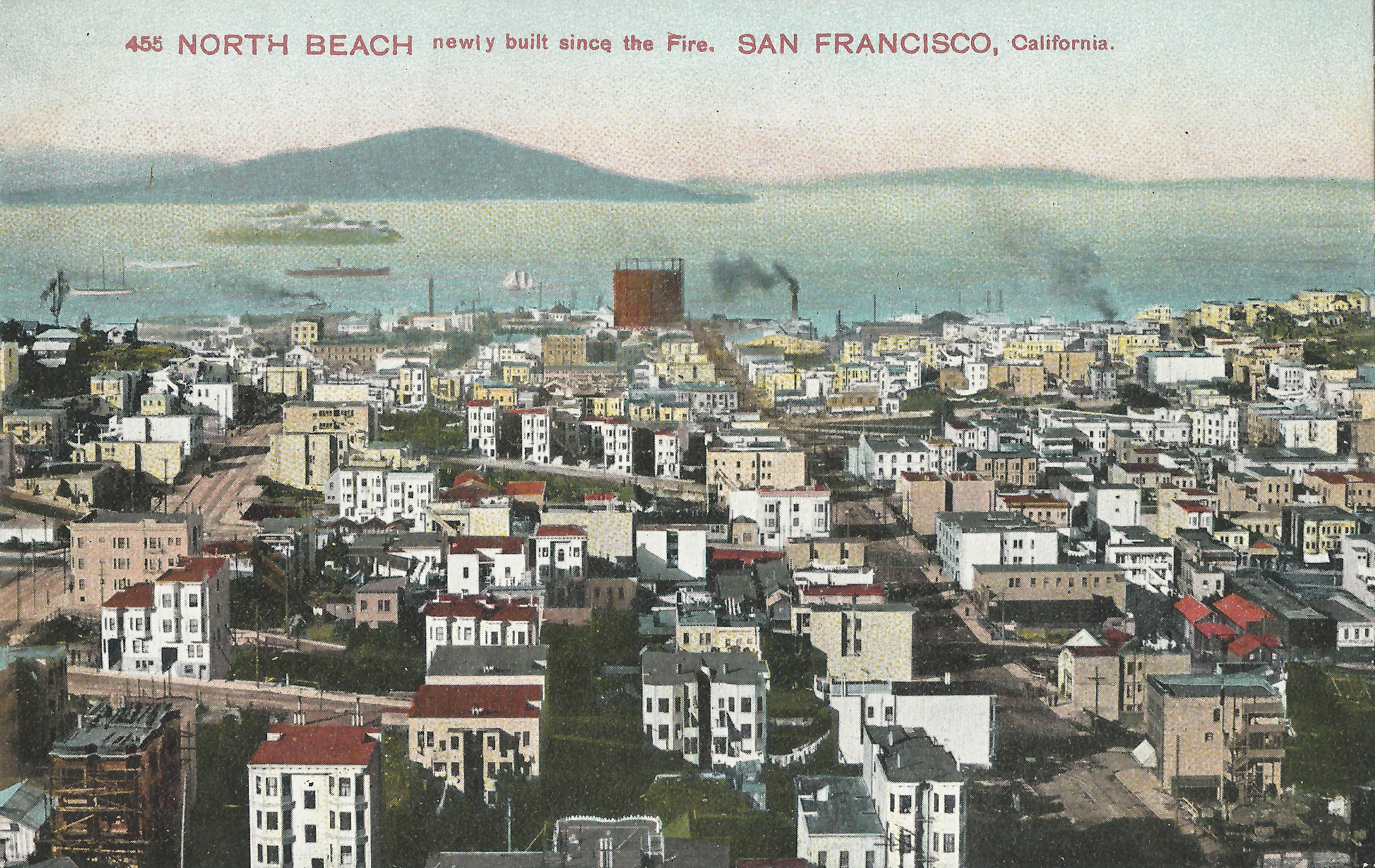
looks north to North Beach from Jackson between Mason (left) and Powell (right).
This area was destroyed on day 3 of the fire.
Most of the post-quake buildings shown still stand today (in 2025).
- Pacific Novelty 218, postmarked 7/18/1910, looks east down California from Nob Hill.
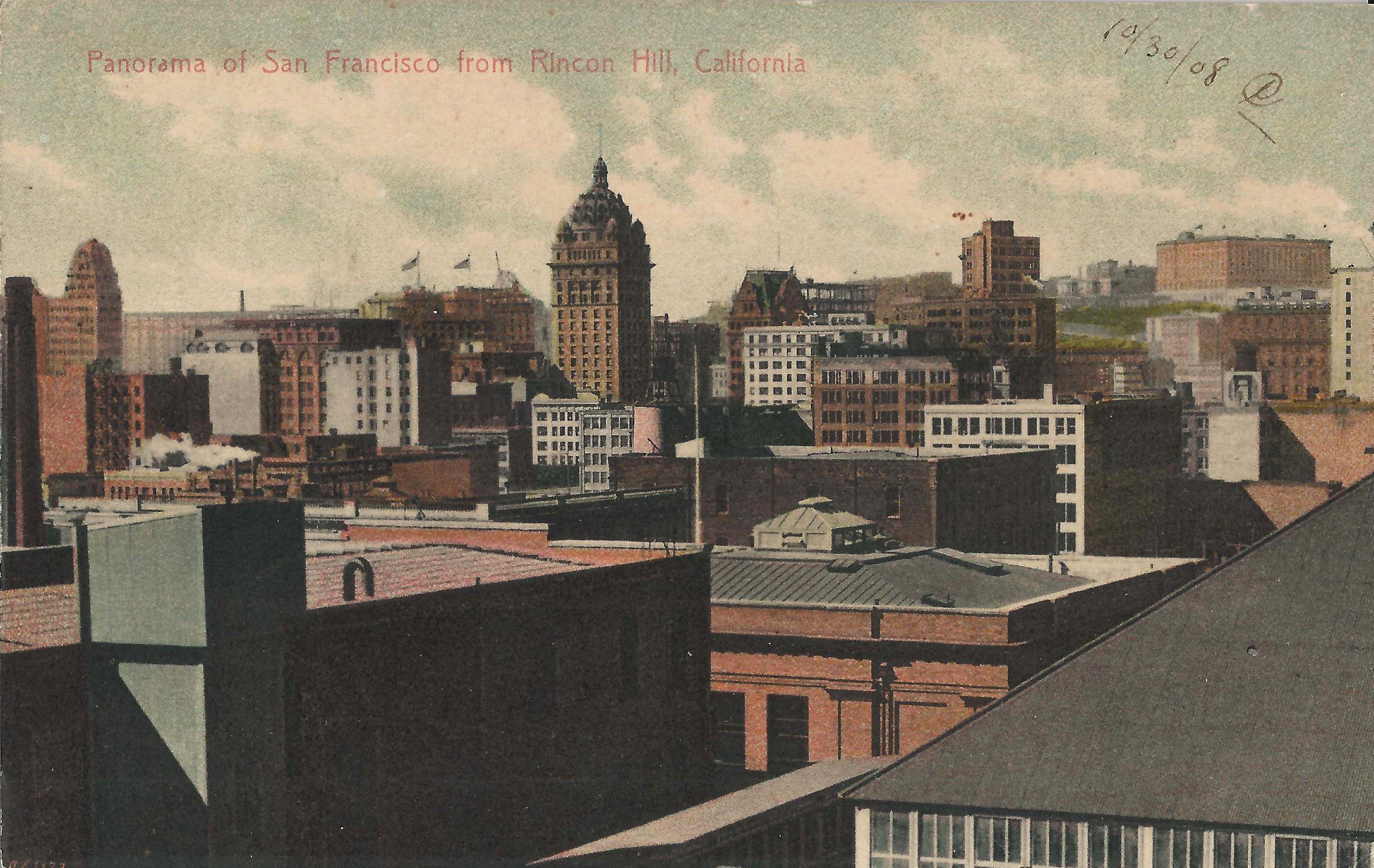
- , postmarked 10/31/1908, looks northwest toward the Call from Rincon Hill (ca. Harrison/2nd).
- , postmarked 2/20/1909, looks southeast from ca. California/Stockton showing post-quake financial district buildings.
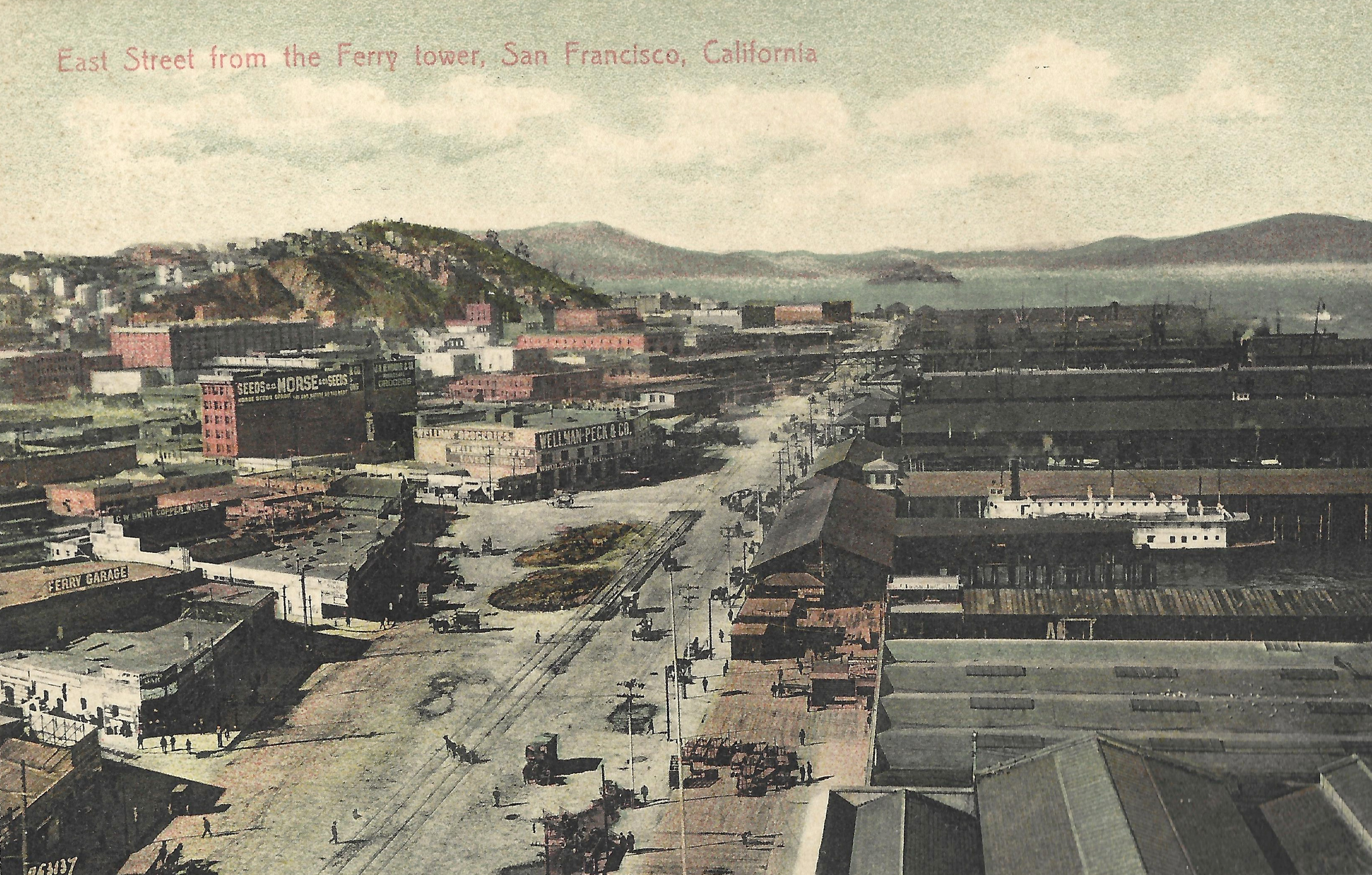
- looks north on East Street (now Embarcadero) from the Ferry Building tower.
These multiview cards show before/after images (more or less).
-
Behrendt 501 oddly shows three unrelated views for before/after/today.
The before image looks east from the Hopkins Mansion before the fire (Call Building at center).
The after image looks southeast past Union Square from ca. Bush/Taylor (Call at left).
The today image looks southwest from Telegraph Hill between Montgomery and Kearny;
the Merchant's Exchange is at left center,
the flatiron Sentinal Building (1907) on Montgomery Ave. (now Columbus) is middle right.
-
Britton & Rey 1125:
The top image prominently shows the Kohl and Merchant's Exchange buildings
at California/Montgomery, so the viewer must be south of California
and the caption "From Fairmont Hotel" must be incorrect;
Old St. Mary's (California/Dupont) is not shown,
so the view must be from Stockton or Powell just south of California.
The bottom image looks east on California from a much higher viewpoint,
probably from an airplane; the caption "Same view point" is wrong.
These are much later postcards.
-
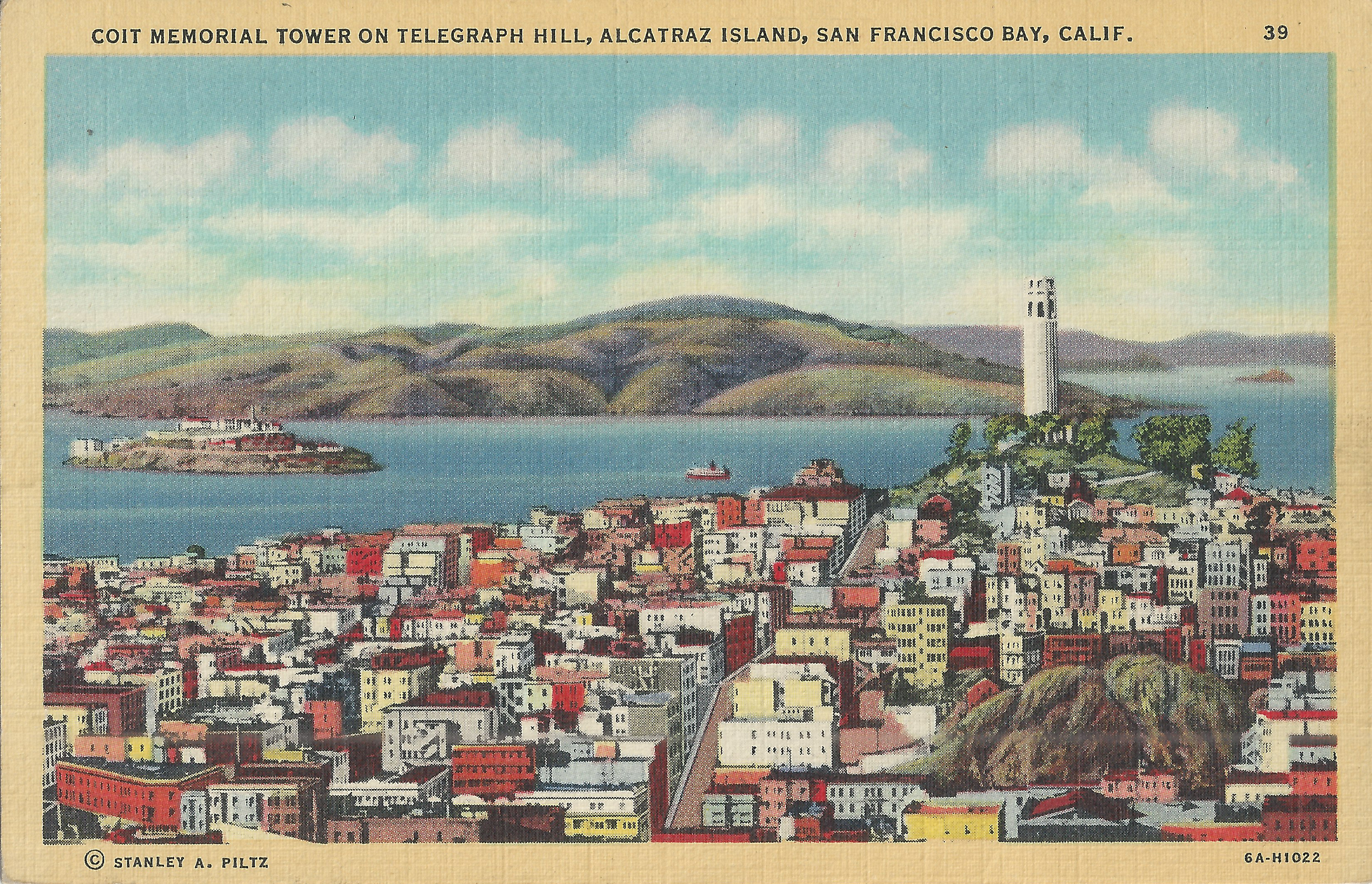
Piltz 39, linen era, looks north to Coit Tower from between Kearny and Montgomery.
Kearny is just right of center and
the bottom edge buildings are on Broadway.
The lower left triangular building at Broadway/Columbus
became famous in the 1960s as the site of the Condor Club, where Carol Doda performed topless.
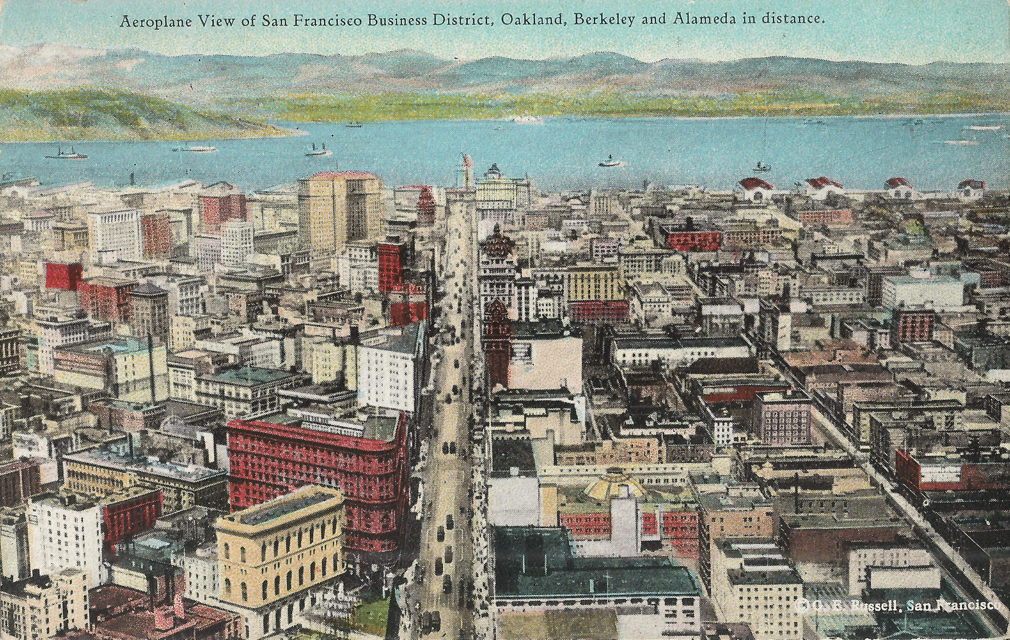
- Cardinell-Vincent 58 is an aerial view looking east on Market to the Ferry Building.
-
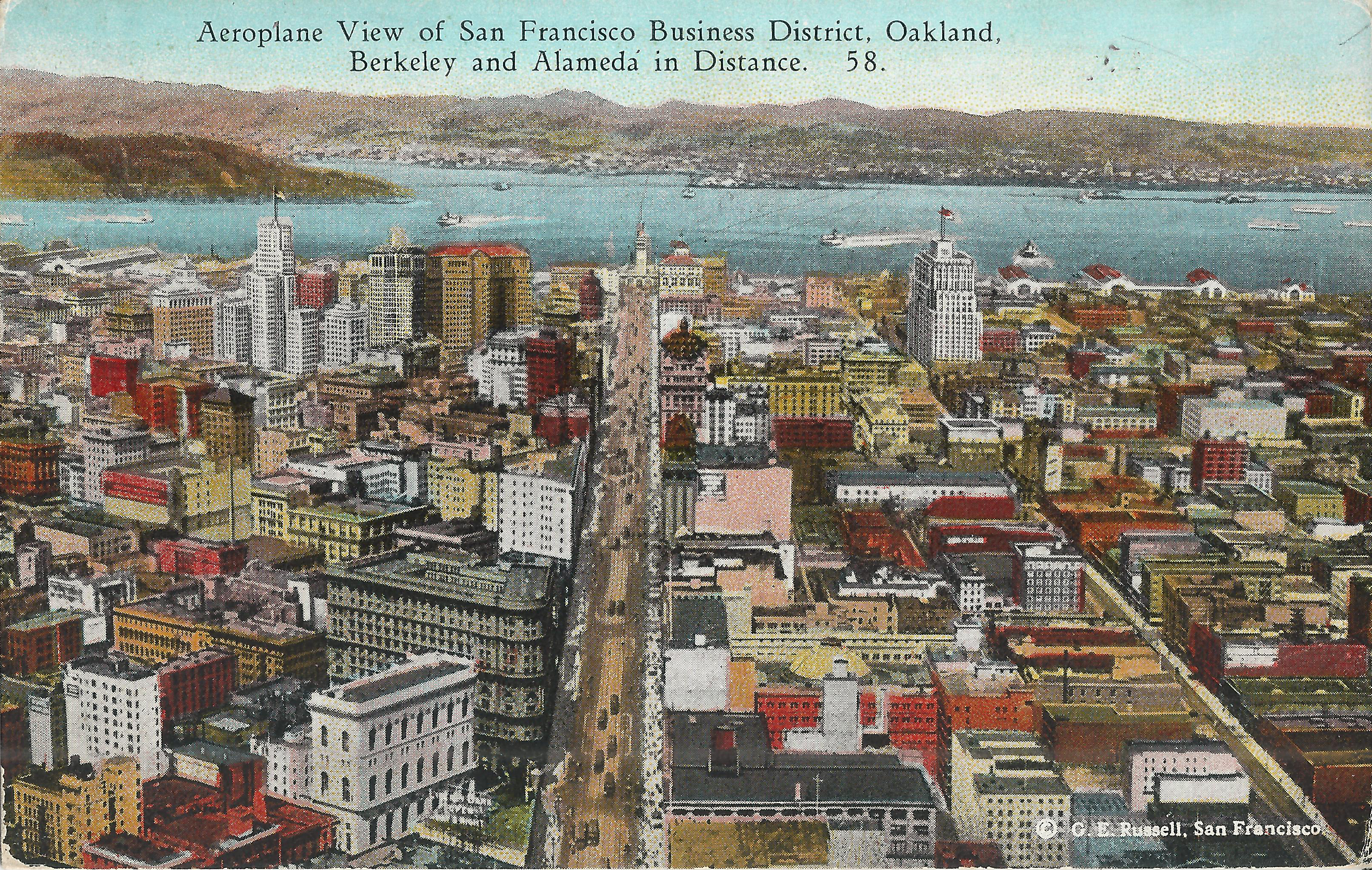
Pacific Stationery 58: the view is identical to the preceding
and vehicles on Market are in the same positions in both,
so both must be based on the same image.
This card contains several buildings not shown in the preceding,
notably the Telephone Building, built 1925.
Steve's SF postcard pages:


