S.F. & S.J. R.R.

Click on any image to view full-resolution version, then use your browser's back button to return. Most of the maps link to zoomable versions, many with geolocation overlays available.

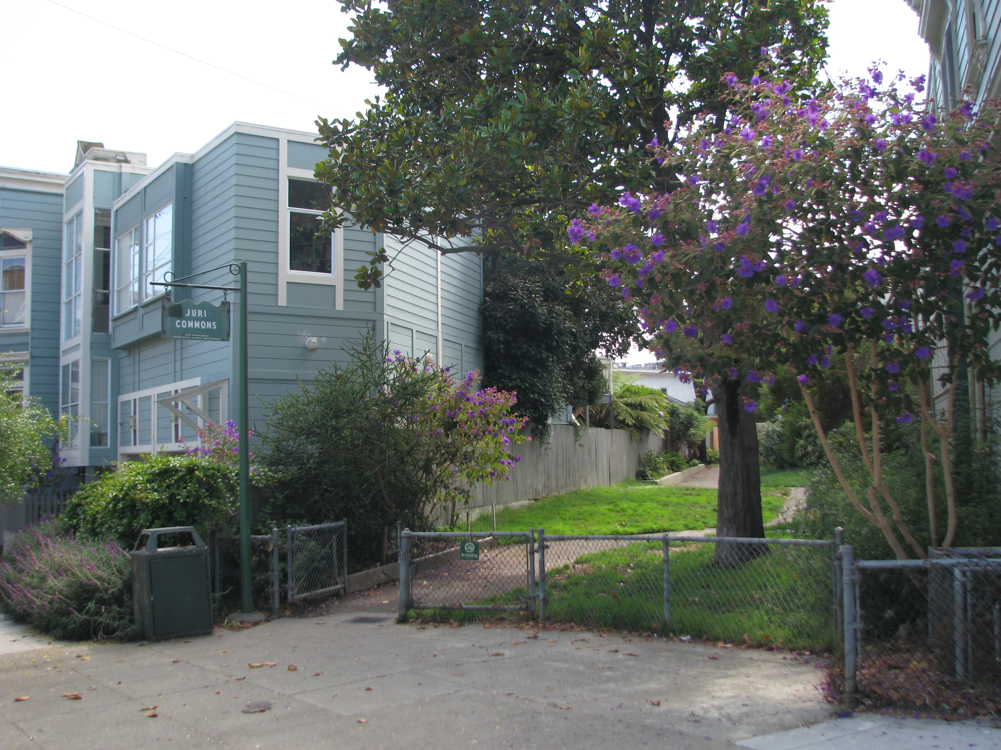
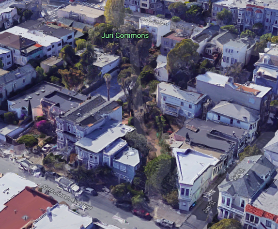
Harrison Street still had railroad tracks when I moved to San Francisco in 1977, and it was hard to miss occasional diagonals of old railroad right-of-way slicing through the Mission's rectilinear street grid toward Noe Valley, like the bizarre Atlas Stair Building (2901 22nd Street at Harrison) and Juri Commons (between Guerrero/26th and San Jose/25th). Let's dust off some old maps (chronologically), eyeball some old photos (roughly north to south), unfold some musty newspapers, and look for some present-day artifacts.
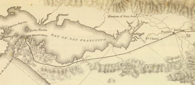
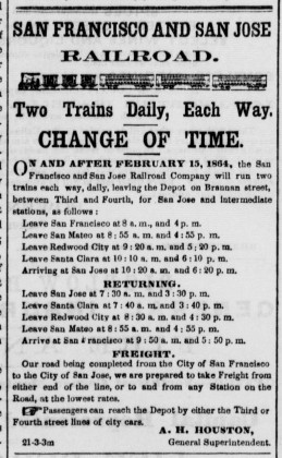
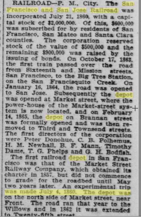
An 1853 survey of proposed California railway routes (northeast at top) shows why building a railroad to San Francisco was a daunting task: the hilly local topography is very problematic, especially the San Bruno range. Several 1850s proposals went nowhere. Then the San Francisco & San Jose Railroad incorporated in 1859, ran its first train from San Francisco to Mayfield (in Palo Alto, now California Avenue) in 1863, and began service from San Francisco to San Jose in 1864 (Daily Alta California 10/18/1863, 01/17/1864). Its route followed roughly the route proposed here, requiring a cut near Glen Park (the Bernal Cut) to get out of the city. Southern Pacific acquired the S.F. & S.J. in 1870 (San Francisco Chronicle 03/16/1870). SP built an alternate route out of SF in 1907 (the Bayshore Cutoff, still in use in 2018 by Caltrain), but the tracks through the Mission and Noe Valley (the "Mission branch") remained in use for some passenger trains until 1932 and for freight trains until 1942.
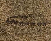
This 1862 S.F. & S.J. map shows the railroad running to Valencia/25th, near the oval Pioneer Race Course. The line does not continue across the Mission and does not cross Mission Creek. I don't think this map indicates the Bernal Cut, but it's hard to tell because of poor image resolution.
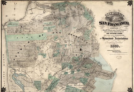
Gensoul's 1863 Railroad Map of the City of San Francisco (west at top) is the earliest San Francisco map I've seen with rail lines marked. The map's legend lists four street railway companies (Market St. RR, Central RR, North Beach & Mission RR, and Omnibus RR). The S.F. & S.J. Railroad line is not listed in the legend but is shown: a station at 4th/Brannan, out Brannan to 9th, across Mission Creek on a bridge at 9th, veer south to 16th/Alabama (now Folsom), and south on Alabama to the edge of the map at Alta (now 21st). But maps can be misleading — looking at the maps below, I think this is the proposed line, not an actual 1863 line, and I believe this map to be one source of oft-repeated incorrect information about S.F. & S.J stations.
Butler's 1864 map paints a picture quite different from Gensoul's map. The S.F. & S.J. line terminates at Temple/Old San Jose (now 25th/San Jose), close to the end of the streetcar line that runs on Valencia from Market to Navy (26th). The line runs southwest through Noe Valley and Glen Park, with depots marked at Old San Jose/Mt. Vernon and Lakeville (Delaware/State, now under I-280 near Worcester/Ramsell). A bridge crosses Mission Creek at 9th/Brannan, but no railroad line is shown there, and the block of Brannan between 4th/5th is under water, part of Mission Bay tidal wetlands. No diagonal track runs through the Mission.
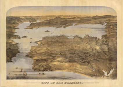
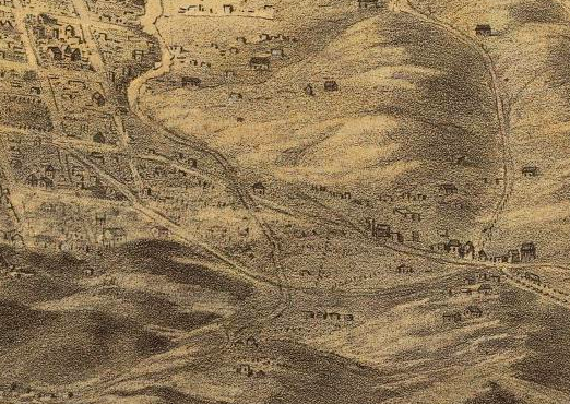
Goddard's charming 1868 birds-eye view from the west is not to scale, but it tells us a lot about San Francisco at the time. In the detail above, the horizontal road is Old San Jose Road (now San Jose Avenue). The diagonal down from left middle is the S.F. & S.J. line. It starts at 25th/San Jose, crosses Precita Creek in uninhabited Noe Valley, and passes through the Bernal Cut before crossing Islais Creek at right (so the houses at right are in Glen Park). Follow the railroad line a little further to find The Little Engine that Could steaming from Lake Merced toward the city.
Goddard's 1869 map shows the SP railroad track on Valencia from Market to 25th Street, then southwest to Dolores and 27th, then curving south between Church and Dolores to Dolores/Old San Jose/Randall, then southwest toward Glen Park and beyond to the city limit. In Noe Valley, the track is within lines that imply an elevated berm. The Bernal Cut is not indicated per se, but the track interrupts contour lines to suggest the cut. The map shows four stations: at Valencia/Market, just south of Islais Creek (Glen Park), at Sickles/Old San Jose, and at San Jose/Delaware. No diagonal track runs through the Mission, no station at 4th/Brannan.

The U.S. Coast Survey of 1869 shows a track crossing the Mission: from 16th/Harrison to 22nd/Harrison, then southwest to join the Valencia line at a Y at 25th/Valencia. The track starts near 16th, not crossing Mission Creek. The map shows no heavy rail track near 4th/Brannan, but streetcar tracks on 4th lead to Market (and then to Valencia). In 1898, when SP petitioned to install a second track through the Mission, residents noted that the Mission track was an unfranchised spur to the roundhouse at 16th/Harrison, with the franchise for use of Townsend to the downtown depot granted in 1872 (Chronicle 08/02/1898, 07/25/1903).
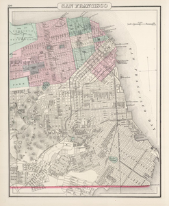
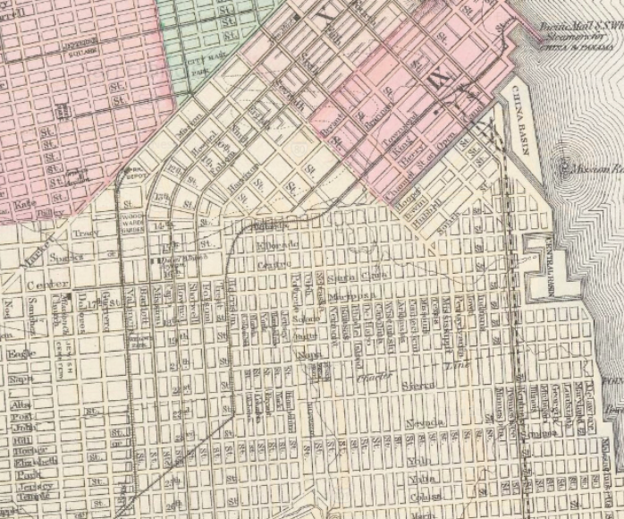
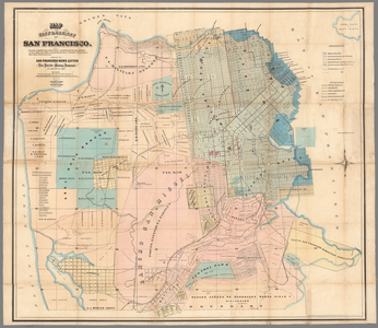
Gray's 1878 map has "RR Depot" at the Valencia/Market terminus of the Valencia line. The Mission tracks connect from Townsend to Alameda to 16th/Harrison, then cross the Mission as above.
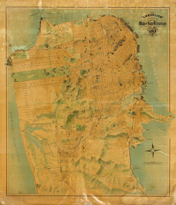
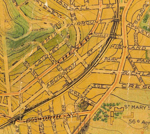
Chevalier's delightful 1911 map includes contours and tiny drawings of buildings and features. It shows the bridge at 27th/Dolores and the overpasses in Noe Valley, and in Glen Park a train approaches the Bosworth overpass just after passing through the Bernal Cut.
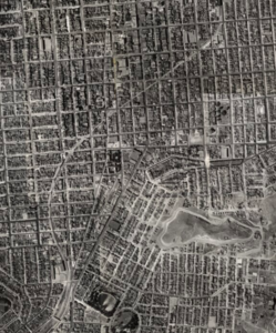
Ryker's 1938 aerial view composite covers all of San Francisco with astonishing detail. Left: the tracks arc through the Mission and Noe Valley. Center: the trestle at 27th/Dolores. Right: the berm and the overpasses through Upper Noe ca. 1940. In Ryker's 1948 aerial view, the berms and overpasses have been removed and construction has begun on a few houses on the former right-of-way.
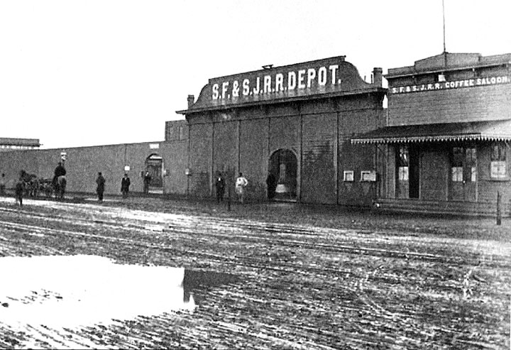
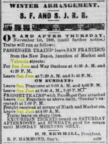
Enough maps already! Let's look at some pictures, generally following the S.F. & S.J. tracks south through the city. This Muybridge photo of the depot at Valencia/Market must date from 1866 to 1870, before SP acquired the S.F. & S.J. Online sources suggest that the depot existed from 1866 to 1874, when it was replaced by a station at 4th/Townsend. No Starbucks back then, but it does have a Coffee Saloon. An ad in the Alta of 03/13/1867 refers to the "New Depot" at Market/Valencia, but I'm not sure just when the line was extended from 25th/Valencia (the original depot, see below) to Market. An ad in the California Farmer of 2/19/1864 references another depot, on Brannan between 3rd/4th, and an article written decades later says the Brannan depot opened on 2/14/1865 (San Francisco Call 05/15/1905), but period maps do not show tracks through the Mission, and I've found no pictures of a Brannan depot; perhaps it was a horsecar depot with service connecting to the Valencia depot. Parts of the old S.F. & S.J. depot at Market were still standing when the lot was sold in 1895 (Chronicle 12/14/1895).
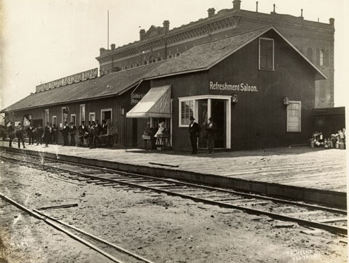
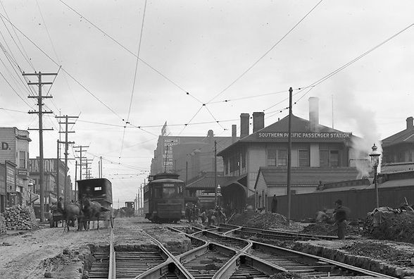
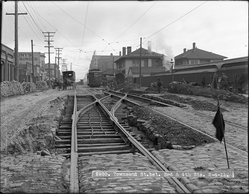
The SP passenger depot at 4th/Townsend in this 1879 photo succeeded the Market/Valencia depot in 1874 (Chronicle 07/27/1874). The "rather shabby structure" was abandoned in 1889, replaced by a new depot at 3rd/Townsend (Chronicle 07/26/1888, 03/19/1889, 04/11/1889). The second photo (cropped from original) shows the new Southern Pacific Passenger Station (as the sign on the roof loudly proclaims), looking northeast on Townsend toward 3rd on 2/04/1911. A train with a smoking engine is hidden behind the fence.
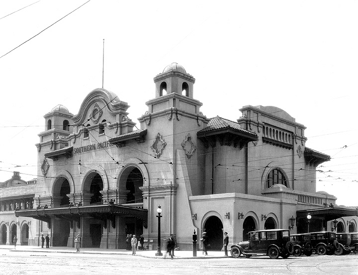
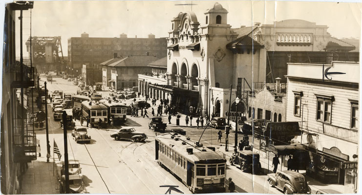
And here's the Mission Revival SP terminal that replaced it in 1913 (Chronicle 11/25/1912), ca. 1930 and 6/04/1940. It was replaced in turn by today's Caltrain terminal a block away in 1972.
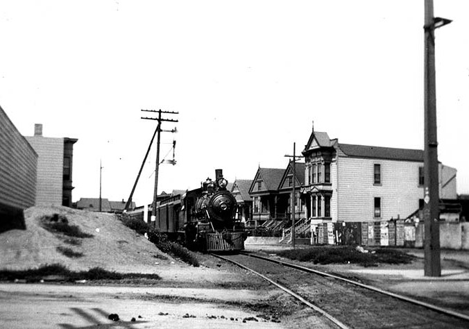
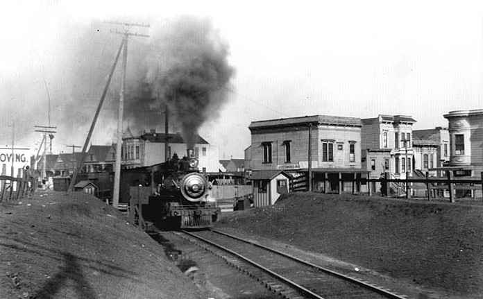
The Mission was sparsely populated when S.F. & S.J. started service in 1864, but urban growth in the ensuing decades created significant risks at grade crossings and raised calls for better signals (Chronicle 03/18/1895). Trains ran straight down Harrison from 16th to 22nd, very close to houses. At left a southbound train on Harrison approaches 22nd in 1907, and at right a train rounds the curve at 22nd in 1905. The little building next to the engine is a gatekeeper's house, we'll see identical structures in several other pictures below. The houses on Harrison and on 22nd are all remarkably well preserved today.
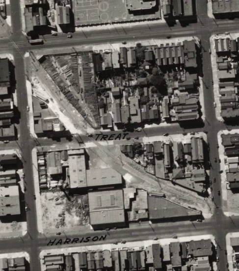
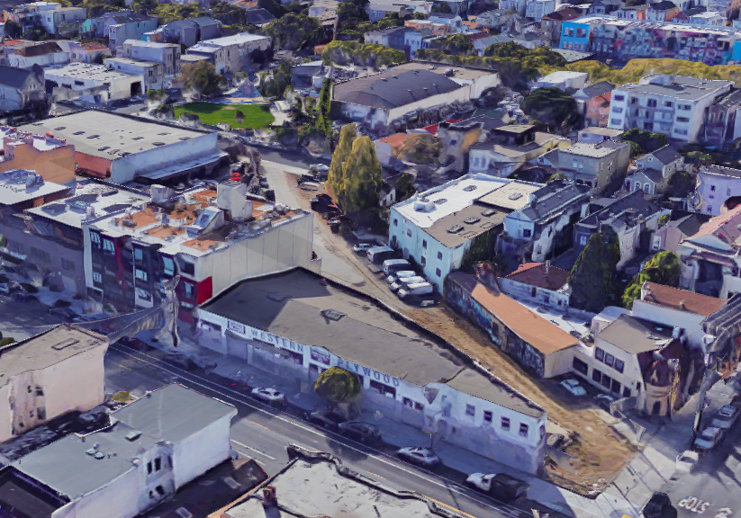
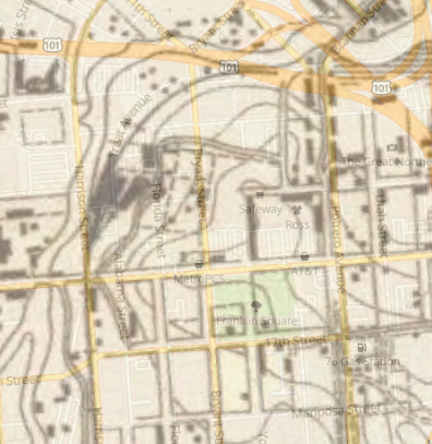
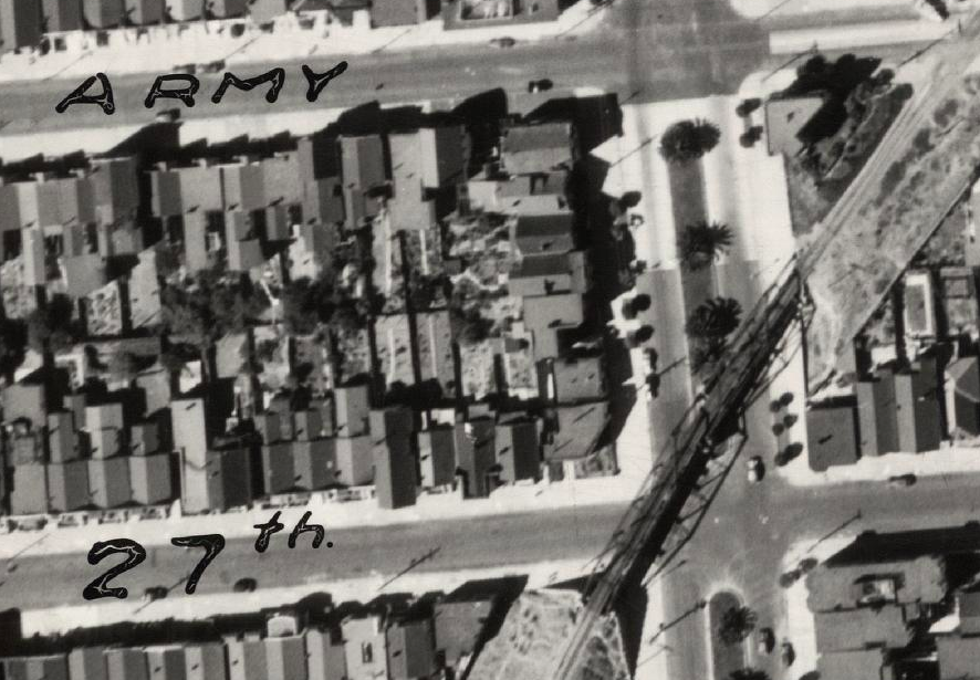
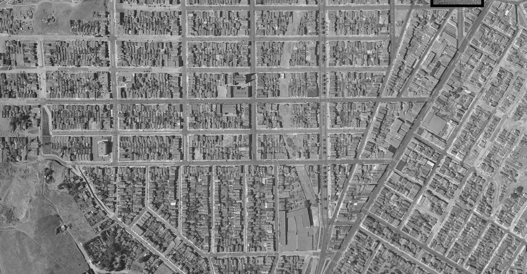
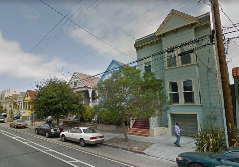
The track begins its diagonal slash across the Mission street grid at 22nd/Harrison, complicating the layout of the two blocks between 22nd/Harrison and 23rd/Folsom. The photo from 7/09/1959 looks southwest from the middle of the block between Harrison and Treat. The house viewed from the back at center is 953 Treat (demolished 2018, replaced 2019). The 1938 aerial view detail (west at top) shows multiple side tracks in addition to the main line, and the 2018 aerial view shows how distinct the rail line diagonal remains eighty years later. The unique Atlas Stair building is at lower right.
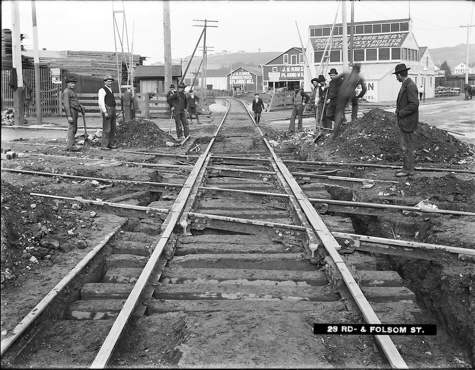
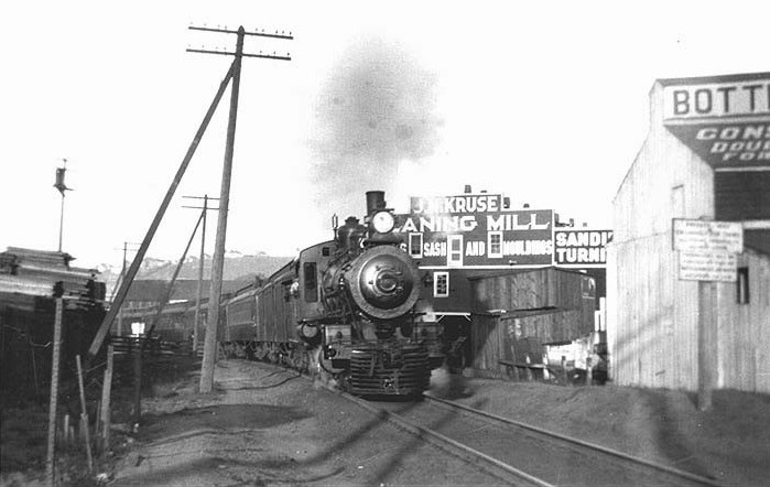
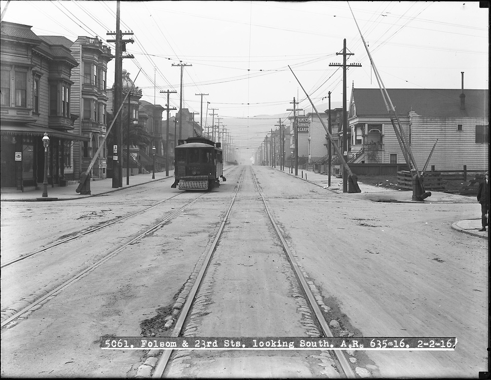
The railroad tracks crossed the Mission at street level, so busier intersections had crossing gates. The first two photos look northeast toward the site of the previous photo, from 23rd/Folsom on 3/16/1905 and from Treat in 1908, and the third looks south down Folsom on 2/02/1916. Lack of visibility around the curve made the tracks a dangerous pedestrian shortcut (Chronicle 09/06/1898). Let's take a short break here while I pop into Consumers Brewing (3070 23rd) to sample their XXX porter.
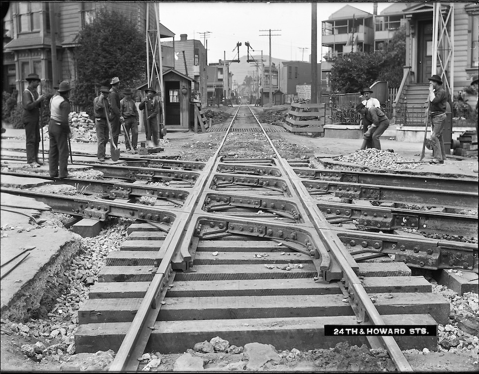
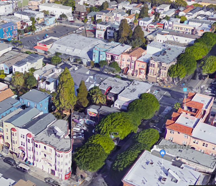
Construction at Howard (now South Van Ness) between 23rd/24th on 6/13/1905, looking northeast as the single railroad track crosses double streetcar tracks on Howard. An aerial view today (24th/South Van Ness at middle right) clearly shows the diagonal route of the S.F. & S.J. track in several places.
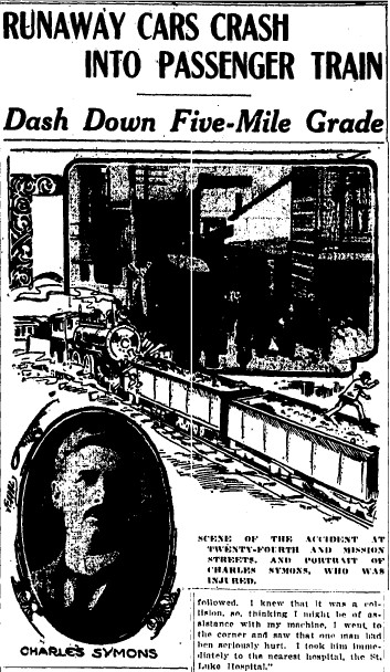
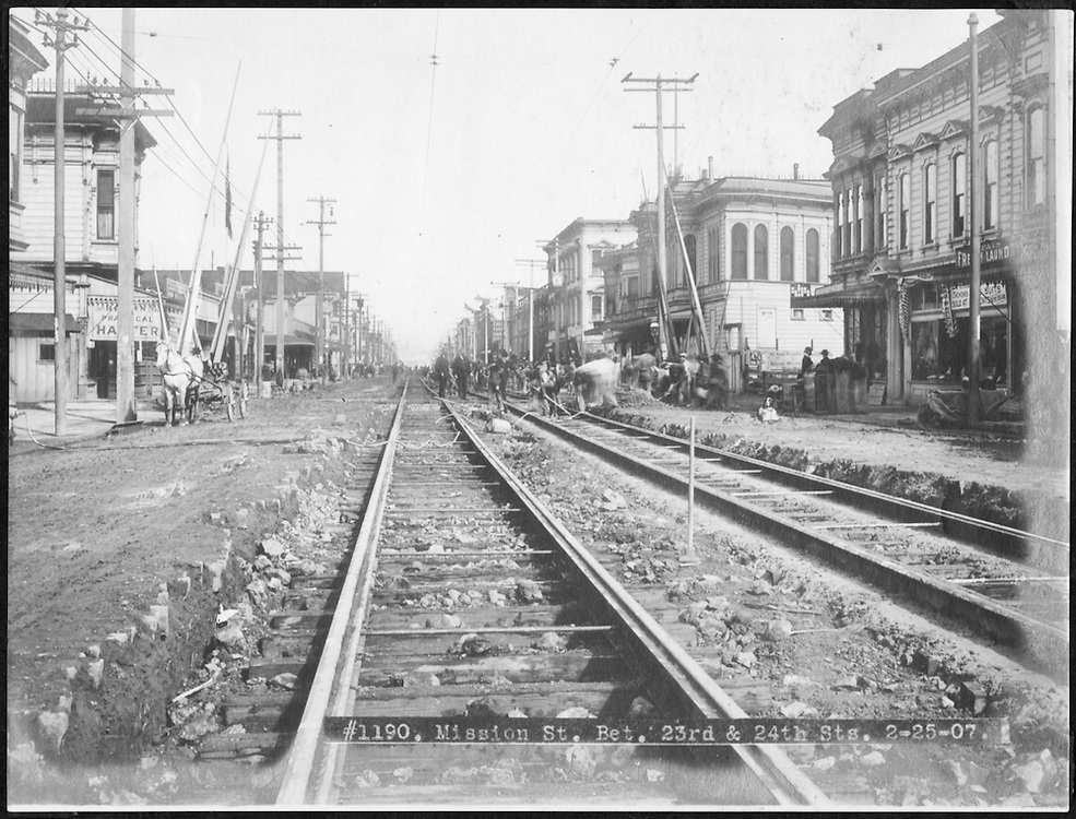
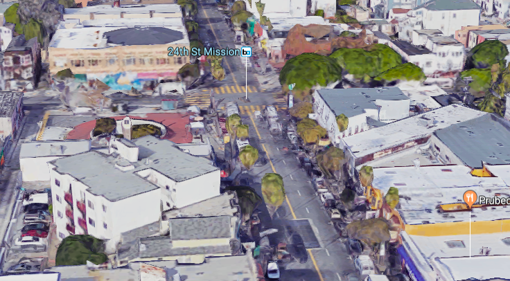
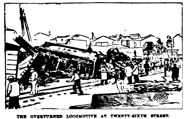
Mission between 24th/25th was the site of an amazing 1908 accident (Chronicle 05/01/1908): two railcars disengaged from a southbound train past Sunnyside, then rolled back unimpeded five miles through Glen Park and Noe Valley before crashing into another train in the Mission. (Runaway cars in a similar accident reported 07/10/1895 made it even farther, ending at 16th/Harrison.) A few years earlier, the dead body of a man struck by a train here was then robbed by "ghouls" (Chronicle 07/21/1905). The photo at center looks north on Mission from between 24th/25th on 2/25/1907 with railroad crossing gates half a block up (here's the same view a couple decades later). The buildings aligned with the old railroad right-of-way today are particularly striking here.
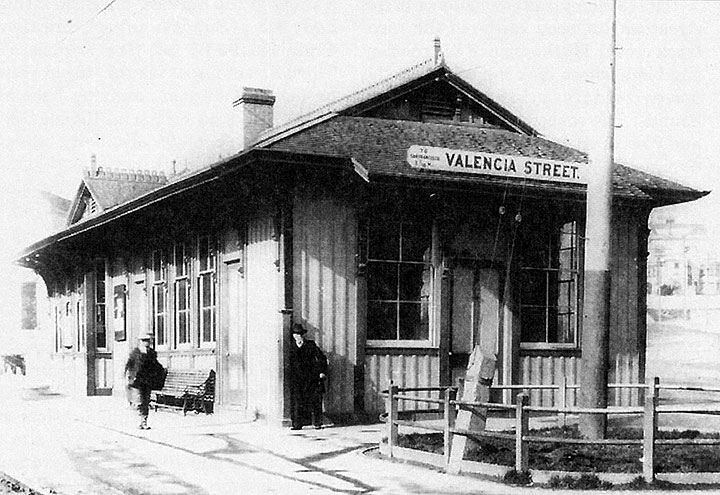
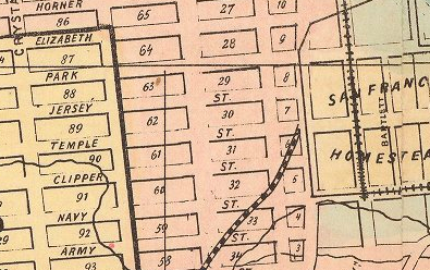
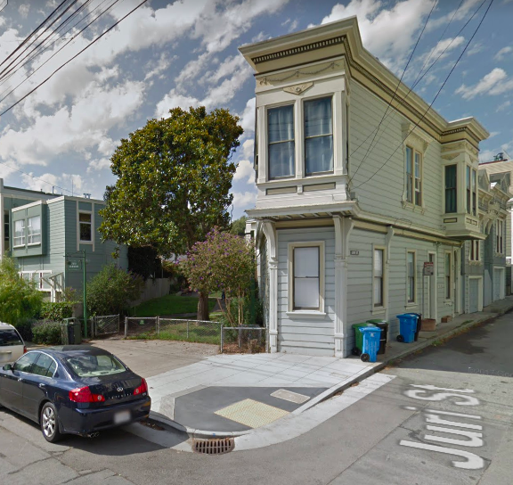
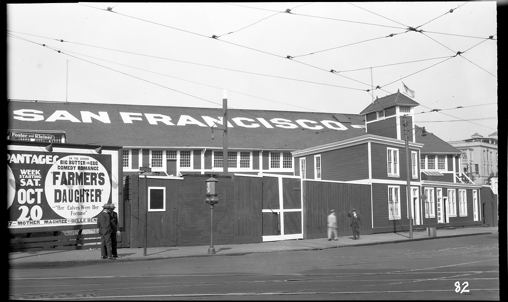
The first S.F. & S.J. depot in San Francisco, dating from 1864, was near Pioneer Race Course (Alta 01/17/1864: "... the Race Track, the present depot of the San Jose Railroad..."). The original depot was at Temple/Old San Jose (now 25th/San Jose, or roughly 25th/Valencia), The Valencia Street depot at the southwest corner of 25th/Valencia shown in these undated images might be the original building, or perhaps it was built later. The first looks west from Valencia toward San Jose, the second southwest along the track. A block up at Juri/San Jose is the charming diagonal-walled 1 Juri Street bordering the old railroad right-of-way (now Juri Commons). The Chronicle says service to the 25th/Valencia depot was discontinued as of 07/14/1903, but it was in use after the 1906 earthquake (05/15/1906), and online sources suggest the depot existed until the 1920s.


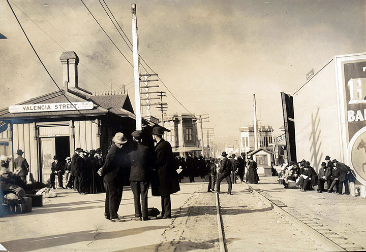
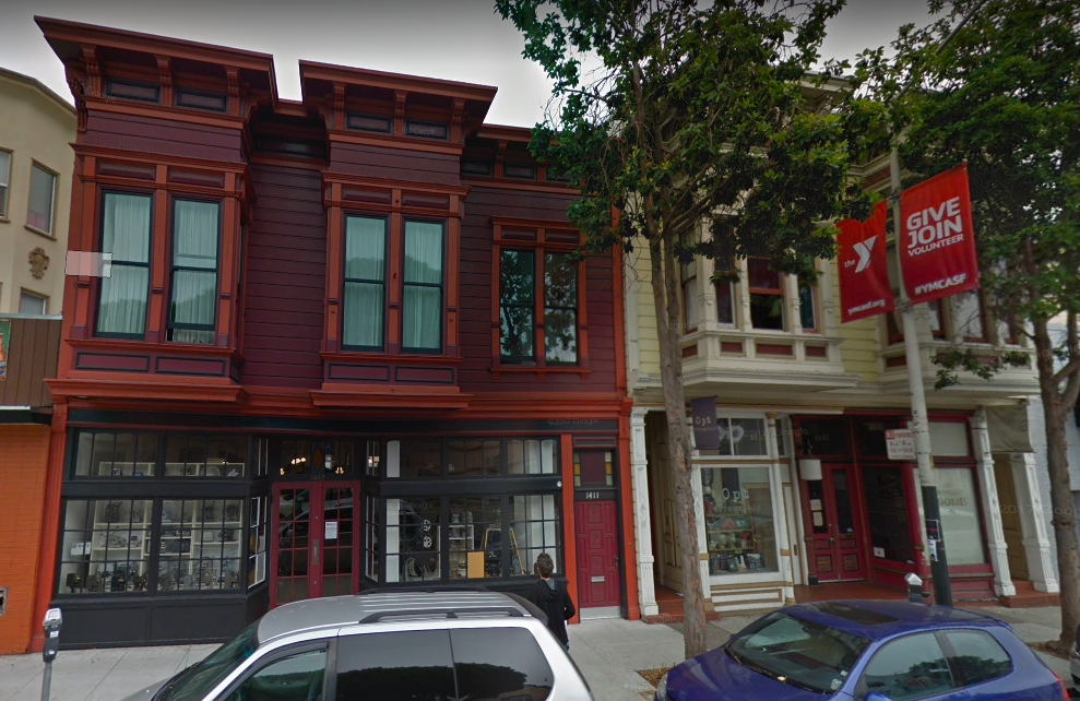
Two more views at 25th/Valencia. The first looks northwest ca. 3/1905, with the single railroad track crossing double cable car tracks on Valencia. The Valencia cable line (converted to electric operation after the 1906 earthquake) terminated at the 28th/Valencia/Tiffany carhouse. Need a shoeshine? There's a bootblack at work on the corner. The second looks south down Valencia toward Bernal on 7/28/1909. The first two handsome Victorians at left remain today.
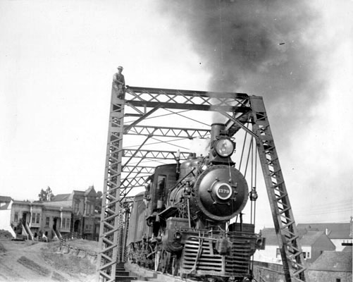
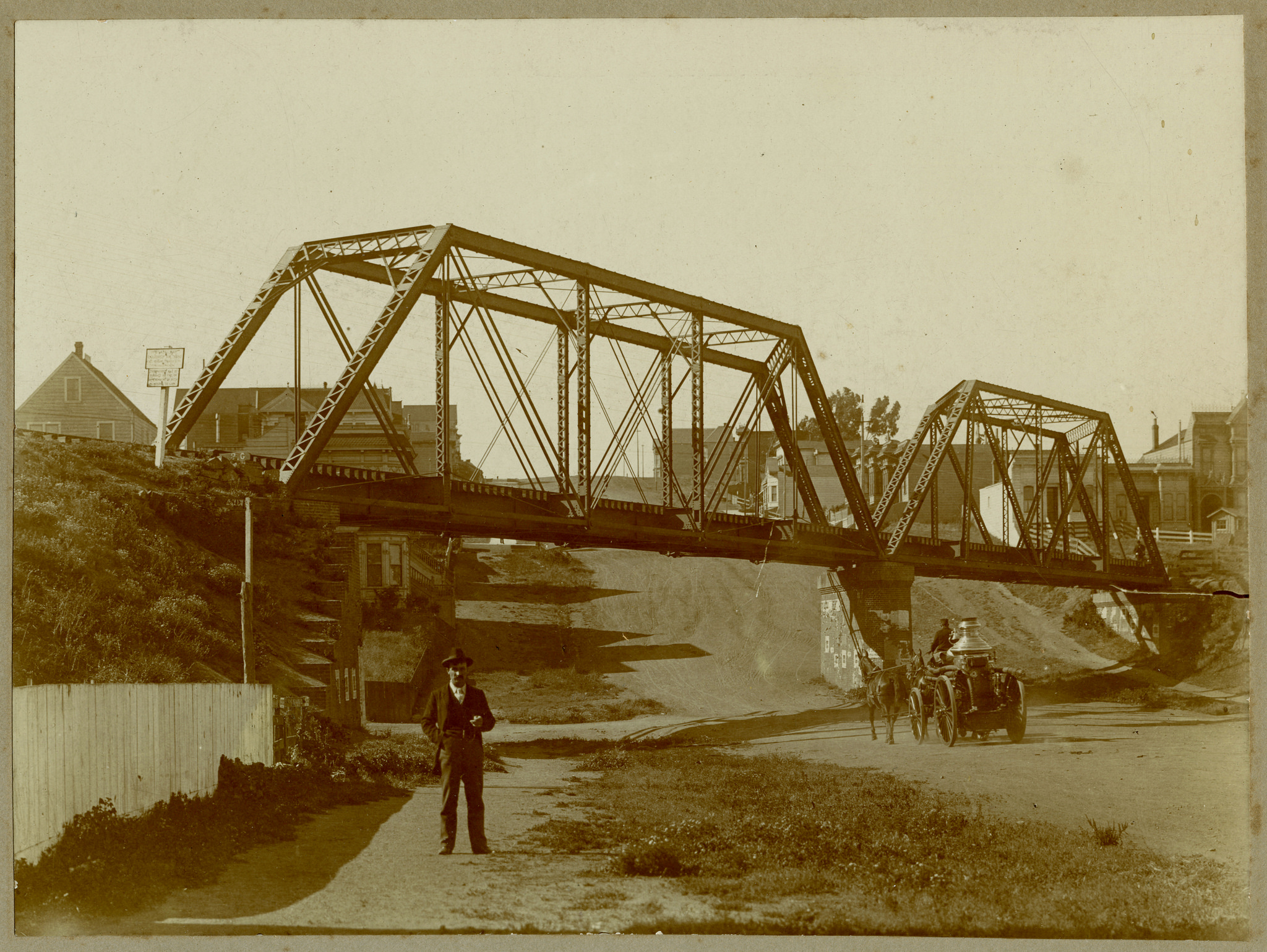
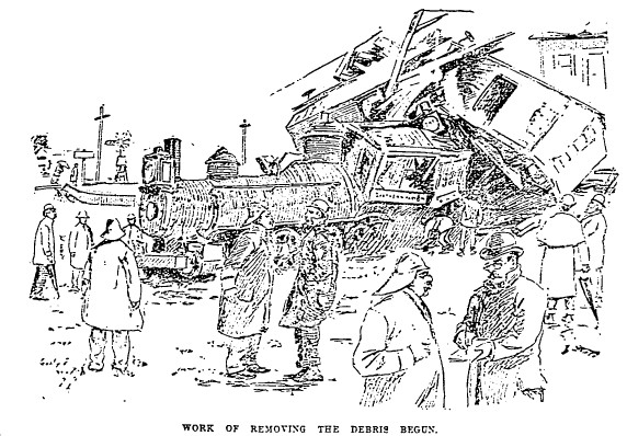
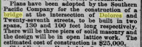
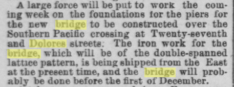
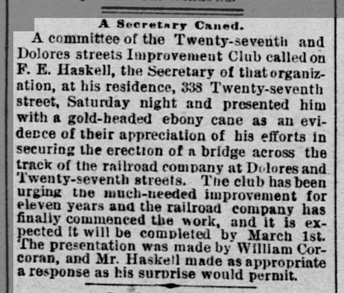
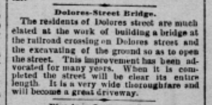
At 27th/Dolores, the S.F. & S.J. track passed over a bridge built in 1891 (Alta 08/08/1890, 10/01/1890; Call 12/22/1890, 12/26/1890; Chronicle 01/31/1890, 08/07/1890, 11/20/1890, 12/13/1890, 01/23/1891, 03/13/1891). The drawing from the Chronicle of 03/26/1893 shows a significant accident at 26th, just past the bridge, attributed in the article to a "malicious mischief-maker" breaking the lock on a switch. The center photo shows southbound #1379 in 1908, looking northeast from just past the southwest end of the bridge. I looked at it several times before I noticed the man casually sitting atop the bridge. The houses at left are on Army (now Cesar Chavez) just east of Dolores. The right photo looks north on Dolores in 1910 from just south of 27th as a horse drawn steam fire engine heads north down the middle of the street. The bridge must have been irresistible to adventurous neighborhood kids.


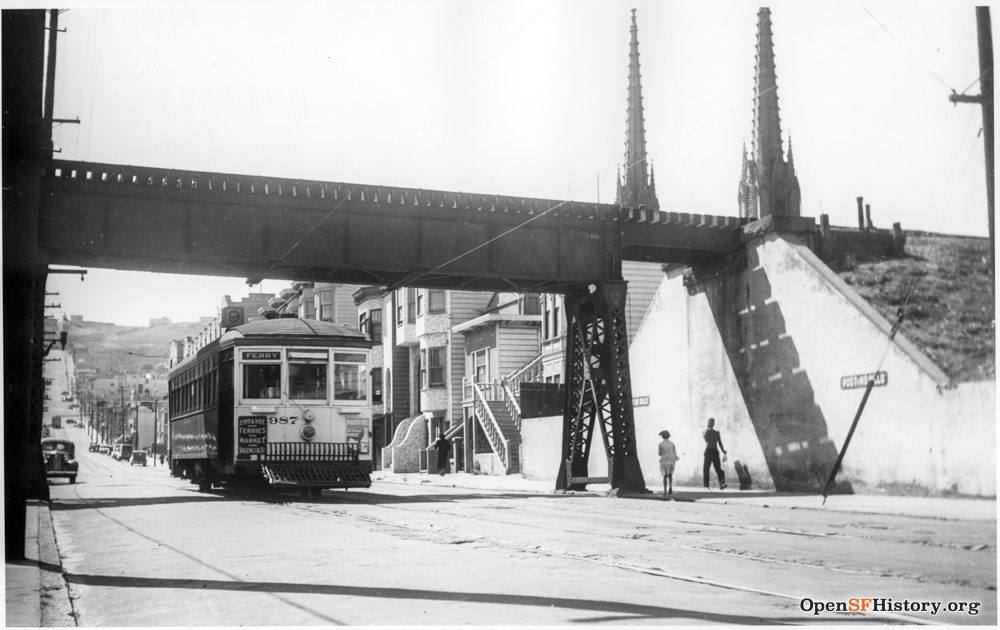
Two views of the Dolores bridge in 1937: northeast along the bridge (with pedestrian) from the south end and northwest from Dolores just below 27th. The track crosses the big concrete pier in the middle of Dolores on a diagonal, resulting in a weird off-kilter look to the trusswork, and the track curves across the straight bridge.

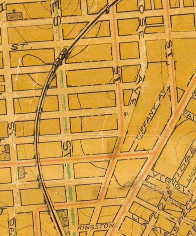
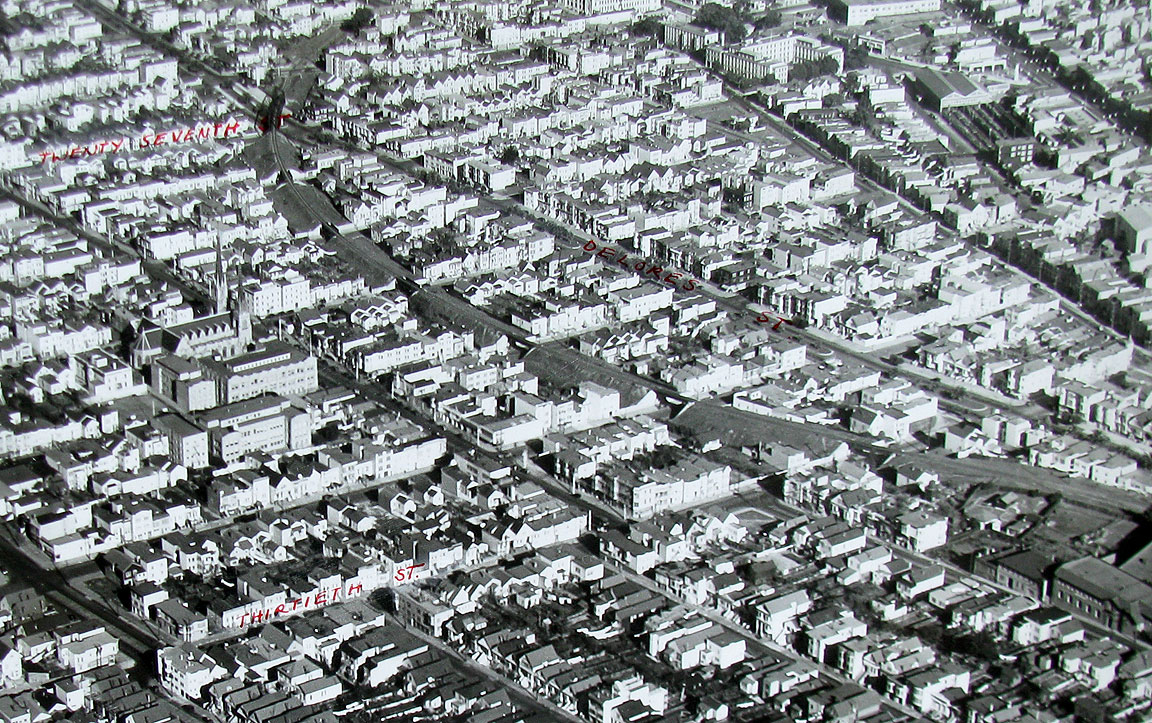
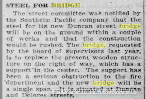
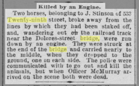
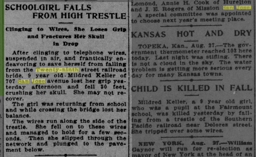
After passing over the Dolores/27th bridge, the S.F. & S.J. track runs south through Noe Valley between Dolores and Church. To avoid losing altitude before heading uphill through the Bernal Cut, the single track runs on an elevated berm, about 25' high and 75' feet wide, before returning to grade at Randall. The berm causes significant traffic problems as Upper Noe urbanizes (Chronicle 12/24/1881, 01/31/1890), and eventually six overpasses (at Duncan, 28th, Valley, 29th, Day, 30th) allow streets to cross under the elevated tracks. These photos look west on 29th Street between Dolores and Church in 1940 and east on 30th Street between Church and Dolores in 1938. The bridge and the overpasses are visible in photos on my Upper Noe page. In a post-earthquake 1906 photo, the 30th Street overpass has trusswork that is gone in this 1938 view. At Duncan, a steel overpass replaced a previous wooden bridge in 1913 (Call 08/23/1912, Chronicle 02/01/1913), perhaps other overpasses were also rebuilt at around that time. The Dolores bridge and the six Noe Valley overpasses were dismantled in 1942.
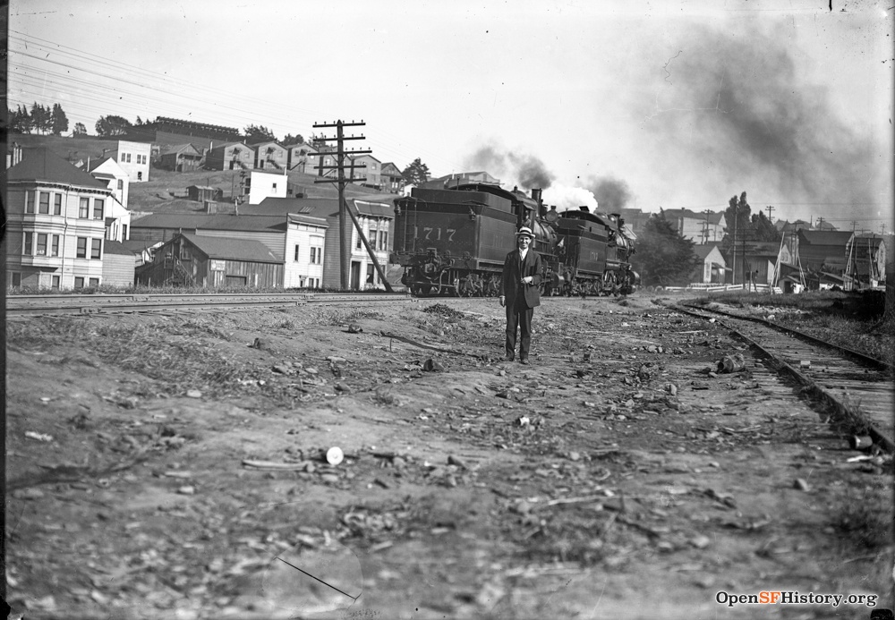
Two engines head south toward the Bernal Cut in 1905, viewed from Dolores/San Jose. The Holly Park Reservoir is at the top of the hill, the houses below it are on Elsie, and the house at left at the southeast corner of Santa Maria/Mission is 3525 Mission. The track at right is a secondary spur that rejoins the line at St. Marys. Just a bit further south, the second photo looks east across the grade crossing to Mission St. from Randall/San Jose in 1926. The grade crossing at Randall was particularly dangerous (Chronicle 03/18/1895), but there were many accidents all across Upper Noe (Call: 05/11/1891 [27th/horses], 08/28/1913 [29th]; Chronicle: 05/23/1886 [29th], 05/11/1891 [27th/horses], 09/02/1892 [30th], 04/15/1896 [Day], 08/22/1897 [30th], 11/05/1905 [30th]).
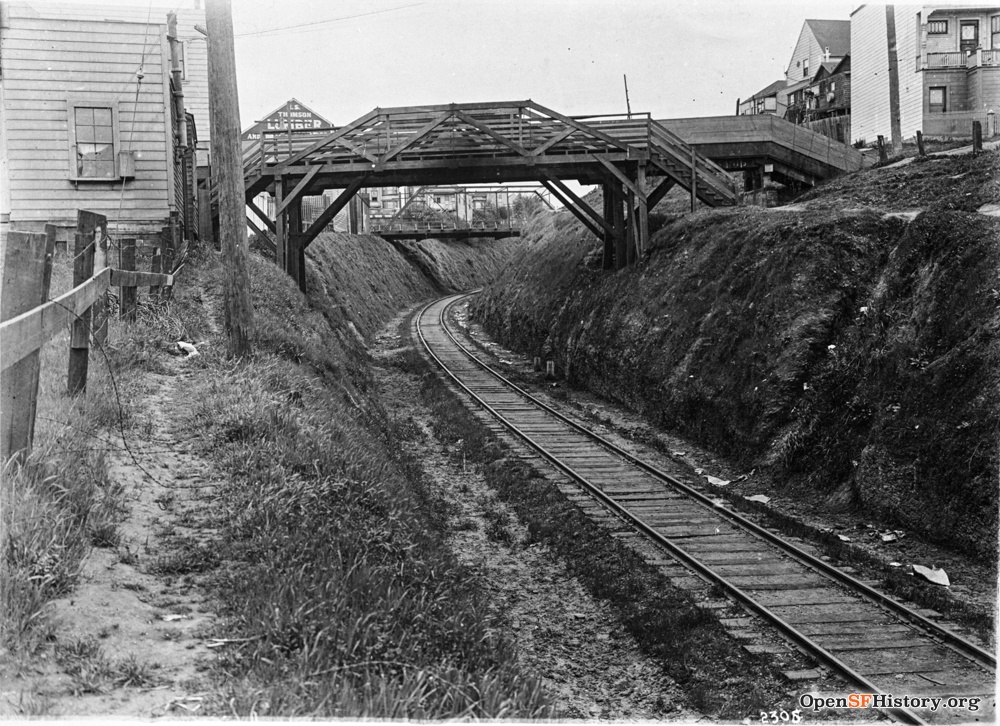
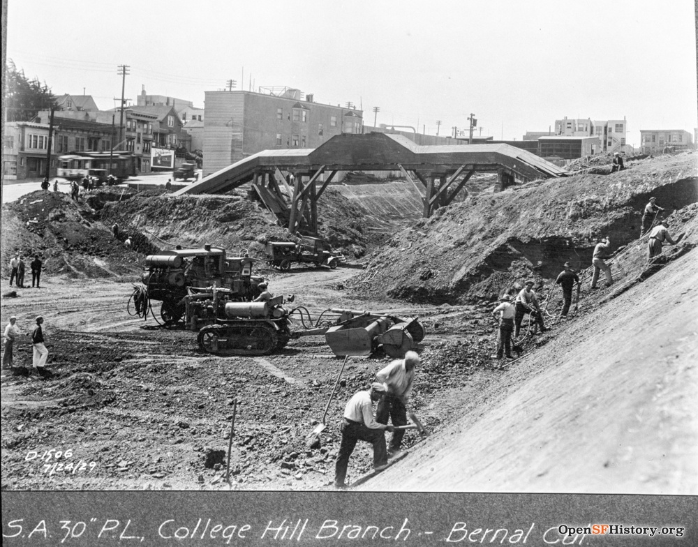
The Alta of 10/18/1863 describes the Bernal Cut: "The most expensive cut on the road is thirty-five feet deep and a quarter of a mile long." The original cut was only wide enough for a single track. Thirty years later, residents in the rapidly growing neighborhood expressed a need for bridges across the cut, resulting in the building of the Charles Street bridge in 1896 (Chronicle 08/06/1893, 01/22/1896). The photo at left looks south into the cut on 3/24/1915, with pedestrian bridges crossing the cut at Fairmont/Appleton and at Charles. The odd covered structure just beyond the Fairmont bridge is the Spring Valley Water Co. flume carrying water into the city. Increasing automobile traffic in the 1930s made traffic on Mission nearby a nightmare, so the cut was widened in 1928-1929. The water pipeline was buried as part of the widening project, but at right it still remains above ground on 7/24/1929.

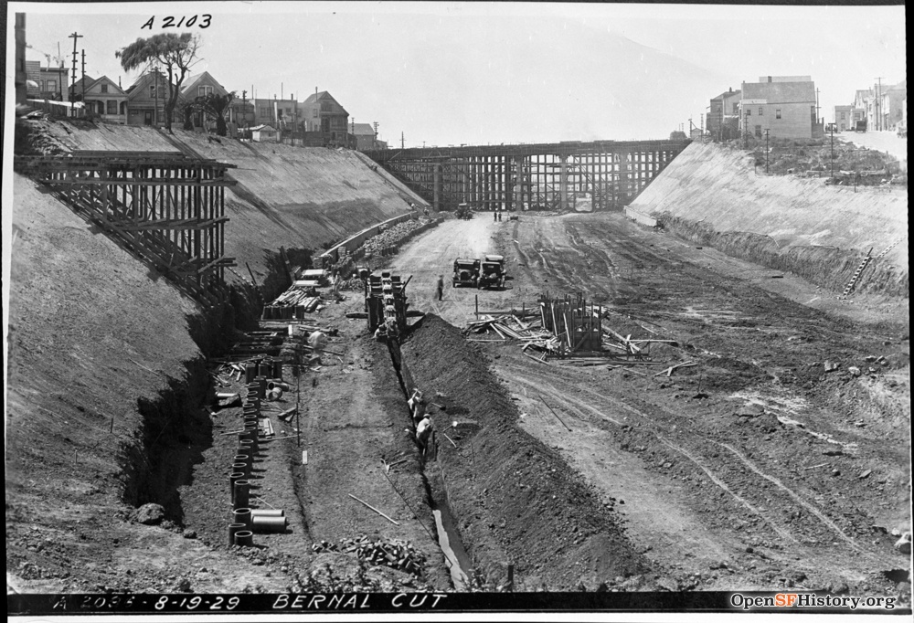
A southbound train passes under a partially constructed bridge at Richland on 9/18/1911. That bridge was replaced in 1929 as part of the cut widening, as shown in the second photo, looking south on 8/19/1929 during construction of Highland and Richland bridges. The third photo looks north from the Highland bridge in 1930.

The Alta of 10/18/1863 referenced above mentions Islais Creek bridge: "The longest bridge is two hundred and forty feet trestle-work, at Islais Creek... The long bridge at Islais Creek is made not to give room for a great quantity of water but to save an expensive embankment over a deep and steep ravine." Islais Creek runs south out of Glen Canyon (now underground), crossing the tracks roughly at Bosworth. I have found no pictures of the old Islais Creek trestle. By the 20th century, the tracks ran on a berm instead, crossing over Bosworth on the bridge seen here (undated). The cut widening project demolished this bridge (shown here on 12/22/1928) and replaced it.


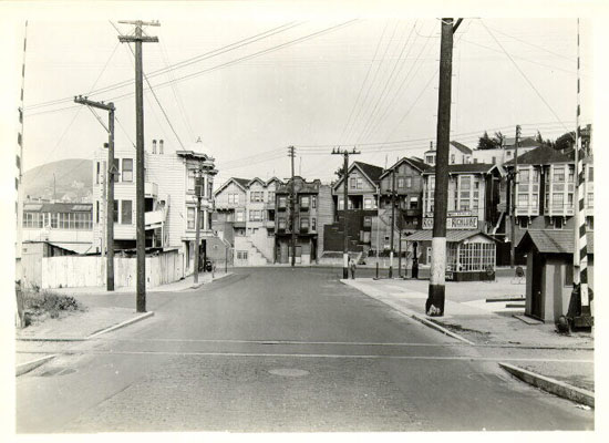
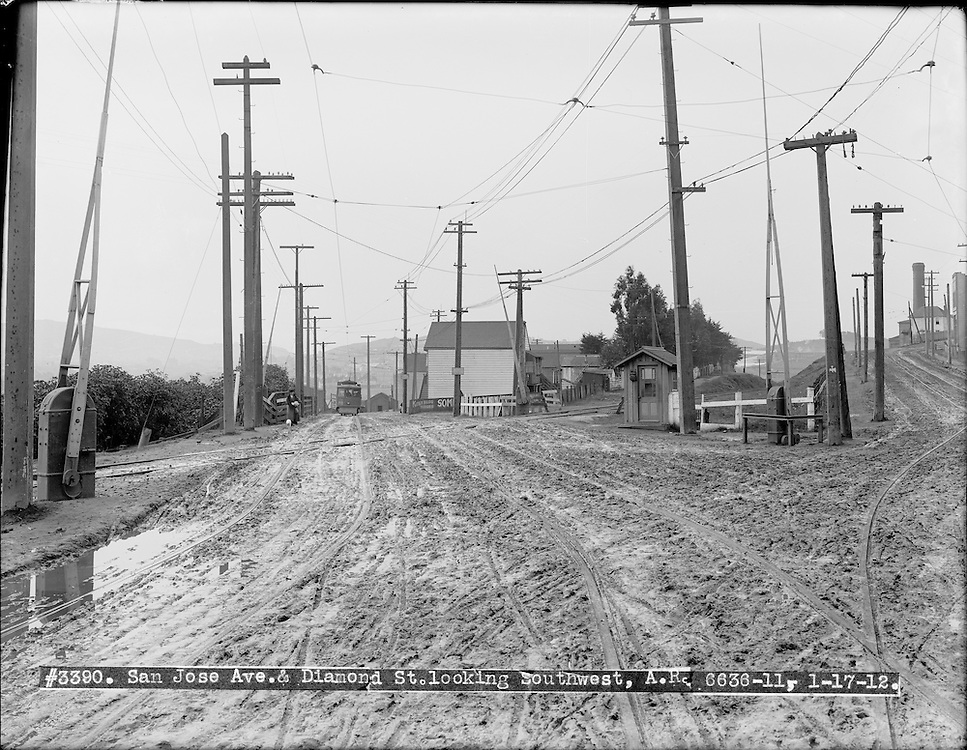
Just past the Bosworth bridge, this 1/17/1912 photo (detail from original) looks south on Diamond at San Jose as a Noe Valley-bound S.F. & S.M. Ry. Interurban streetcar approaches the railroad grade crossing, a notorious accident site (Chronicle 03/05/1895, 03/18/1895, 10/02/1899, 09/05/1902, 09/05/1902, 09/06/1902) called the Sunnyside Crossing. Another streetcar line (at right in the original) runs up Sunnyside (now Monterey) from here toward the Sunnyside Powerhouse. Today San Jose Avenue runs under I-280 at this spot.
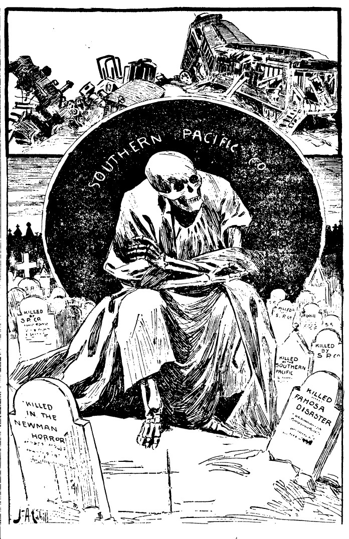
The 1893 drawing (Chronicle 11/27/1893) depicts a crash at Old San Jose / Ocean House Road (Ocean/I-280 at Balboa Park today) purportedly caused by sabotage, and the gruesome graveyard graphic is from an 1899 article about the "red record" of Southern Pacific (Chronicle 09/18/1899). Sabotage and vandalism were recurring issues for SP (Chronicle 03/26/1893, 04/16/1905).
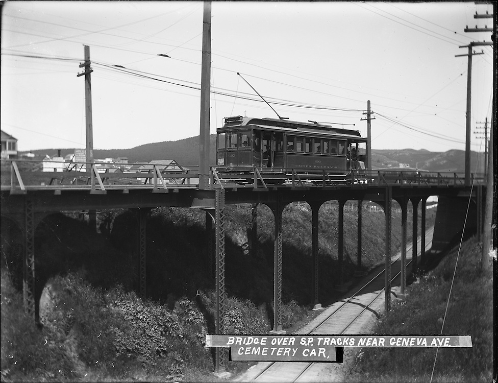
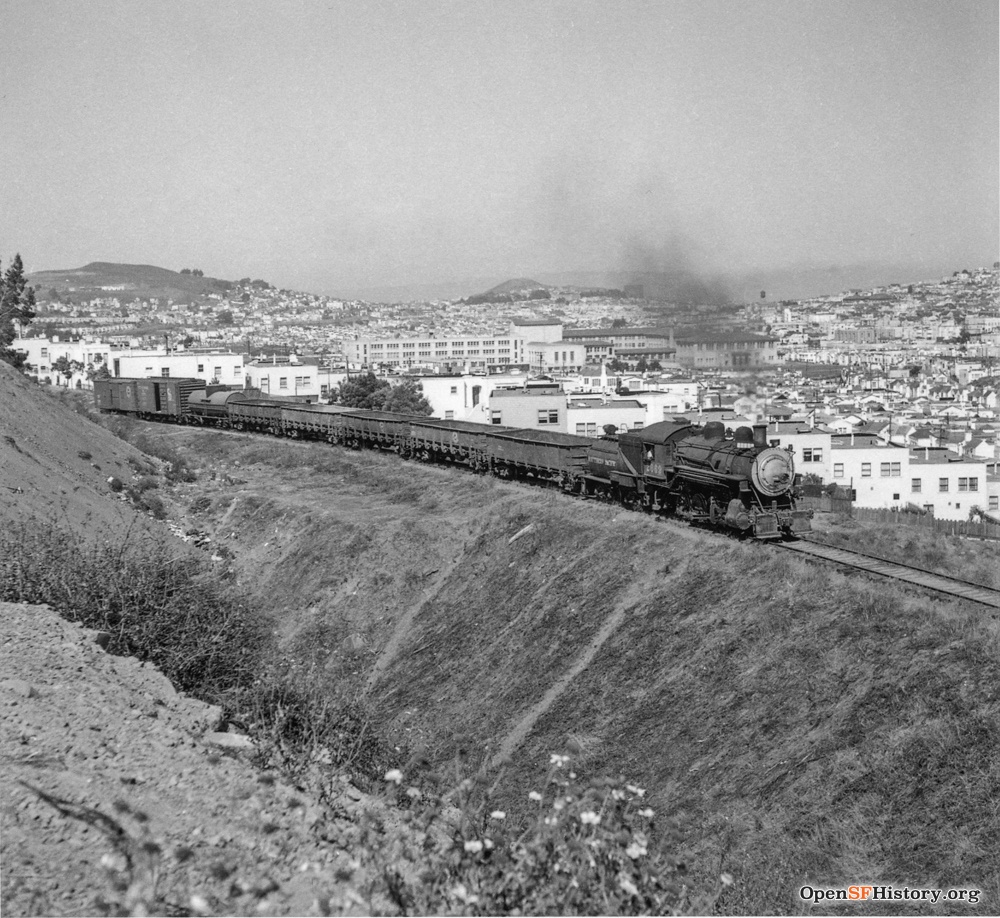
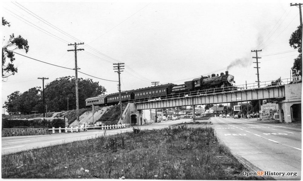
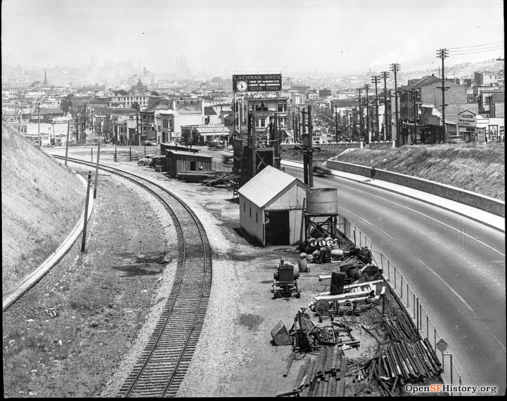
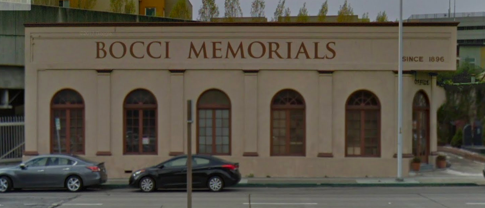
A little further south near Geneva on 4/14/1905, an Interurban cemetery streetcar returning from Colma passes over the SP rail track. At center, looking east from San Jose/Mt. Vernon, an SP freight heads out of the city in 1951 after its climb through the Bernal Cut. Passenger service on the Oceanview line ended in 1932; at right the train crossing over El Camino Real in Colma in 1953 is a nostalgic excursion for railway fans, heading south from SF. The overpass (rebuilt) carries BART today, and the headstone company just north of it remains.
Open questions:
- Date for Mission tracks via Harrison?
- Did the berm through Noe Valley exist from 1864?
- Date tracks and berm through Noe Valley removed?
Articles:
- Callwell, Robert: Transit in San Francisco 1850-1995
- Curbed SF: The lost railroad tracks of the Mission and Noe Valley
- Daggett, Stuart: Chapters on the History of the Southern Pacific
- Duncan, Mark: The San Francisco Peninsula Railroad Passenger Service
- Ferroequinologist: Southern Pacific's Bayshore Yard
- FoundSF: Southern Pacific Railroad Rolls Through the City
- FoundSF: Bernal Cut
- Justice, Burrito: blog post 8/02/2013
- Justice, Burrito: Dolores Street Bridge
- Miller, Louis Richard: History of the San Francisco & San Jose Railroad
- Noirscale: A Freight train through the Mission
- SF Trains: Southern Pacific Railroad in San Francisco
- sunnysidehistory: The Sunnyside Crossing
- Wikipedia: San Francisco and San Jose Railroad
- WX4: Third & Townsend Depot
Maps:
- 1853: Williamson
- 1862: S.F. & S.J. R.R.
- 1863: Gensoul
- 1864: Butler
- 1868: Goddard [birds-eye view]
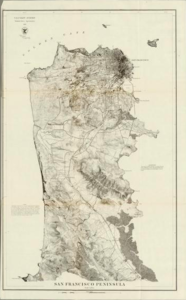
- 1869: Goddard
- 1869: US Coast Survey
- 1878: Gray
- 1897: Southern Pacific
- 1911: Chevalier
- 1938: Ryker [aerial view]
- 1948: Ryker [aerial view]
Newspapers:
- California Farmer and Journal of Useful Sciences: 2/19/1864 (ad).
- Daily Alta California: 10/18/1863 (excursion), 01/17/1864 (opening), 03/13/1867 (depot at Market/Valencia), 08/08/1890 (Dolores bridge), 10/01/1890 (Dolores bridge).
- San Francisco Call: 12/22/1890 (Dolores bridge), 12/26/1890 (Dolores bridge), 05/11/1891 (horse killed bridge), 03/27/1894 (accident 30th/Chenery 1/27/1894), 07/27/1895 (Duncan bridge), 07/07/1899 (shots at Bernal Cut), 05/15/1905 (historical survey), 08/23/1912 (Duncan bridge), 08/28/1913 (fatal fall).
- San Francisco Chronicle: 03/16/1870 (bought by SP), 07/27/1874 (depot relocated), 12/05/1875 (Mission litigation), 12/24/1881 (tunnel at 29th), 05/23/1886 (accident 29th), 07/26/1888 (new depot), 03/19/1889 (new depot), 04/11/1889 (new depot), 01/31/1890 (Dolores bridge), 08/07/1890 (Dolores bridge), 11/20/1890 (Dolores bridge), 12/13/1890 (Dolores bridge), 01/19/1891 (accident), 01/23/1891 (Dolores bridge), 03/13/1891 (Dolores bridge), 05/11/1891 (horse killed), 09/15/1891 (fatal accident), 09/02/1892 (accident), 03/26/1893 (accident), 08/06/1893 (bridge over cut), 11/27/1893 (accident/sabotage), 03/05/1895 (accident Sunnyside), 03/18/1895 (crossing accidents), 07/10/1895 (runaway accident), 12/14/1895 (Valencia/Mission sale), 01/22/1896 (cut bridges), 04/15/1896 (fatal accident), 08/22/1897 (fatal accident), 08/02/1898 (Mission litigation), 09/06/1898 (fatal accident), 09/18/1899 (SP accidents), 10/02/1899 (fatal Sunnyside), 03/30/1900 (fatal accident), 09/05/1902 (accident Sunnyside), 09/05/1902 (editorial Sunnyside), 09/06/1902 (editorial Sunnyside), 07/14/1903 (25th/Valencia depot), 07/25/1903 (Mission litigation), 04/16/1905 (signal vandalism), 07/21/1905 (fatal/robbery), 11/05/1905 (fatal accident), 05/15/1906 (16th/Harrison station), 05/01/1908 (runaway car accident), 11/25/1912 (depot plan), 02/01/1913 (Duncan bridge), 10/16/1913 (depot plan; widening cut), 03/14/1918 (Valencia nostalgia).
Photo archives:
- FoundSF
- OpenSFHistory
- SFMTA (MUNI)
- SF Public Library (geolocation map here)
