Earthquake/Fire: Lafayette Park
Lafayette Park occupies a steeply sloped site at Gough/Sacramento/Laguna/Washington. The post-quake fires on earthquake day (4/18/1906) were far away, but early on day 2 (4/19/1906) fire from Chinatown crested Nob Hill and rapidly spread west through Polk Gulch, while simultaneously the fire from near City Hall expanded north along Van Ness. Faced with a tenuous water supply, firefighters fought to keep the fire from spreading west by dynamiting large homes on the east side of Van Ness to create a fire break. The fire crossed to the west side of Van Ness at Sutter at 2:30 PM on day 2 and burned west to Franklin and then north, but firefighters stopped its westward advance at Franklin/Clay (a block from Lafayette Park) at around 3 AM on day 3 (4/20/1906), saving the Western Addition from destruction.
1905 Sanborn (V. 3 sheet 260) shows details of the area before the fire. Kennedy's fire timeline describes the progress of the fire in detail, represented graphically in a map by Palacios. A Lafayette Park history page explains why the privately owned Holladay house (1915 Gough in 1906, now replaced by an apartment building at 1925 Gough) occupies part of the site.
 |
 |
 |
 |
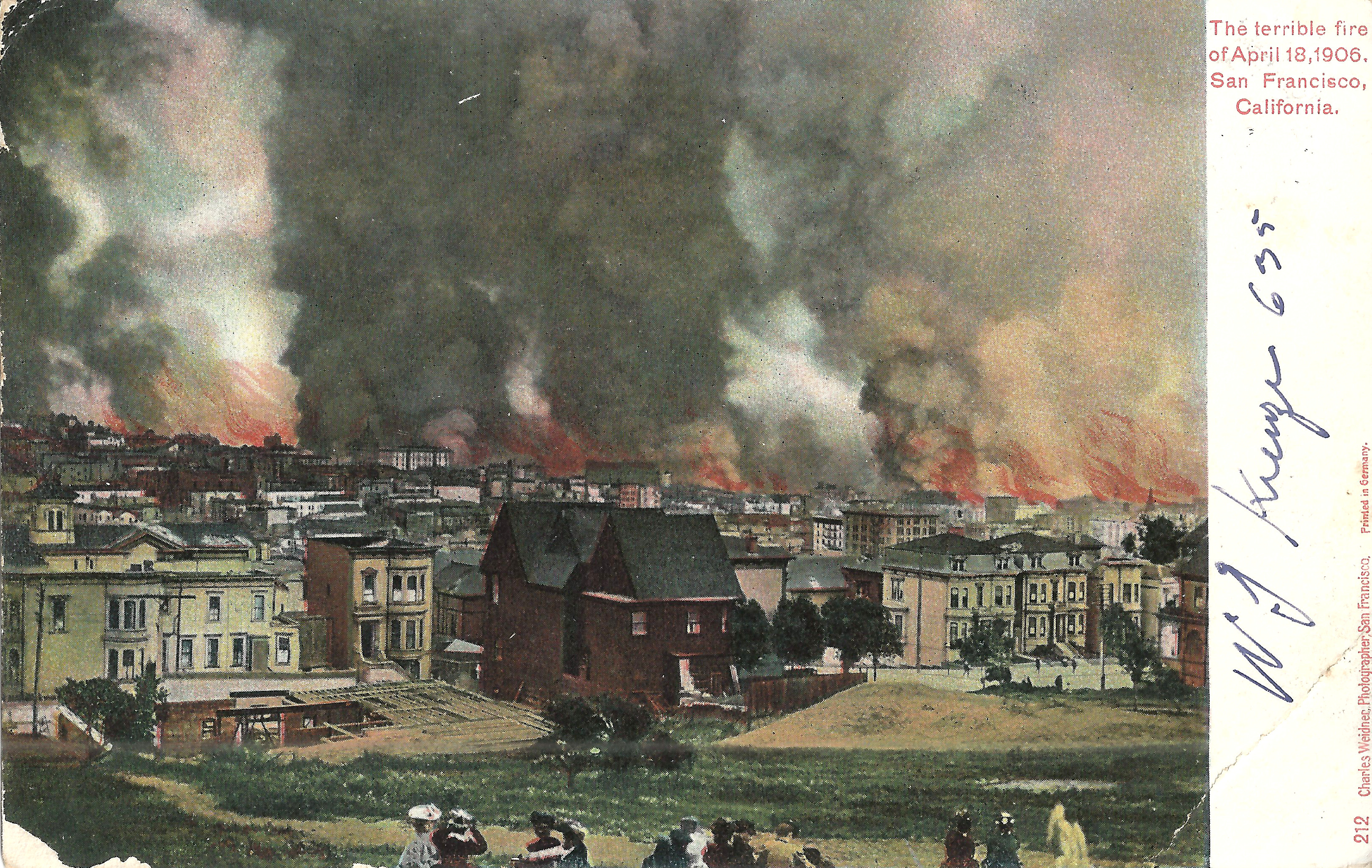
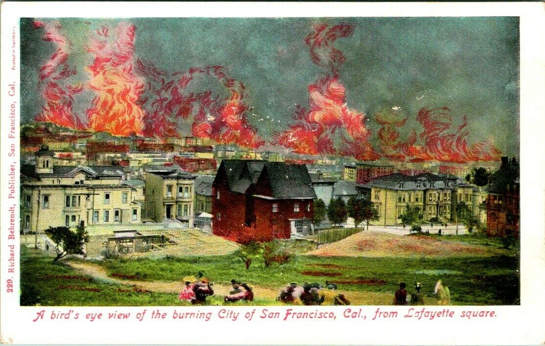
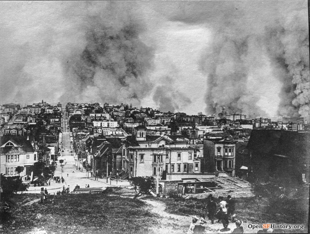
- Weidner 212, postmarked SF 4/15/1907, looks southeast from near Clay/Gough toward downtown on day 1, with only a few spectators looking at the distant fires. Clay is just past the left edge; the house at left is 1941 Clay (southeast corner Gough/Clay), with the tower of 1939 Clay just beyond. The top floors of the back of the St. Francis Hotel peek over the horizon just left of center, with the dome of the Call building to its left. Center: the S.W. Holladay house, 1915 Gough. Right edge: 1812/1814 Gough. Behrendt 229 shows the same image with dramatic coloring of flames added. The image is a considerably cropped version of a very dramatic Bancroft library image. Images here and here are very similar.
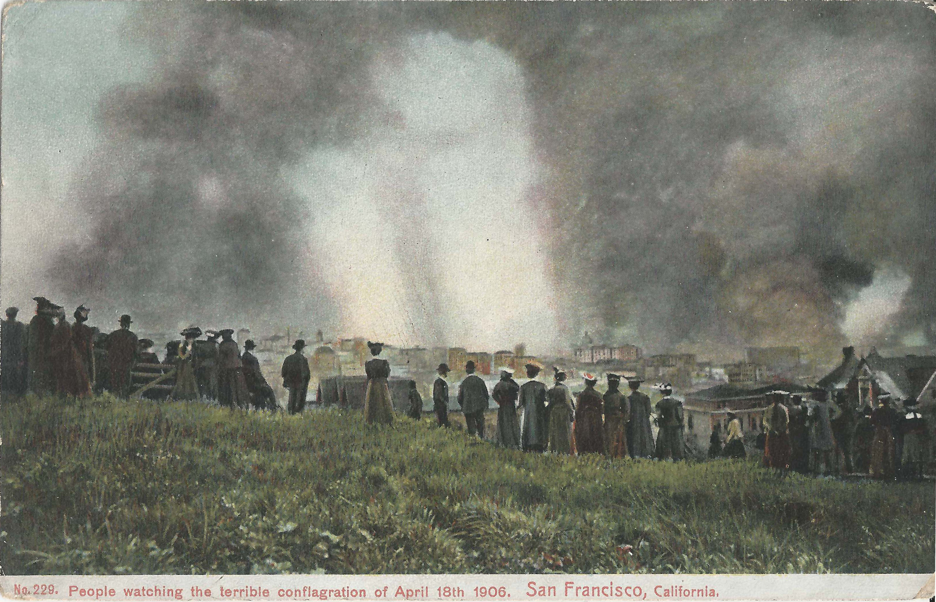
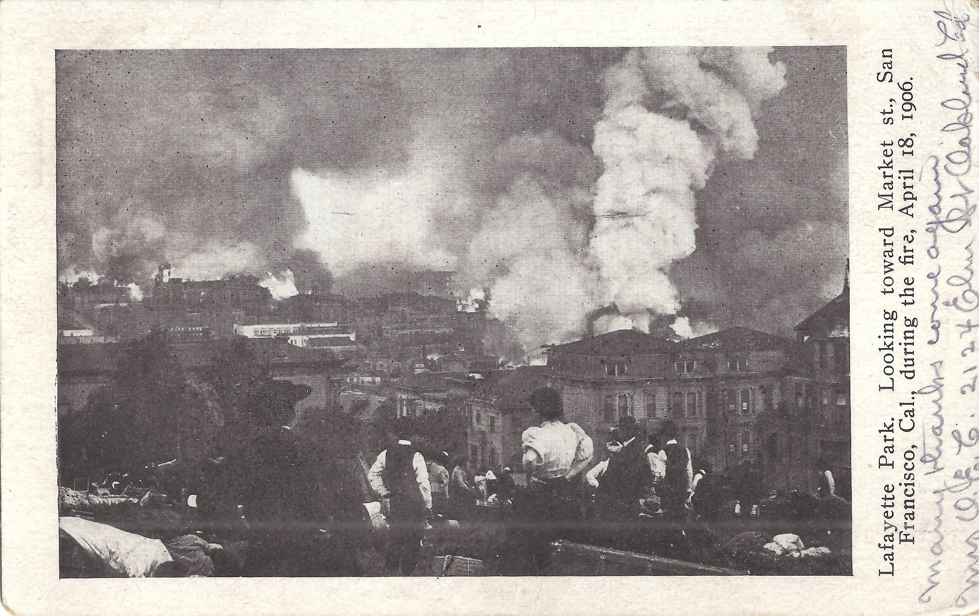
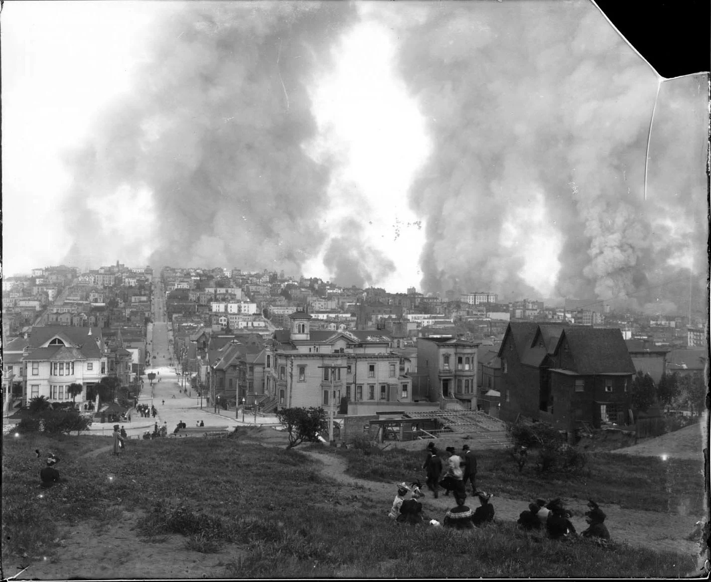
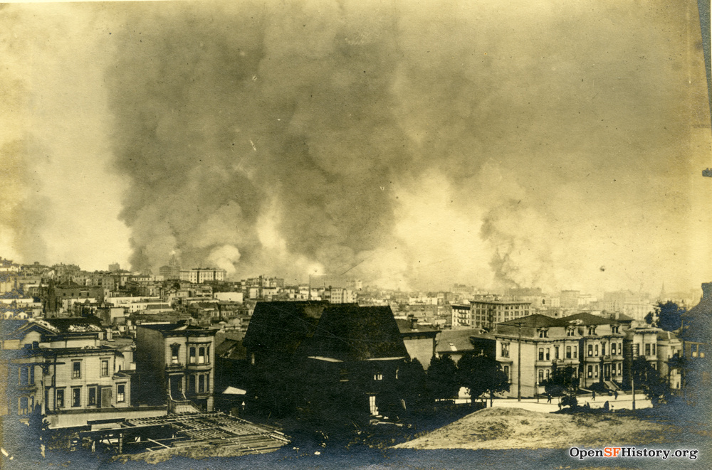
- Weidner 229 looks southeast over Polk Gulch from the top of the ridge in the park. Center, below the people on the ridge: roof of 1915 Gough. Right center: top floors of the St. Francis Hotel with the dome of the Call just beyond.
 |
 |
 |
 |
 |
 |
 |
 |
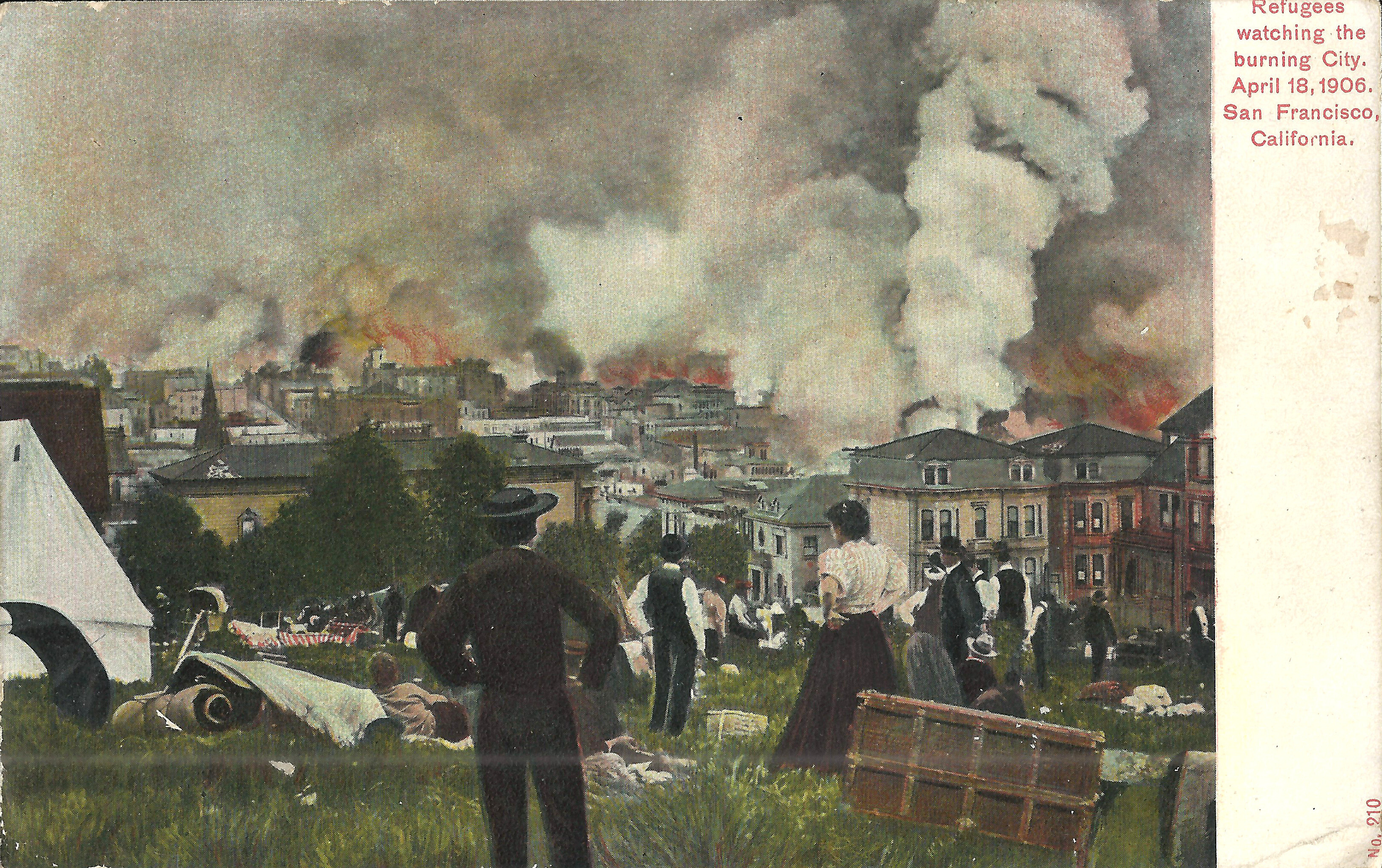
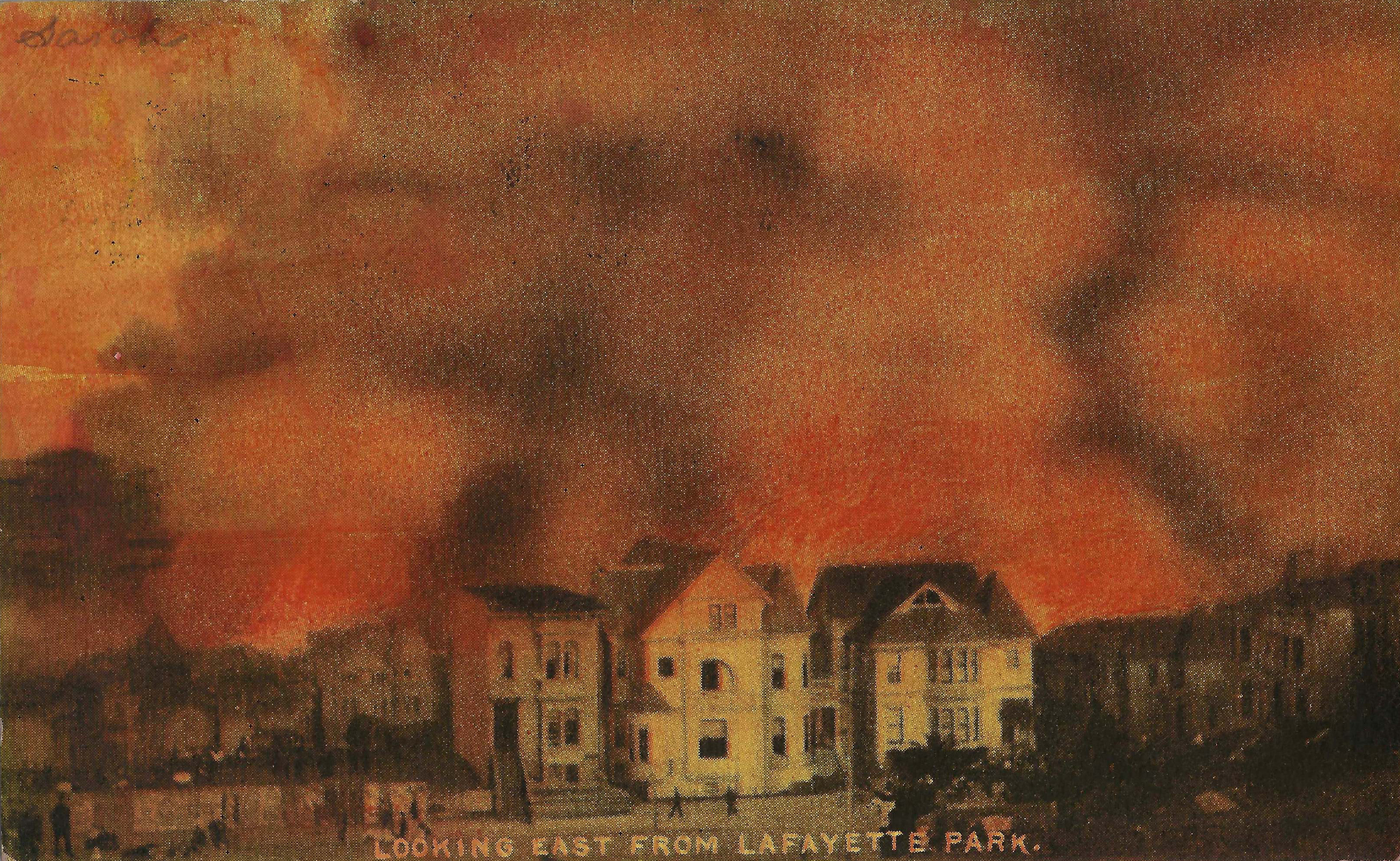
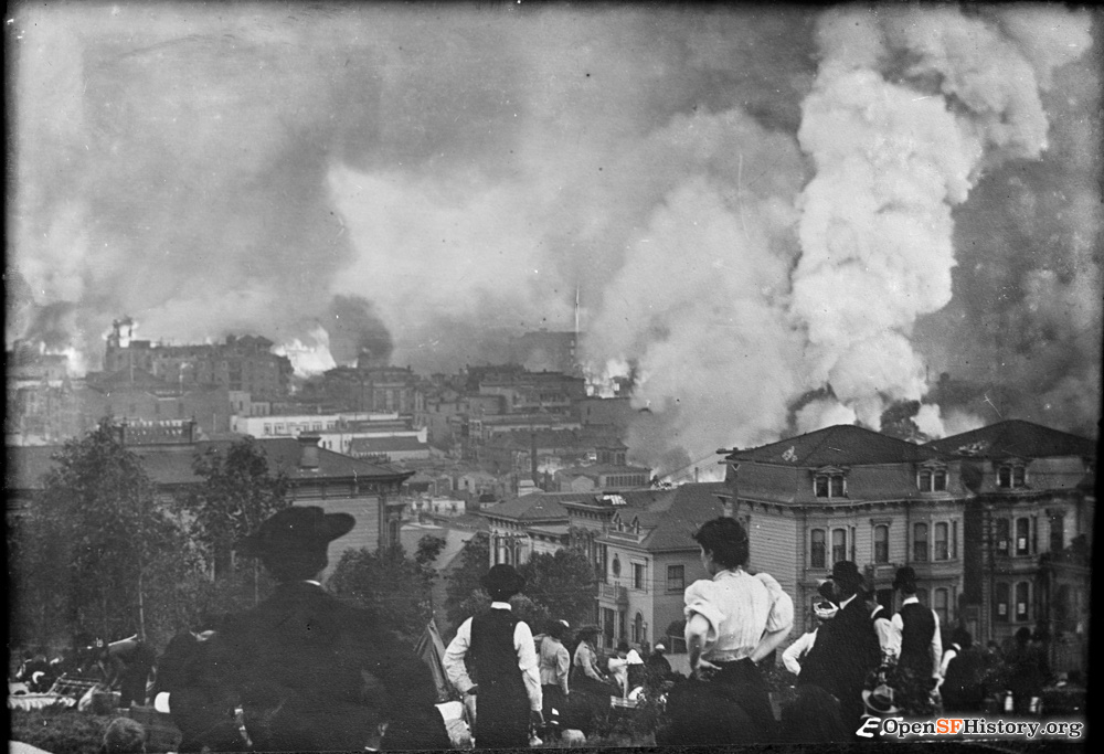
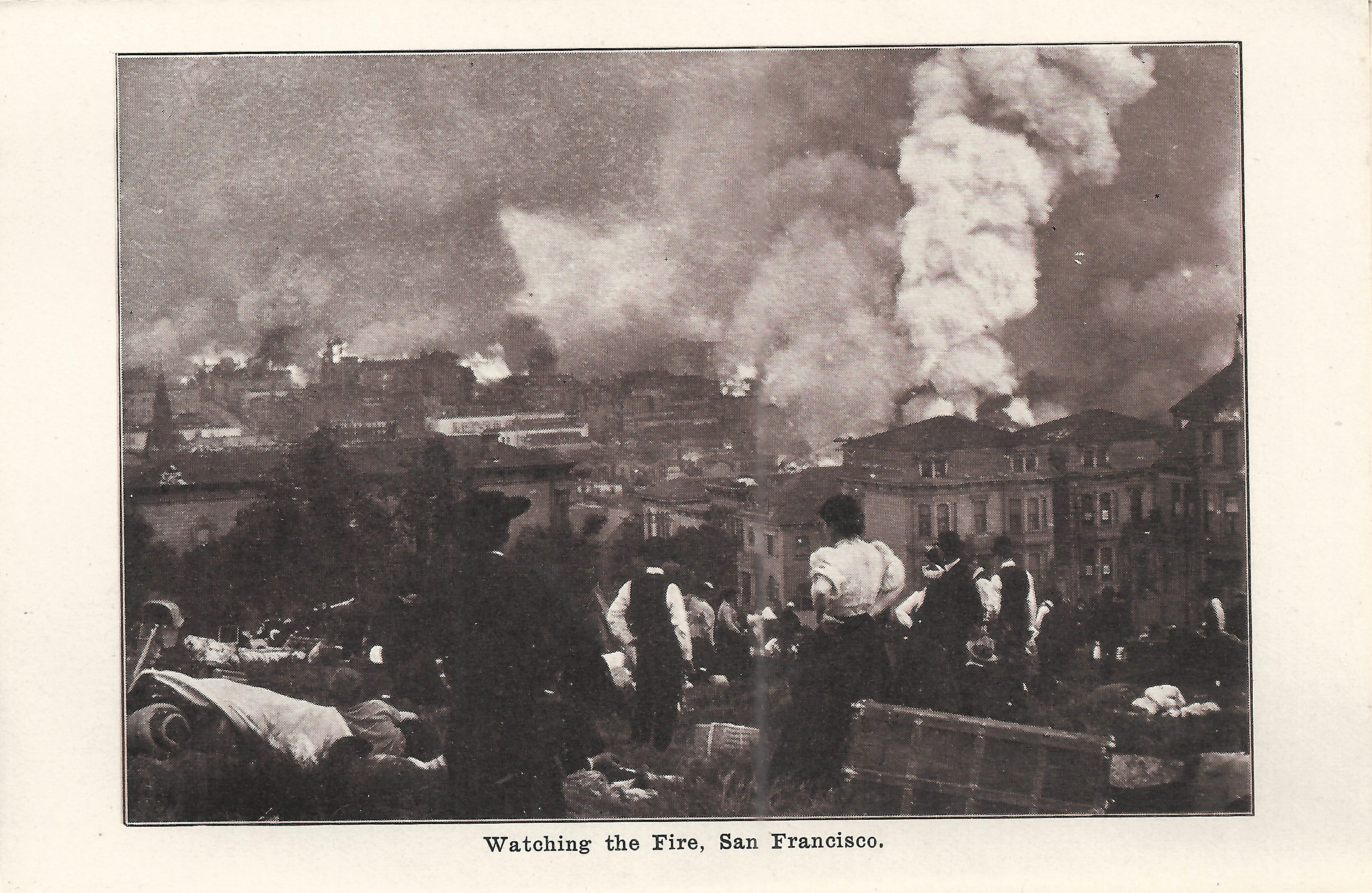
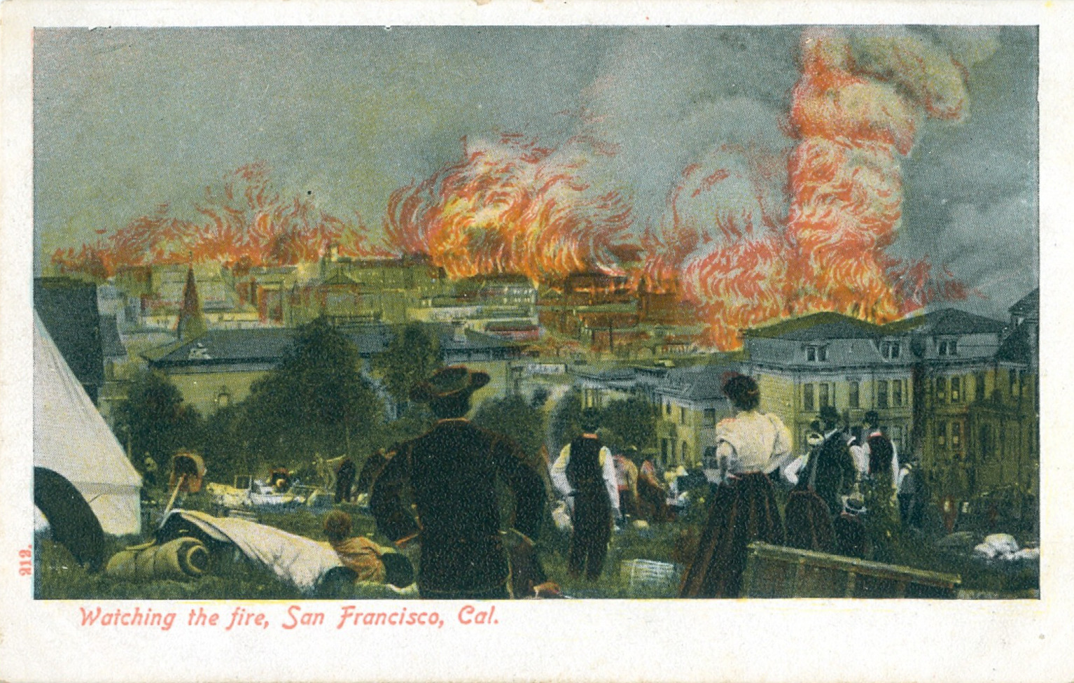
These four postcards from three different publishers show the same view from day 2; a higher resolution image is here. A large tent has been erected, the park is filling with refugees and their belongings, and the fire is much closer. The houses at 1812/1814 Gough again appear at the right edge. Just left of the woman's white blouse is 1919 Sacramento, still standing today (in 2026). The image also appears in Behrendt's souvenir folder Destruction of San Francisco by Fire and Earthquake, titled "Watching the Fire". Unknown publisher 212 (same stock number, so presumably Behrendt) colors and enhances the image with sensationalized flames.
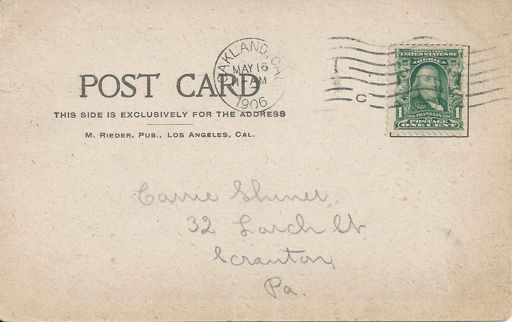
- Rieder, postmarked Oakland 5/16/1906, less than a month after the earthquake and fire.
- Rieder, postmarked 9/10/1906, variant of previous with caption moved and publisher credit added.
- Behrendt 212, same image as preceding.
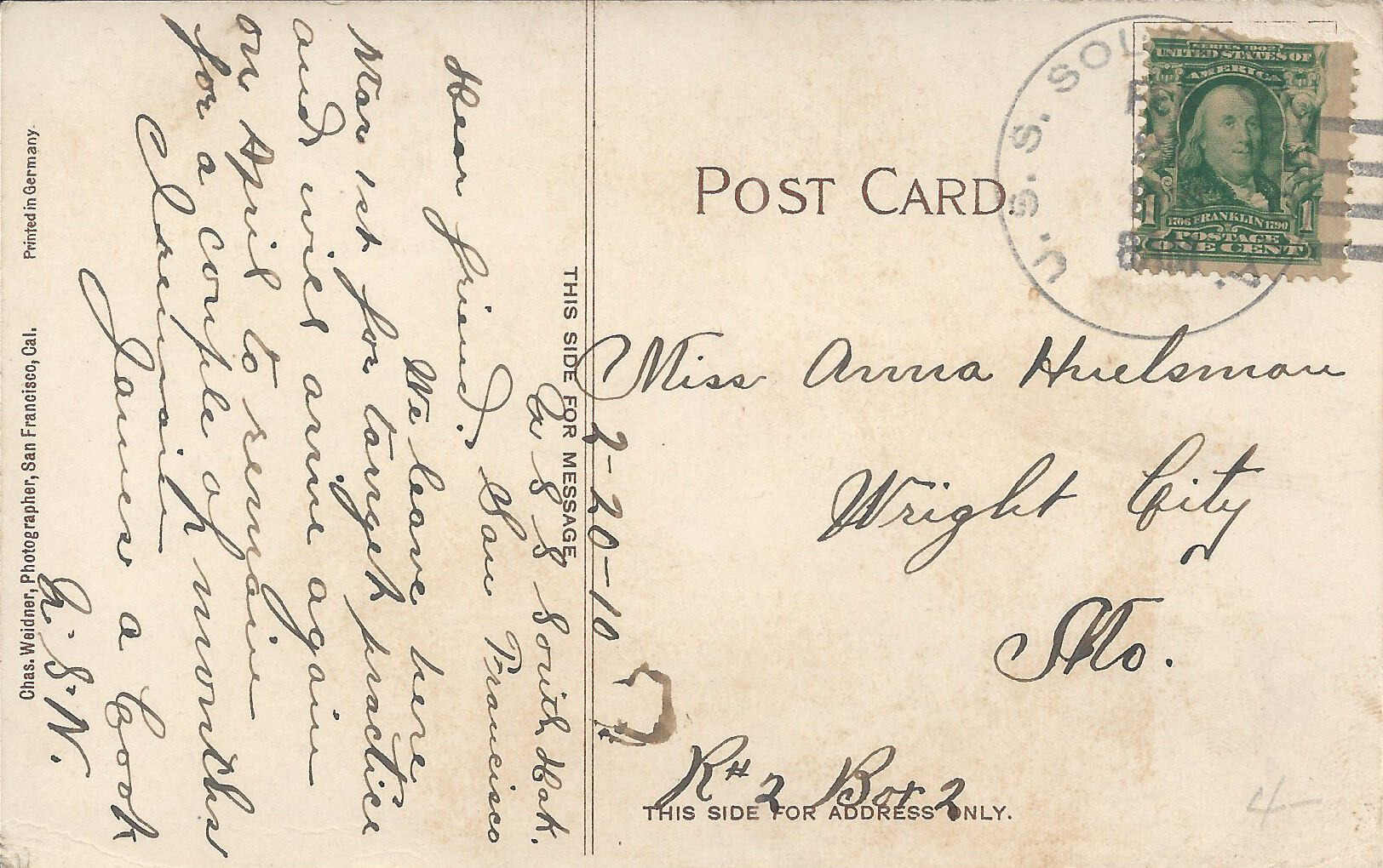
- Weidner 210, postmarked U.S.S. South Dakota, postmark date illegible but message dated 2/20/1910; colorized version of same image.
 |
 |
 |
 |
 |
 |
- Rotograph "Looking east on California from Steiner", postmarked 6/26/1906, about two months after the quake. The caption is incorrect: it looks east on Washington from Gough (i.e., from the northeast corner of Lafayette Park). The fire is raging on Polk Street on the late afternoon of day 2. Just left of the poster wall is the turret of 1915 Franklin, still standing today (now 1945 Franklin). Houses east of the fire toward Russian Hill remain intact; the map by Palacios shows its subsequent spread north and east. The back of the card quotes Collier's Weekly praising the virtues of dynamite in stopping the fire.
- Rotograph, postmarked 2/13/1907, looks east across Gough between Washington and Clay on the night of day 2 with the fire very close. A fire refugee noted that crews "were dynamiting Van Ness and the noise was terrific. After each explosion the air would be filled with feathery cinders that fell on our clothes and covered our hats." The foreground houses are 2010/2004/2000 Gough (northeast corner Gough/Clay). The turret at left is 1945 Franklin, also shown on the preceding card.
- Unknown publisher "The Fire and Burned District from Holliday Heights" is a double foldout photo card (not a postcard); the uncredited publisher is surely Sub-Post. It shows a wider view east including the same houses as the preceding card. The fire on day 3 has moved north past Lafayette Park, but it remains very active east of Van Ness and around Telegraph Hill. The burnt-out shell of the Fairmont tops "Knob Hill" (per caption) and the dome of the Call is dimly visible at far right. "Holliday" should read "Holladay" and "Knob" should read "Nob". The houses at 1823 Jackson (left), 2004 Gough, and 2000 Gough still exist today.
Steve's SF postcard pages:


