Mint Hill 1906
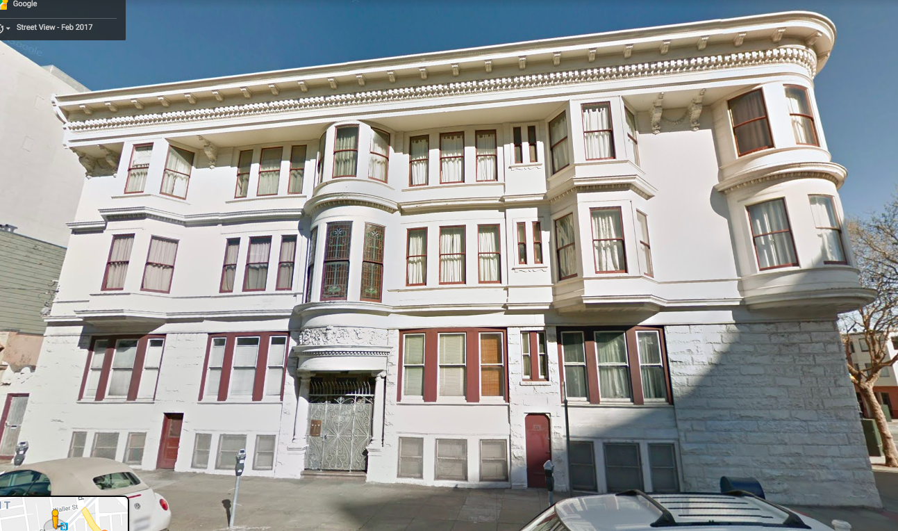
My collection of San Francisco postcards includes a dozen cards with images looking east from Mint Hill (then called Clinton Mound or Rock Hill) toward Hermann/Laguna/Market, taken before, during, and after the 1906 earthquake/fire. This page displays the postcards, the original photos used for the cards, and other photos taken nearby at the same time. As is often the case in San Francisco, the present contains vivid echoes of the past: the apartment building prominently placed in these images still stands at 2 Laguna as of November 2019.
Click on any image to enlarge, then use the Back button on your browser to return.
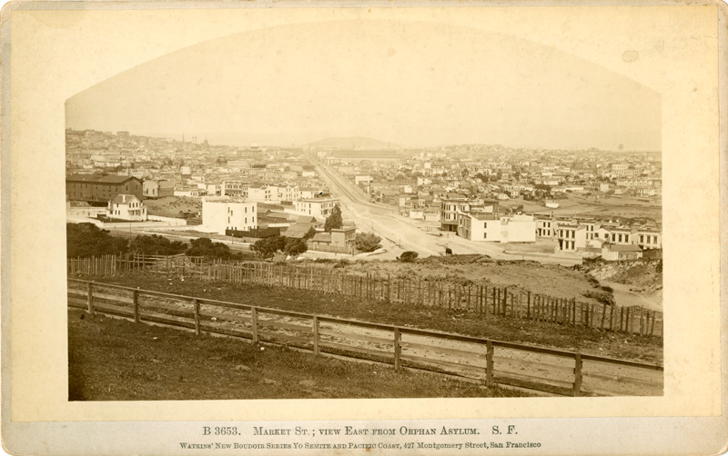
Left: Carleton Watkins boudoir card B3653
looks east on Market from Clinton Mound.
Most images on this page are taken from roughly the same spot.
The image is undated, but it must date from the late 1870s.
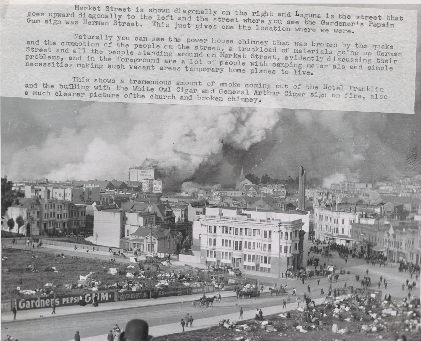
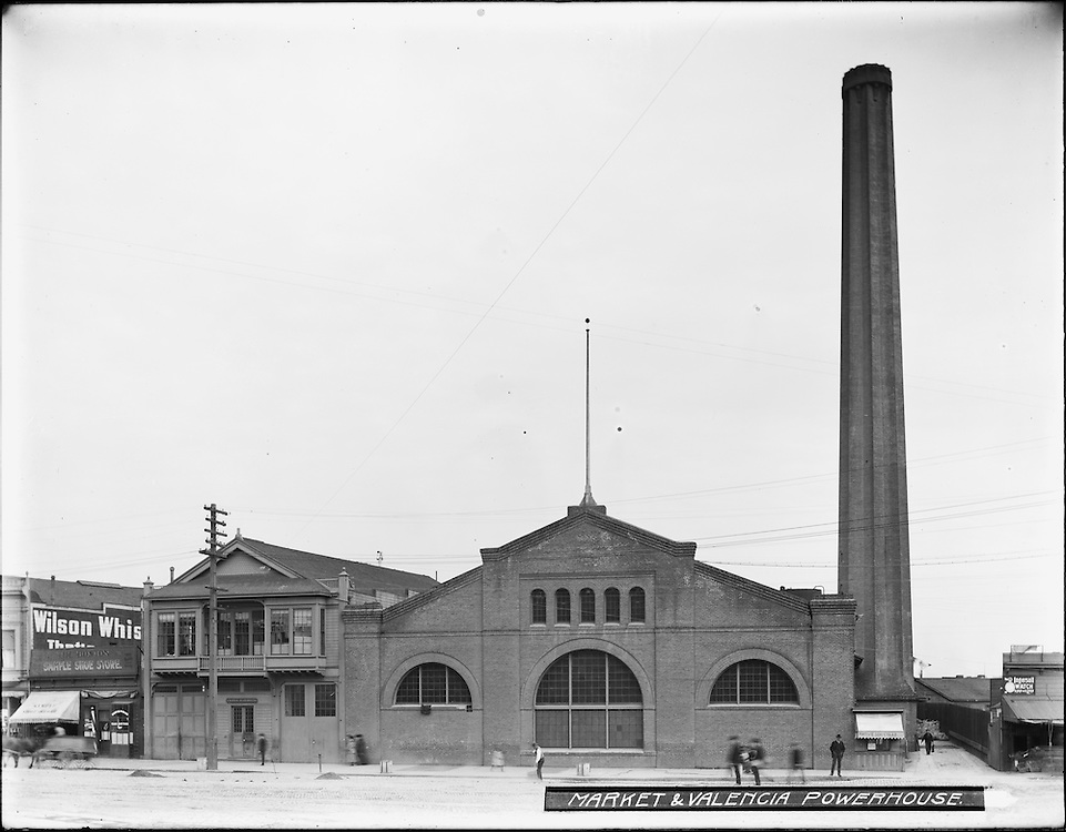
Market Street runs diagonally from middle right to upper left.
Trolley lines from downtown split off at Valencia,
but the Valencia Powerhouse (built 1883) seen in photos below has not been built yet.
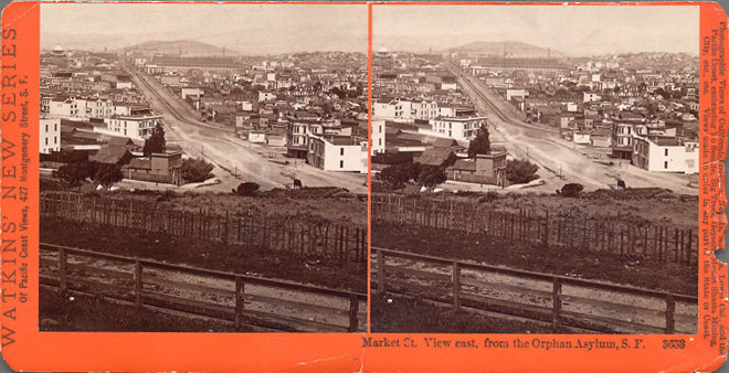
Center: Watkins stereoview 3653, a more tightly cropped stereo version of the same view
(click here for crosseyed viewing).
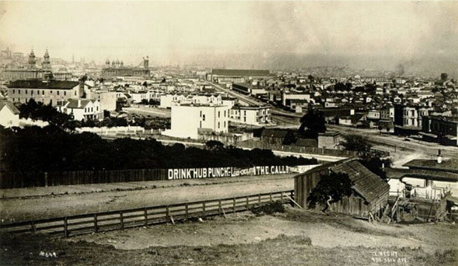
Right: Photo with Hermann in the foreground,
Hermann/Laguna/Market at the right edge.
The twin towers at upper left are St. Ignatius Church,
with City Hall (under construction, no dome yet) just beyond.
This photo is dated online as 1883,
but it is likely somewhat earlier, as it does not show the Valencia Powerhouse.
City Hall construction began in 1872 and was not completed until 1897.
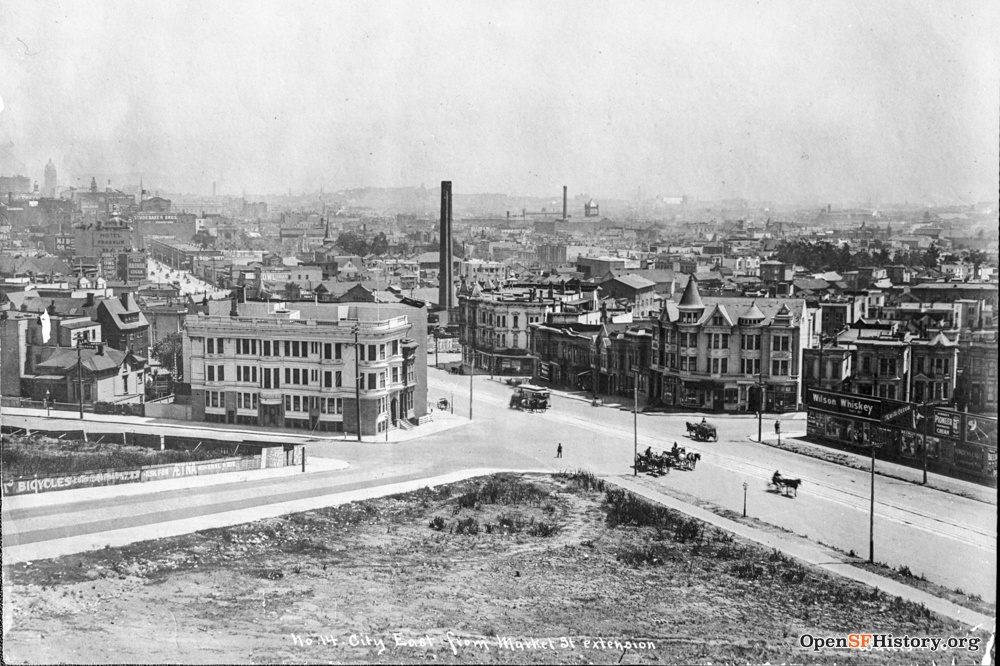
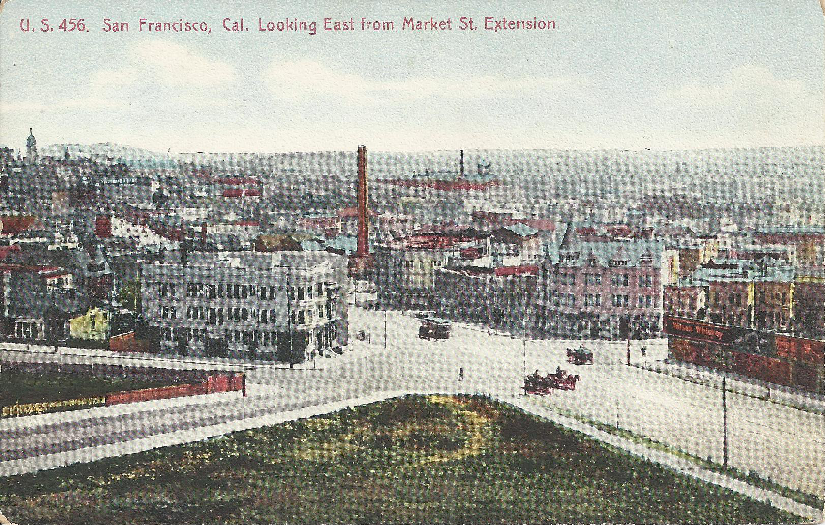
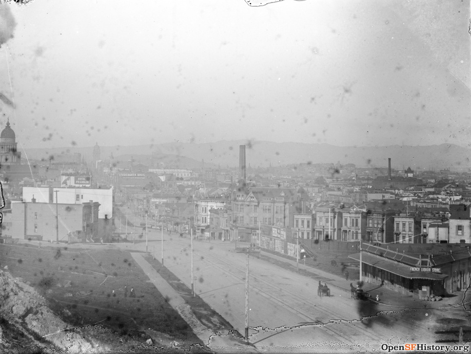
Left: This photo must date from shortly before the earthquake (online sources say 1904,
I think 1905 or even early 1906);
Market Street runs diagonally from lower right to upper left.
Hermann is at lower left, Laguna just above it,
and the large white apartment building at left center is 2 Laguna.
(An earlier photo predating 2 Laguna is also dated online as 1904,
so 2 Laguna must have been built ca. 1905.)
The distinctive building across Market is at the southeast corner of Market/Guerrero.
A block further east on Market, the tall chimney and large brick building (mostly hidden)
is the Valencia Powerhouse at Market/Valencia.
On the horizon at top left is the Call Building at Market/3rd (completed 1898),
then the tallest building in the western U.S.
The street has a few horsecarts and a streetcar, no autos.
The rightmost horse and cart on Market in the photo is slightly blurry,
that could be why it was removed for the postcard.
The Protestant Orphan Asylum and its school are just beyond the left edge of the frame.
The open space behind the fence at left is the orphanage schoolyard,
and the open space at bottom is the undeveloped hilly triangular parcel Market/Buchanan/Hermann.
Right: color postcard U.S. 456 uses the same image but was published years later.
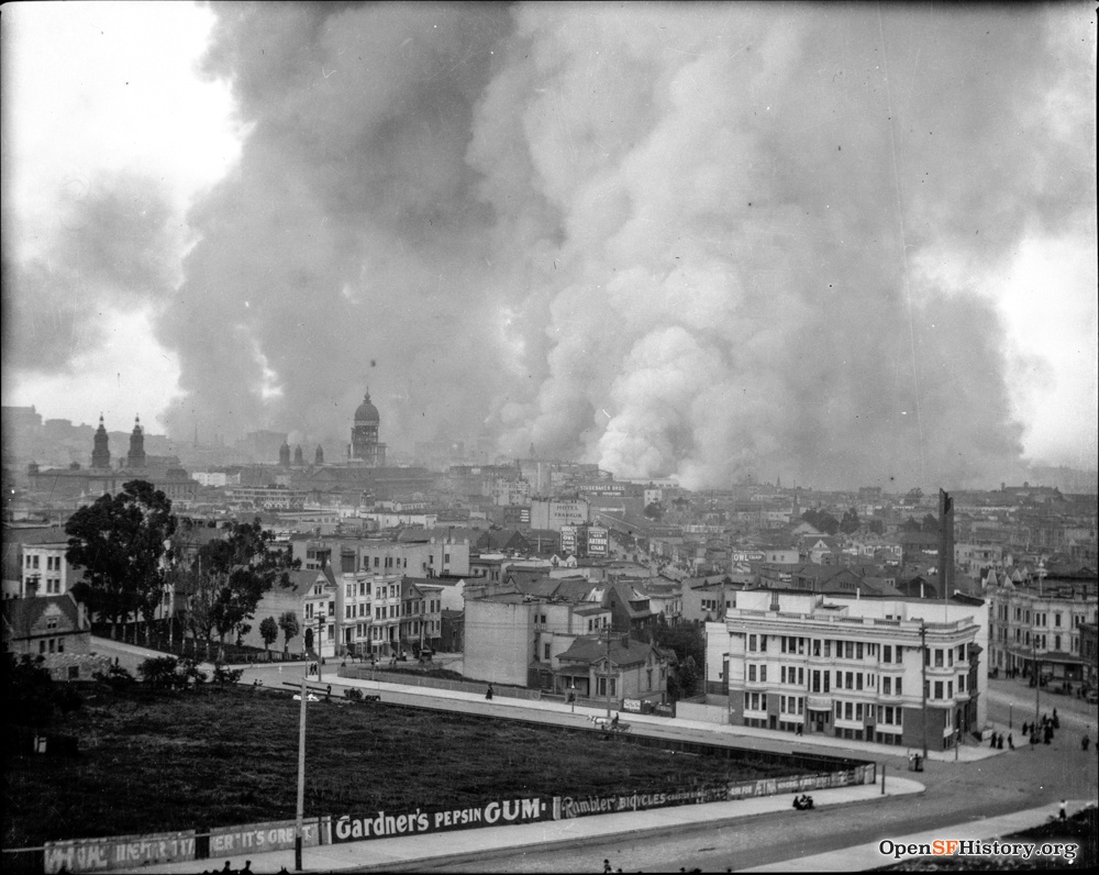
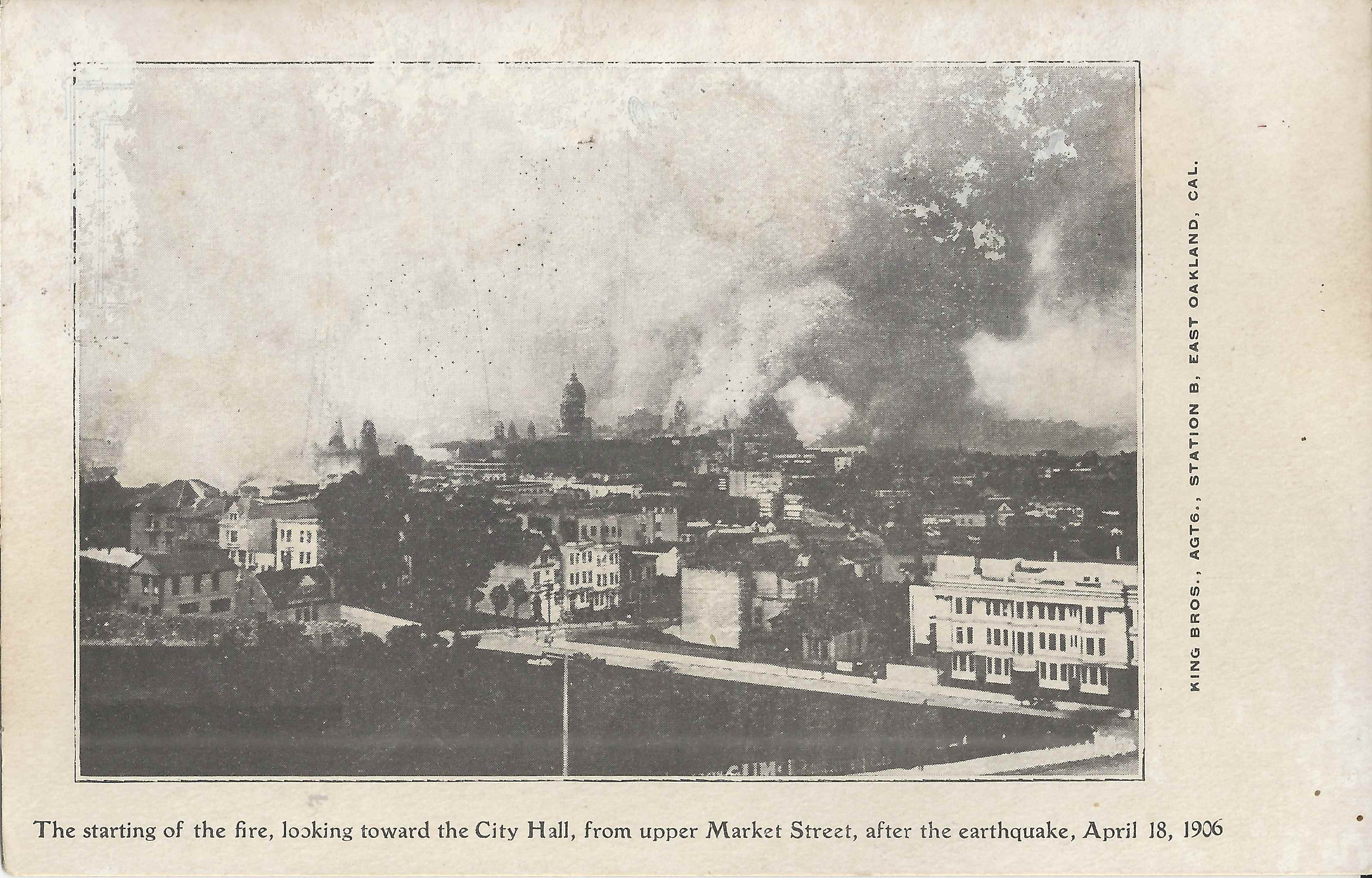
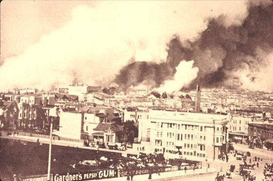
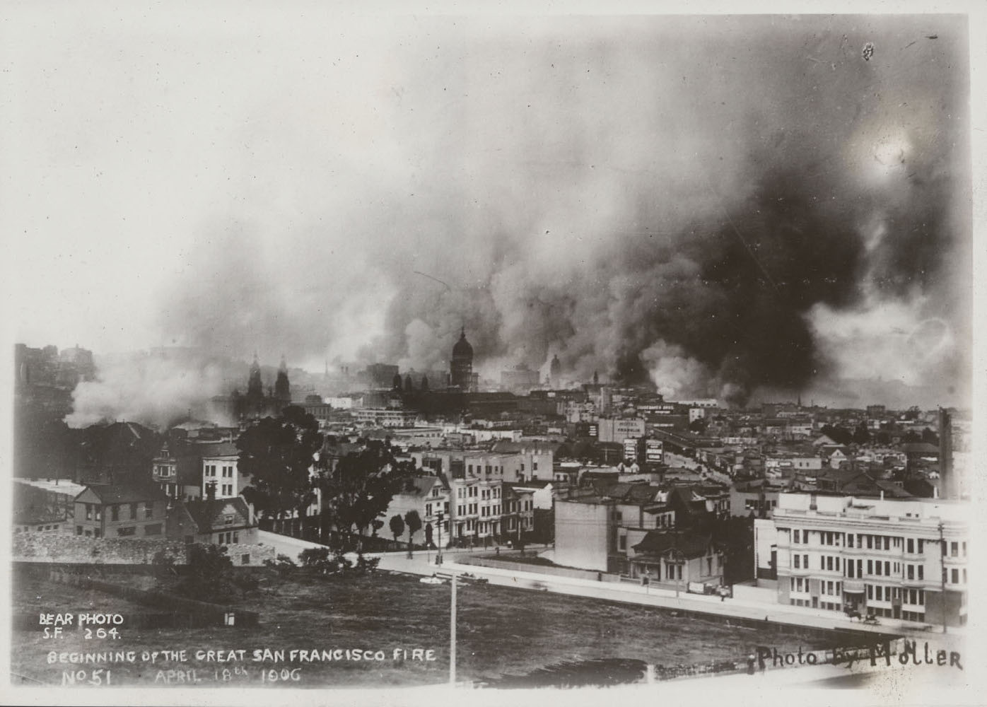
Left: Early in the day on 4/18/1906 (earthquake day),
the fire downtown is raging but still far away.
A small smoke plume rises at the left edge of the image
from the nearby "ham and eggs" fire at Hayes/Gough,
which started at roughly 9 AM (see Kennedy's fire timeline)
and grew to the east all day, eventually reaching City Hall.
The twin towers of St. Ignatius Church (Hayes/Van Ness) are at left,
the severely earthquake-damaged dome of City Hall (Larkin/McAllister) near the center,
and the partially collapsed chimney of the Valencia Powerhouse (Market/Valencia) at right.
The streets are quiet and the open spaces unoccupied.
Right: locally printed b+w King Bros. postcard uses the same image.
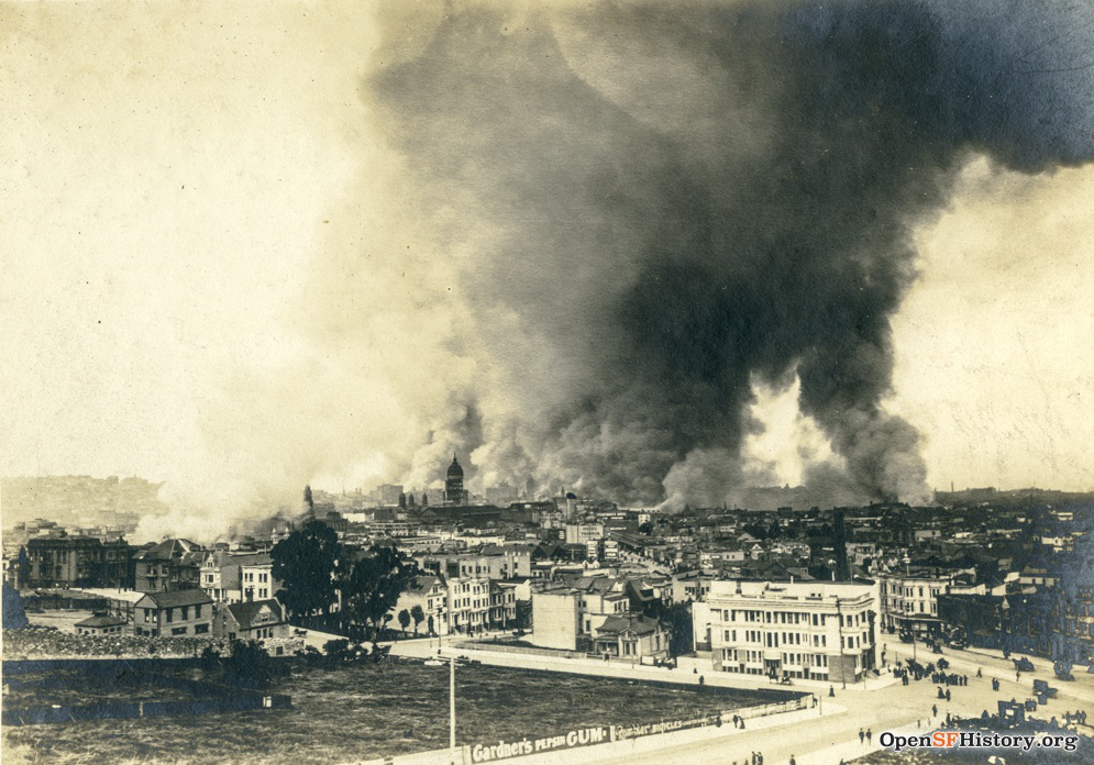
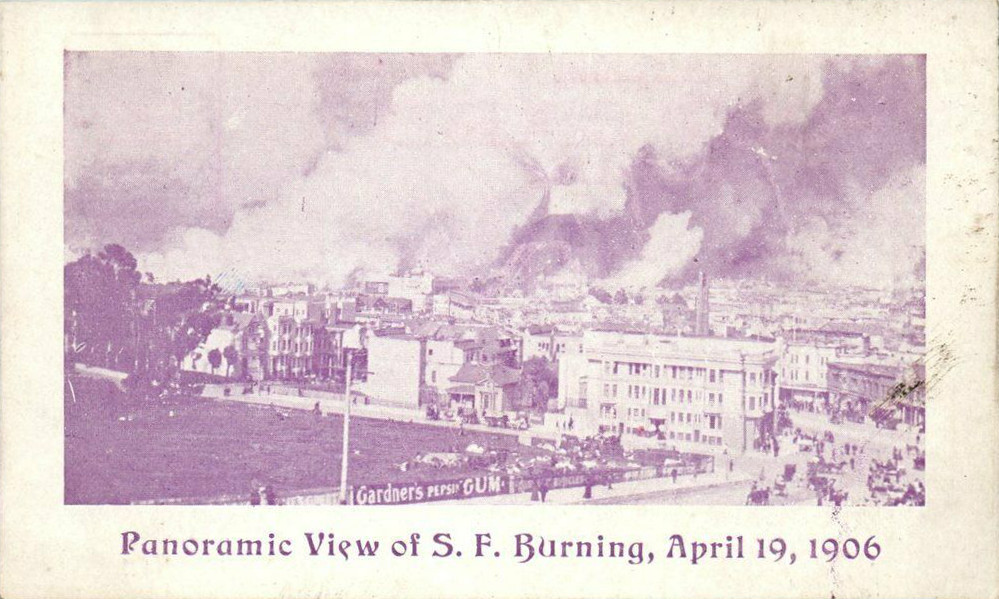
Left: The smoke from the ham and eggs fire suggests that
the photo at left must have been taken very shortly after the previous photo.
A different print is more tightly cropped,
captioned "Beginning of the Great San Francisco Fire April 18th 1906",
and shows multiple credits
("Photo by Moller", "Bear Photo S.F. 264", "No. 51").
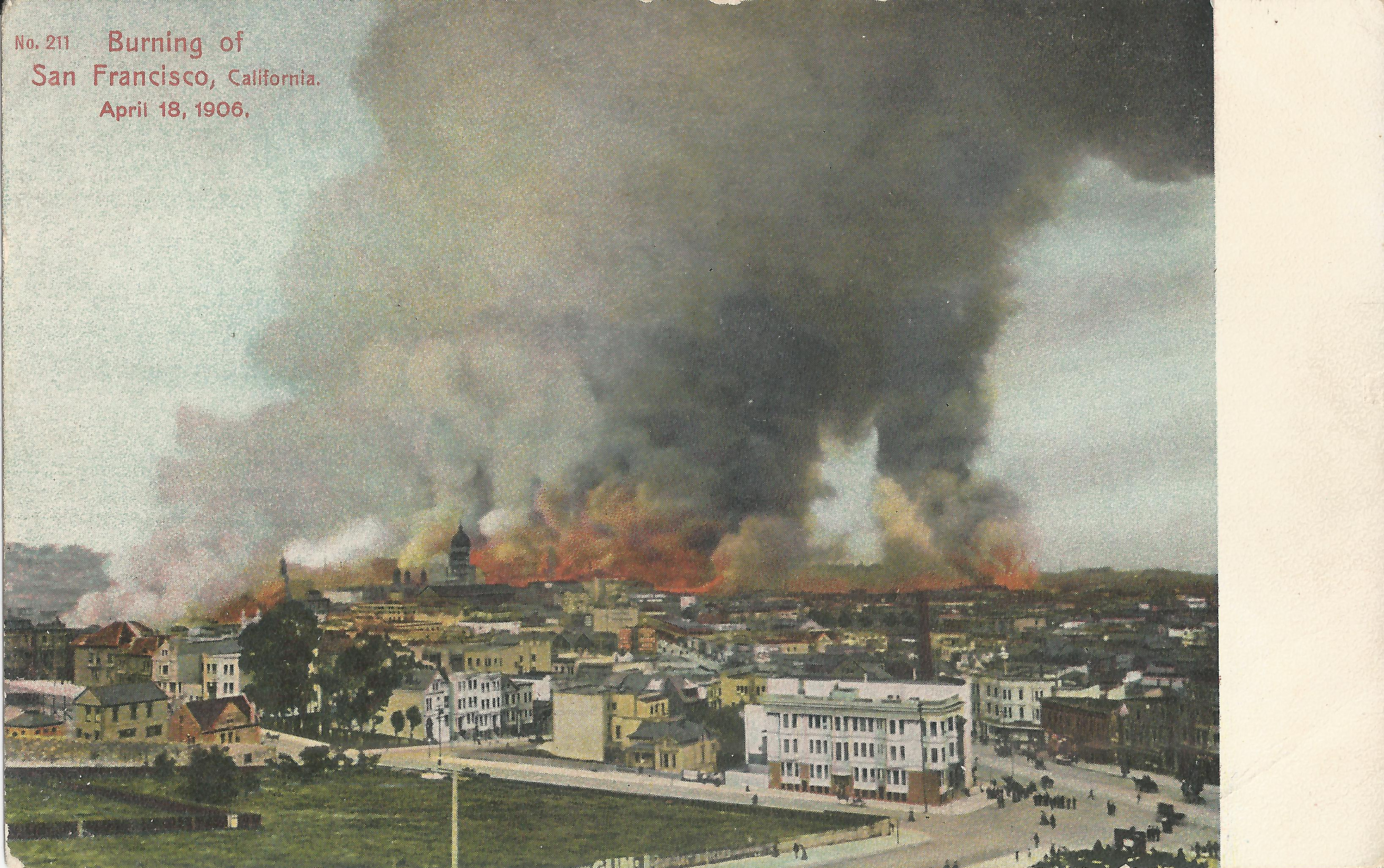
Center: postcard Weidner 211 uses the same image.
Local b+w postcards appeared soon after the event,
but color postcards were typically printed in Germany,
so this card was published months later.
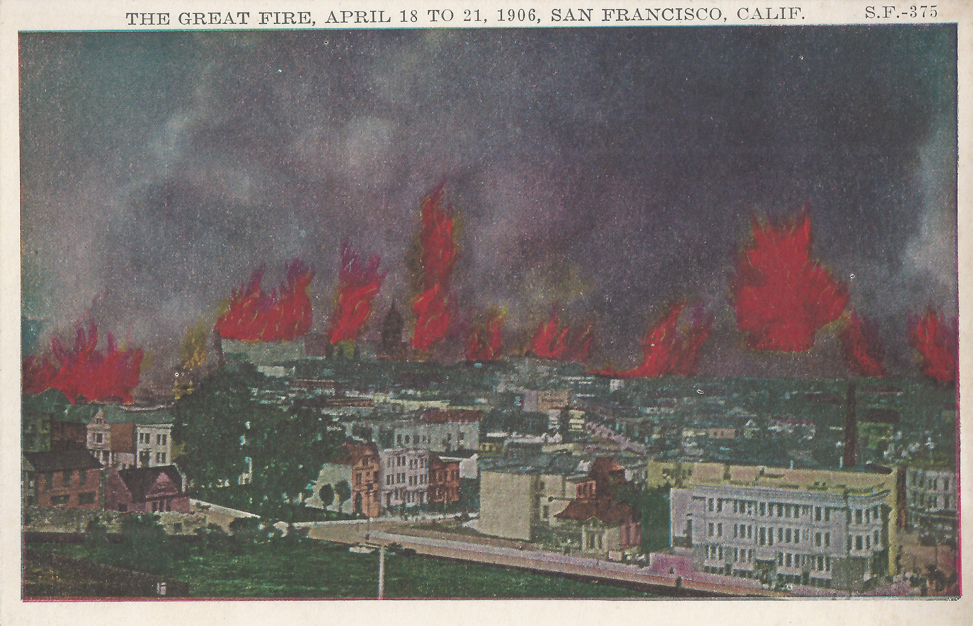
Right: Since color postcards of this period were based on b+w original photos,
the color details are not reliable.
Pacific Novelty 375 shows dramatically exaggerated flames.
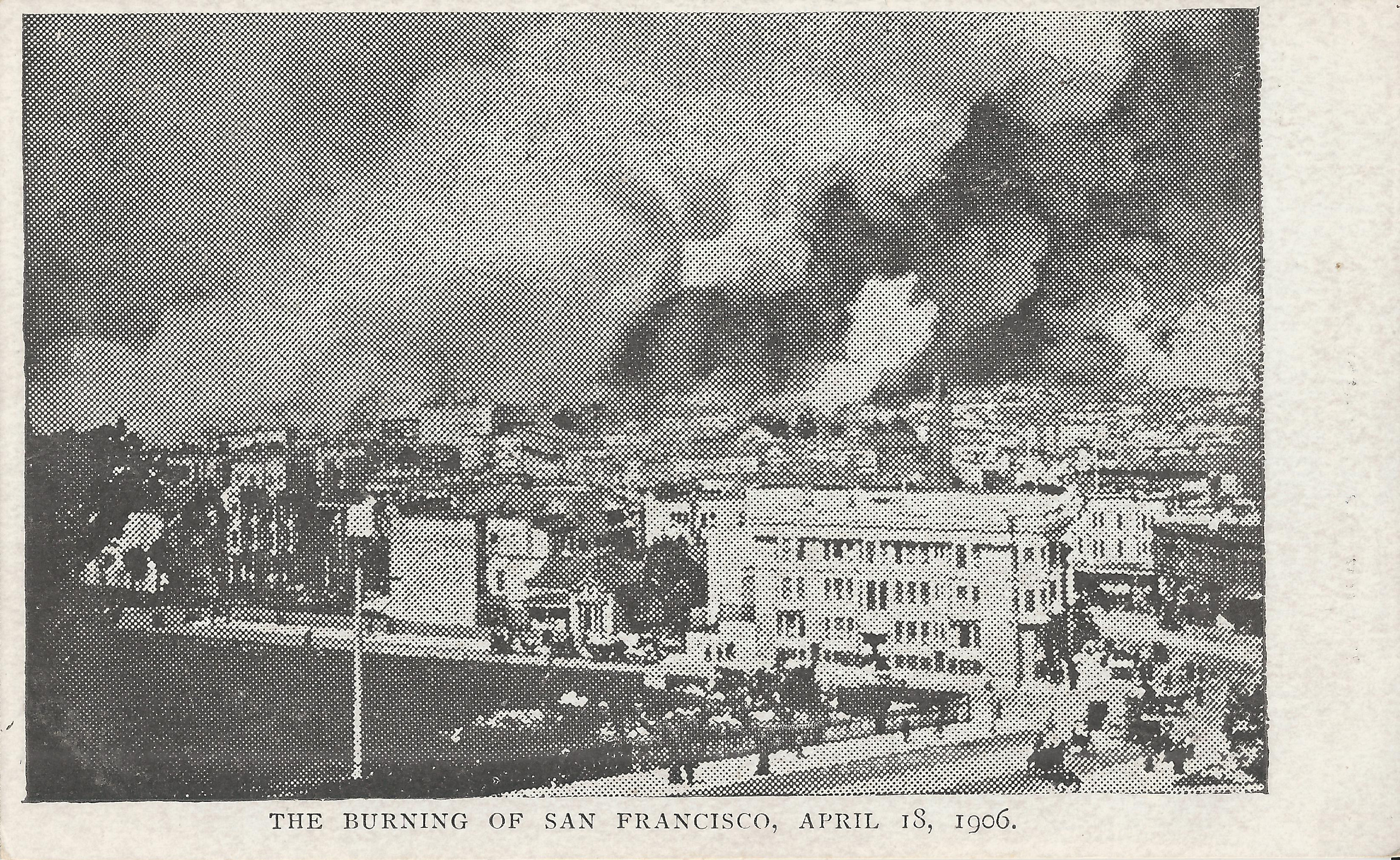
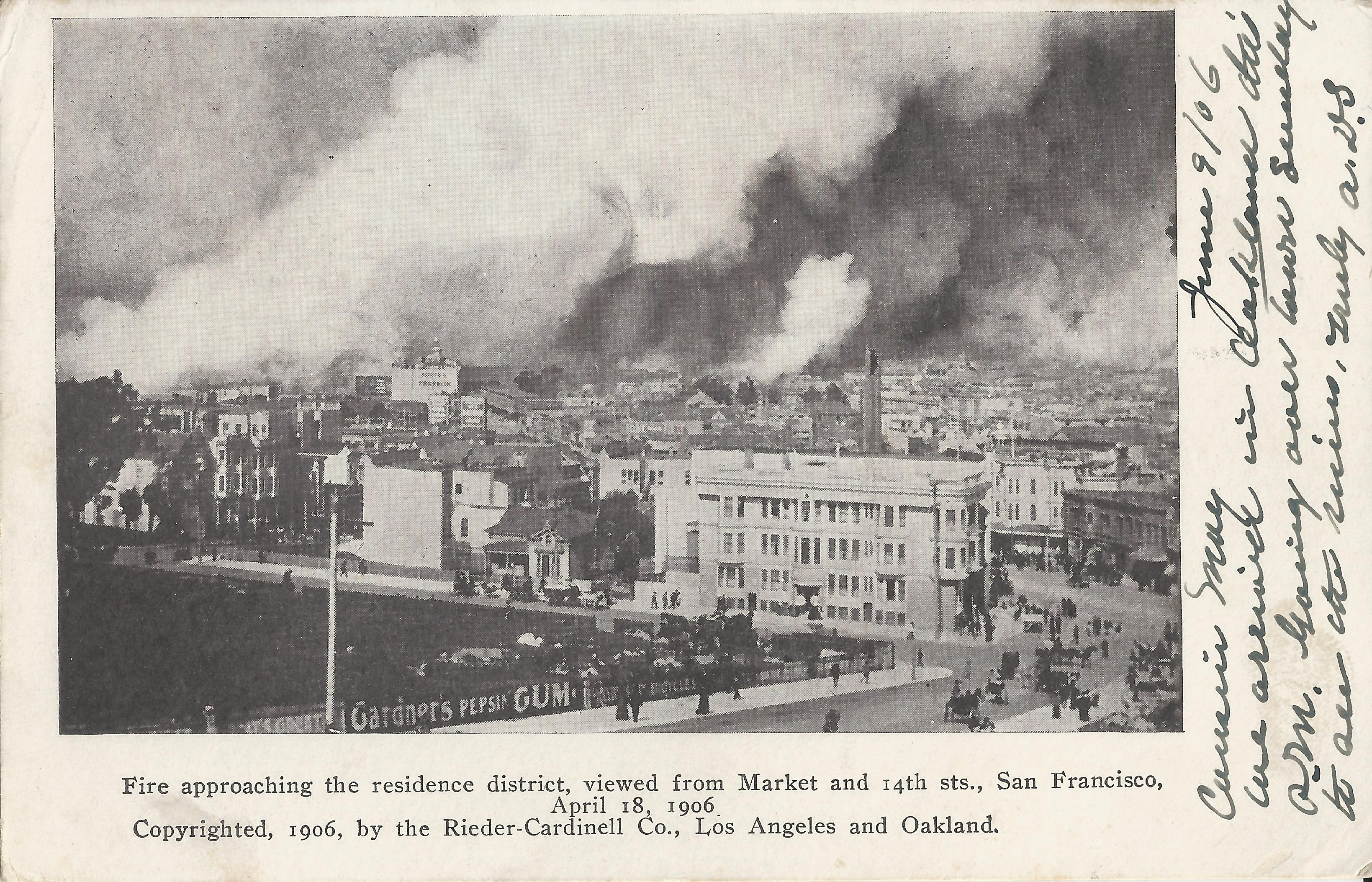
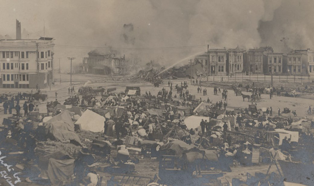
Left: This photo was taken somewhat later in the day,
with more activity in the street and the first fire refugees in the open space.
The three postcards all use this image.
Next: postcard from unknown publisher.
Hastily produced poor quality b+w postcards appeared very soon after the fire.
Next: Gannett postcard.
Right: higher quality later Rieder-Cardinell postcard.
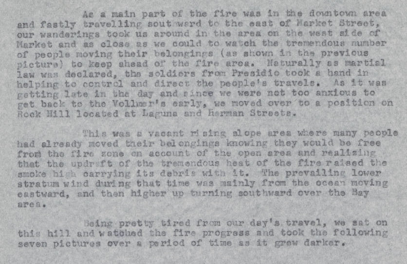
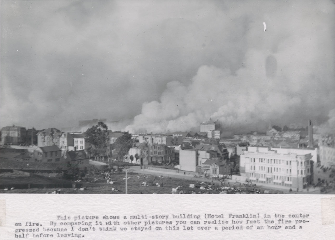
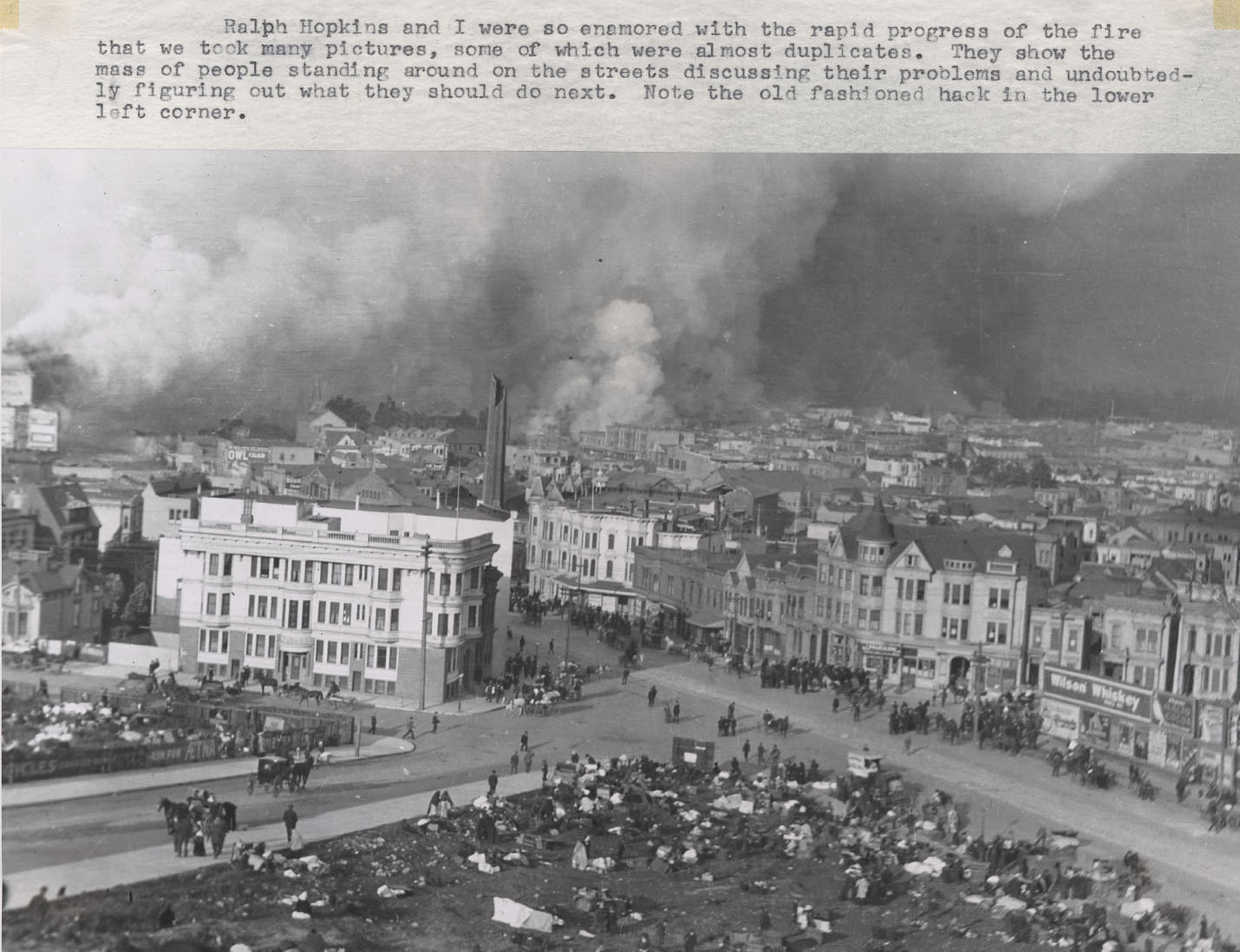
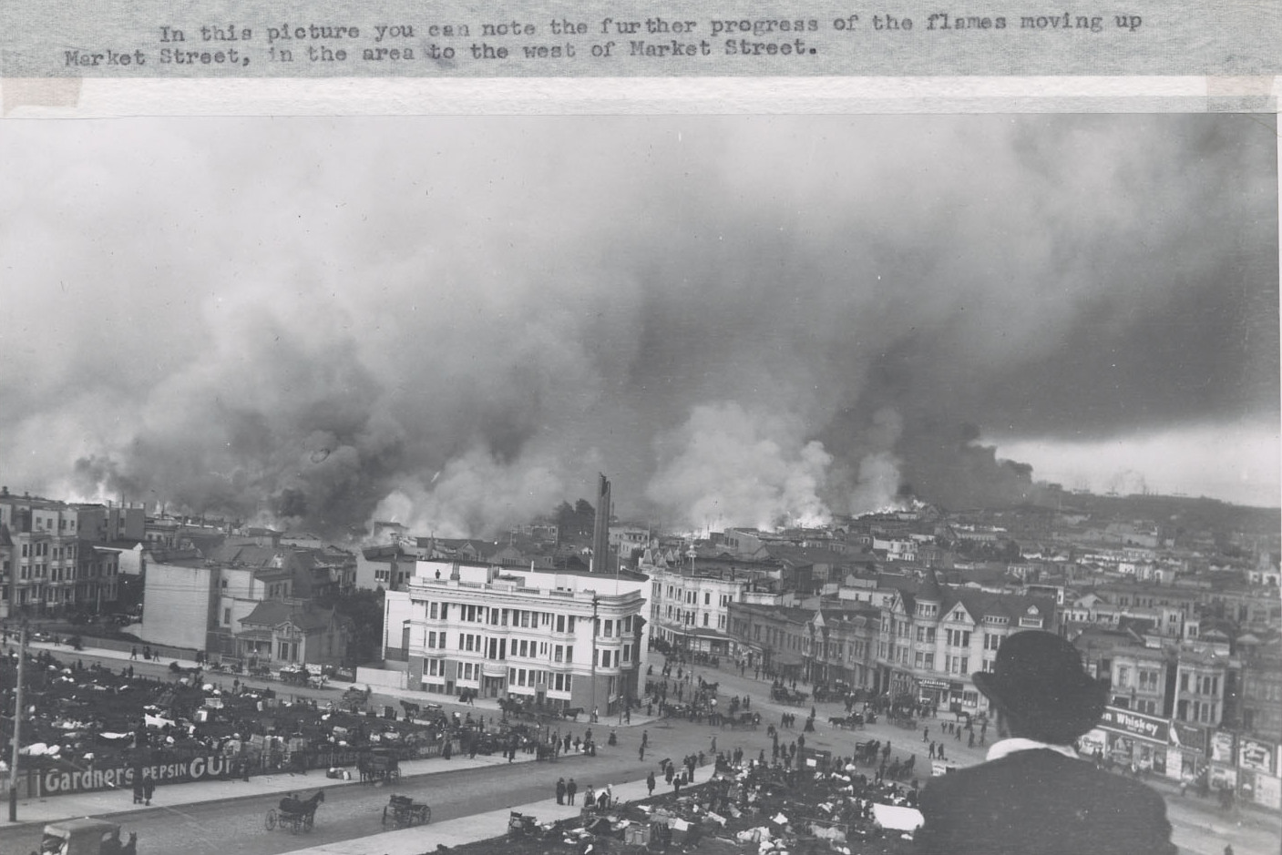
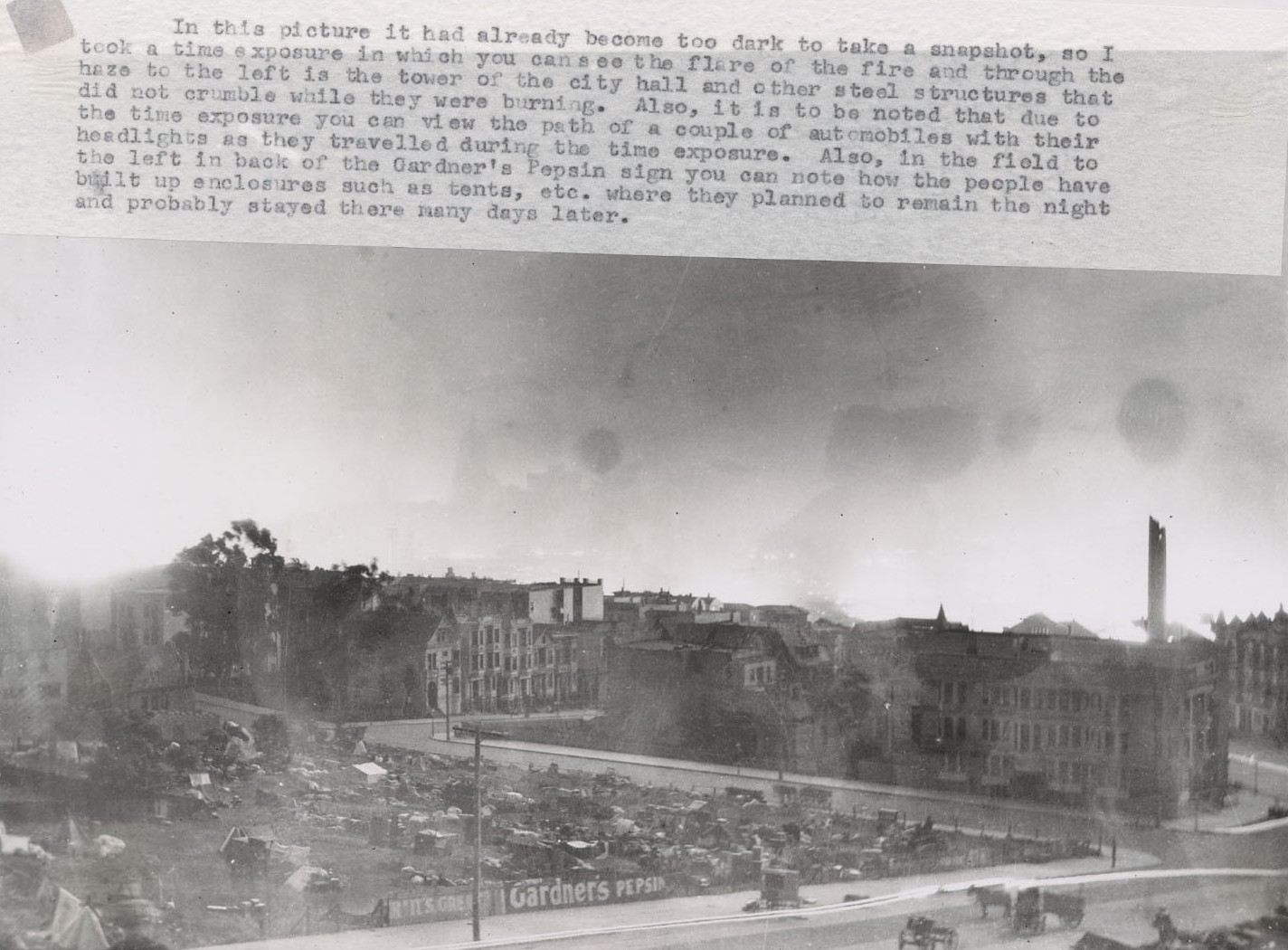
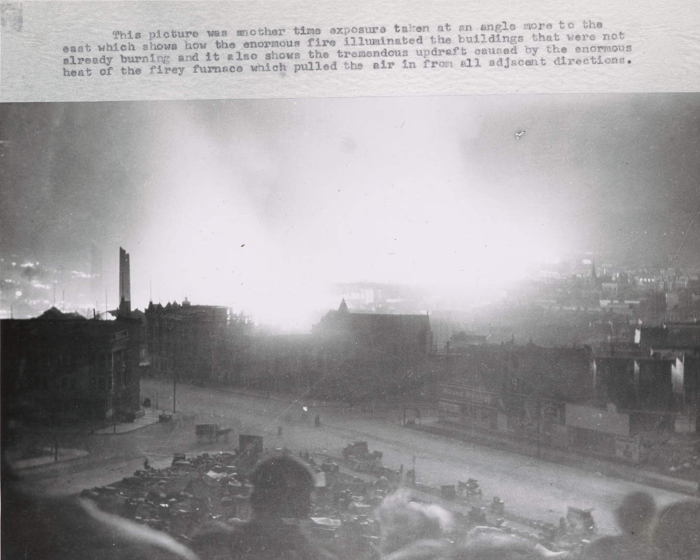
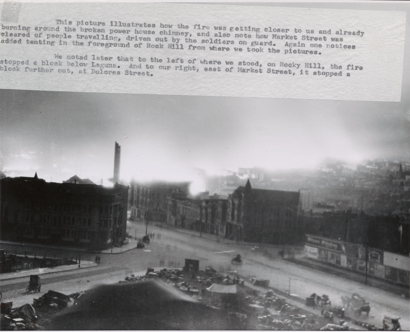
Awakened by the earthquake on 4/18/1906, Stanford student Carl Breer grabbed his Eastman No. 3A Folding Pocket Kodak camera, took great pictures of earthquake damage at Stanford, and then biked to San Francisco, where he took eight pictures from Rock Hill (as he calls it). More than fifty years later, in 1963-1964, he wrote a detailed narrative describing his earthquake experience. Breen says he reached the site "late in the day" and was there "an hour and an half". Sunset was at 6:48 PM on 4/18/1906, so the earliest photos must be from late afternoon, likely 4:30 PM or later. The last three photos are time exposures taken at dusk and after sunset. Breer's booklets are here (Vol. I: Stanford) and here (Vol. II: S.F.). Unfortunately, his typewritten narrative covers part of each photo in these scans.
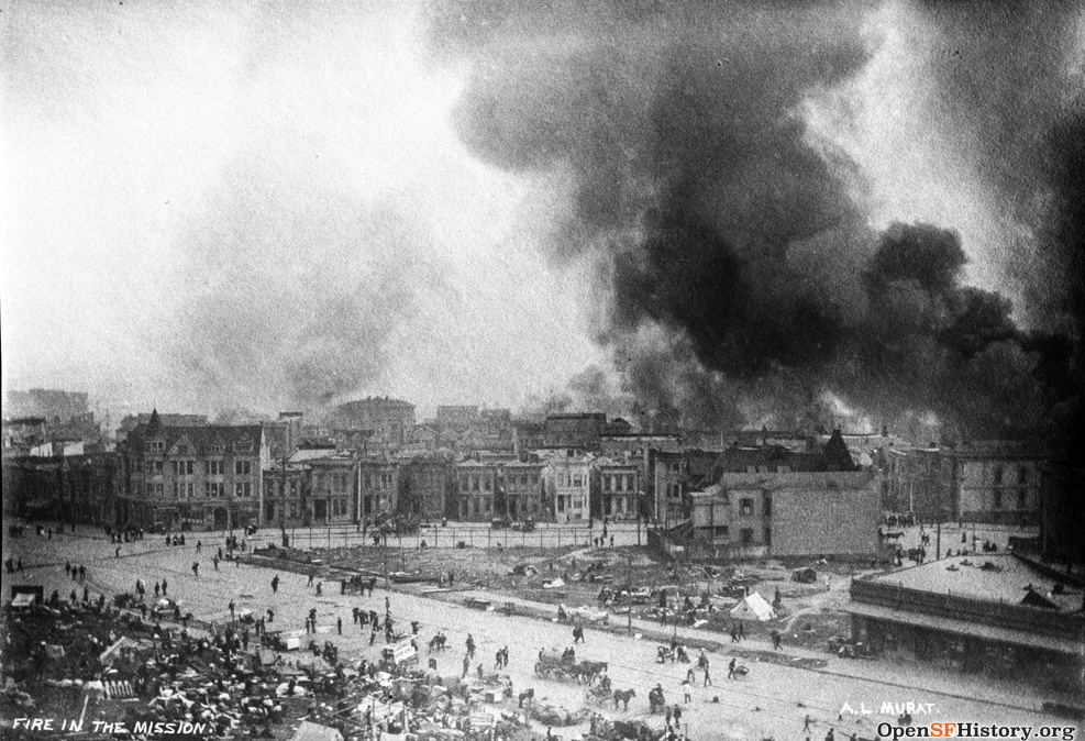
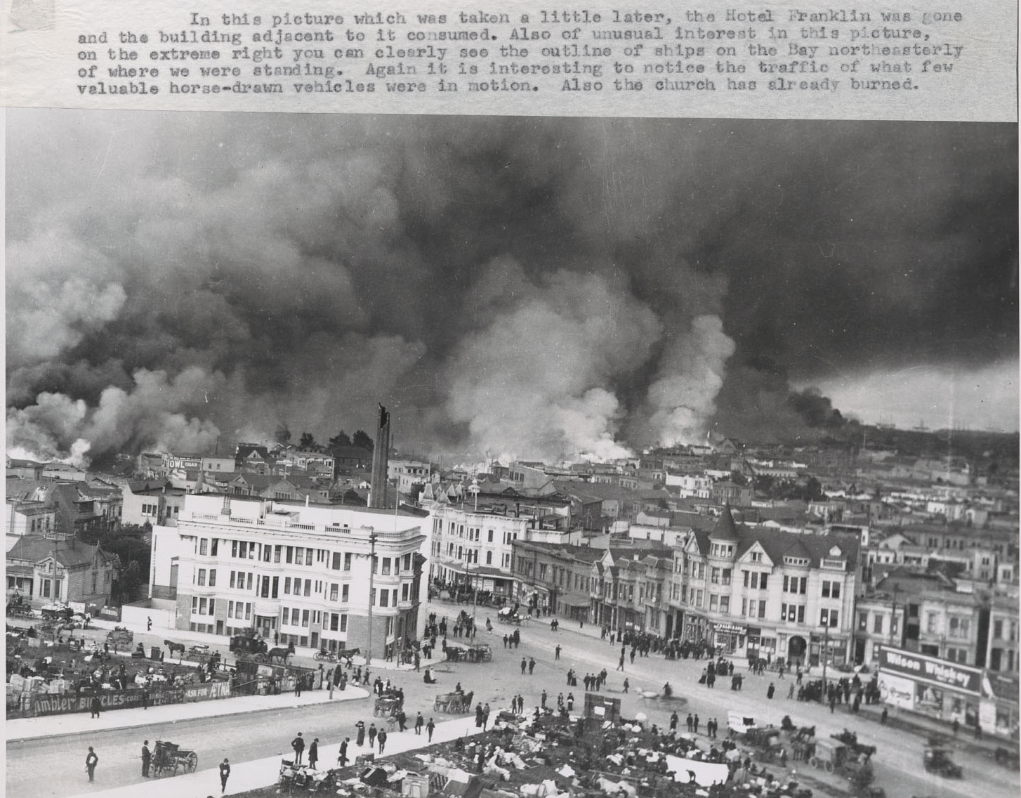
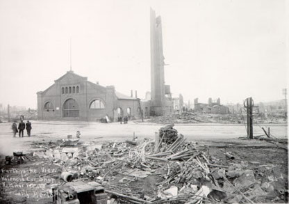
Fires burned for three days, eventually destroying most of the city east of Van Ness and south of Market.
Kennedy's fire timeline says the Mission fire reached 15th/Dolores by 11 AM on the second day (4/19/1906),
16th/17th by 7 PM, 18th/Valencia by 10 PM, was stopped at 20th/Dolores ca. 11 PM,
and was out by 7 AM on the third day (4/20/1906).
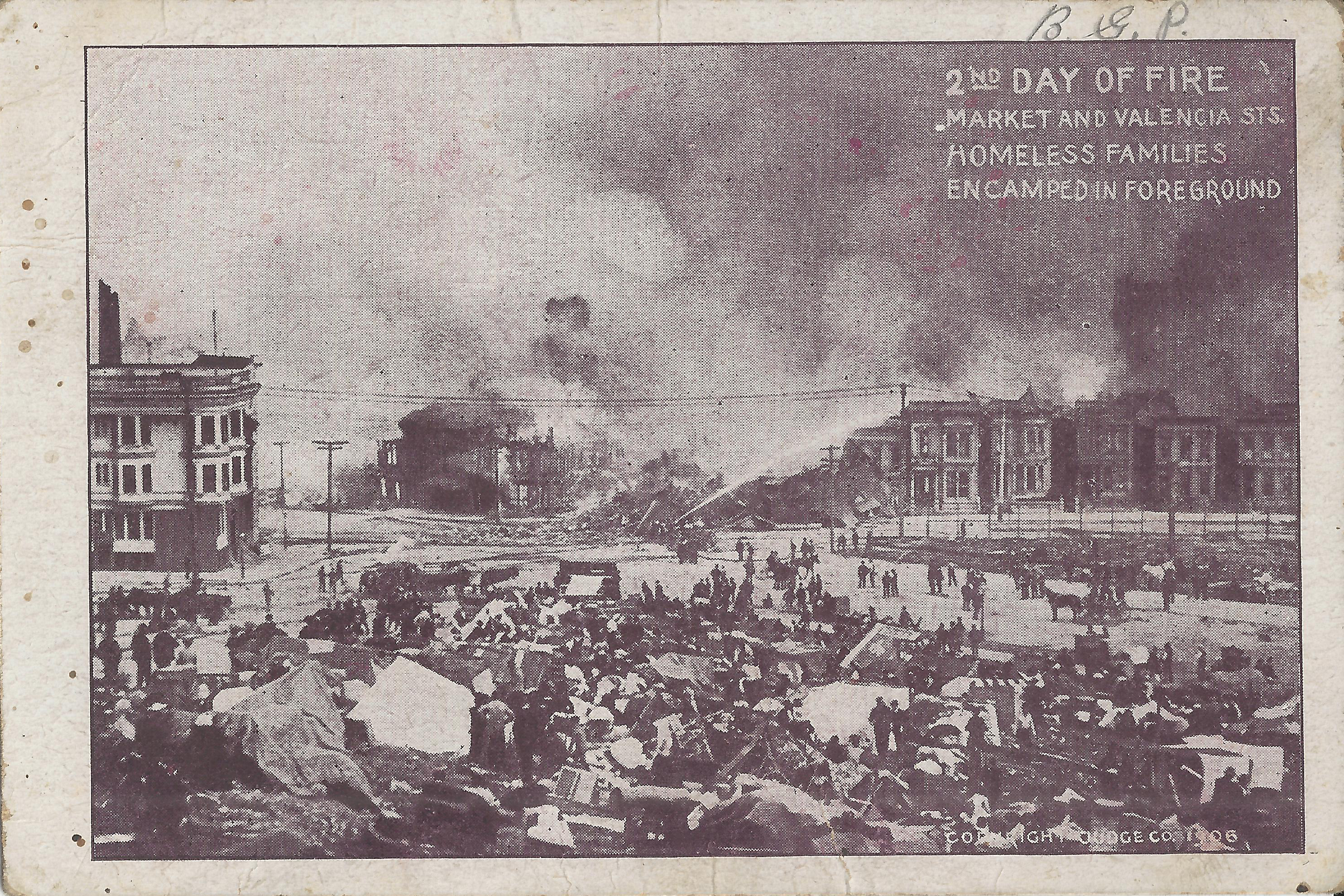
Left: Early on the second day, looking across Market/Guerrero with the Mission fire very close.
The long "Wilson Whiskey" billboard along Market at Guerrero
still stands in Breer's nighttime photos above but is down now.
Right: This Judge postcard (based on this photo) shows the fire at Market/Guerrero
("Market and Valencia" on the card is incorrect).
Firefighters have dynamited the corner building and are attempting to save its Guerrero neighbors,
but within a few hours all these buildings will burn.
Dolores Park 1906 has more pictures of the fire from Dolores Park.
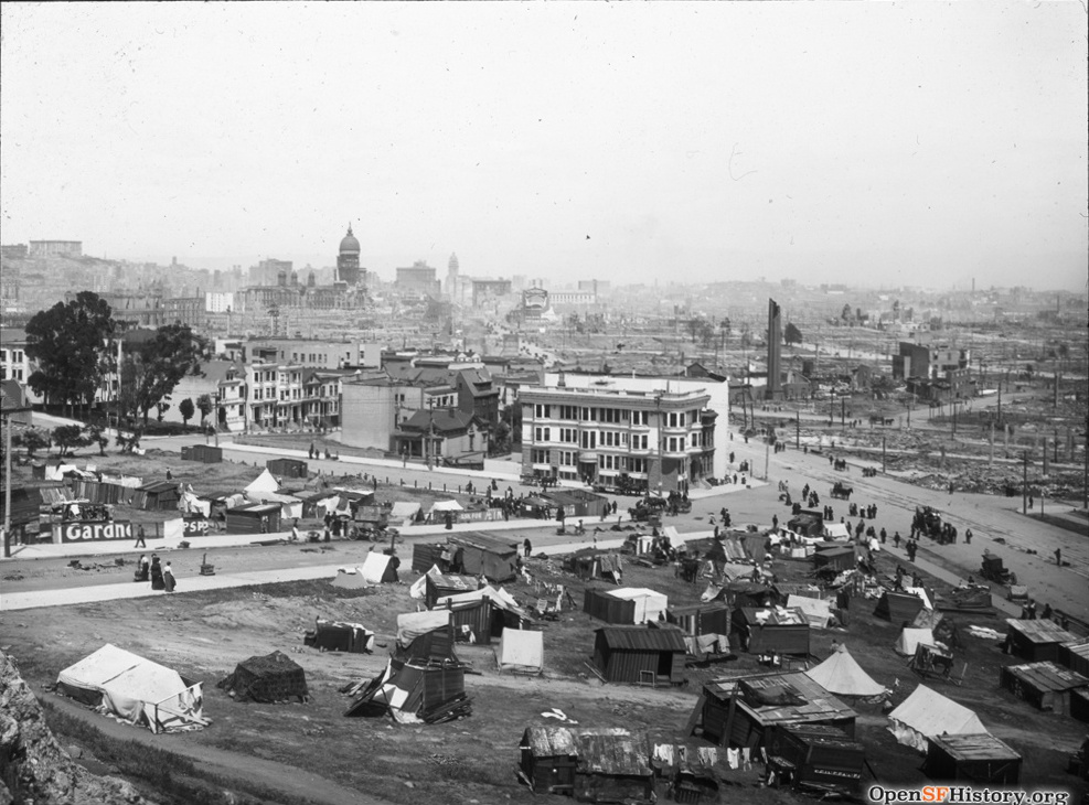
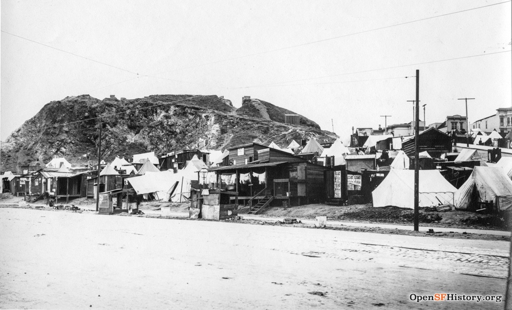
Left: After the fire, the buildings on Laguna and Waller still stand but everything south of Market is gone,
and refugees have settled into the open spaces.
Protestant Orphan Asylum has more photos of refugees at this site.
The Fairmont Hotel on Nob Hill at top left
was close to completion in April 1906,
but earthquake/fire damage delayed its opening until 1907.
The postcards both use this image.
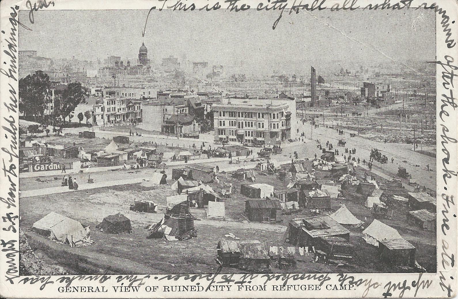
Center: This postcard is postmarked 5/07/1906, about three weeks after the earthquake.
The sender writes "This is the City Hall all what remains after the shock.
Fire ate it up but shock knocked it to pieces.
This quake has taught S.F. how to build her buildings."
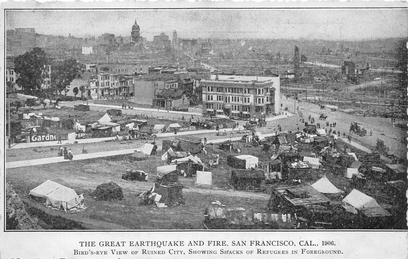
Right: Later American postcard.
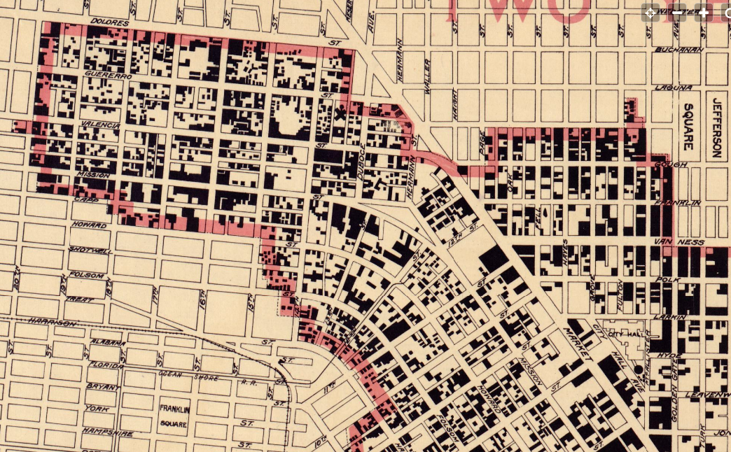
Punnett's Two Years After map (detail above, with north at right) shows the fire perimeter in red. Black blocks represent buildings rebuilt by two years after the fire.
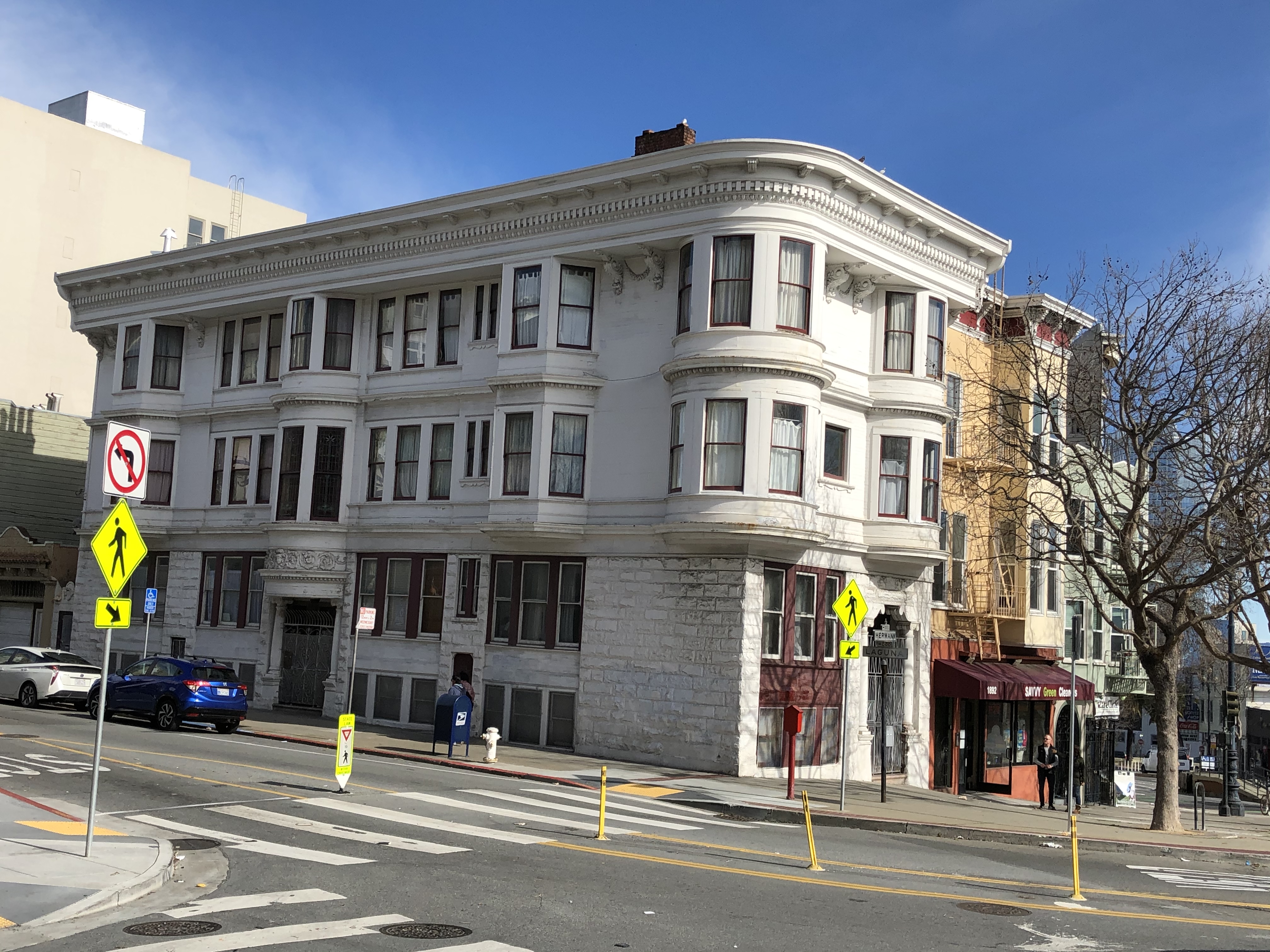
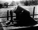
All the photos above were taken from Clinton Mound, shown here looking west from Market just above Laguna in 1906. The new U.S. Mint was built on the mound in 1937, so it's now called Mint Hill. This page is dedicated to 2 Laguna, a staunch survivor.


