Before Dolores Park
This page describes the history of the Dolores Park site before it became a city park in 1905. It is a prequel to my Dolores Park 1906 page.
Dates for old photos online are unreliable. The same photo often appears on different websites with different dates, rarely with information about the source for the date, and sometimes the dates are provably incorrect. The future Dolores Park site was largely bare of vegetation until 1860, so the growth of landscaping provides helpful clues for dating the photos below.
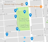
Click on an image to view full-resolution version. Click on the map at right for a map showing photo locations.
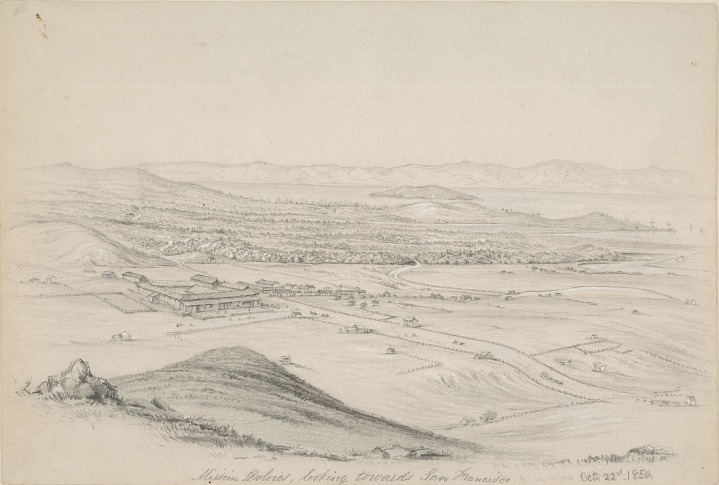
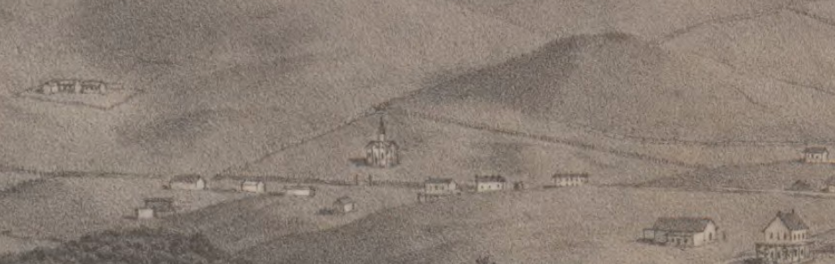
William Dougal made this drawing of Mission Dolores on 10/22/1850, looking northeast from Dolores Heights at Sanchez/21st toward Yerba Buena Island and San Francisco Bay (compare this photo from the same hill on earthquake day, 4/18/1906). A few dozen buildings cluster near the self-sufficient Mission in a bucolic setting as yet unaffected by the recent influx of '49ers. The roads intersecting at the Mission are now Dolores/16th. At lower right, Dolores crosses a gulch formed by a tributary of Mission Creek that roughly follows present-day 18th, so the lower right corner of the drawing is now the northeast corner of Dolores Park. This is probably the creek called Arroyo de Los Dolores by Juan Bautista de Anza in 1776, giving Mission Dolores its name. Today the seasonal creek runs underground and the substantial gulch has been filled.
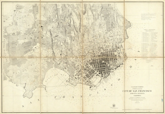
This wonderful 1859 US Coast Survey map (click to open a zoomable version) provides an incredibly detailed view of San Francisco. Comparing its streets, streams, and vegetation to the present provides an education in the early development of San Francisco.
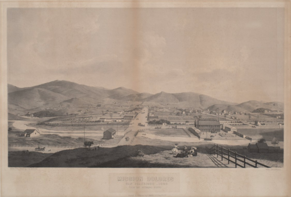
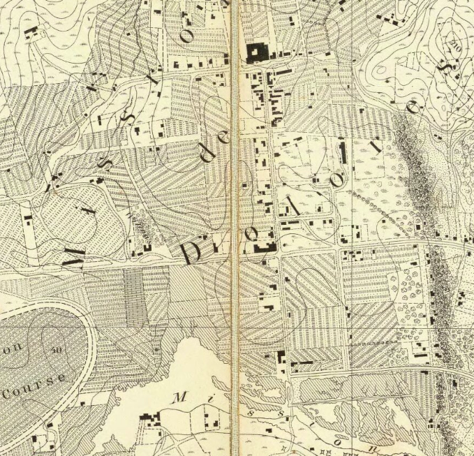
This lithograph (click to open a zoomable version) of a delightful C. B. Gifford drawing, captioned "Mission Dolores / San Francisco - 1860 / From the Potrero Nuevo", looks west up 16th Street, which ends at Dolores; the old Mission church is just left of 16th/Dolores. The foreground picnickers are roughly at 16th/Bryant. The bridge on 16th crosses Mission Creek between Harrison and Folsom, and Central Woolen Mills (later called Mission Woolen Mills) is on Folsom between 16th/15th. N/S streets, mostly delineated by fences, run horizontally: Folsom / Howard (now South Van Ness) / Mission / Valencia / Guerrero / Dolores (bottom to top). E/W streets run vertically: 18th / 17th / 16th / 15th (left to right). The cluster of trees near the left edge is The Willows (18th/Mission). The 1859 survey detail at right (west at top) covers roughly the area of the buildings in the drawing; the survey provides precise location information for the buildings.
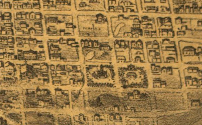
A small section of the 1859 survey (west at top) overlaid on a present-day Dolores Park map shows Dolores veering off as it crosses the gulch just south of 18th, while the other streets that bound the park today do not yet exist. The buildings just inside the park's south edge appear on the hill at upper left in the lithograph, so the detail at right includes the location of the present-day park. The distinctive building in the center does not appear on the 1859 survey because it was built in 1860. It's part of a cemetery in the middle of the future Dolores Park site, with the fence in front of it running along Dolores between 19th/18th. We'll see a lot more of it below.

Congregation Emanu-El's cemetery at Vallejo/Franklin/Broadway/Gough became overcrowded in the late 1850s,
and as seen above there was plenty of empty land near distant Mission Dolores.
In 1860, the congregation purchased property in the Mission for a larger burial ground
called Home of Peace (Navai Shalom) Cemetery, dedicated on 7/26/1860.
The purchase included 6.75 acres in block 86 plus an additional 3.75 acres, total 10.5 acres for $3,000.
In 1861, Congregation Sherith Israel purchased the adjacent block 87 for its
Hills of Eternity (Giboth Olam) Cemetery, dedicated 5/1861.
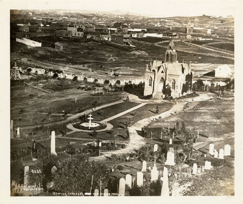
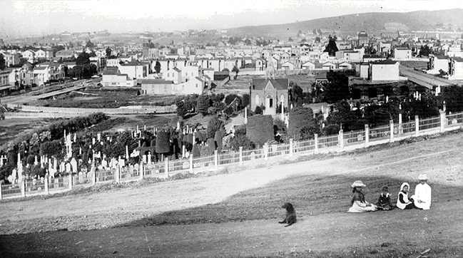
The photo looks northeast from Church/19th downhill toward Home of Peace.
The newspaper report on the dedication refers to the cemetery building
as "House for the Dead", and the 1865 city directory notes
"a substantial brick chapel, a portion of which is used for a receiving tomb.".
The windmill at left is at 18th/Dolores, and the gulch along 18th is still clearly visible.
The blocks east of Dolores between 18th and 19th remain undeveloped,
probably because of the marshy terrain.
Landscaping around the chapel is very sparse here,
so I think this photo predates the other photos below.
George H. Goddard's 1869 map looks very different from the 1859 survey:
the rectilinear Mission District street grid is complete and Market Street extends past Castro.
The two blocks bounded by Church / 18th / Dolores / 20th are labeled Jewish Cemetery,
with 19th running through the middle.
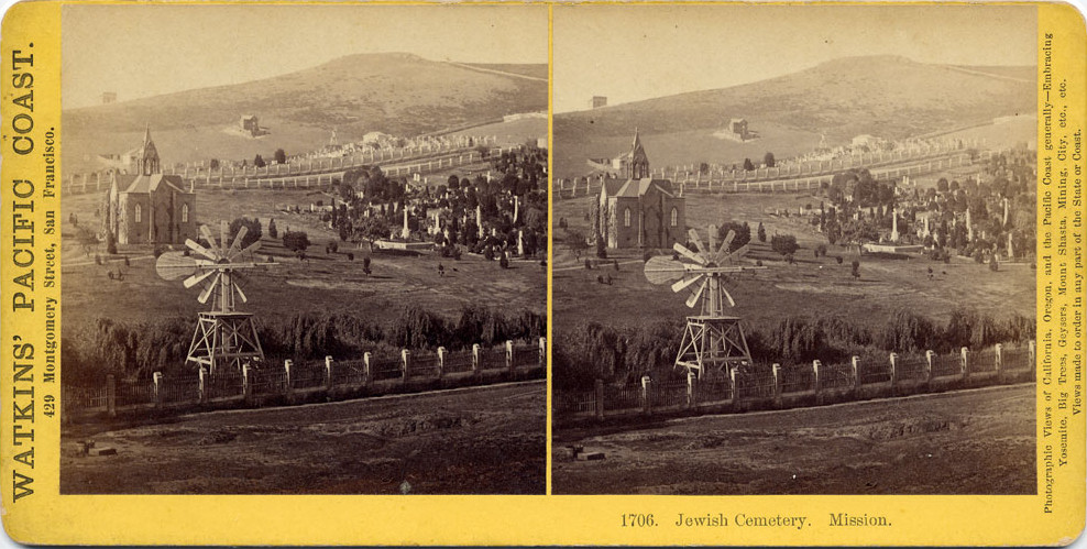
Carleton Watkins stereoview #1706 ca. 1872 looks southwest from 18th just west of Dolores toward 20th/Church. The parallel fences beyond the chapel are at 19th Street, separating Home of Peace (foreground) from Hills of Eternity (background). The house hidden behind the spire is on 20th, with another house on Liberty up the hill toward Dolores Heights.
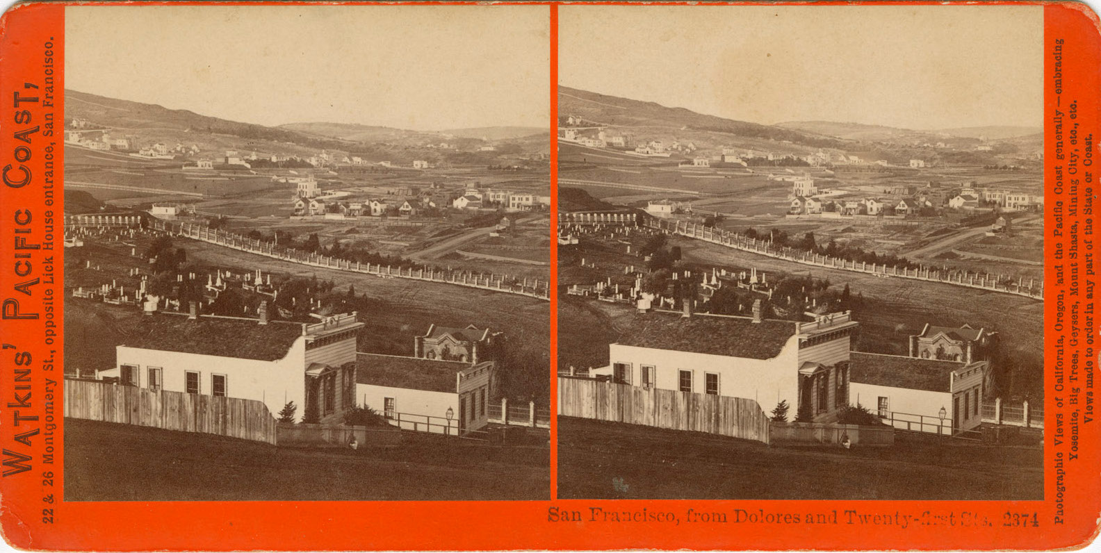
Watkins stereoview #2374 looks northwest from Dolores/21st toward Corona Heights.
The foreground buildings are on the west side of the steep block of Dolores between 20th/21st,
so the fence just beyond them runs along 20th, bounding the south side of the cemetery.
The Home of Peace chapel lies beyond the right edge of this picture.
The small structure behind the foreground house,
similar to the Home of Peace chapel but without a tower,
is presumably the Hills of Eternity chapel;
I have found no other pictures of it.
The fence starting at middle left runs briefly along Church
before it intersects the double fence running along 19th.
Church runs from the right edge (Dorland/Church) toward the middle of the double fence,
where it becomes obscured by the slope of the hill.
The houses just above Church are on 18th, and a few still exist today.
I believe the large two-story building in the middle of the picture is Sanchez School,
built in 1879 between 17th/18th on Sanchez (a block from today's Sanchez School).
The buildings beyond it are on or near Market Street.
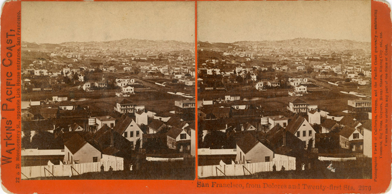
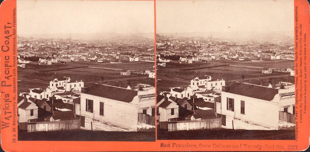
Watkins published additional stereoviews from the same location,
looking northeast (#2376: water runs along 18th to 18th/Valencia at right)
and looking southeast (#2377: Bernal at upper right).
Presumably #2375 is another similar view, but I have not found it yet.
The gulch along 18th is deep enough so that the water in it is not visible in #2374,
but the water shows as a substantial creek just to the east in #2376.
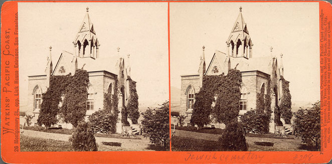
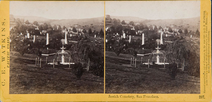
Watkins stereoview #298 looks at the chapel from Dolores/19th and #297 (copyright 1867) looks west at the fountain and graves just past the chapel. The cows grazing beyond the fence are roughly at present-day Church/19th.
This detail from Goddard's 1876 birdseye view of San Francisco overlooks the cemetery from the west. 16th through 21st run vertically (left to right), Sanchez through Valencia horizontally (bottom to top). Mission Dolores church is at middle left. The northeast corner of 18th/Dolores remains empty, and a small body of water occupies the southeast corner. It shows both the larger Home of Peace chapel and the smaller Hills of Eternity chapel.
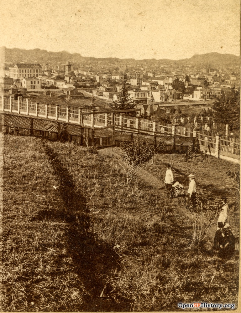
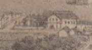
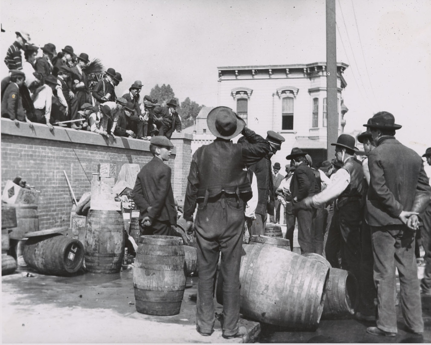
Looking east from Church between 18th/19th ca. 1880. Dolores runs behind the chapel, and the blocks east of Dolores between 18th/19th remain undeveloped. The Victorian at the left edge is at the northeast corner of 18th/Dolores; it appears again in the background of Carl Breer's 1906 liquor barrel photo. The right edge shows a partially completed bridge along 19th, an antecedent of today's pedestrian bridge over the streetcar tracks at 19th/Church. The date is highly uncertain.
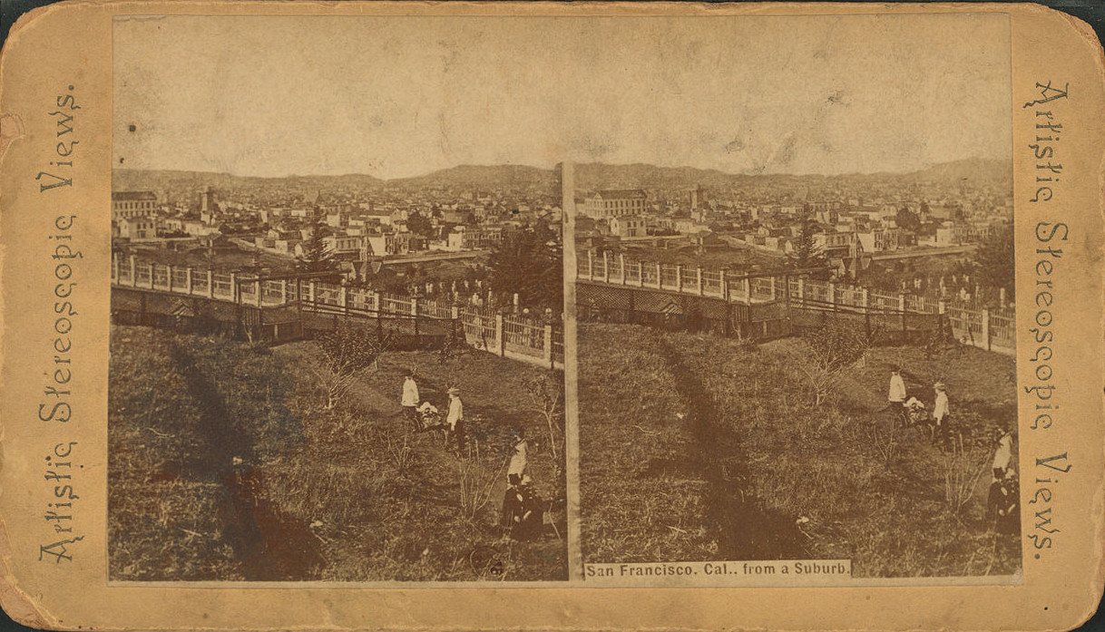
This photo looking northeast from Church/20th is variously dated 1880 and 1885 online; a stereoview version has the caption "San Francisco, Cal., from a Suburb". The windmill seen above remains at the southwest corner of 18th/Dolores, with the Victorian at the northeast corner of 18th/Dolores visible just left of the chapel's spire. The Church/18th/Dolores/Dorland block, site of Mission High School starting in 1898, is largely vacant, as is the east side of Dolores south of 18th.
In 1860 Congregation Emanu-El thought its new cemetery would suffice for a century, but about 30 years later it was full. The congregation opened a new Home of Peace in San Mateo county (now Colma) in 1888 (see Daily Alta California of 11/17/1888), Hills of Eternity followed suit in 1889, the Mission cemeteries closed to further burials as of 1/1/1889, and eventually graves were relocated to the new cemeteries (see San Francisco Chronicle, 06/13/1890 and 08/13/1892). Residents lobbied for conversion of the cemetery site into a city park (see San Francisco Call of 06/14/1896) and formed The Mission Park Association in 1897. San Francisco issued bonds in 1904 to finance the purchase of the land and paid Congregation Emanu-El $151,350 for block 86 on 2/18/1905 and Congregation Sherith Israel $140,000 for block 87 on 2/23/1905. The community celebrated the new park in March 1905 (Call of 03/25/1905). The 1906 earthquake and fire delayed work on the new park (originally called Mission Park or New Mission Park, now officially Mission Dolores Park but commonly Dolores Park). The park housed refugees until 1908, as seen on my Dolores Park 1906 page.
Stereoviews:
The stereoviews above are interesting per se, but of course you should view them in stereo. You can focus in front of a right-left reversed image to see a stereo image (crosseyed viewing). Click on a link below to display a stereoview flipped for crosseyed viewing, then use the browser back button to return.
- Artistic Views: SF from a Suburb
- Watkins #297
- Watkins #298
- Watkins #1706
- Watkins #2374
- Watkins #2376
- Watkins #2377
See also: San Francisco Stereoviews, More San Francisco Stereoviews.
Sources:
- Benjamin, Israel J.: Jewish Life in San Francisco, 1860.
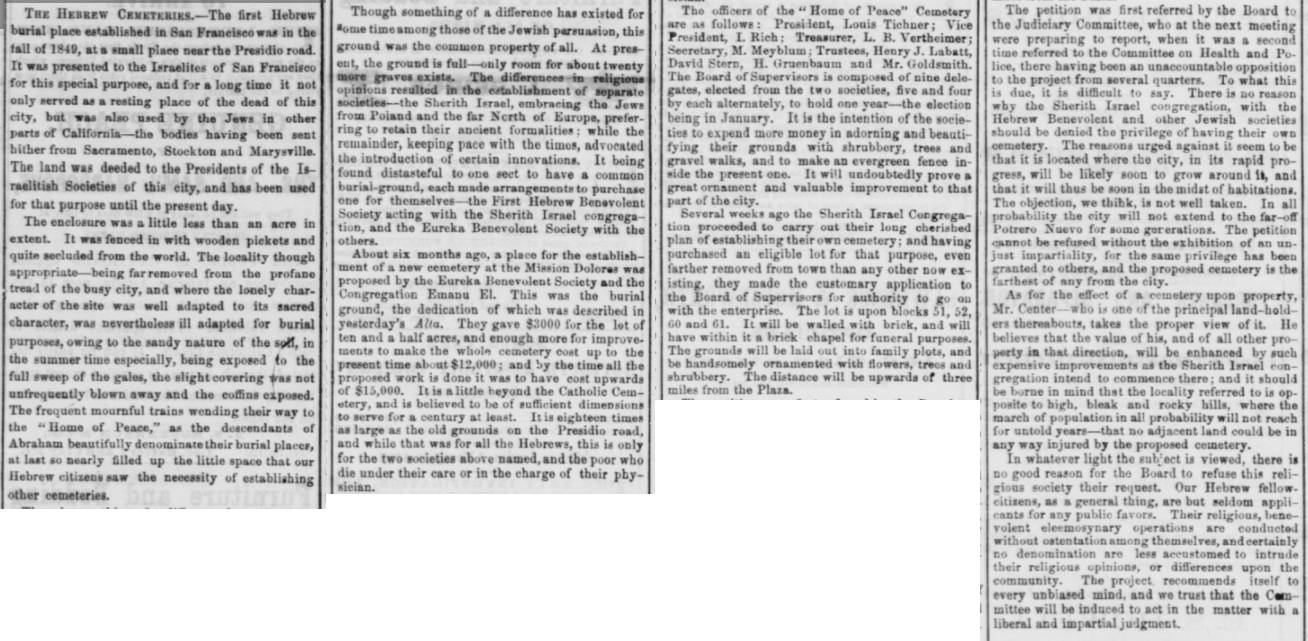
- Daily Alta California: 07/26/1860 (Dedication), 07/27/1860, 11/17/1888 (Colma).
- FoundSF: Jewish Cemetery.
- FoundSF: Old Cemeteries in the City.
- FoundSF: Unraveling the Mystery of Lake Dolores.
- Langley: San Francisco City Directory: 1861 (p. 32), 1865 (p. 38)
- Salvano, Chris: Antecedents to San Francisco's Dolores Park.
- Salvano, Chris: San Francisco's Lost Cemeteries & Pioneer Burial Grounds.
- San Francisco Call: 06/14/1896 (Mission park proposal), 03/25/1905 (Mission park celebration).
- San Francisco Chronicle: 06/13/1890, 08/13/1892 (relocating bodies).
- SFgenealogy: Home of Peace (new) Cemetery.
- Voorsanger, Jacob: The Chronicles of Emanu-El.


