Drunken Houses
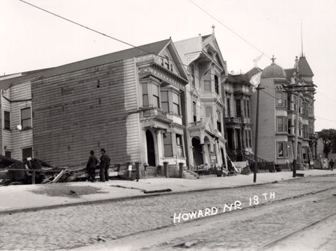
The 4/18/1906 San Francisco earthquake caused major damage on filled land in the Mission District. On the east side of Howard (now South Van Ness) between 17th/18th, several houses fell off their foundations and soon became known as the "drunken houses", and one house collapsed completely. Directly across the street, all buildings on the west side of the street burned on the second day of the fire (4/19/1906). A few houses on the east side remained habitable after the earthquake/fire and many others were repaired. Two still survive in 2019. This page examines census data, city directory data, parcel maps, photos, postcards, and stereoviews related to the block.
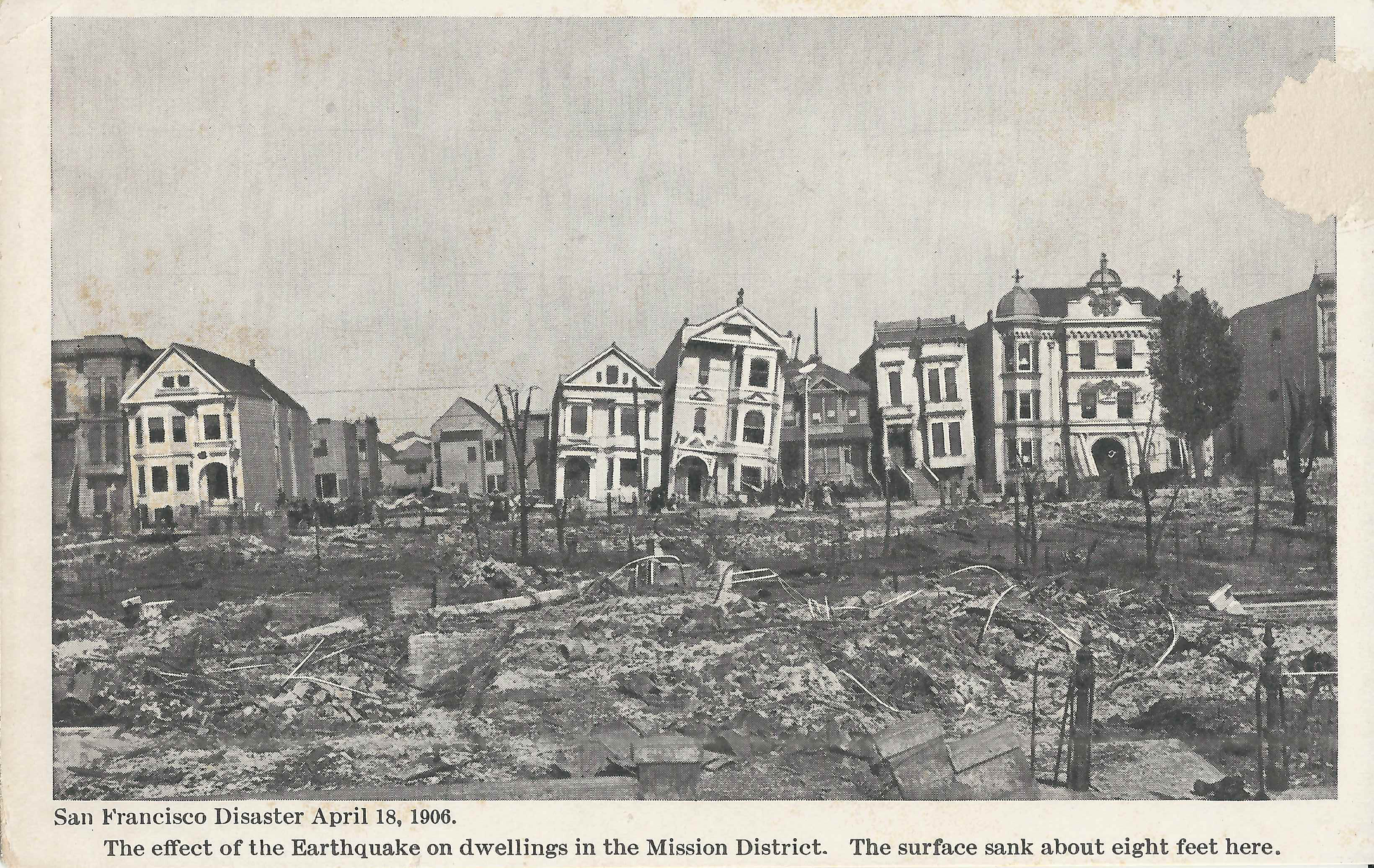
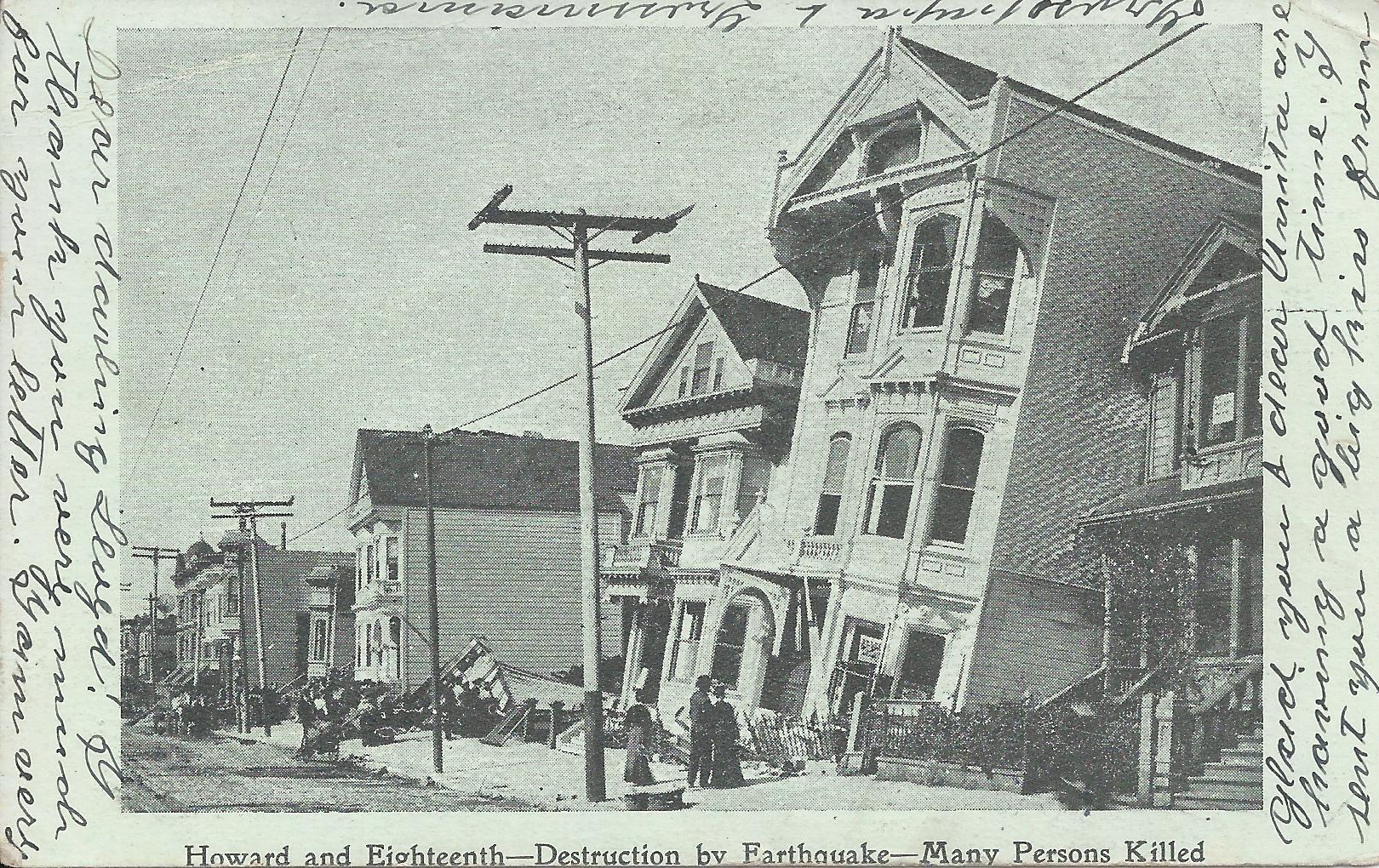
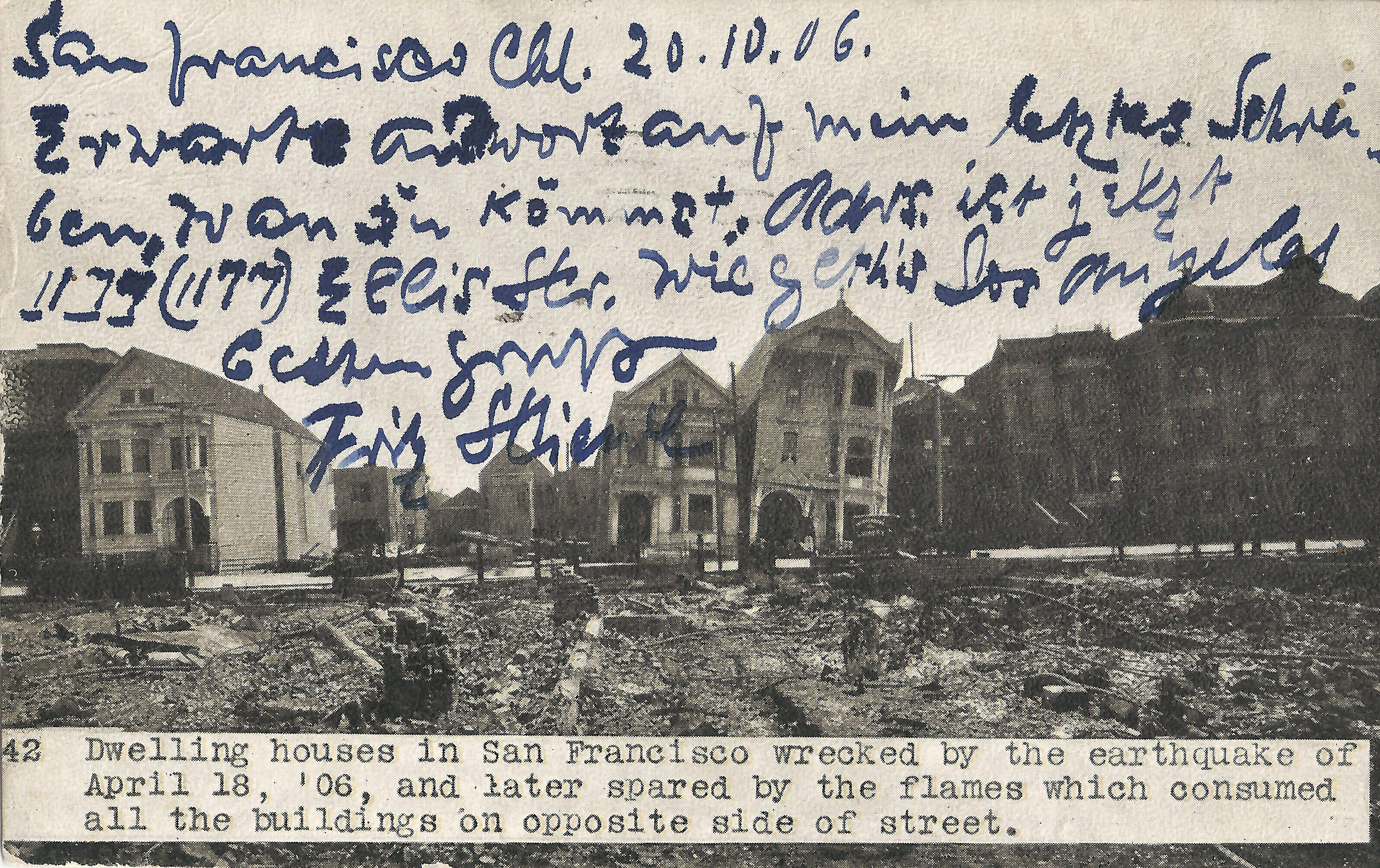
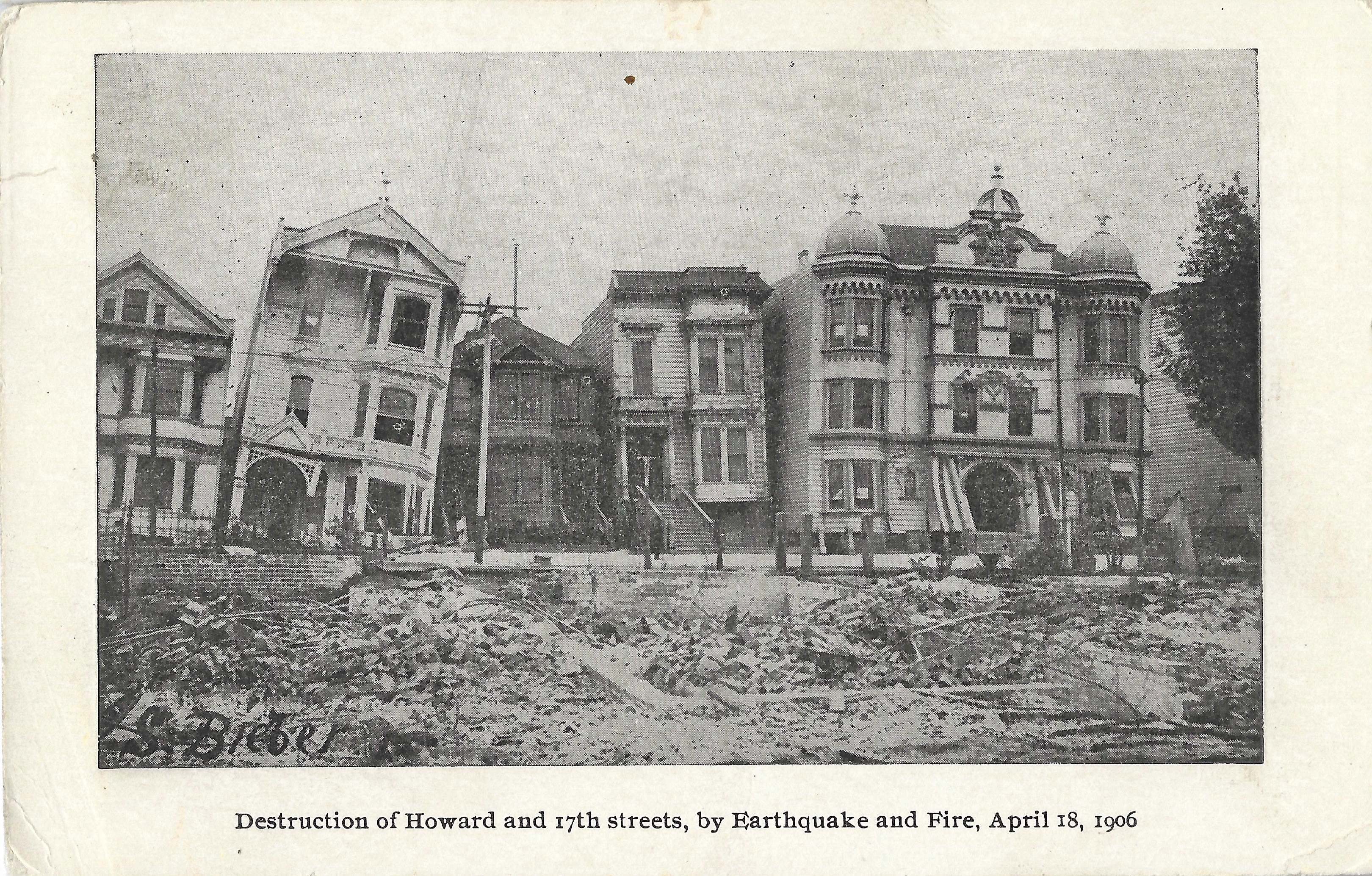
Let's start with some popular images of the block. Very soon after the earthquake and fire, publishers printed b+w postcards of the drunken houses. The card at left, issued in Connecticut within a month of the quake, looks east across Howard; all the buildings on the west side of Howard burned. The postcard at center is postmarked 6/01/1906, about five weeks after the quake, and the card at right is dated SF 10/20/1906. Cards produced locally soon after the quake were typically of poor quality.
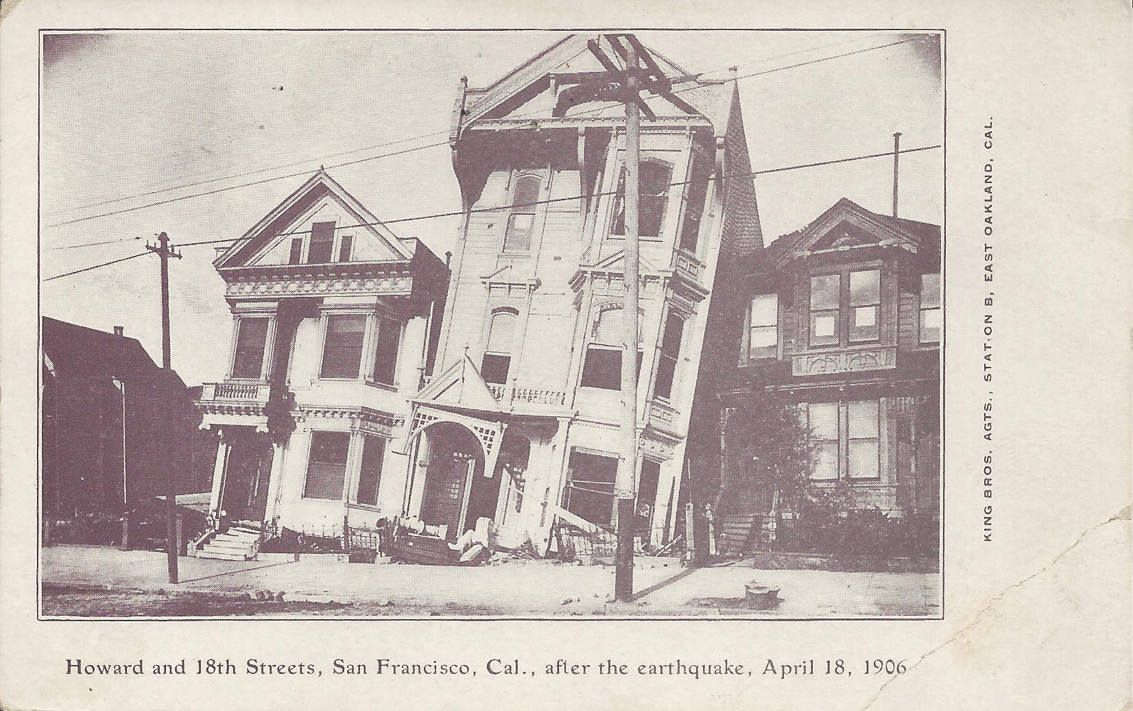
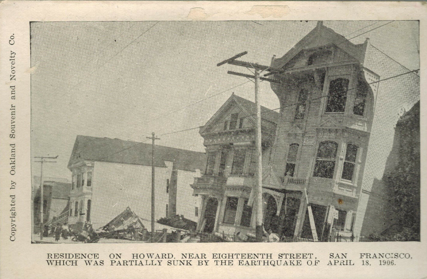
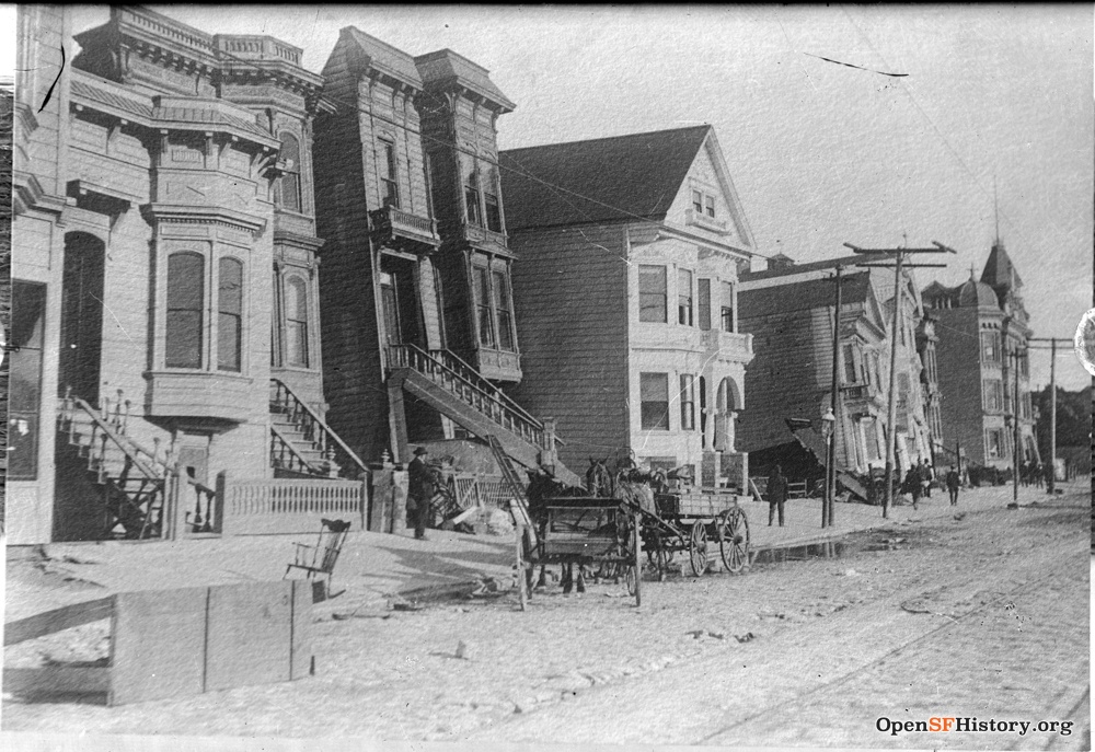
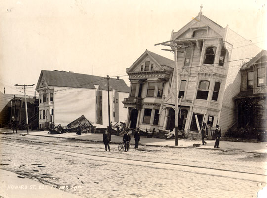
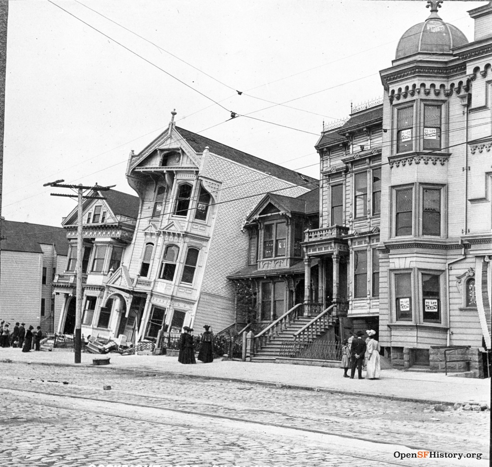
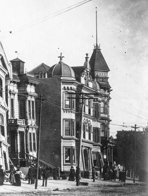
The large 3-story building (2119 Howard) has collapsed or sunk at the rear, causing it to tilt back from the street (east), and also has tilted to the south, coming to rest on the adjacent dark 2-story house (2121). The next house north (2117) is off its foundation too, similarly leaning east and south. And just north of that, a house (2115) has collapsed completely, with part of its roof clearly visible on the sidewalk in the postcards above.
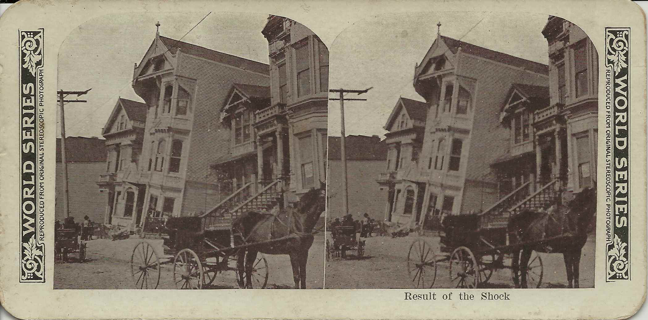
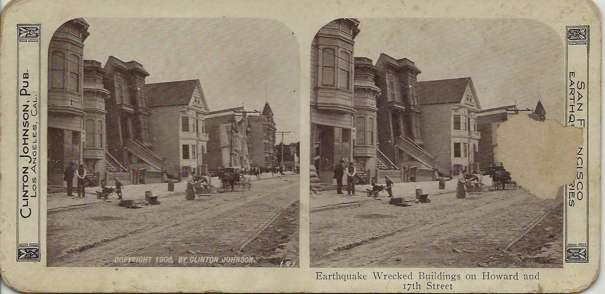
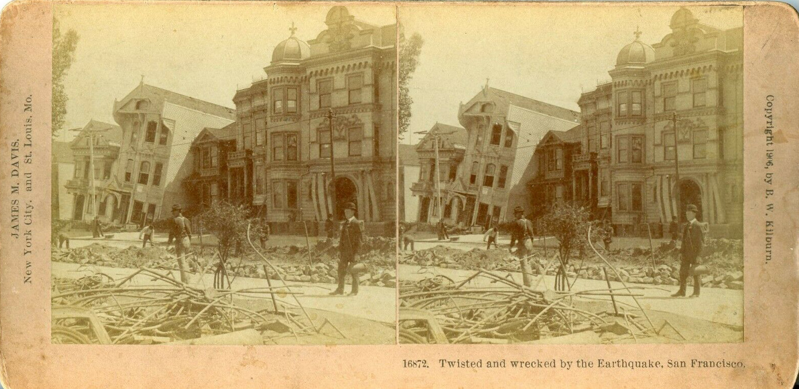
The San Francisco disaster was a rich subject for stereoviews (click here, here, and here for crosseyed viewing). The Clinton Johnson stereoview, unfortunately damaged, shows that life goes on: a woman pushes a baby carriage, a boy gives another kid a ride in a wheelbarrow. My San Francisco Stereoviews and More San Francisco Stereoviews pages show many additional 1906 earthquake/fire stereoviews.
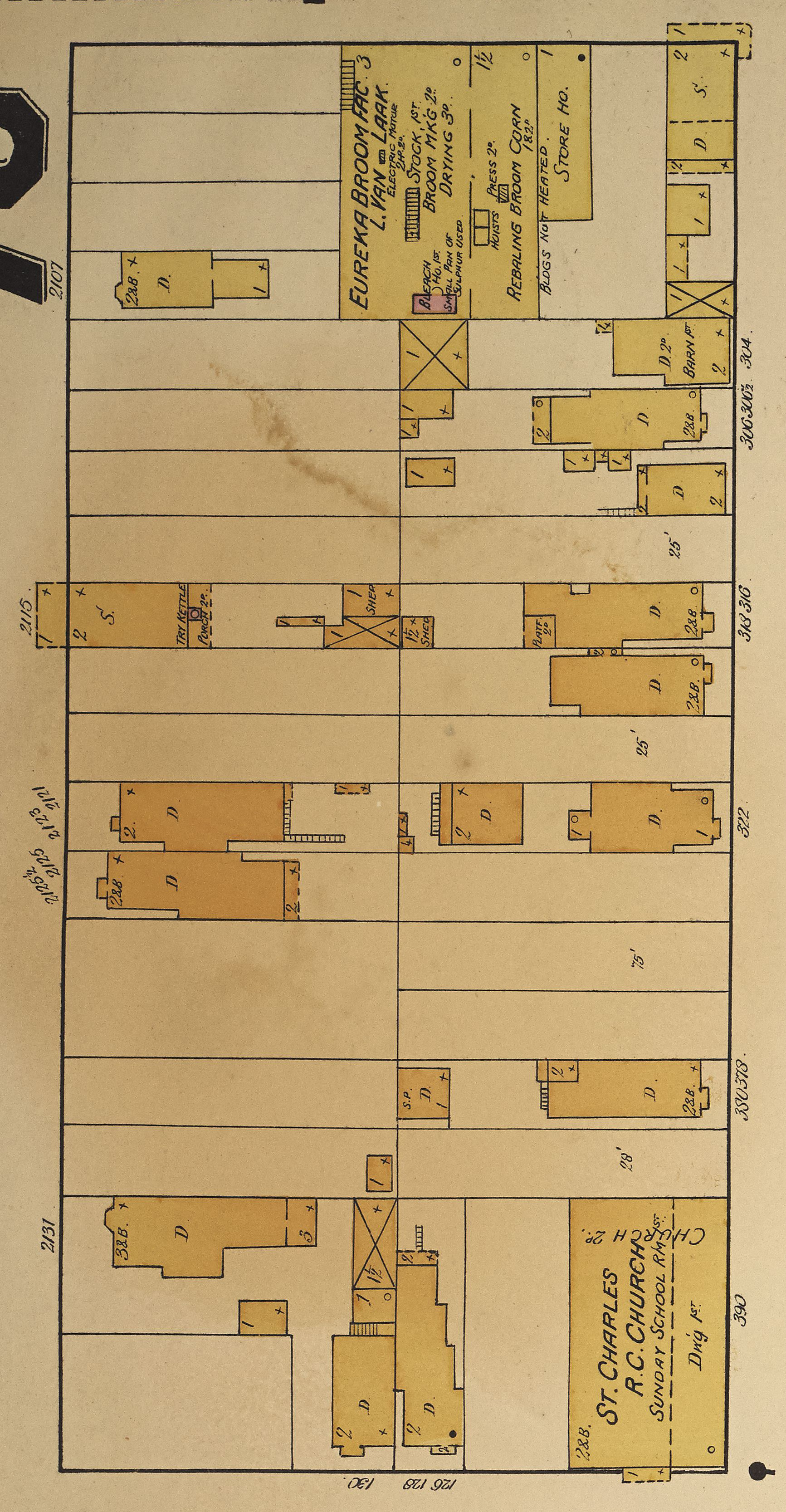
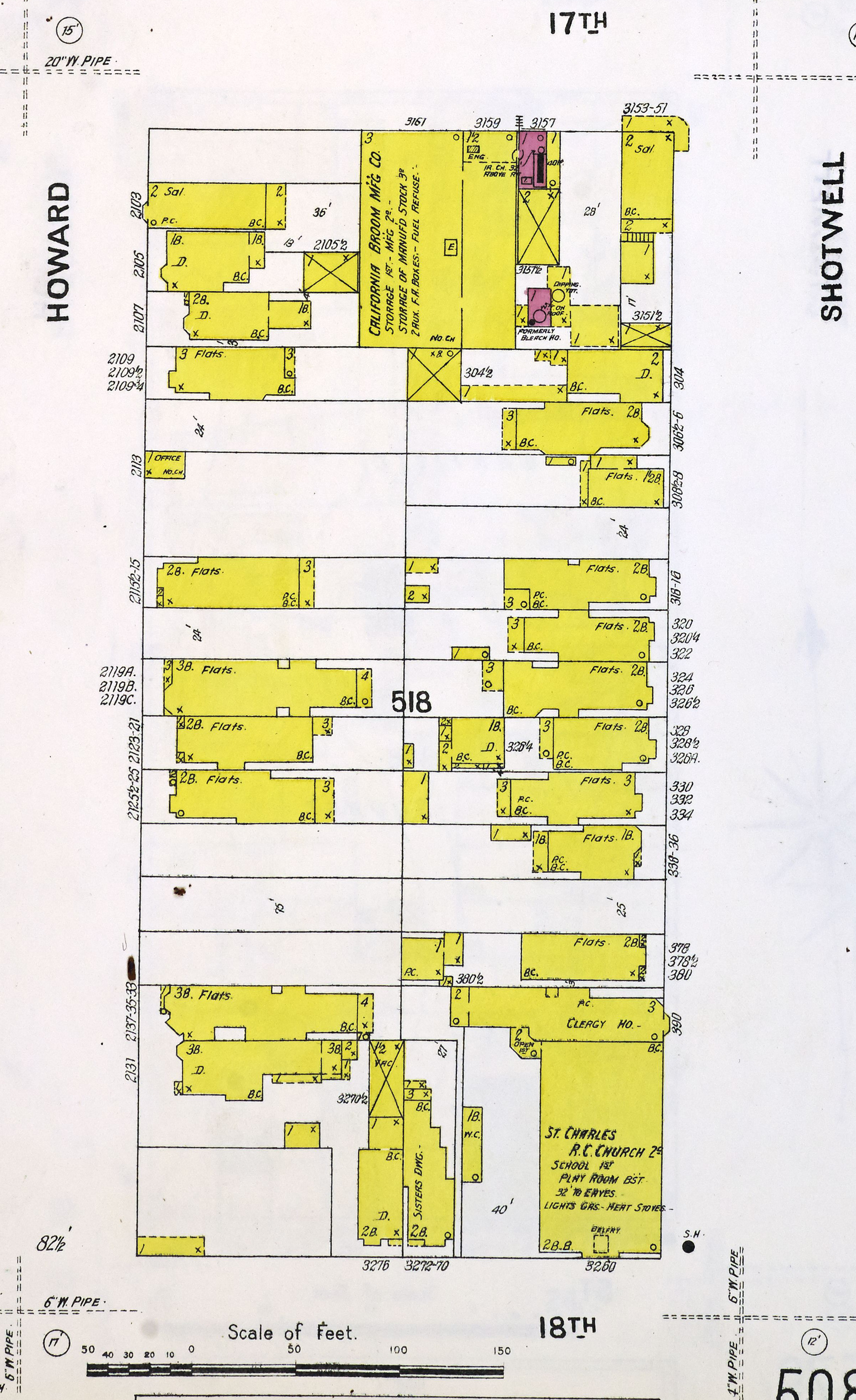
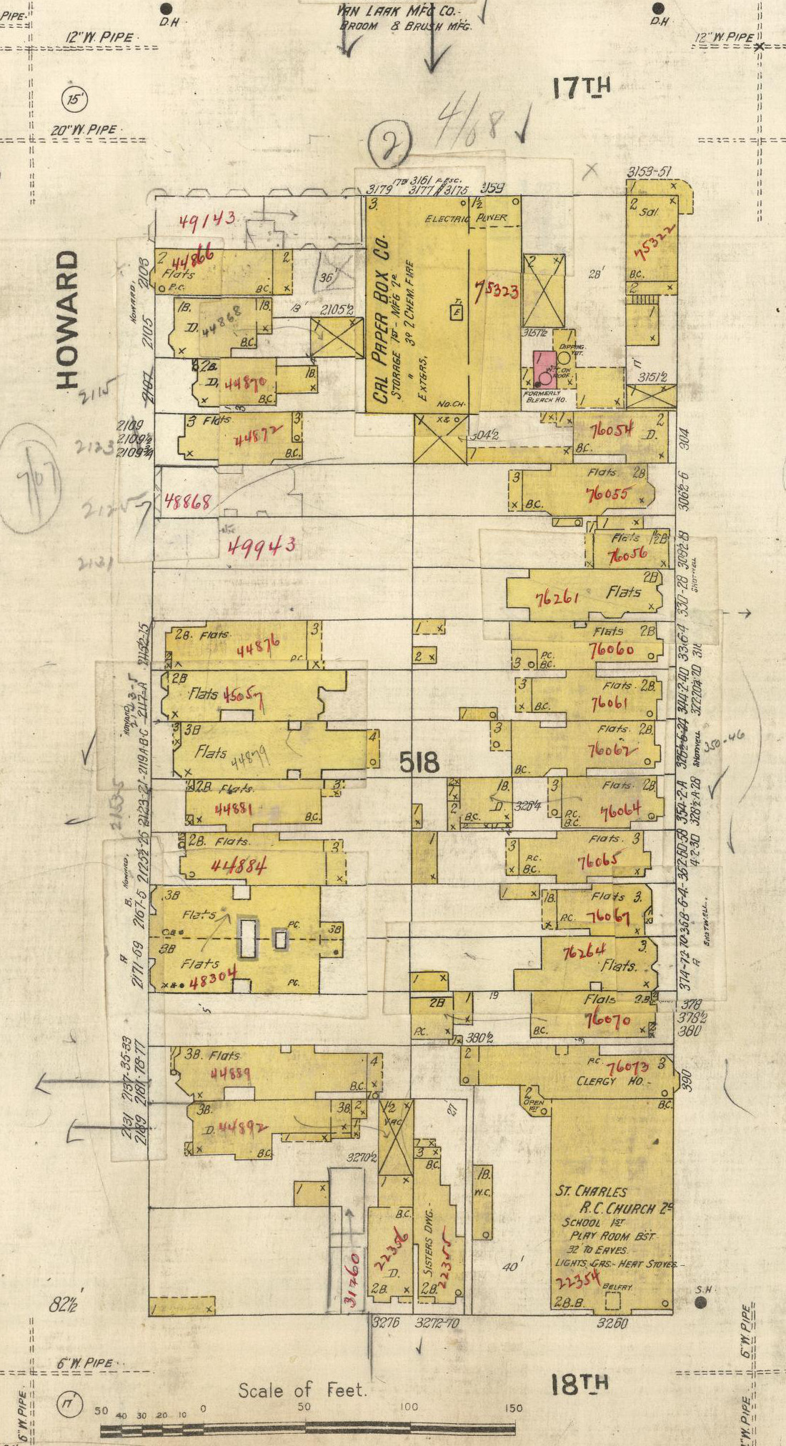
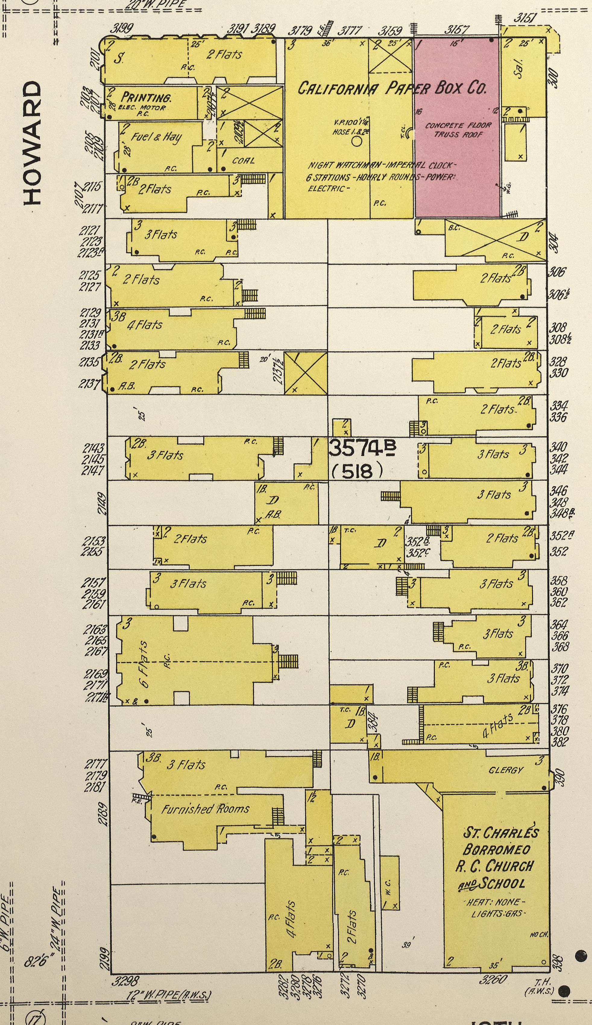
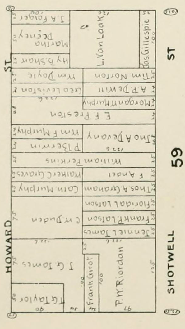
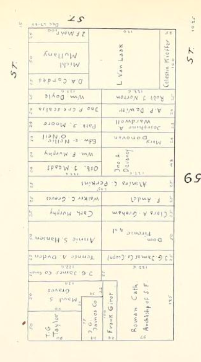
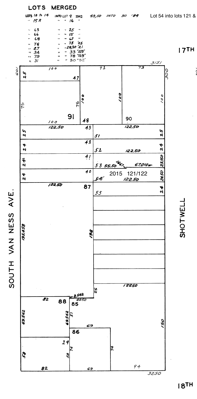
Sanborn's Insurance Maps of San Francisco (simply Sanborn below) document the development of buildings on the block. From left: block detail from Sanborn for 1889 (V. 3 sheet 76R), 1900 (V. 5 sheet 510), 1905 (V. 5 sheet 510), and 1914 (V. 6 sheet 551), the San Francisco Block Book for 1894 and Jan. 1906, and the 2015 assessor's parcel map (block 3574). House numbers on the block were confusing (out of order) before 1906, changed after 1906, and changed again when Howard became South Van Ness in 1932; this page uses the pre-quake 1905 numbering. Most of the lots are 25'x122'6", but the assessor's map shows some variation. The maps show 5 buildings on Howard in 1889, 10 in 1900, 15 in 1905 (including 2 added in pencil), and 16 in 1914. The block had 6 empty single lots in 1905 and 5 in 1914. The block data page correlates data from these sources.
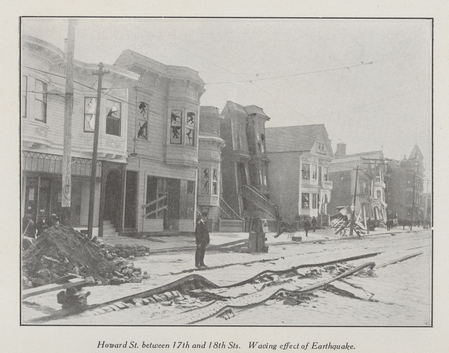
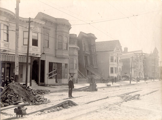
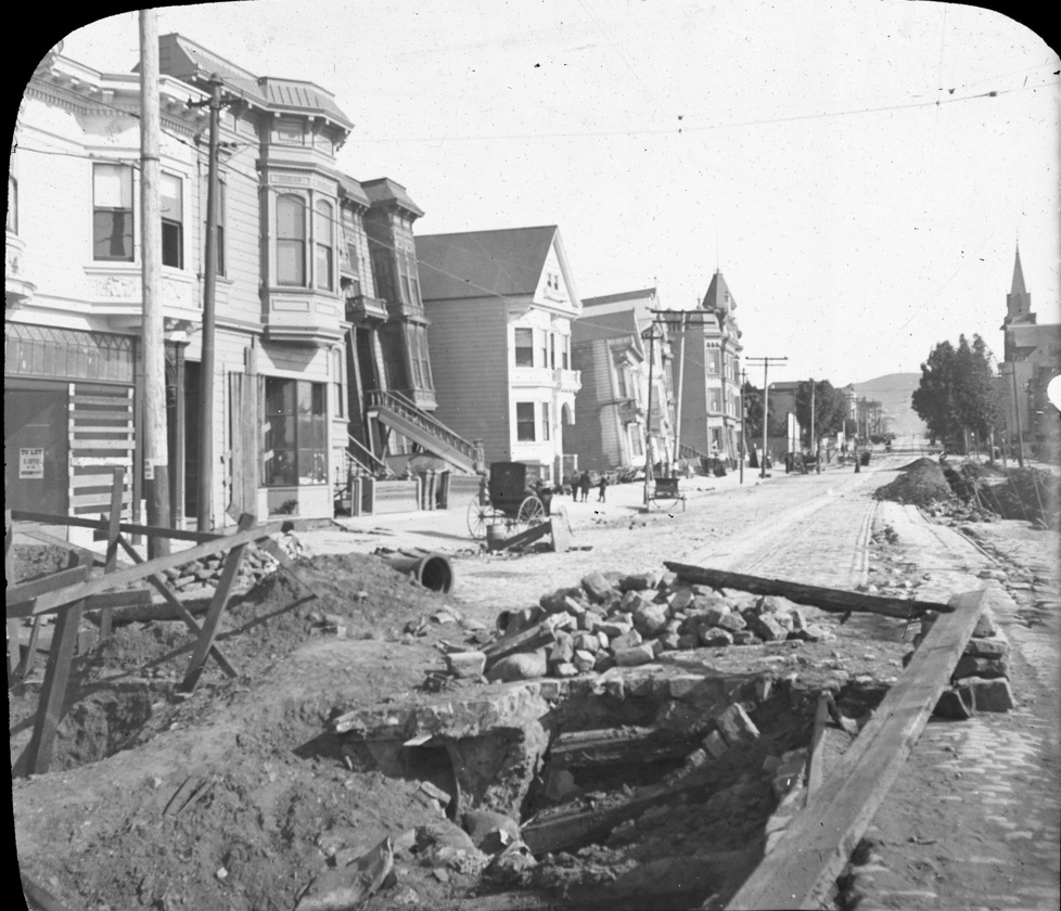
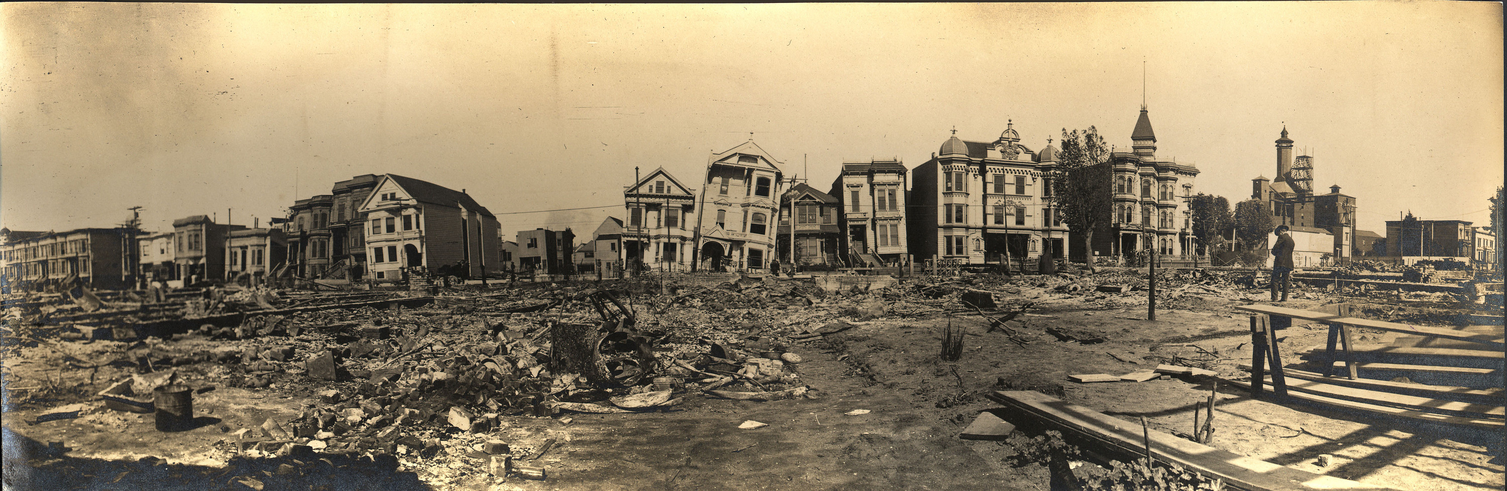
These photos look south from 17th and show the entire block. Let's look at each house, starting at 17th/Howard and moving south. Left: Soon after the earthquake, with streetcar tracks warped dramatically, broken windows, a large pile of rubble at the collapsed house down the street, and a small pile of dirt and bricks at left, probably from water main repairs. But... Center: Aha! This original shows that those dramatic warped tracks were enhanced and the broken windows added. Right: Somewhat later, with a large water pipe next to the big repair mess in the street.
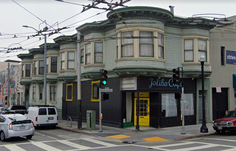
Current assessor data says the corner store at left (2101 Howard) was built in 1906. Pre-quake assessor dates are unreliable, but 1906 seems likely in this case: the building is added in pencil in Sanborn 1905 and it has "To Let" signs in its ground floor window here. By 1907, it was a corner grocery run by Greek brothers Constantine and George Sarantitis. The building survives in 2019 (601/603 South Van Ness [Joliba Café] and 3189/3191 17th).
The storefront next to 2101 (2103, built between 1889 and 1900) was William Deeney's Liquors from about 1893. The 1900 census lists owner Irish-born Deeney (61), his wife, and four daughters at 2103. He owned both 2101 and 2105 next door, and he sold both to Michael Mullaney before 1906 and moved to Eureka Valley, so he missed the earthquake excitement here. The 1910 census lists Mullany, his wife, and 7 children here, and possibly also single hardware/lumber merchant Clarence Wolfe; the house numbering in Sanborn 1914 is very confusing. By 1914, the corner storefront was a print shop run by Mullaney's son George Mullaney.
The next small house (2105, built between 1889 and 1900), set back from the street and thus hard to see, was rented by the McIntyre sisters, two single dressmakers from Ireland, in 1900. Servant Harriet Hughes and her teamster son lived there in 1910. After the earthquake, owner Michael Mullaney replaced it with a 2-story coal and hay store plus residence.
Austrian-born saloonkeeper John Ipswitch lived in the house at left (2107) in 1880 with his wife, six kids, and a widowed Irish servant. Widow Phoebe Widber owned the house and lived there with her sister in 1900. In 1910, widow Katherine Morrison, three of her children, a son-in-law, two grandsons, and two boarders lived in one flat, and locomotive engineer Charles Wyse lived in the other flat with wife, two children, and two stepchildren.
Next door, at 2109 (built between 1889 and 1900), the first floor rear has collapsed, so the building leans back from the street and the front stairs have moved up from the sidewalk. Three families rented flats at 2109 in 1900: lumberman Albion Leavitt with wife and boarder, engineer Adam Gigerich and wife, and tinner William Doyle with wife and two sons. 2107 and 2109 look unchanged from Sanborn 1905 to 1914, so presumably 2109 was successfully repaired. The Doyles still lived there in 1910, along with factory laborer Don Dennison and bartender Alfred Gibbs and their families.
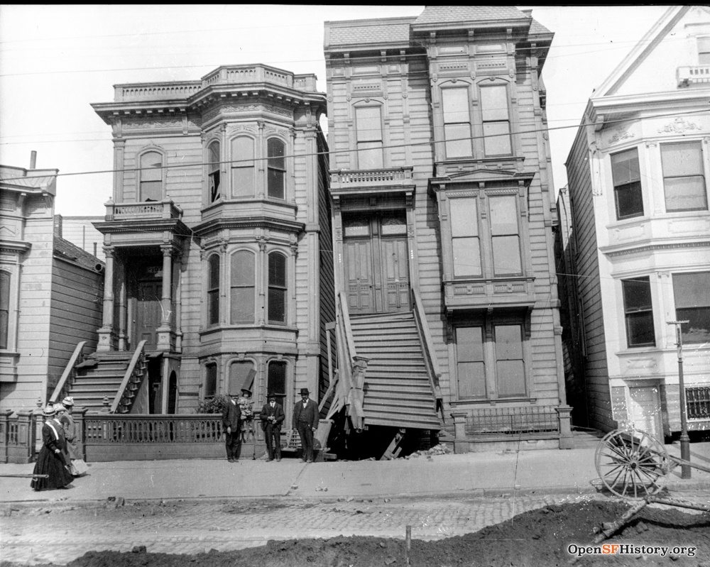
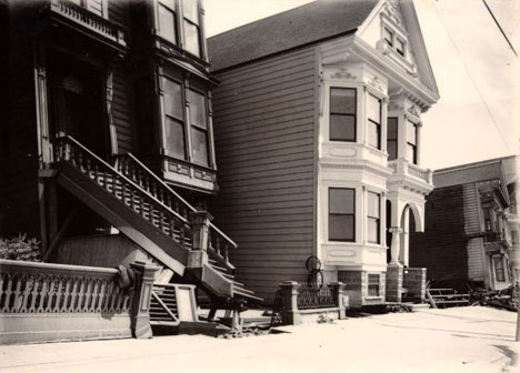
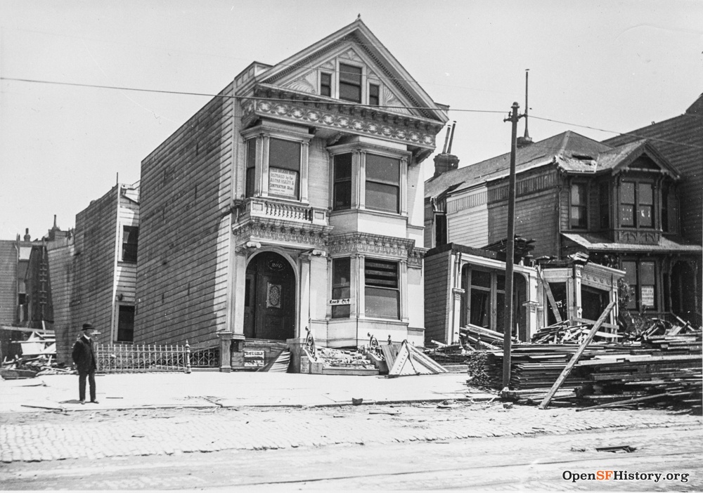
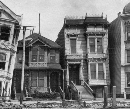
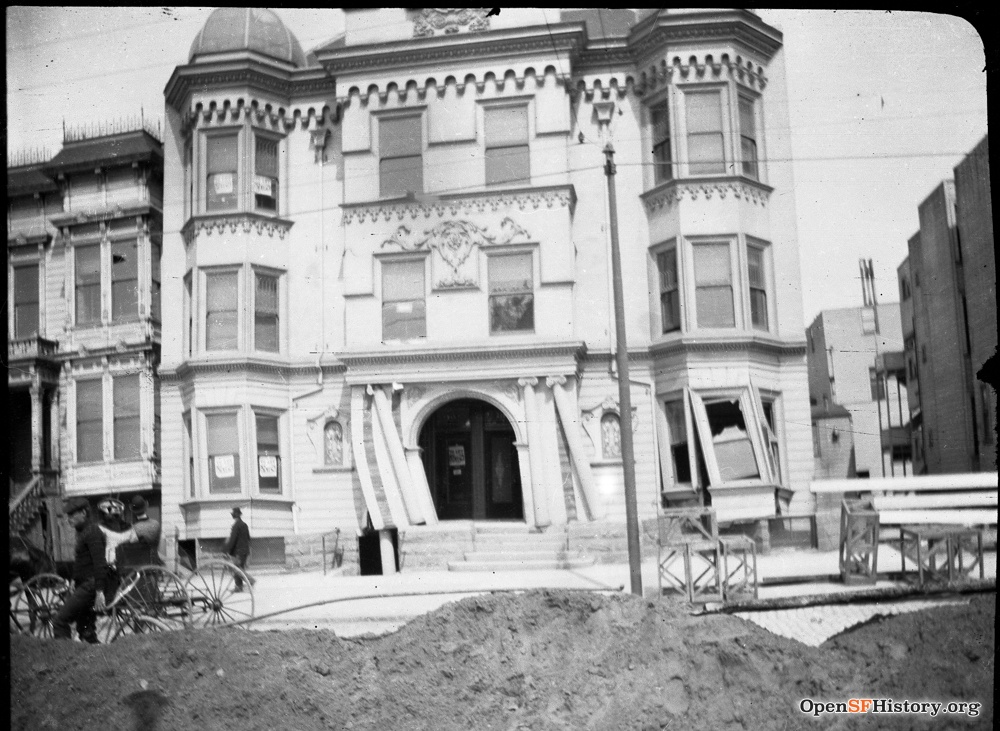
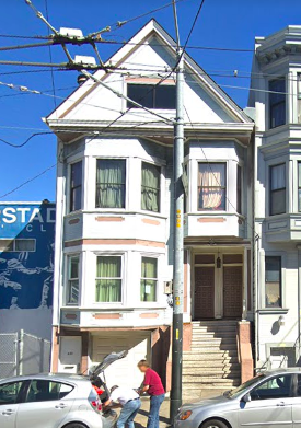
The white house (2111, built 1904 per assessor data) survives in 2019 (629/633 South Van Ness). Clerk Joseph Crescalia owned the lot in 1906. He lived on Harrison in 1905 but was in this house by 1907, suggesting it was still habitable post-quake, though the pictures center and right show damage (relatively minor) to its entryway. Crescalia lived here in 1910 with his wife, two small daughters, and mother-in-law, and rented the other flat to Russian-born bottle yard merchant Israel Thragge and his wife, daughter, and son-in-law.
Sanborn 1900 shows a tiny office on a double lot south of 2111, but it's gone and the parcel is two vacant single lots by 1905. Flats (3-story and 2-story) were built on those lots before 1914 (assessor: 1900 and 1912, but the 1900 is obviously incorrect) and survive in 2019, as does a small 1-story building at the rear of the southern lot (637 South Van Ness).
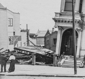
An old 2-story house at 2115 (built before 1880) collapsed completely in the earthquake; there's not much of it left to see post-quake, but the postcards above show part of its roof on the sidewalk. Center: The south wall of 2115 is now horizontal and the stairs of 2117 do not align with the front door; it looks like 2117 moved 2' north, knocking down 2115 in the process. The Estabrook brothers, grocery store clerks, lived at 2115 in 1880. Its lot remained vacant in 1914.
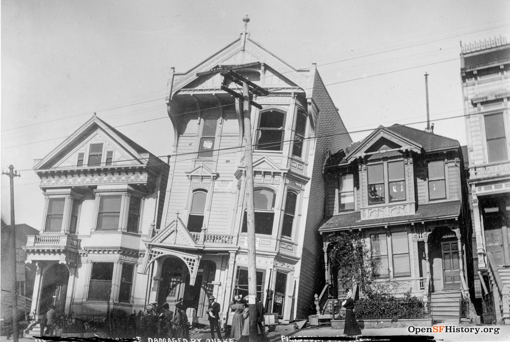
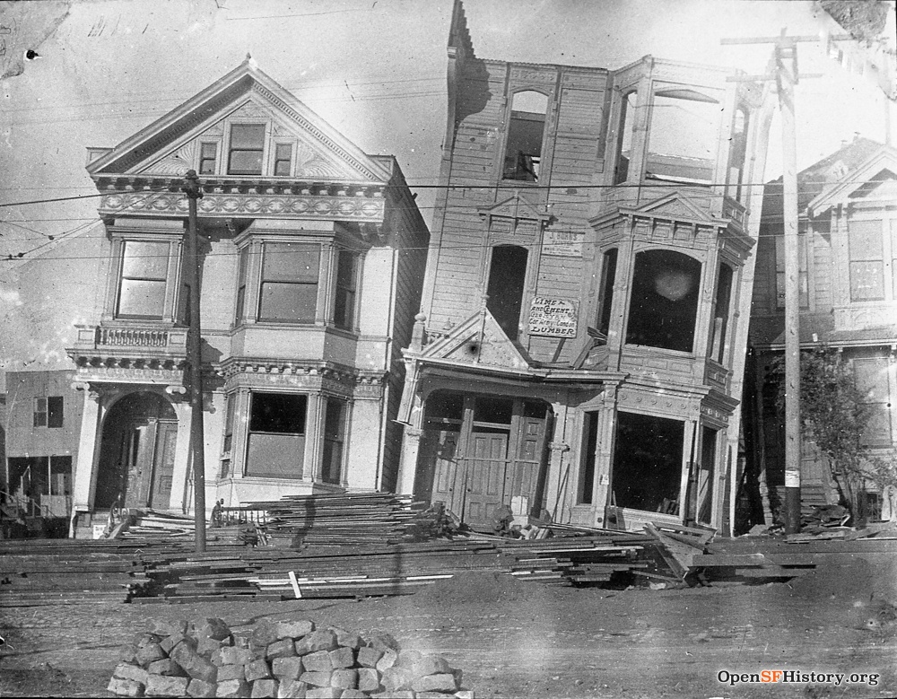
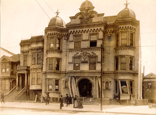
The most famous of the drunken houses: 2-story 2117, newly built between 1900 and 1905, and 3-story 2119, built between 1889 and 1900. Remarkably, Sanborn 1914 suggests that 2117 was successfully repaired. In 1900, two families occupied flats at 2119: English-born steam engineer John Jackson with his wife, six adult children, and two boarders, and Irish-born day laborer Arthur McSorley with his wife, three adult children, and one boarder. 2119 rested on its neighbor 2121/3 until it was disassembled, then a small 1-story house was built at the back of the lot before 1914.
The next two houses (2121/3 and 2125) were both built before 1889. Norwegian-born mining engineer / "speculator" Henry Anderson lived at 2121 with his wife and three adult kids in 1900 and was still there in 1905. In 1910, 2121/3 was occupied by 8 people in 2 families. Two families rented flats at 2125 in 1900: furniture dealer Joseph Jones lived at 2125 with his wife and infant daughter, and retiree John Williams with his wife and four adult children. 2125 was replaced by 3-story flats by 1910, when 17 people in 4 families lived there.
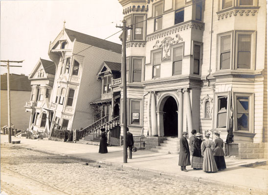
The large apartment house on a double lot (2165/67/69/71) is not in Sanborn 1900 but is pasted into 1905, and it has "To Let" signs in windows of two apartments, so was probably built in 1904 or 1905. The lot to its south is vacant. The lower floor shows significant earthquake damage here, but apparently it was repaired, as its footprint looks unchanged in Sanborn 1914. The 1910 census shows 30 people in 5 families in the building.
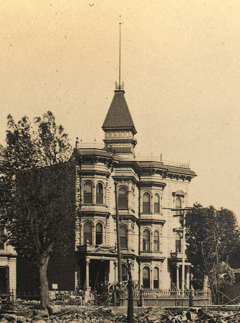
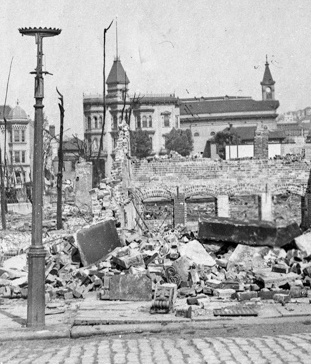
The remaining building on the block is by far the most elaborate, though sadly no pictures show it clearly. J.G. James, then a wholesale butcher, built a 3-story home (2131) at 18th/Howard in 1877. In 1880 census, he lived at 2131 (occupation: "farmer") with his wife, 18 year old daughter, and three servants (black male, Chinese male, and female). In 1890, he expanded the house to the north, building a 3-story addition (flats 2133/5/7) with an imposing diagonally oriented tower. James became a school board director and city supervisor. He owned numerous lots nearby. His daughter Maud married attorney Walter Graves. Occupants of the house at the 1900 census were James ("capitalist") and his wife, his daughter/son-in-law/4 children, a Chinese boarder, and a German-born female servant. In 1906 Maud owned the 2131 double lot, the James Co. owned the 2133/5/7 lot, and Walter Graves owned the 2121/3 lot up the street. James lived on Folsom and Graves on Baker in 1907, but the complex footprint of the flats and house looks unchanged in Sanborn 1914.
The flats added in 1890 were rented by two families in 1900: locomotive engineer Freeman Bowley with wife, 3 kids, mother, and servant, and master mariner Roger Ryfkogel with wife, 4 kids, and a boarder. In the 1910 census, the flats were occupied by 21 people in six families and the house was a rooming house ("Furnished rooms" per Sanborn 1914) with another 16 people in 6 families.
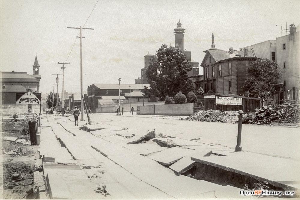
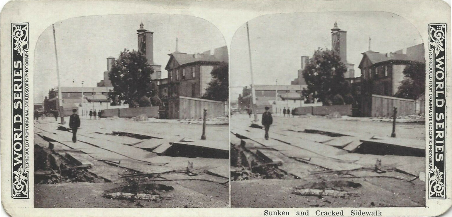
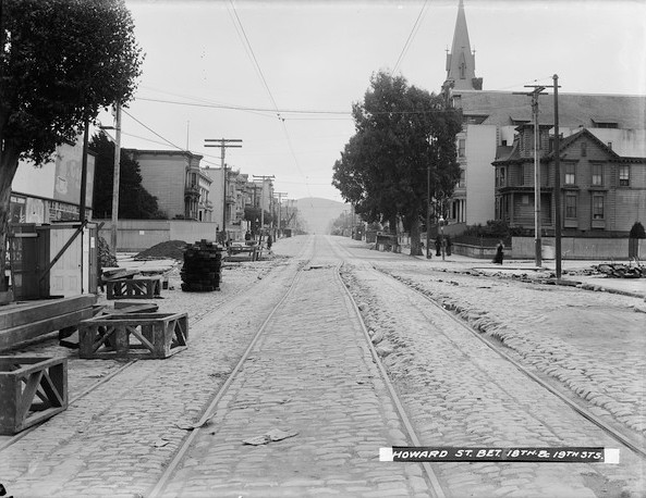
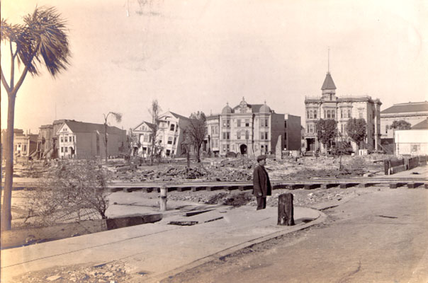
The double lot on the northeast corner of 18th/Howard remained vacant until at least 1914 (the building there in 2019 was built in 1931). It might have originally been part of the grounds of the James house, though T.G. Taylor owned it from at least 1894. Left: Looking east on 18th from Capp toward Howard. The Ghirardelli's Cocoa billboard at the left edge is at the 18th/Howard corner lot, with St. Charles church/school just beyond; the James house is just beyond the left edge of the photo. The sidewalk needs work. The 125' tall tower at center is the New York Malt House at 18th/Shotwell (see Sanborn 1905, V. 5 sheet 508). Center: World Series stereoview (click here for crosseyed viewing) from almost the same spot. Right: Looking south on Howard at 18th, with the billboards at left. The caption "bet. 18th & 19th" is misleading; the photo looks past 18th toward 19th, but the photographer stands between 17th/18th.
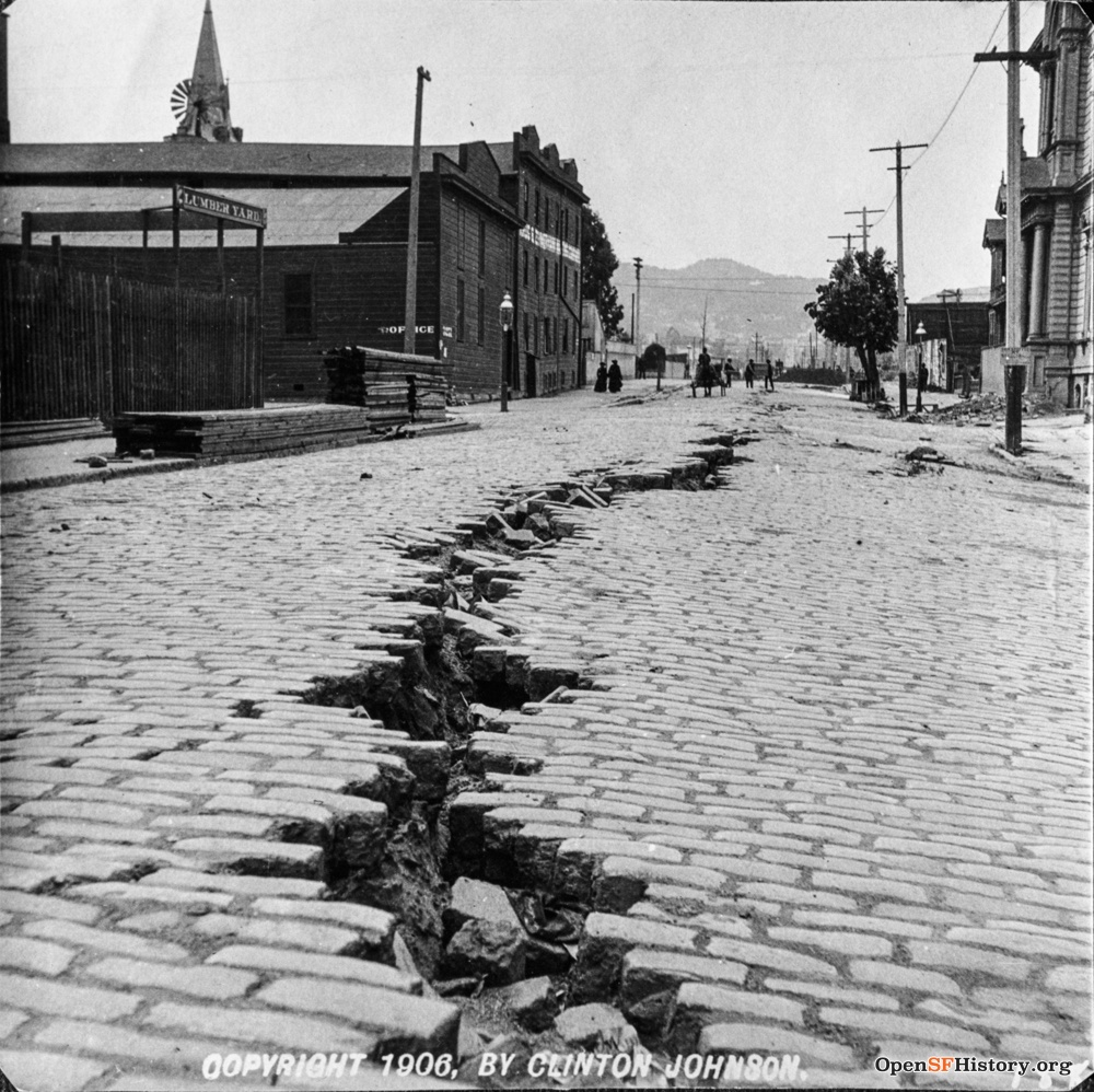
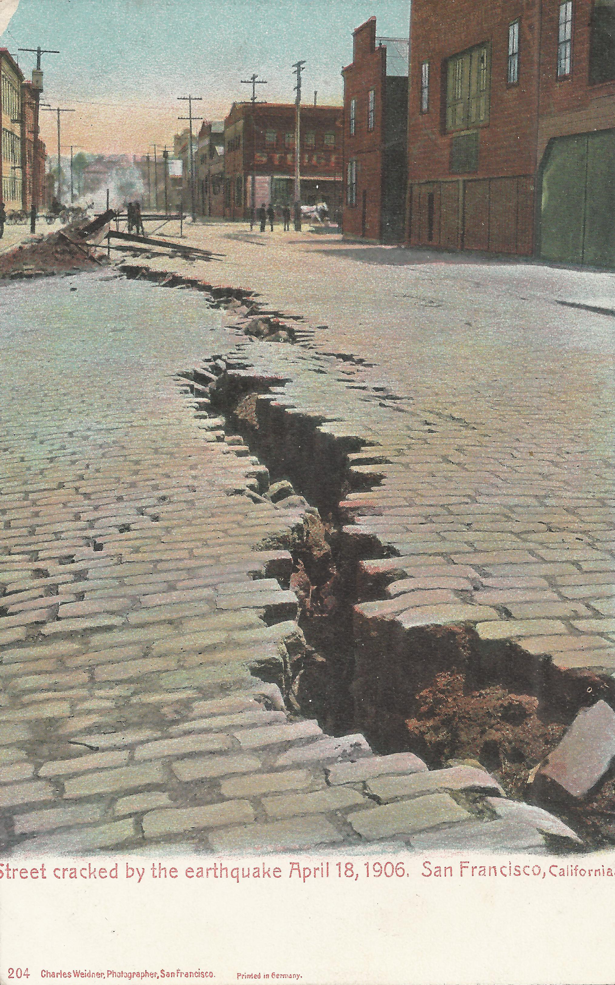
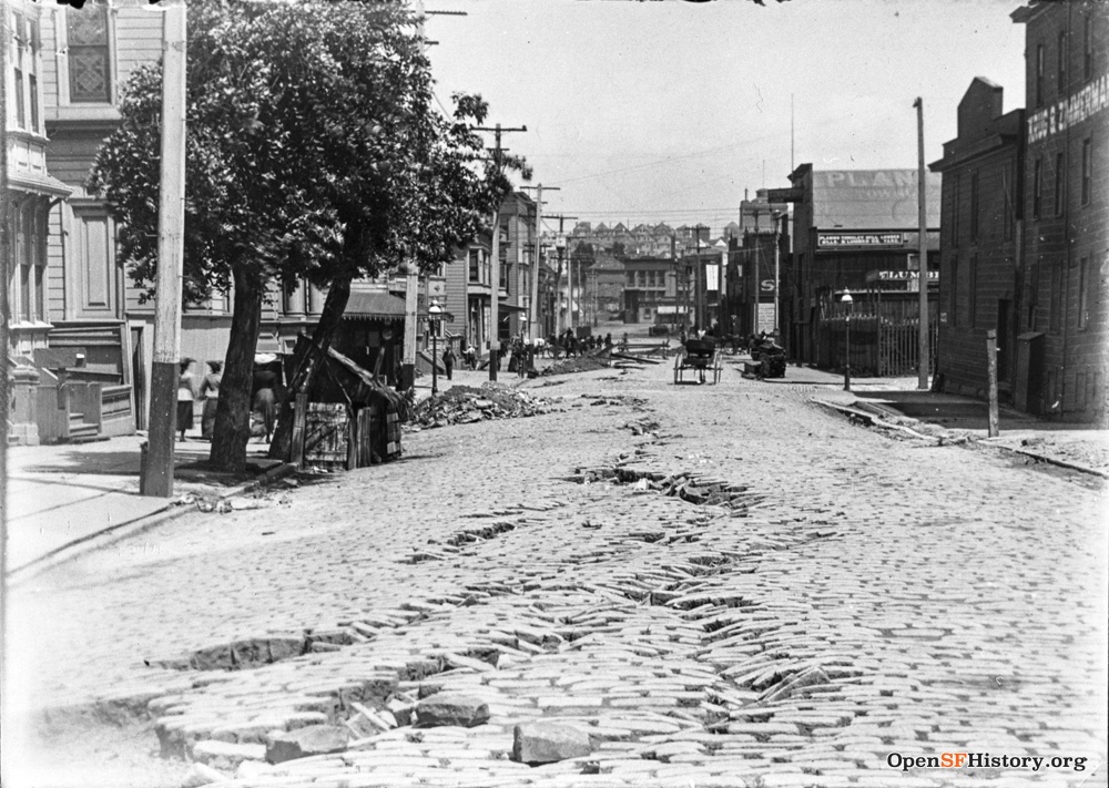
The dramatic fissure in 18th continued for several blocks, following the former path of Mission Creek, buried or filled as the city developed. Left: Looking west on 18th from Shotwell. The facade of St. Charles school at right notably leans to the north, with the billboards on the 18th/Howard corner lot visible just beyond it. The lumber yard at left is Townley Bros. at 18th/Shotwell. Center: Looking the other direction, east on 18th from Treat (Steiger sign: SE corner 18th/Folsom). Right: Looking east past Shotwell on 18th (dead-ending at Harrison), with a street kitchen in front of St. Charles school. This must be somewhat later, as the street fissure has been crudely repaired.
One house on the block (2115) was destroyed by the earthquake and three others (2105, 2119, 2125) were soon replaced, presumably due to earthquake damage. But the other 11 buildings survived, though several obviously needed significant repairs. Today (in 2019) only two of the 1906 buildings survive, and the block is dominated by large auto parts and plumbing supply stores built after 1950.
See also:
- Block data
- Census data: 1870, 1880, [no 1890 data], 1900, 1910, 1920, 1930
- City directories
- Images
- San Francisco Stereoviews and More San Francisco Stereoviews
- Valencia St. Hotel [on Valencia between 18th/19th, i.e., a few blocks away]


