Strolling in Upper Noe
It's a nice day and San Francisco is a great walking town, let's take a stroll in my neighborhood! We'll roam through time as well as place, aided by old photos, newspapers, and maps. No major landmarks, just an urban cityscape evolving over many decades, but we'll encounter plenty of excitement along the way: untaxed cows, hoodlums, a 5 cent robbery, a runaway streetcar, fatal accidents, reckless blasting, even a murder.
This page is dedicated to John Henry Mentz, photographer for Market Street Railroad Company and United Railroads of San Francisco. He took many of the photos on this page and thousands of others over many decades. The shadow of Mentz with his large format glass plate camera is at right (detail from 10/22/1904 photo).
Click on any picture to see full-resolution version. Click here for a map (in a new tab) with the location and date of each old photo.
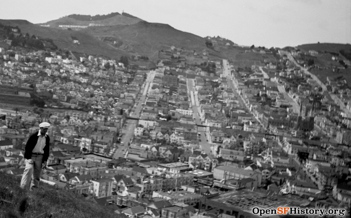
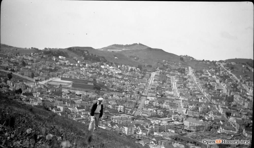
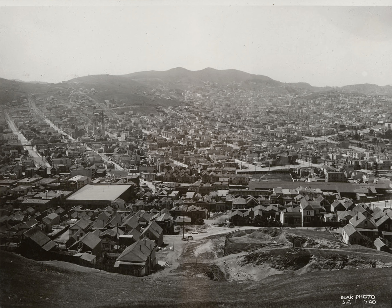
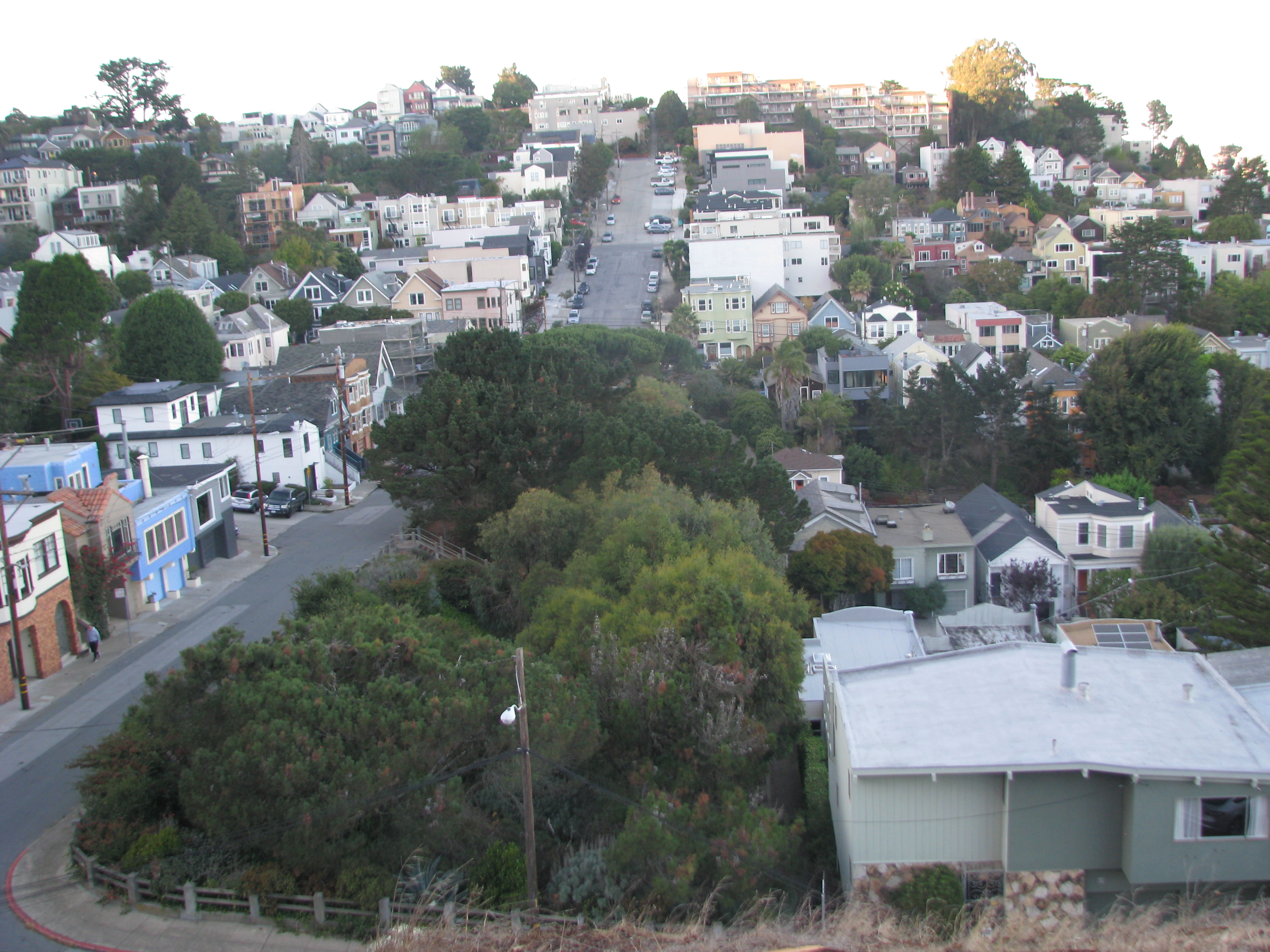
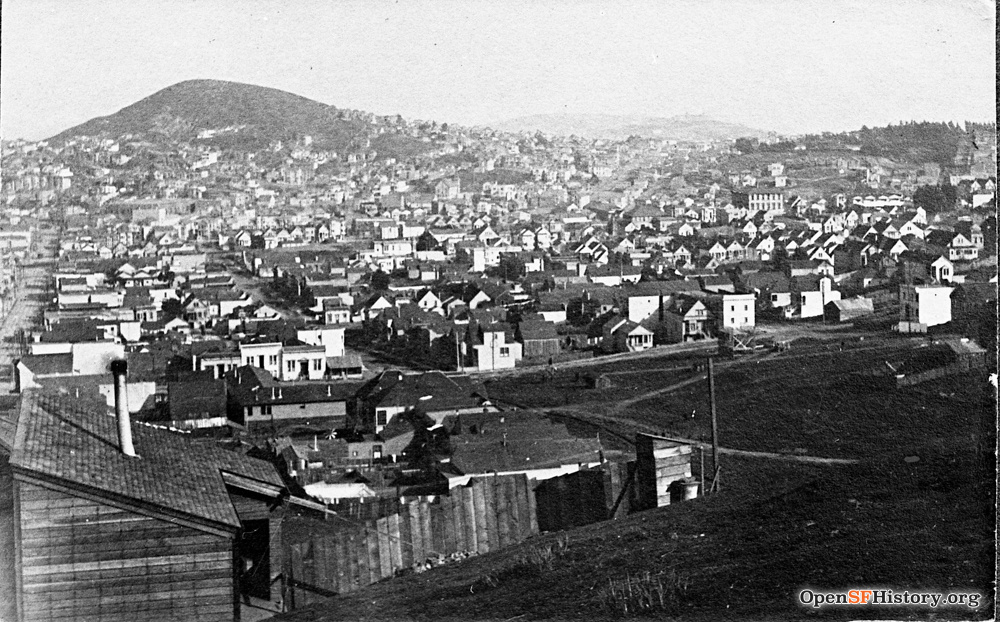
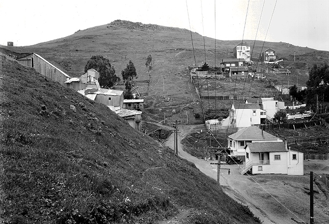
This 1930 overview (slightly cropped from original) shows where we're going: Upper Noe Valley as seen from Bernal Heights, looking west toward Mount Davidson. 30th Street runs up from left center, with Day / 29th / Valley / 28th running parallel to its right. I often sport caps like the one the gent on the left is wearing, just think of him as our tour guide. We'll only venture a few blocks from our house (on 29th between Noe and Castro), within the blocks bounded by Diamond / Valley / Mission / 30th. An earlier view from Bernal, purportedly in 1906, is here.
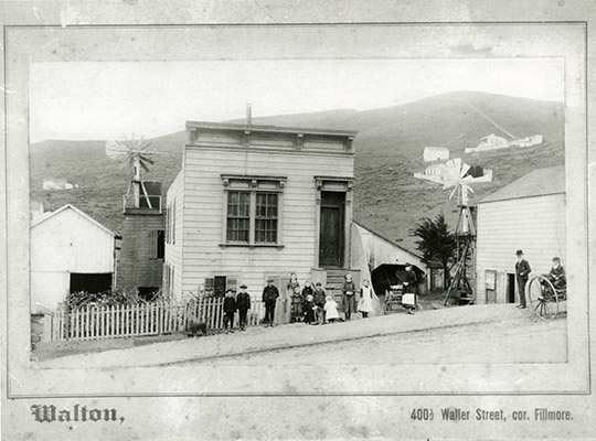
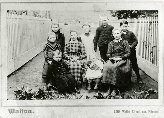
Set the WABAC machine for San Francisco ca. 1890. These two pictures taken on the same day show the family of Margaret Mitchell, including her eight children, at the family's dairy at 505 29th Street, just above Noe. I believe Margaret's husband Edward Mitchell is not in these photos because he died not long before they were taken. The first photo looks southwest from 29th/Noe toward 30th/Laidley. Day Street is just pasture, complete with cows. The top building uphill at right peeks out from behind Billy Goat Hill in the ca. 1910 photo below and is dimly visible in the 1912 Kate Kennedy School photo. The photo description misidentifies it as Crystal Springs Water Company, it should say Spring Valley Water Company instead. If that building is indeed the water company, the line down Gold Mine Hill to it might be a flume. Windmills suggest that the dairy uses ground water at least part of the time, not surprising as the dairy predates water company service. The barn at left might still stand, now as the back part of 414 Day, but none of the other dairy buildings still exist today. The family photo looks west into their pasture from just behind the house. My extensive investigation into these wonderful time capsules is here (I can name the kids!). The two-year-old at front left is John Mitchell, later the father of John and Lawrence Mitchell, cofounders of neighborhood treasure Mitchell's Ice Cream.
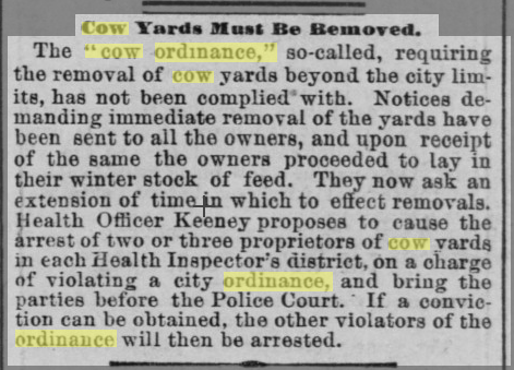
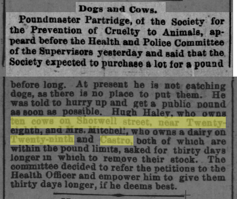
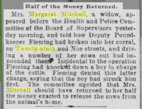
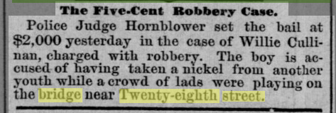
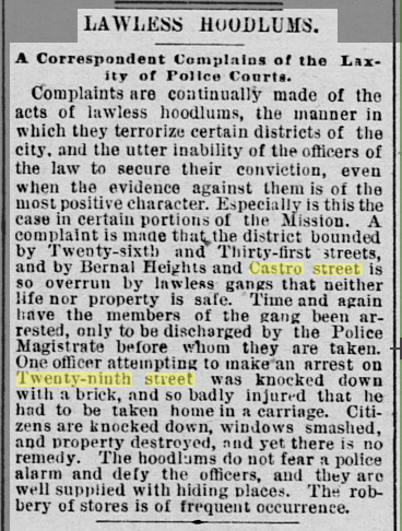
The dairy's days were numbered when these pictures were taken. Cows became a nuisance as urban neighborhoods developed, so a San Francisco "cow ordinance" imposed limits on milk ranches, extended to Eureka Valley and Noe Valley in 1885 (San Francisco Chronicle 12/10/1885). Milk ranch owners were very slow to comply (Daily Alta California 10/20/1889). In 1887 the Mitchell dairy had 100 untaxed cows (Chronicle 02/03/1887; Bridget Murray is the family matriarch). Margaret Mitchell still had cows in 1892 (Alta 04/11/1891), leading to trouble with city authorities (San Francisco Call 06/04/1892). The neighborhood had a hoodlum problem in the 1890s (Alta 07/06/1887, a 5 cent robbery; Call 12/07/1890, lawless hoodlums).

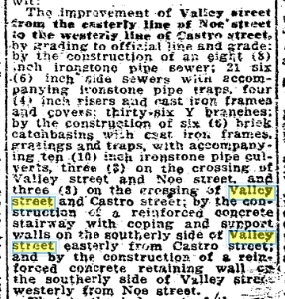
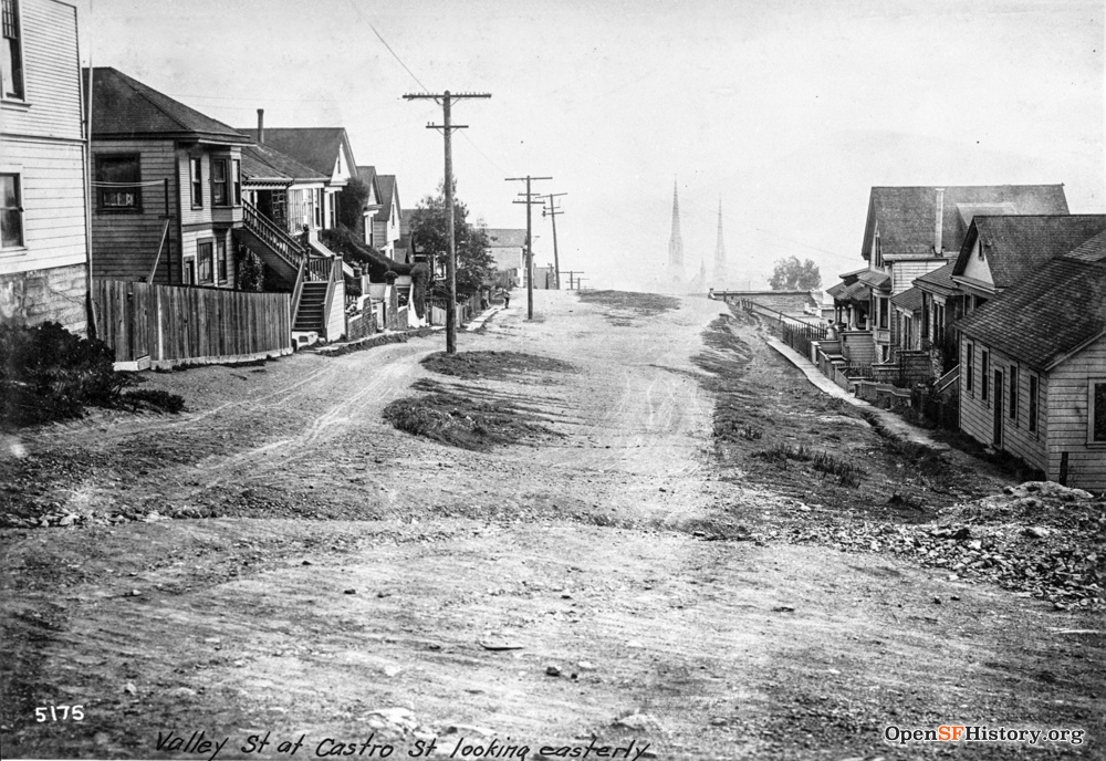
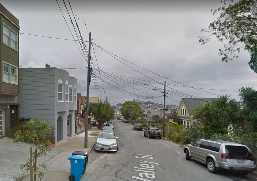
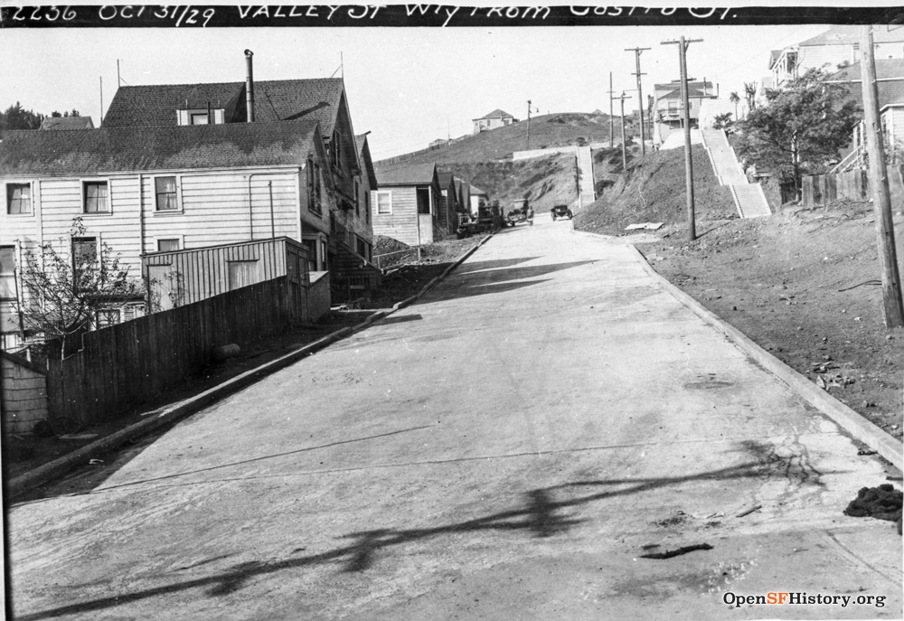
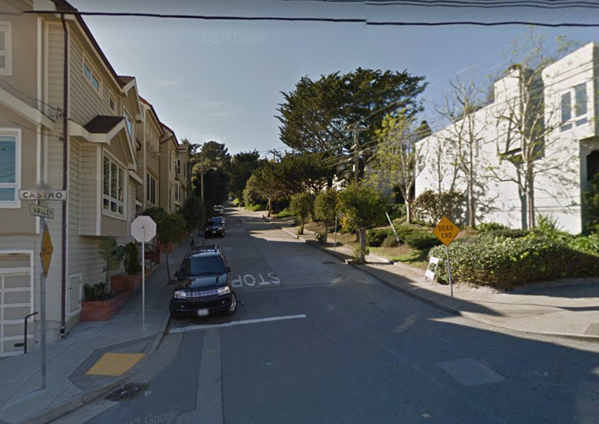
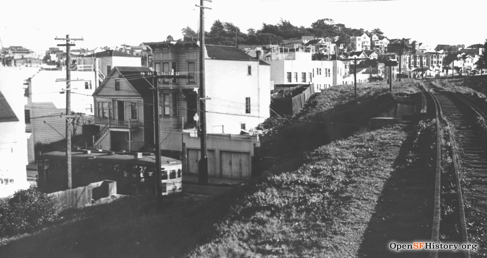
Valley Street bounds the north side of our block. This photo from 3/06/1923 is captioned "Valley St. W. from Castro St.", but it's looking west from Noe, not from Castro. The 1905 Sanborn insurance block map shows much of Valley as "not opened", and the Chronicle 08/18/1922 details the Valley St. improvement project. Here a big steamshovel is at work, maybe preparing for paving. The photographer took two more photos later the same day from just up Valley, as seen below. The Italian Hospital (ca. 1869-1905) was just up the hill from this corner, and Meagher's Ropewalk (cordage factory, ca. 1878-1910) was just below; each is described in detail on its own page.

On the same day, from just past the steamshovel seen above, again looking west up Valley toward Castro. 459 Valley is the first big house on the left; it's directly behind our house, so I've looked at its backside since 1980. The sidewalk on the left ends with steep stairs up to the southeast corner of Valley/Castro. Two boys watch the men at work while several other kids hang out at Valley/Castro, we'll see more of them below.
Five years earlier, in January 1918, looking the other way toward the spires of St. Paul's peeking out of the fog. Sidewalks are wooden and the street is unpaved but somewhat graded. The sidewalk on the south side is considerably below the level of the street. The last house on the right is 459 Valley.
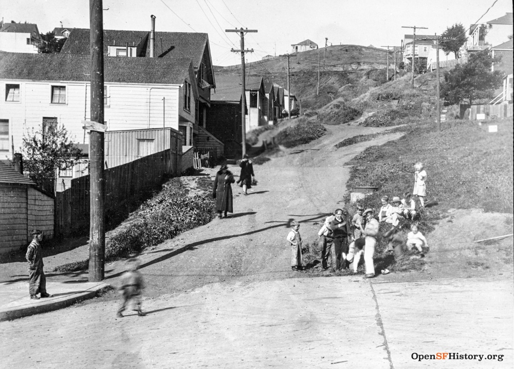
A better view of the children seen above at Valley/Castro reveals a pack of 12 kids of mixed ages. Diamond Street is visible past the houses on Valley. Castro appears to be paved, Valley is not. The houses on the left are 523/525/527 Valley. Six years later on 10/31/1929 from the same spot, changes include paved street, a steep stairway leading up to Diamond at the dead-end of Valley, and stairs leading to the houses on the north side. Since then, the Valley roadway loops back at the foot of the Diamond stairs to reach the houses at top right.
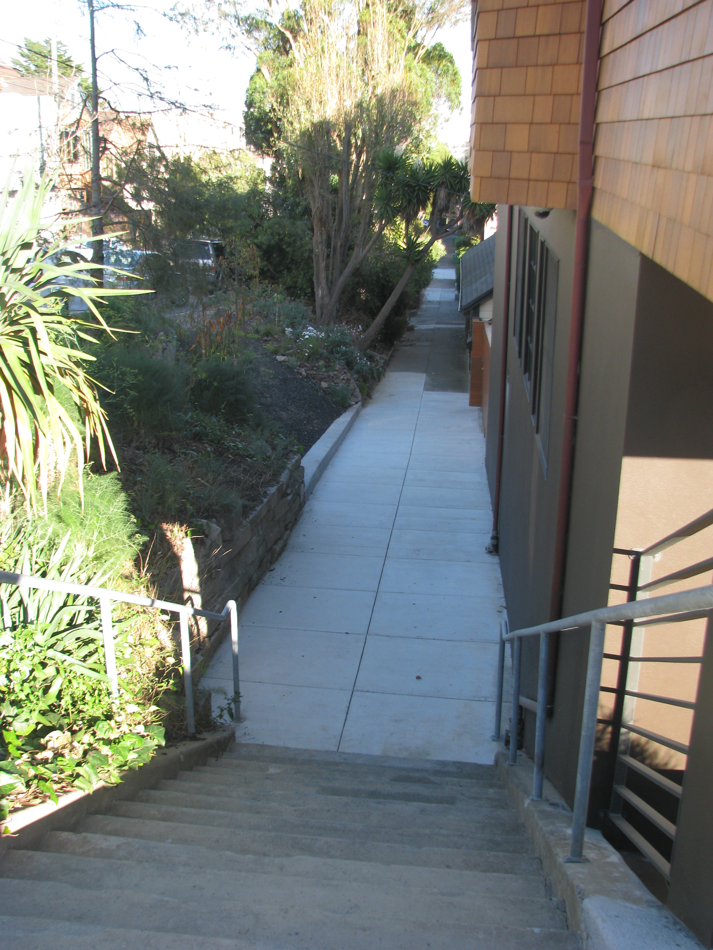
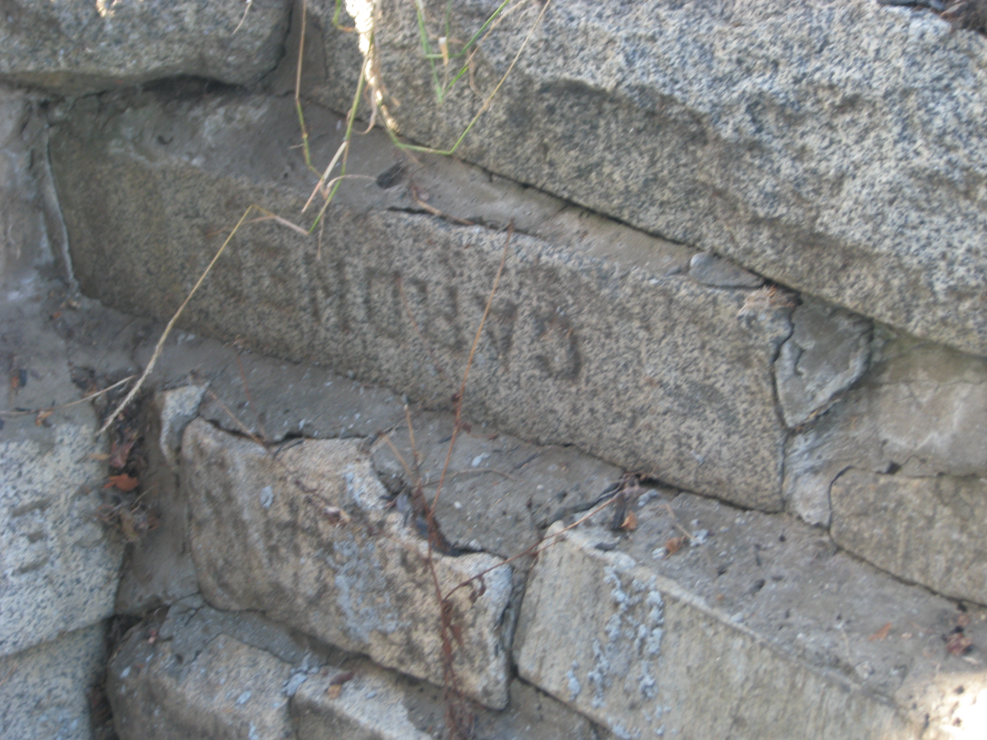
The sidewalk stairs seen above at the steep Castro/Valley corner of our block were replaced during new construction in 2015, but the adjacent retaining wall built of large stone slabs remained. Some of the slabs have engraved names, presumably because they were once headstones. San Francisco moved remains out of city graveyards to create much-needed parks (see my Before Dolores Park webpage), but survivors had to pay to move headstones, so many headstones ended up in public works projects throughout the city.

At left: Looking south ca. 1910 from 29th Street below Castro, probably from an upstairs window or back porch at 583 29th. The houses in the foreground are on the north side of Day Street, so we're looking into their backyards, laundry drying on several clotheslines. Four of the five foreground houses still exist: 478 Day (at left edge of photo, now expanded), 484 Day, 488 Day (gone in the 1915 photo at right), 494 Day, 2329 Castro. Billy Goat Hill at Castro/30th is at center top, with a large dairy on Fairmount Hill behind it, complete with a dozen or so grazing cows and a Christo-like fence running across and down. The small house on 30th below Castro is 578 30th and the small house with the distinctive pyramid roof above Castro across from the quarry is 626 30th. Our front bedroom view is roughly the same area, but houses and trees on the south side of 29th block the view down to Day Street. The Gray Brothers quarry at top right was the source of the stone for St. Paul's Church (see below for more about the Gray Bros.). The house just below the quarry is at Castro/30th.
At right: the same houses from the other side ca. 1915, looking north on Castro from Billy Goat Hill.

The sharp grade from Day up to Castro looks perilous, so eventually it was fixed. Here's the Castro/Day grade from the other side, shot northeast from 30th up Castro toward 29th on 3/10/1927, with embankment construction in progress.

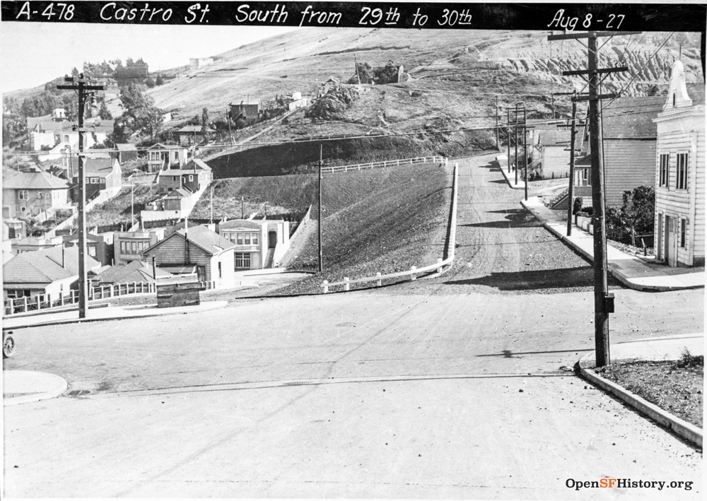
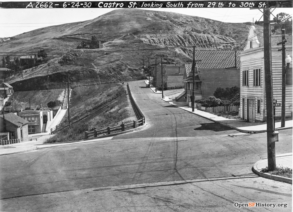
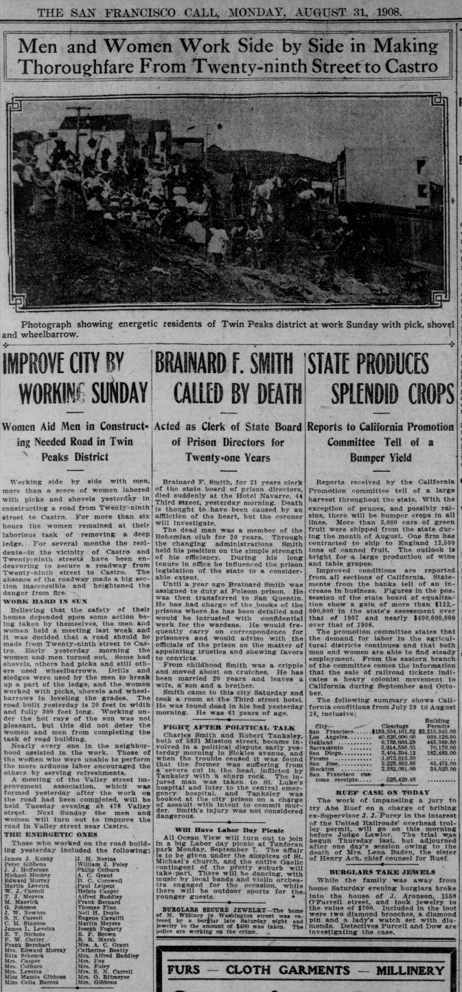
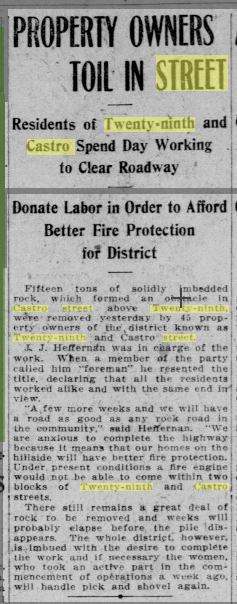
Castro just north of 29th is now broad and flat, but it took a major collective effort in 1908 by neighbors ("energetic residents of Twin Peaks district"!) to remove a deep rocky ledge obstructing the street, thus allowing access by firefighting equipment (Call 08/31/1908, 09/14/1908; the newspaper photo looks north up Castro from 29th). The neighborhood then requested a fire hydrant at this corner (Call 09/16/1908), but the house on the northeast corner of Castro/29th was destroyed by fire in 1911 (Chronicle 04/23/1911). Twenty years later, on 8/08/1927 (five months after the constuction photo above), the second photo looks south down Castro toward 29th. The embankment at the west end of Day Street is finished, so Day westbound jogs right to Castro/29th. A picture from three years later, on 6/28/1930, shows added stairs from Day up to 30th and from Day up to Castro. The first house on the right is 601 29th, thankfully still standing in 2017 after a fire destroyed the house adjacent to it on Castro, leaving the south wall of 601 charred.
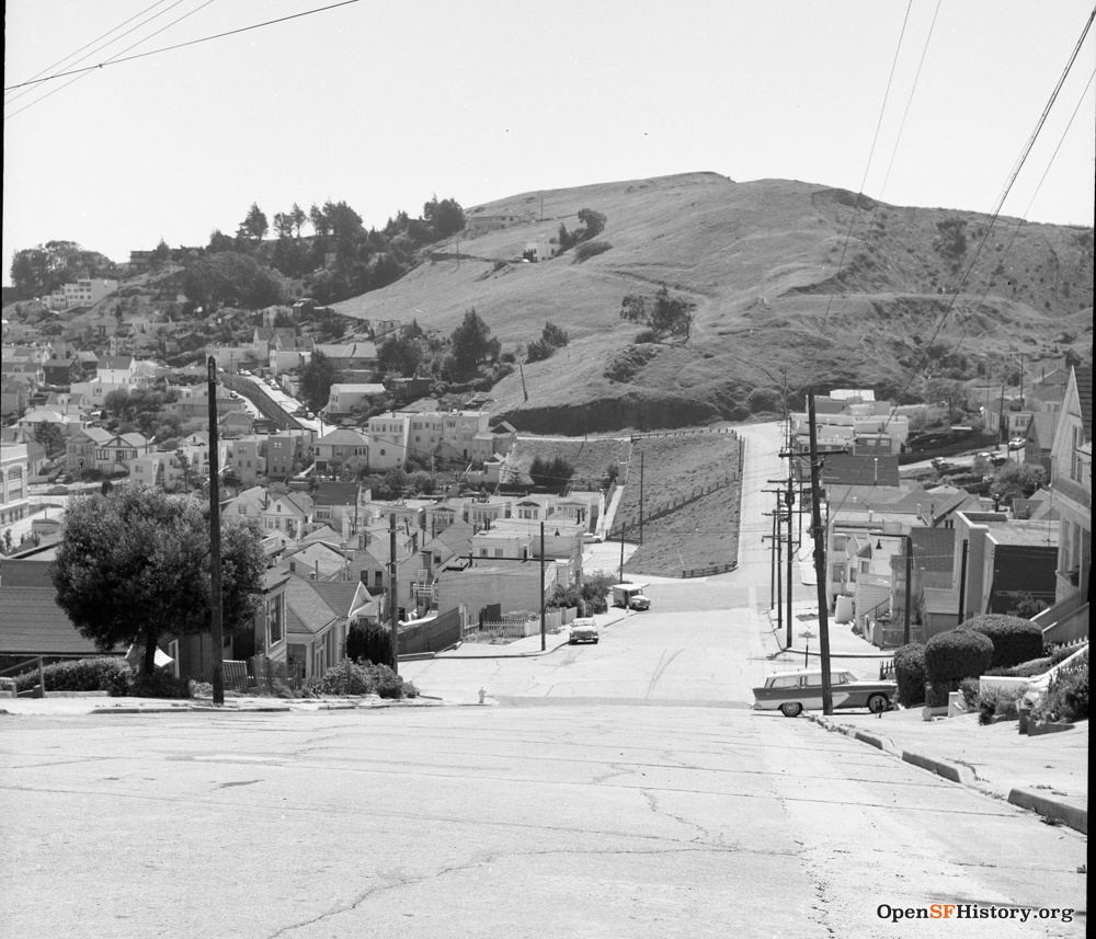
Roughly the same view 30 years later (from just above Valley, April 1957) and 90 years later (from above 29th, 11/07/2017). Check out the new two-tone 1957 Chevy station wagon proudly parked in a driveway. Most of the lots on 30th and on Castro are occupied. The first house on the right is 2108 Castro. Fairmount Hill towers over Billy Goat Hill, peaking at Digby/Everson. The houses above Billy Goat Hill in the 2017 photo are on Beacon and on Digby. I'm not a fan of the overgrown untended embankment greenery.

Looking north up Castro on 8/08/1927 (same day as above) and from Billy Goat Hill on 10/21/2017. Our house is hidden behind a tree near the right edge. The line of five adjacent Edwardian houses on 29th just above Castro looks completely unchanged 90 years later.
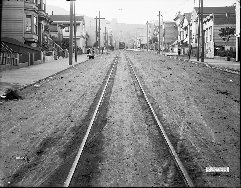
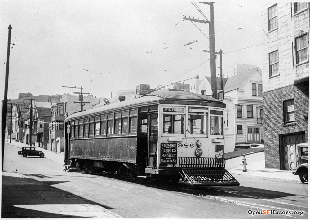
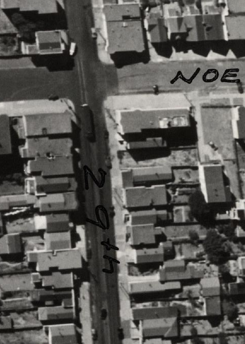
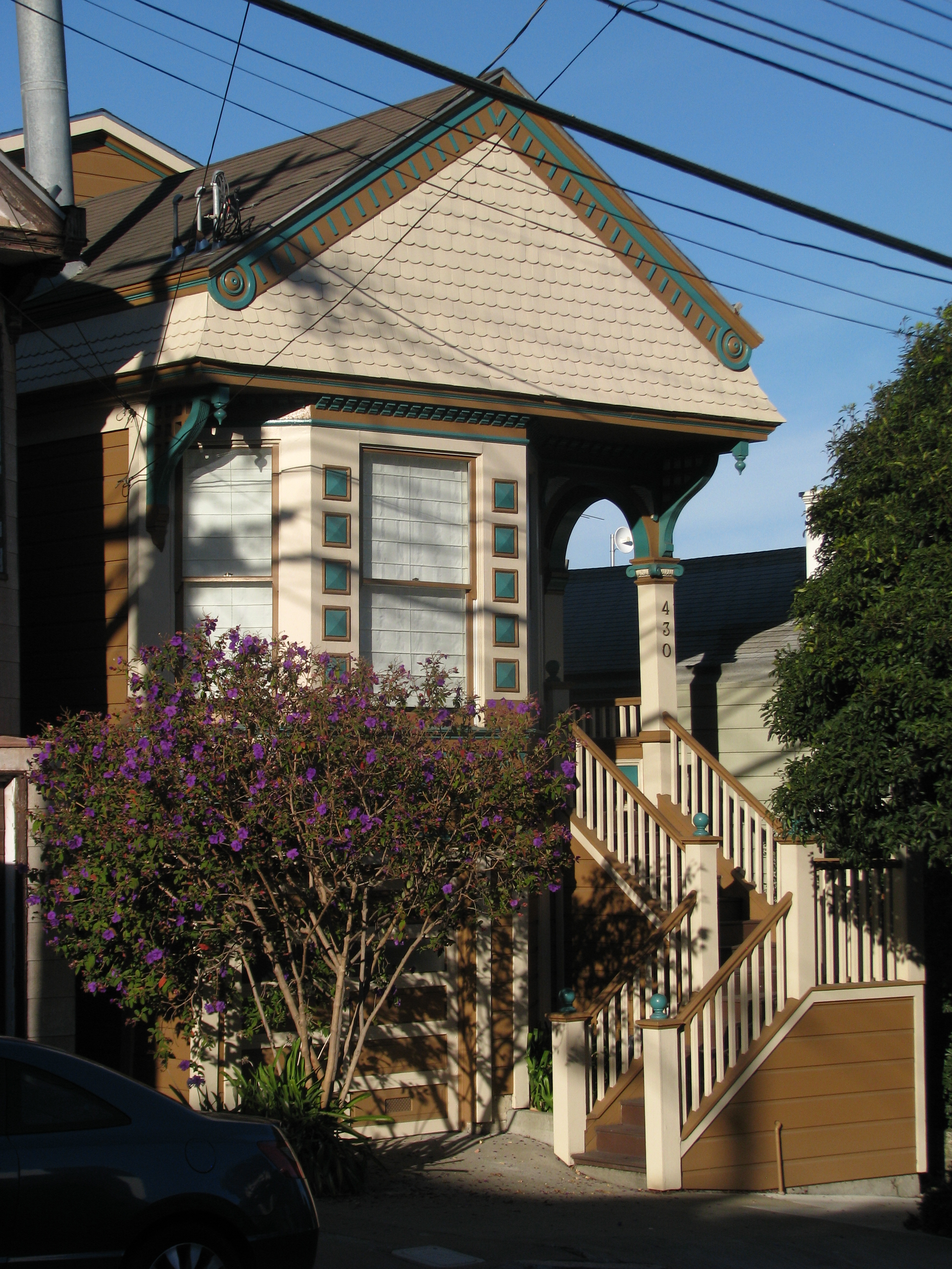
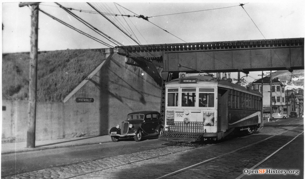
Let's head down 29th Street toward Mission. At left: we're a block down 29th from our house on 12/15/1909, between Noe and Sanchez, looking west toward Noe. Tracks? Yes, a streetcar line from Mission up 29th to Noe began service on 9/15/1894 (Call 05/15/1893, 09/18/1893; Chronicle 05/10/1894, 07/07/1894, 09/16/1894). We'll see below that there were two tracks from Mission to Sanchez, then the single track from Sanchez to Noe seen here. More kids, at least six. Streetcar waiting at Noe, horsecart, no cars. The boy at right stands in front of 430 29th. Electrification of rail service on Mission meant much faster travel to downtown, encouraging neighborhood growth, but it also brought new dangers: the first fatal accident on the 29th Street line was just three days later (Chronicle 09/19/1894). In later years, this became the Market Street Railway #9 line: Ferry Building / Market / Valencia / Mission / 29th. A #9 car waits at 29th/Noe both in the 1938 photo at center and in the 1938 aerial view at right. I often wait at this corner for the 24 bus rather than walking down to Church for the J streetcar. There were no tracks here when I moved to the neighborhood in 1977; I'd like to know when service ended.
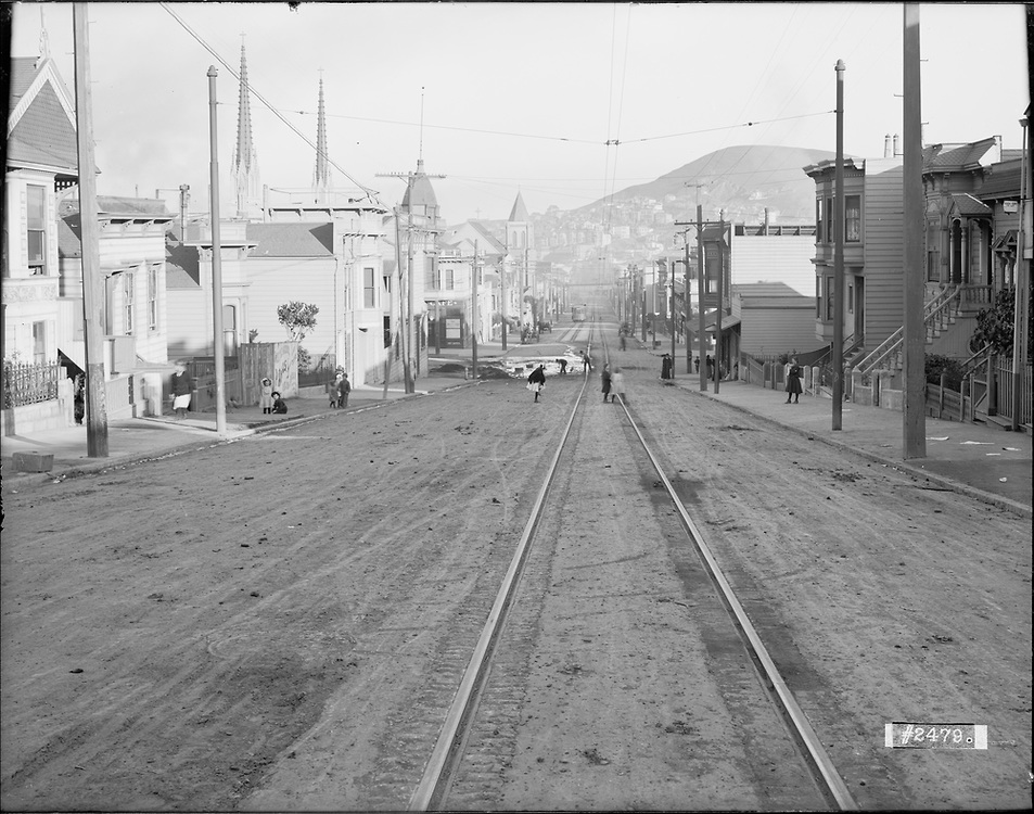


From the same spot, same 1909 day, looking the opposite direction (east past Sanchez toward Bernal), with detail of same photo and 11/07/2017 view. Many kids, some playing in the middle of the street (dangerous even though the street seems quiet: see Chronicle 06/04/1891, 08/25/1904); two streetcar tracks starting at Sanchez; streetcar coming up the hill. The first house on the left is 430 29th. I like street trees, but sadly they make it very hard to see houses today.
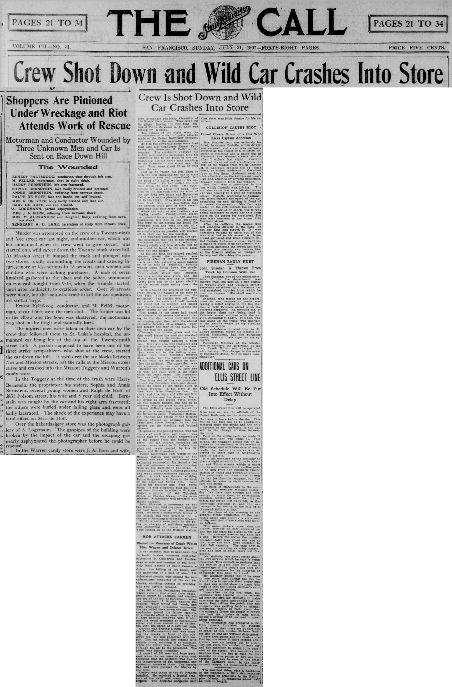
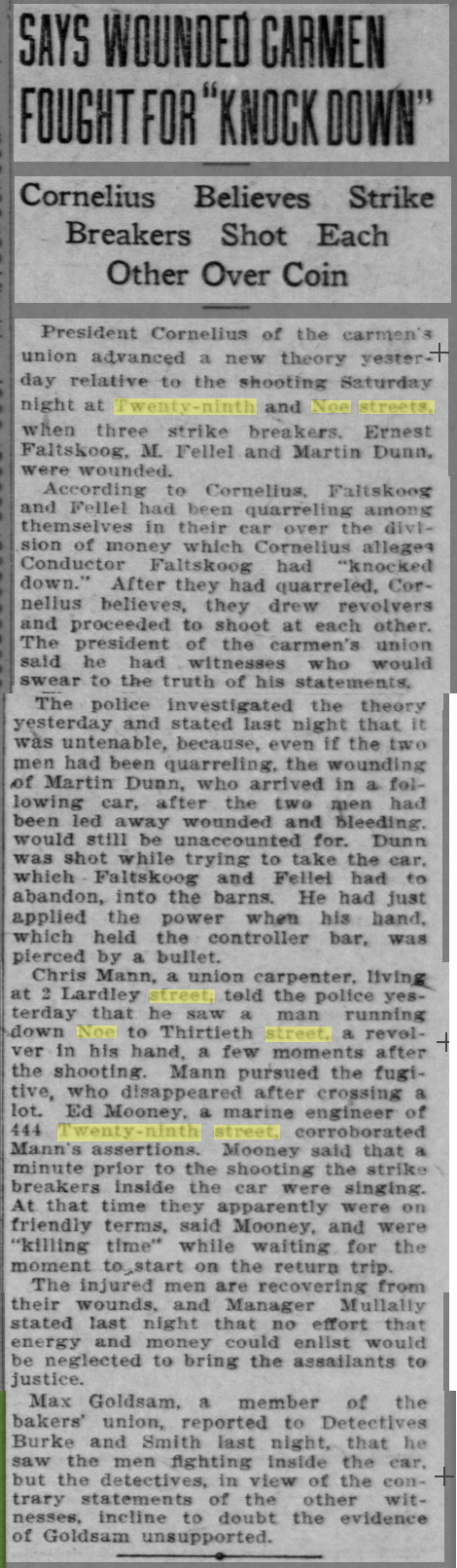
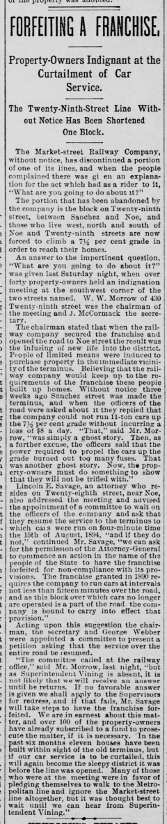
A trolley motorman and conductor were shot at 29th/Noe on 7/20/1907, resulting in an unmanned streetcar careering downhill and crashing into two stores after jumping the tracks at Mission, injuring a dozen people and precipitating a riot by several hundred (Call 07/21/1907). Subsequent reports (Chronicle 07/22/1907, Call 07/23/1907) advanced differing theories about the cause. The violent 1907 streetcar strike resulted in 31 deaths; the streetcar crew members were strikebreakers, so this incident was probably an attack by strike sympathizers.
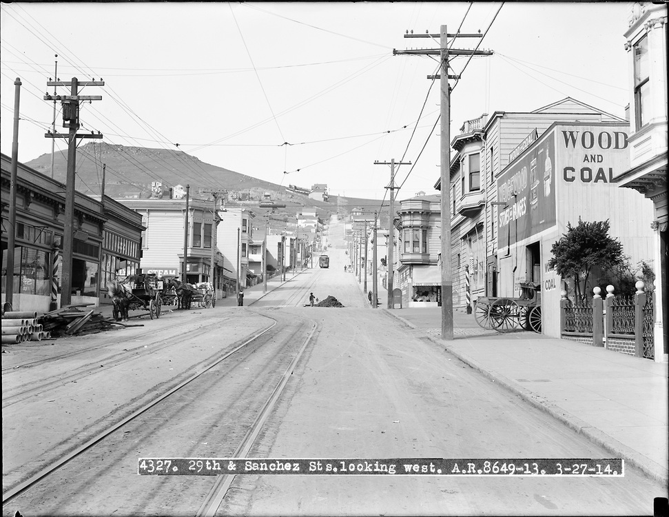
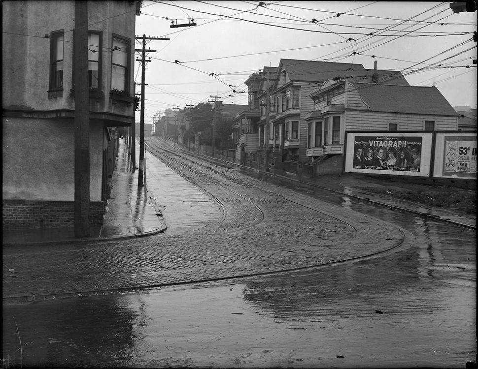
Looking west from half a block further down the hill, just below Sanchez, five years later on 3/27/1914. It's a much nicer day than in the 1909 photo above, so details on Gold Mine Hill are much clearer. Wonderful buggy at the wood and coal dealer, mailbox at corner just like the ones we still use today, yet again a streetcar waiting at 29th/Noe, a few horsecarts but no cars. I assume the striped poles left and right mark competing barber shops. The utility poles have a more substantial crosspiece added since 1909, clearly electrical usage is ramping up and they're carrying more load. The leftmost two houses on the hill at left are on the east side of Diamond, between Beacon and (now) Diamond Heights; they are also in the 1940 quarry photo above.
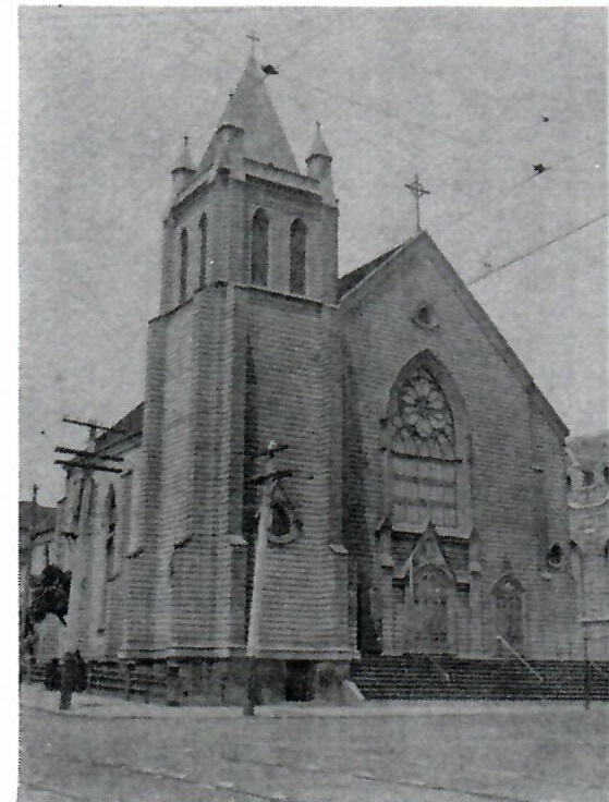

The 1906 overview from Bernal and the 1909 photo above both show the old St. Paul's church at the northwest corner of Church/29th as well as the spires of the new St. Paul's just down the block at Church/Valley. The now-familiar steeples were a fairly recent addition to the neighborhood in 1909: church construction began in 1897 and was not completed until 1911.
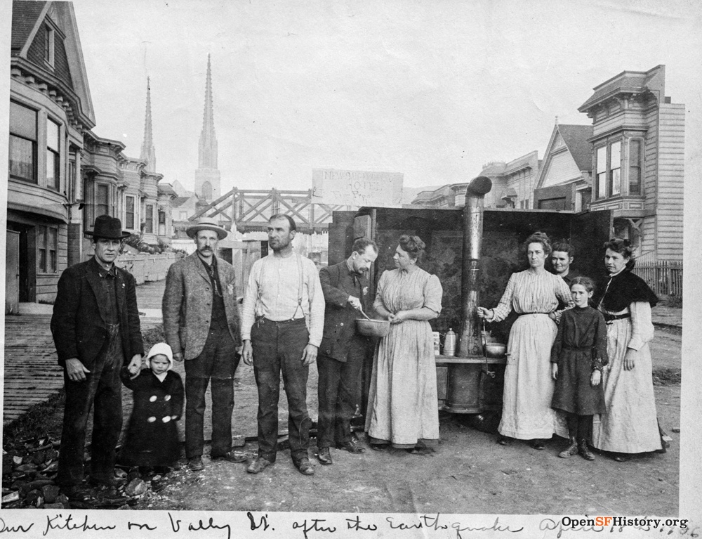
Noe Valley survived the 1906 earthquake and fire largely unscathed, but as a precaution indoor fires were not allowed during the recovery period, so families cooked in improvised communal street kitchens for several months. This post-quake picture looks west on the 100 block of Valley toward St. Paul's. The sign reads "New San Francisco Hotel / Fire proof". The trestle crossing Valley is wood, unlike most of the Upper Noe trestles shown on the S.F. & S.J. R.R. page.


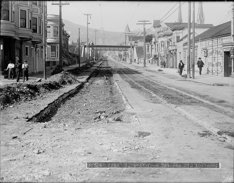
Looking west up 29th from between Dolores and Church ca. 1940. 268 29th is at the right. A railroad line ran through Noe Valley from the 1860s until the early 1940s, as described in more detail on my S.F. & S.J. R.R. page. The single track ran north/south between Dolores and Church on an elevated berm, roughly 25' high and 75' wide, crossing east/west streets on overpasses as seen here. The berm and the overpasses are clearly visible across Upper Noe Valley in the 1930 overview from Bernal at the top of this page and in the 1938 aerial view at the bottom, but they are gone in the 1948 aerial view.
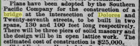
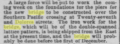
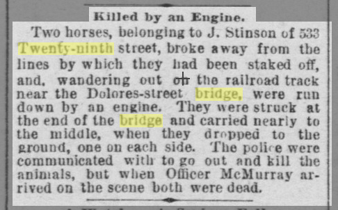
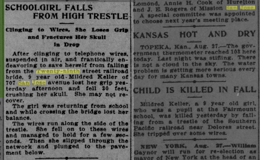
The S.F. & S.J. built the railroad berm through open dairyland in 1863, but Noe Valley urbanization in the ensuing decades made the berm problematic. In 1881 the Supervisors heard a request to tunnel through it at 29th (Chronicle 12/24/1881). The berm blocked Dolores/27th until a bridge was built in 1890 (Chronicle 01/31/1890: "the bank of earth has caused a dam, the resort for cats and dogs with suicidal intentions"; Alta 08/08/1890, 10/01/1890), and other overpasses followed (Call 07/27/1895). Train accidents killed horses, men, women, and children (Chronicle: 05/23/1886, 05/11/1891, 07/04/1903, 11/05/1905; Call: 05/11/1891, 08/28/1913).

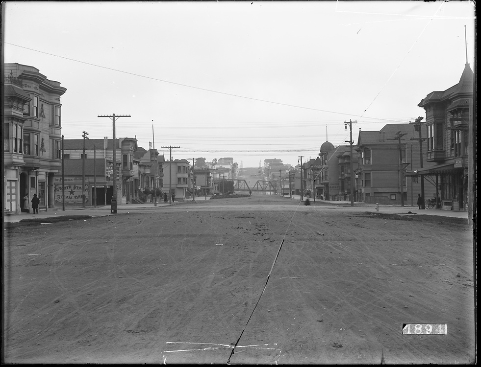
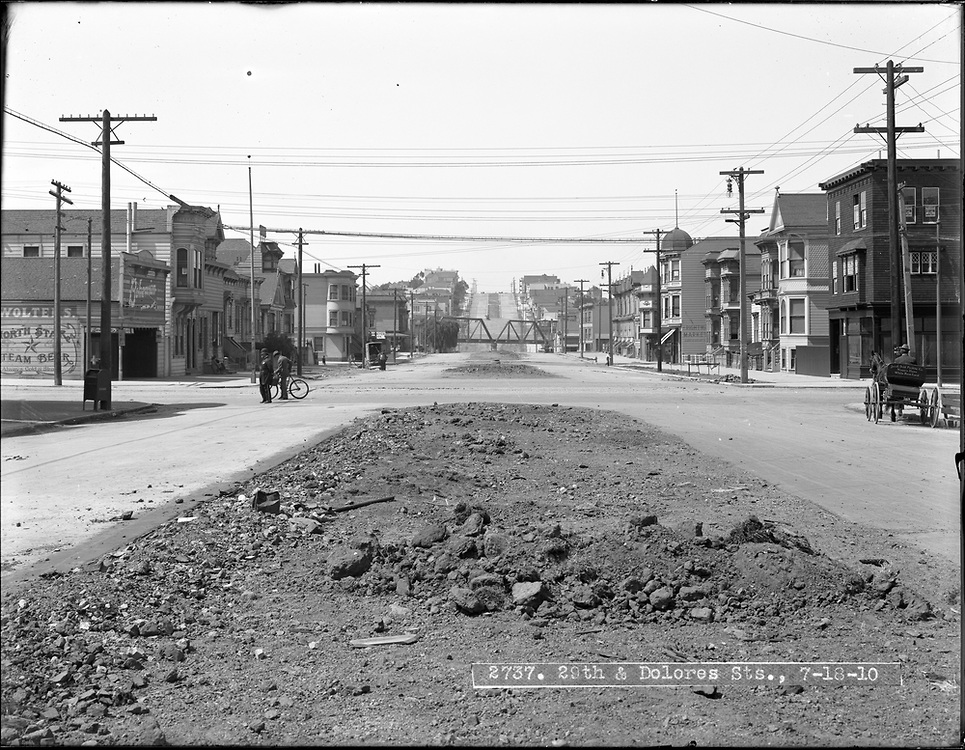
More views west up 29th from Dolores on 11/09/1908, 10/07/1909, and 10/21/2017. I'm reasonably sure the sidewalk on the right in 1908 is made of wooden boards. At left, the southwest corner of Dolores at 29th is 1600 Dolores, home of a dive bar now called Dolores Corner but known as O'Greenberg's during most of my Noe Valley tenure. A couple decades earlier, neighbors complained about the tannery near this corner (Chronicle 10/04/1889). The store on the southeast corner at 1601 Dolores was the side of a gruesome fatal accident on 11/26/1893 (Chronicle 11/27/1893). I'll go across the street to the northwest corner instead for a North Star steam beer at A. Wolters, thanks.
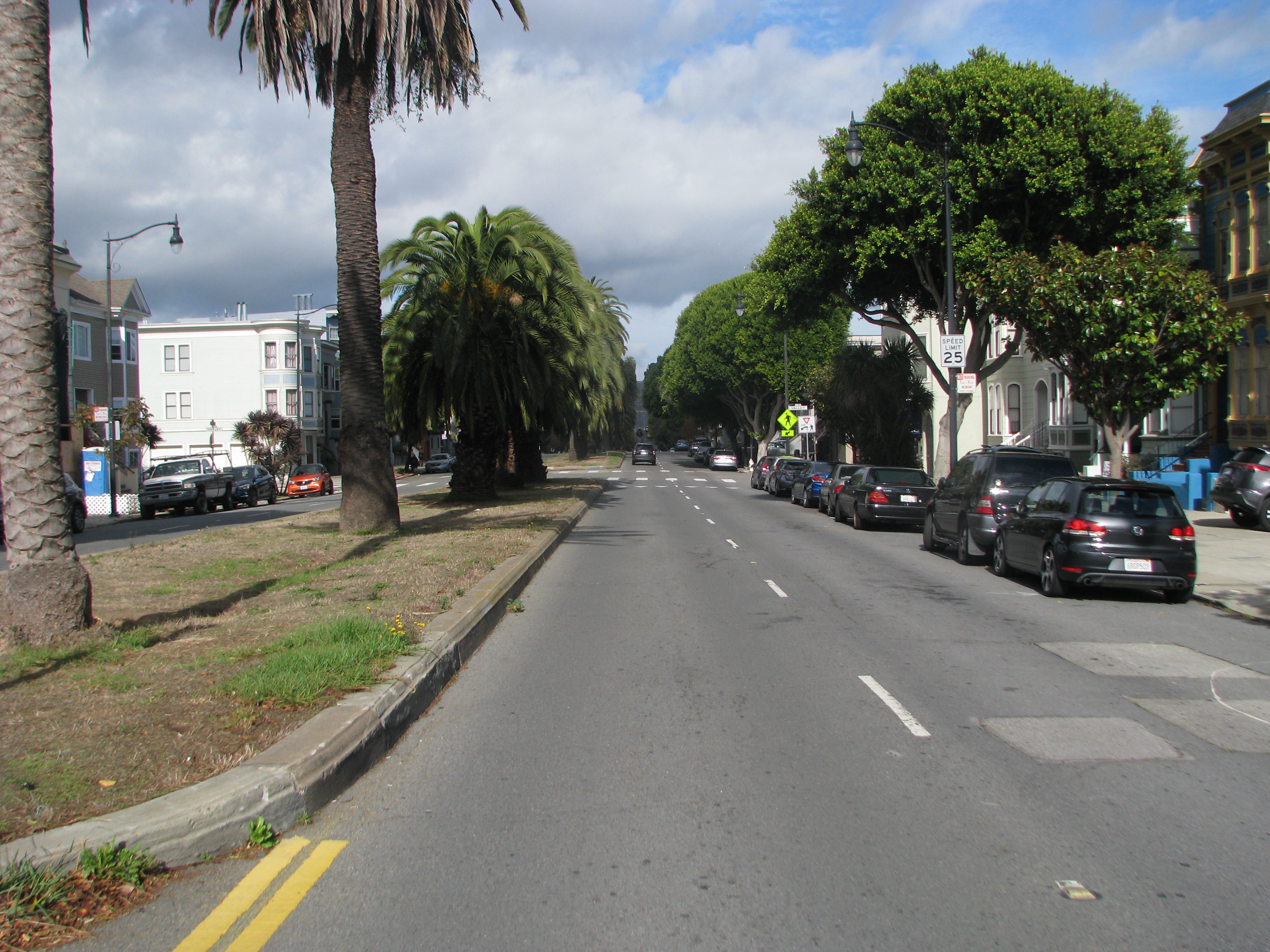
From roughly the same place (but just south of 29th), looking north up Dolores, on 11/09/1908 and 7/18/1910. The 1890 railroad trestle crosses Dolores at 27th; my S.F. & S.J. R.R. page has better pictures of the bridge. The 1910 photo shows work in progress on the Dolores median dividers. We see mostly trees in 2017.
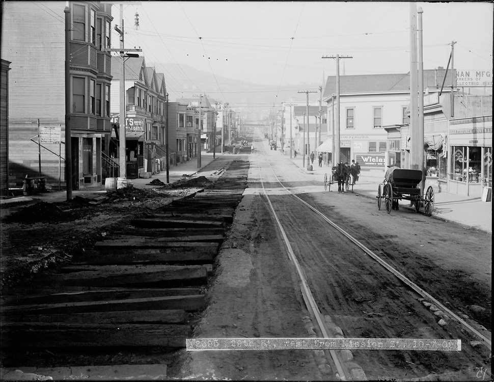

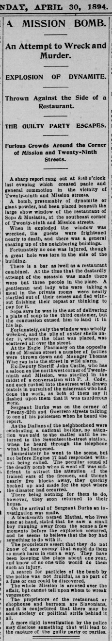
On 10/07/1909 again, from a couple blocks further east, looking west up 29th from Mission toward Tiffany, and again ca. 1930. The first house on the left is 33 29th. The 29th/Mission carhouse (built 1894 at the northeast corner of Virginia/Mission; Chronicle 04/07/1894, Call 04/24/1894) and the 28th/Valencia carhouse were both nearby, so it's not unusual to see trolley conductors hanging out here. A restaurant on the southwest corner was bombed in 1894 (Call 04/30/1894, Chronicle 04/30/1894). The 29th Street tracks crossed the S.F. & S.M. tracks (see below) a block up, at San Jose, creating yet another opportunity for accidents (Chronicle 09/22/1894, 03/31/1902, 04/01/1902). Let's head south to 30th and then circle back toward home, leaving the Mission Street walkabout and Tiffany's remarkable history for another page.
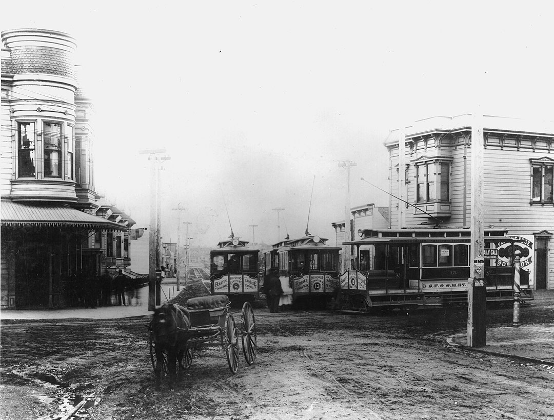
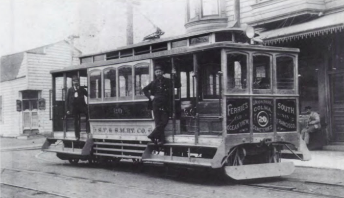
The San Francisco & San Mateo Railway was San Francisco's first electric streetcar line, starting service in 1892 and merging into United Railroads a decade later, so these photos must date from the 1890s (Chronicle 05/04/1891, 12/12/1891, 05/13/1901). Both show the railway's headquarters at the northwest corner of 30th/Church, taken facing north and facing southwest. S.F. & S.M. Ry. streetcars starting from the Ferry Building ran on Market to Guerrero, then on Guerrero and San Jose to the end of the line at this corner. Passengers heading further south transferred to a different car here and continued on 30th and Chenery to Glen Park and beyond. The 1902 prohibition on burials in San Francisco did not prevent people from dying, and S.F. & S.M. offered chartered funeral cars to Holy Cross Cemetery in Colma. The headquarters Victorian is gone today, perhaps the victim of street widening in 1929, but the building at the northeast corner is 797 San Jose. I like to imagine that the smoke blowing over San Jose from the west is from a train passing on the nearby S.P. tracks.
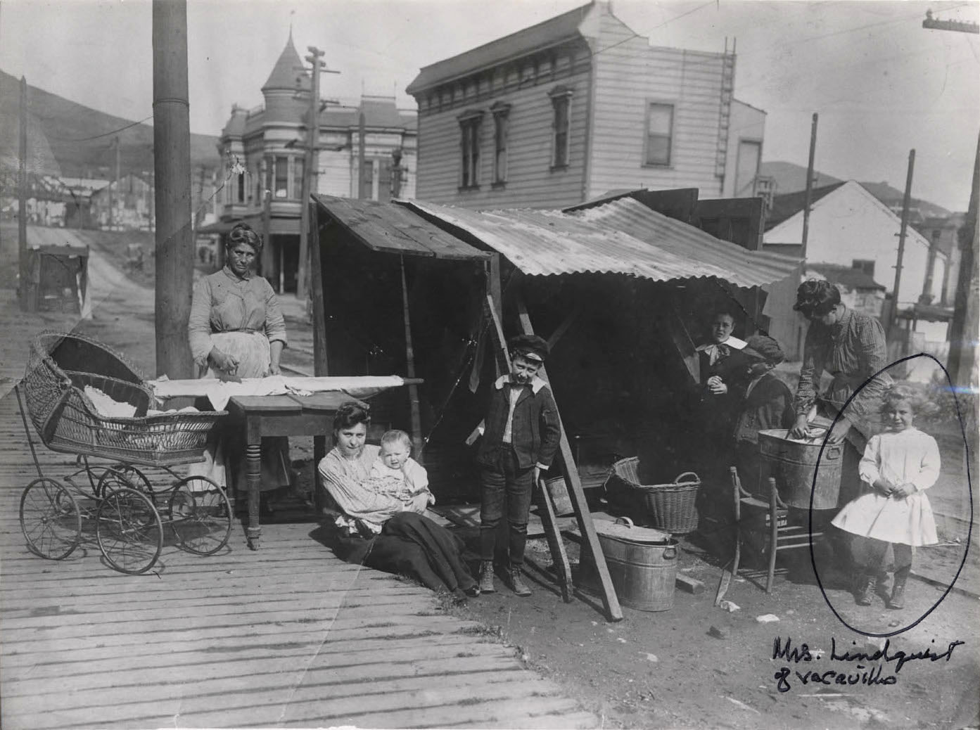

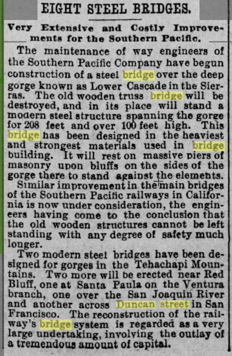
Looking west up 30th in post-earthquake 1906, both corner buildings at 30th/San Jose seen above reappear in this photo, though the S.F. & S.M. Ry. building seems to have sprouted a witches' cap turret. It's laundry day at an improvised street kitchen for the family of San Francisco photographer Charles Weidner (see my Weidner page for more details about this picture and another photo Weidner took here at about the same time). The woman at left (Weidner's mother-in-law Anna Horstmann, I believe) irons on an improvised ironing board while the woman at right washes laundry in a large copper tub, just as my grandmother did; I still have her tub. Board sidewalk, fabulous baby carriage, great caps on the boys, no obvious earthquake damage. At the left edge is the SP overpass on 30th just past Dolores, the image is fuzzy but it shows trusswork that is absent in the photo below from a decade later. A steel overpass replaced the wooden overpass on Duncan in 1913 (Call 08/23/1912, Chronicle 02/01/1913), perhaps the other Upper Noe overpasses were replaced at around the same time.
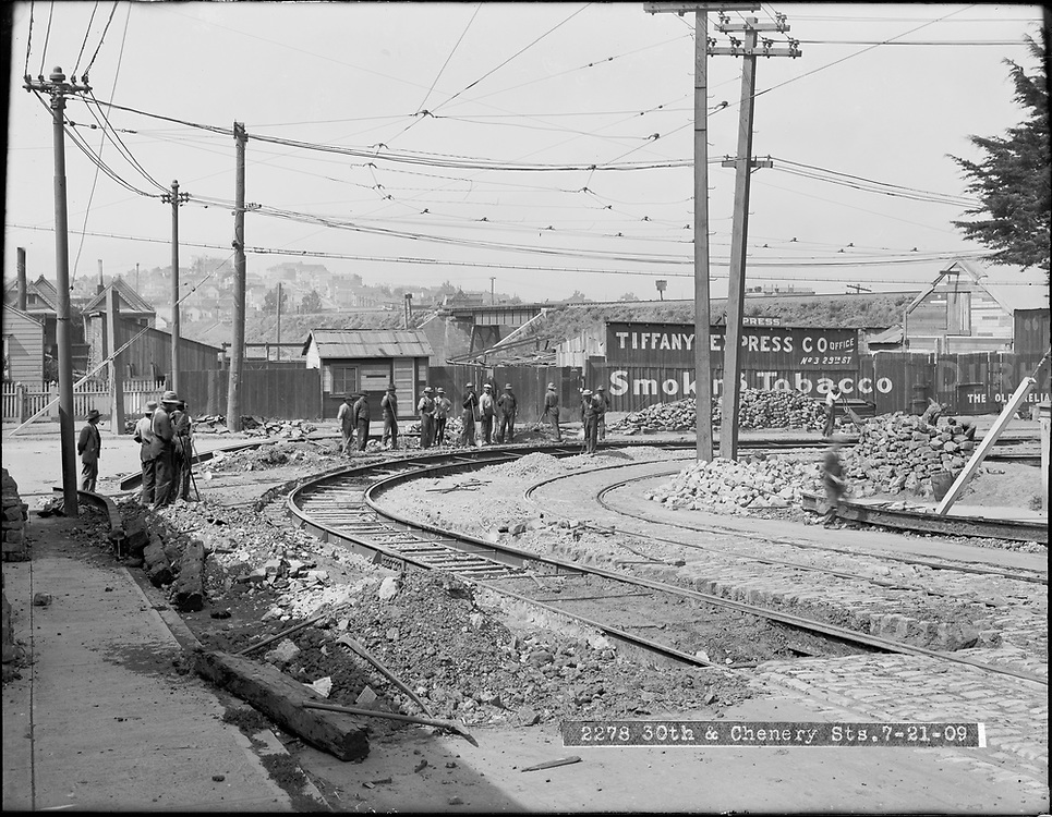
The first photo looks northeast from Chenery at 30th on 7/21/1909 during construction work on the 30th/Chenery curve. The Chronicle of 01/29/1894 reports a major accident at this spot on the "perilous route" (see also Call 03/27/1894), and a few months later another accident on 08/28/1894 (followup 08/29/1894) almost killed the mother-in-law of photographer Charles Weidner. S.F. & S.M. cars heading south to Holy Cross Cemetery in Colma rounded this curve just after leaving the 30th/San Jose transfer point in the photo above. One of the two houses at left must be 170 Day, but its twin companion is now gone. The SP railroad berm and Day Street overpass are in the background. The second photo looks at the same curve from the opposite direction (south down Chenery) a decade later on 10/01/1919. The Vitagraph poster is on the empty corner lot next to 12 Chenery. A few steps down 30th toward Dolores on the same rainy October 1919 day, the third photo shows a streetcar under repair under the 30th Street SP overpass. Today 1799 Church remains at the northeast corner of 30th/Church, though stripped of its turret and Victorian character.
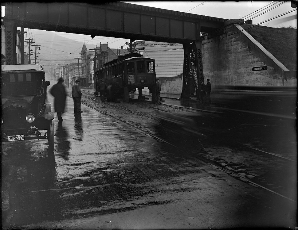
At left: the same overpass from the other side ca. 1938, looking east on 30th from near Church, with 1699 Dolores just past the streetcar. At right, also 1938: looking south from the overpass, with 207 30th behind the streetcar below. As noted above, this steel overpass replaced a wooden overpass here in 1913.
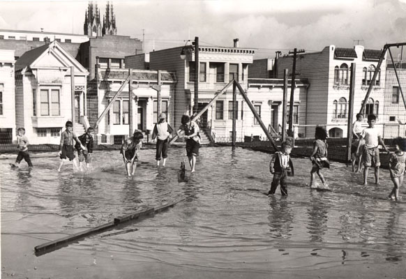
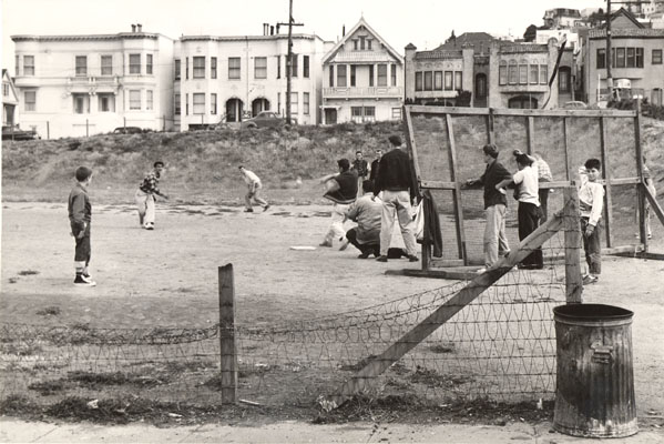
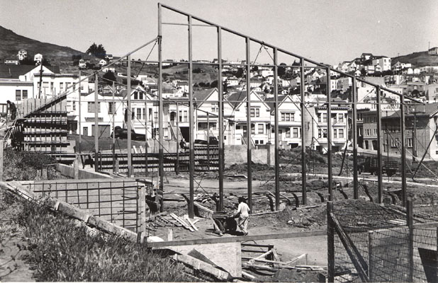
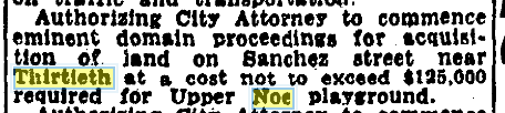
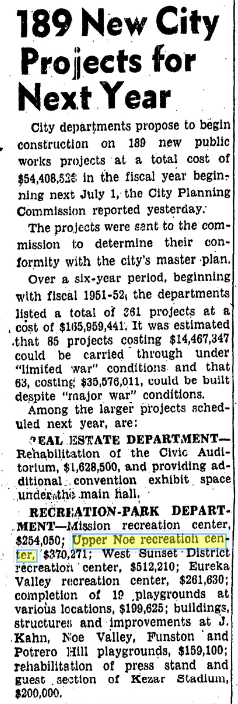
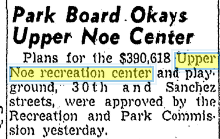
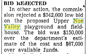
In 1938, houses filled the block bounded by Church / Day / Sanchez / 30th, as confirmed by the 1938 aerial view at the bottom of this page. Today most of the block is Upper Noe Rec Center and playground. The Board of Supervisors approved obtaining the land by eminent domain in 1949, funding was proposed in 1950, houses were purchased and removed in 1951, some Rec Center funding was approved in late 1953, and a bid on the building was rejected in 1955 (Chronicle 05/17/1949, 12/29/1950, 02/01/1951, 12/11/1953, 03/22/1955). The 11/12/1951 flooded field photo faces northeast toward 228/224/220 Day (224 has an added a second story today), so the western part of the block was already cleared by the early 1950s. Repair work has addressed ongoing drainage issues on the site several times since I moved to the neighborhood in 1977. The 7/14/1954 photo of kids playing baseball looks south toward 30th, with 351 30th (corner 30th/Whitney) at left, so the infield would be inside the rec center building today. The undated construction photo looks northwest from 30th toward Sanchez, obviously postdating the 1954 baseball photo.
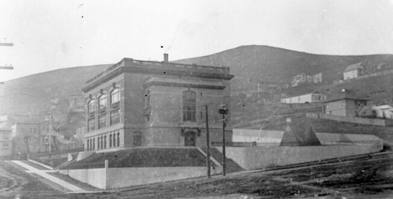
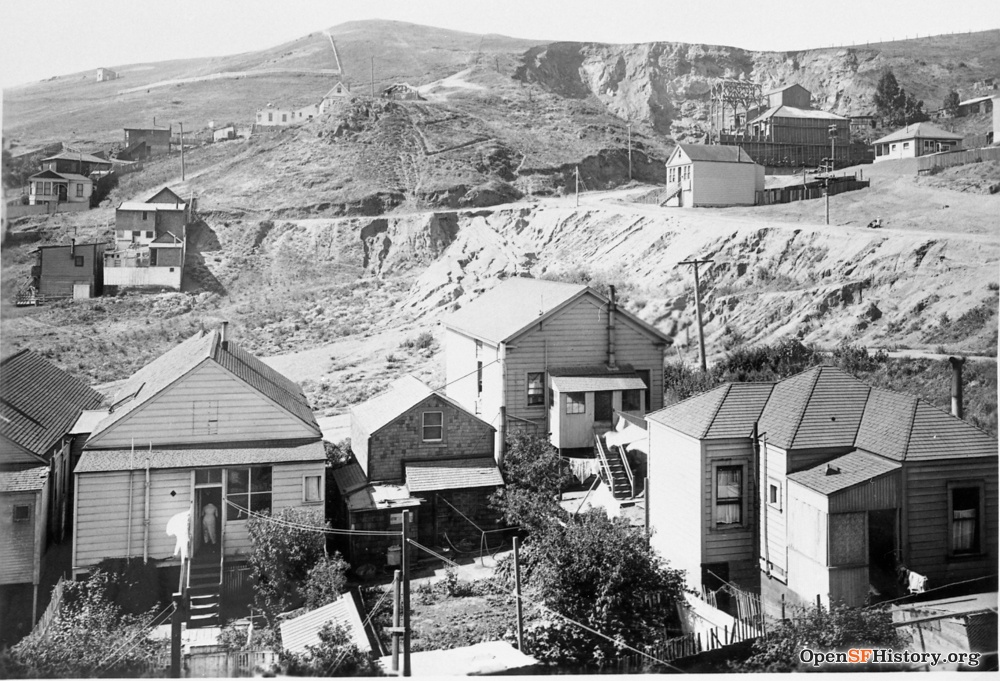
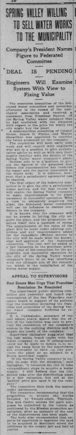
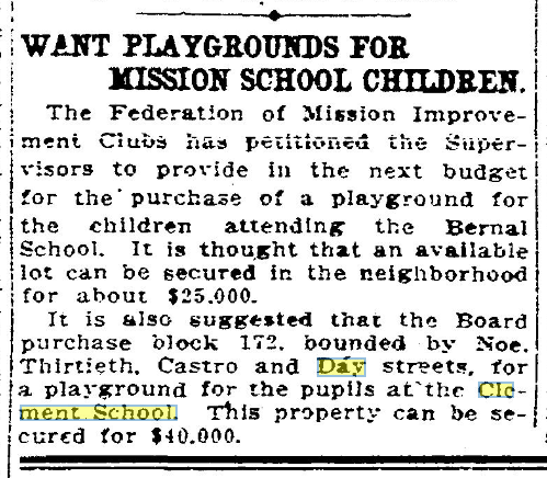
The first photo above looks east toward Bernal from Castro between 29th/Day ca. 1907-1909; 29th is at the left edge, Noe/Day at center, and Noe/30th at right edge middle. Day paving ends at Noe, and most of the Day/Noe/30th/Castro block is still open space. The low L-shaped building at the NW corner Noe/Day is Clement School, shown in pencil (presumably building in progress) in 1905 Sanborn. The barn just north of the school must be part of the former Mitchell family dairy. Scaffolding at the NW corner Noe/30th is at the later site of Clement School, now Kate Kennedy School. A 1907 proposal suggested turning the two blocks between 29th/Noe/30th/Castro into a city park (Chronicle 04/25/1907, Call 05/04/1907), but nothing came of it. In 1908, blasting at the nearby Gray Brothers quarry recklessly endangered students with rocks falling on the schoolgrounds (Chronicle 08/25/1908).
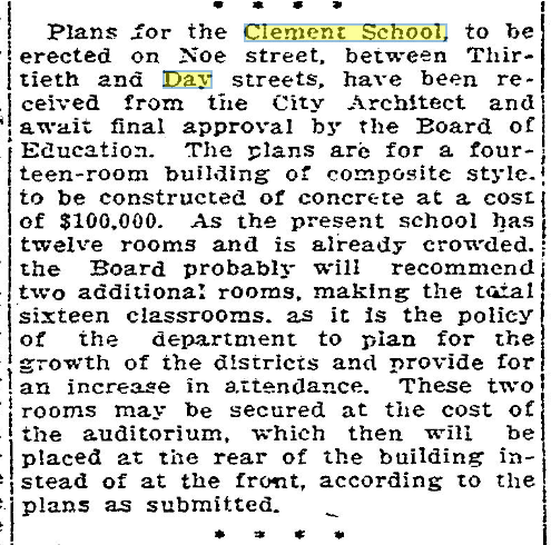
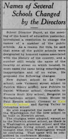
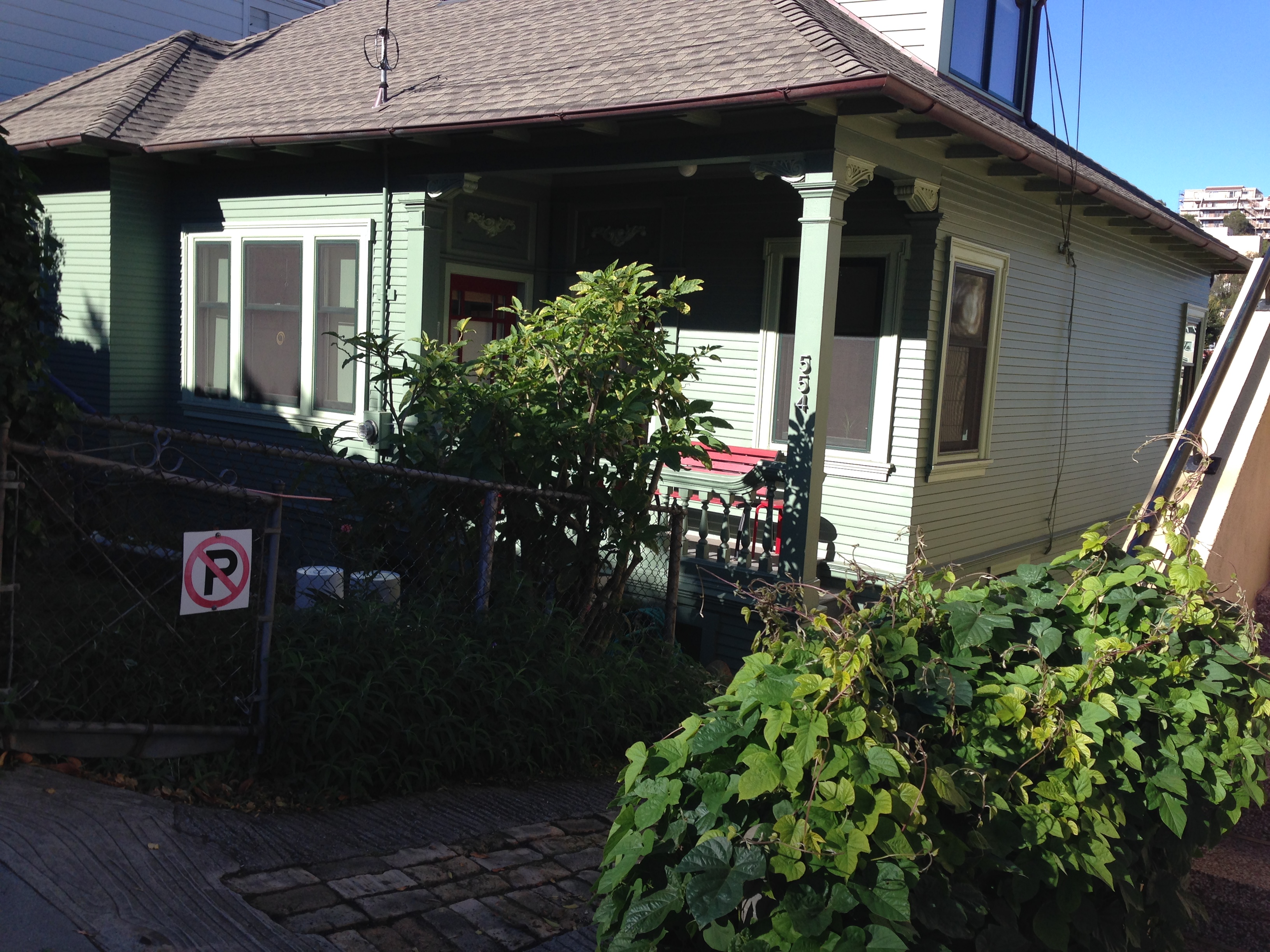
In 1909 the city purchased the Day/Noe/30th/Castro block and filed plans for a new school building (Chronicle 03/10/1909, 05/01/1909). The second photo looks SW from Noe/Day in 1912. The new Clement School, renamed as Kate Kennedy School in 1911 (Call 11/09/1911), fills the west side of the block of Noe between Day/30th. The third house from the left edge is 513 30th and the house at the right is 554 30th. The big bare hill is Fairmount Hill; its crest is roughly at Digby/Everson in Diamond Heights. The other buildings at right would be on Laidley or Beacon near Billy Goat Hill, possibly related to the Gray Brothers quarry. I believe none of those buildings exist today, but one is visible in the 1890 dairy photo above.
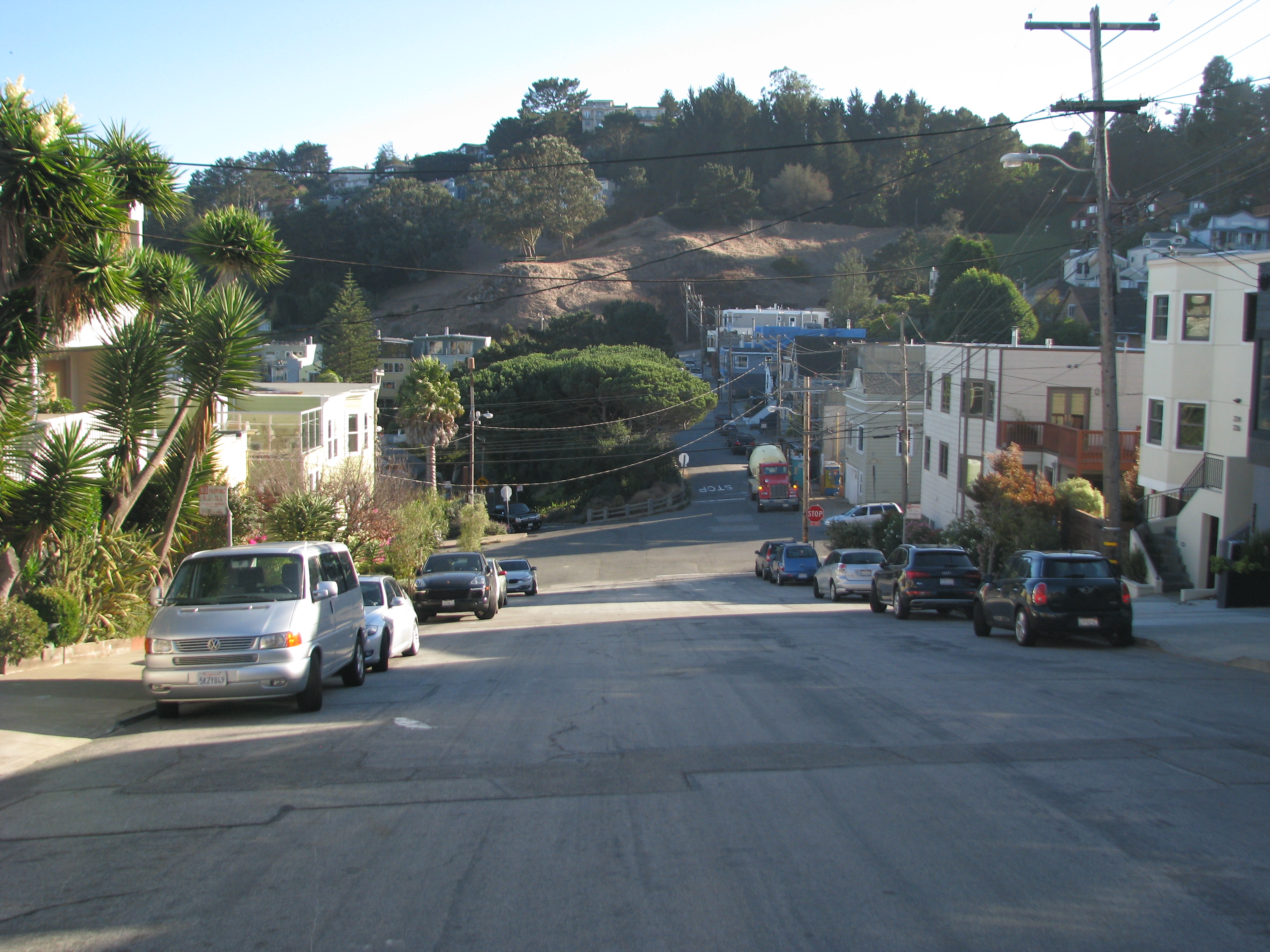
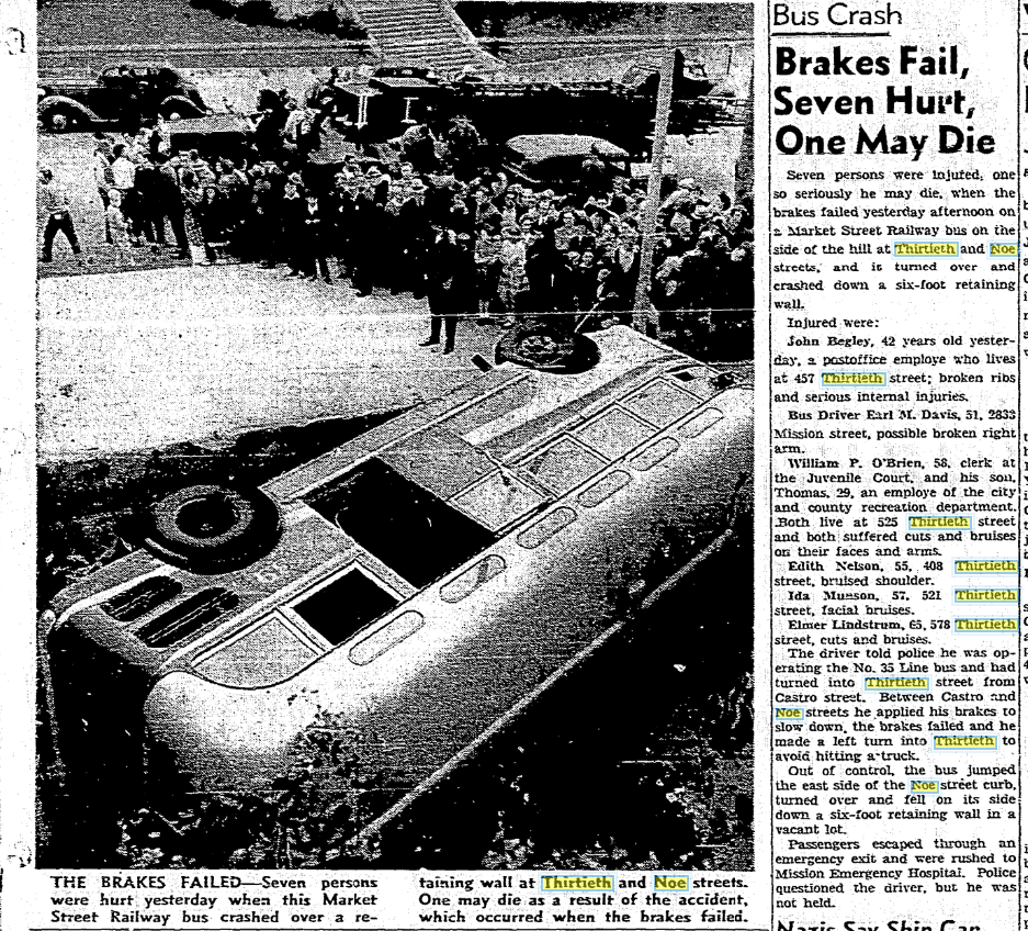
Looking west on 30th to Billy Goat Hill and Gold Mine Hill from Noe, in 1926 and on 10/21/2017. 532 30th is on the left. The Model T seems to have a motor problem. I'm guessing that the very young girl at the center is caretaker for the even younger little tot in front of her. The fence at right bounds the Kate Kennedy School playground. A bus coming down the hill in 1942 lost its brakes and overturned at this corner, causing a fatal injury (Chronicle 07/03/1942).
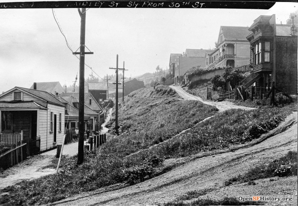
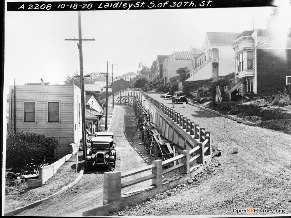

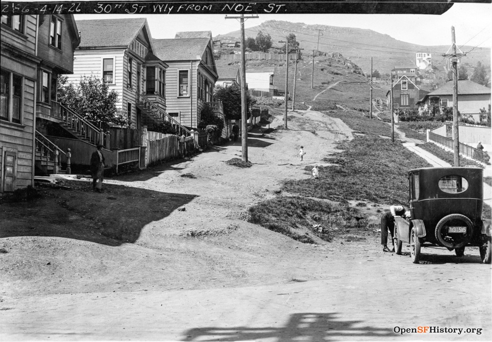
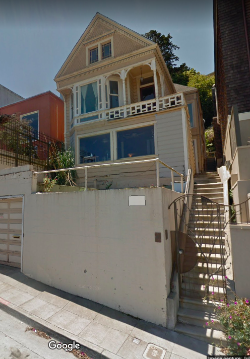
The first block of Laidley starts at 30th just below Castro. The 4/14/1926 photo shows only footpaths on the steep slope, but three years later on 10/18/29 the slope has been graded and construction is in progress on a divided road retaining wall. The second house on the right is 44 Laidley, remarkably well preserved today.
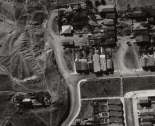
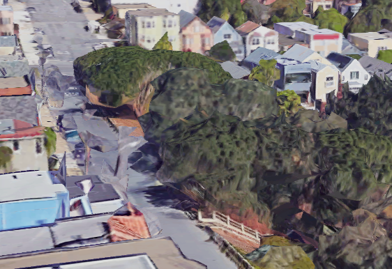
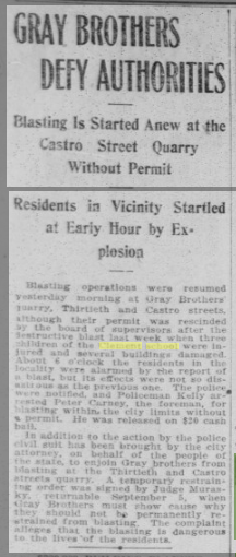
30th dead-ends just west of Castro, at the Gray Brothers quarry site. The Gray Bros. were notoriously lousy neighbors (Chronicle 09/14/1895, 08/25/1908; Call 04/20/1896, 04/30/1907, 02/21/1908, 09/01/1908) as well as lousy employers, and on 11/10/1914 a disgruntled employee murdered co-owner George Gray at the quarry (Chronicle 11/12/1914). Online sources date this photo looking west up 30th from Castro to Gold Mine Hill as ca. 1940, but that cannot be correct, it must be much earlier. The ca. 1910 photo above pinpoints the location of the quarry building relative to 626 30th, and it's gone in the 1938 aerial view (rotated here to correspond to the photo, west at the top). Yenne's San Francisco's Noe Valley dates this photo as ca. 1920, which seems much more likely.
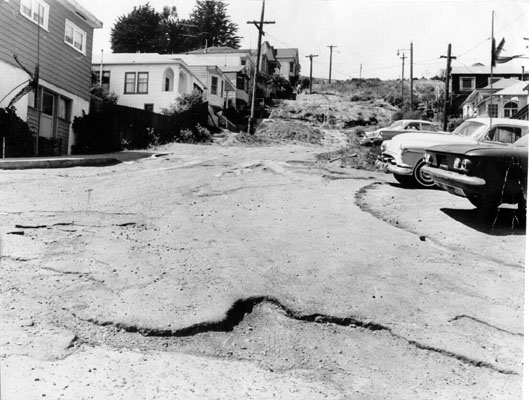
Day Street westbound jogs right before Castro as seen above, but past the Day Street steps it resumes above Castro for a short dead-end half block. This picture from 8/25/1962 looks west up unpaved Day from Castro. It was paved the following year.

Tired from all that walking? Me too, it's the hills. But they produce great views, like this one from the top of our hill ca. 1957, looking east on 29th from Diamond toward Bernal.
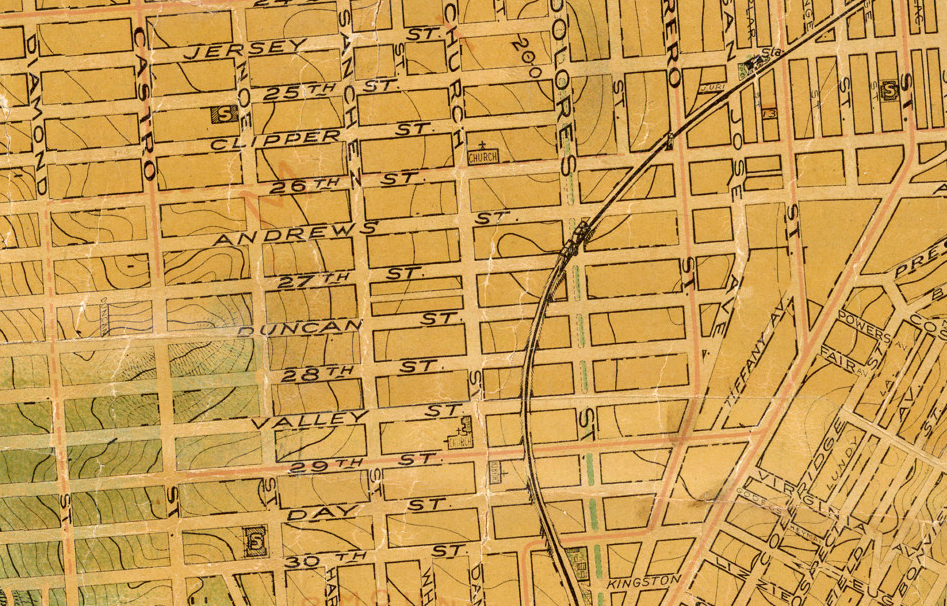
We're done walking around, now we can sit down and rest and see where we've been. This piece of a beautiful 1915 map shows the streetcar line on 29th and the SP track (Dolores bridge and overpasses drawn in), and contour lines show the hills. The westerly extensions of Valley / 29th / Day / 30th uphill past Castro or Diamond do not represent reality, neither then nor now. Andrews is an extension of Army, now Cesar Chavez.
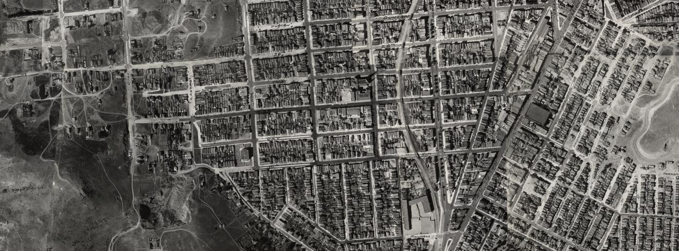
A small section of an amazing 1938 aerial view shows Upper Noe Valley as seen in the overview from Bernal at the top of this page. Douglass is at left, 27th at top, Bernal Heights at right, Randall at the bottom. The S.F. Planning swipe map compares the 1938 and current aerial views.
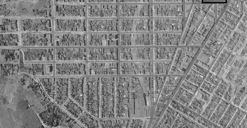
A decade later, a 1948 aerial view shows the railroad overpasses and berm removed and the beginning stages of building on the former right-of-way.
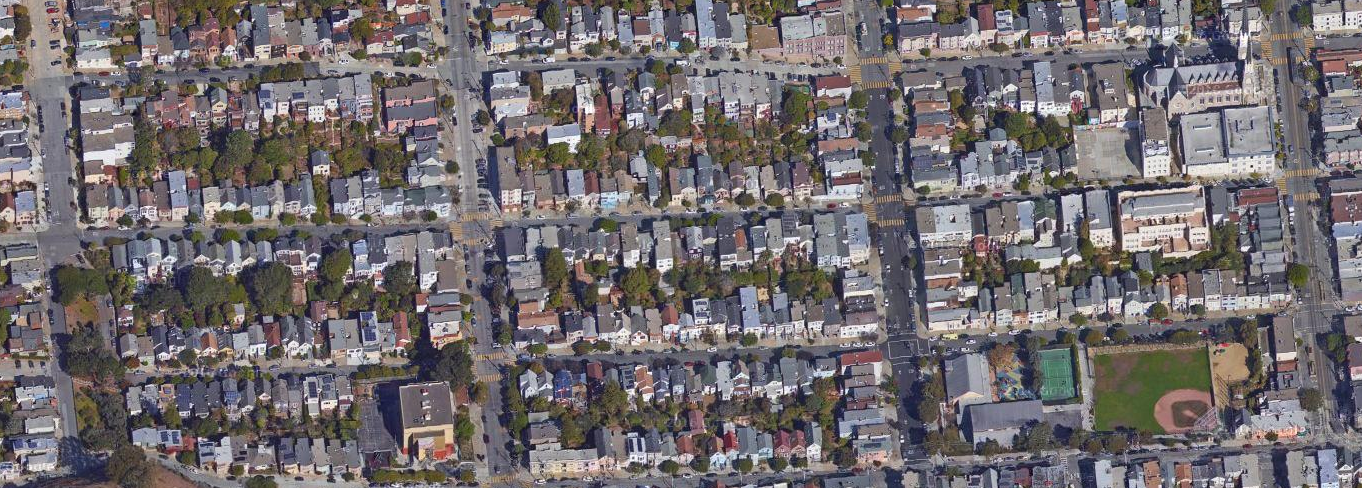
Finally, a narrower 2017 satellite view, from 30th/Castro at lower left to Valley/Church at upper right. Upper Noe Rec (a.k.a. Day Street park, between 30th/Sanchez and Day/Church, including the softball diamond) didn't exist yet in the 1938 view above, the block was fully occupied with houses. The SP right-of-way was a block east of this block, so the genesis of Day Street park is unrelated to the removal of the SP tracks. I'd like to know more details about the park's creation.
Open questions:
- When did streetcar service on 29th end?
- When were the SP tracks and overpasses removed? (Early 1940s, but I'd like more precise information.)
Send email if you know, thanks!
Articles:
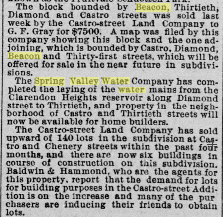
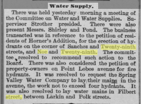
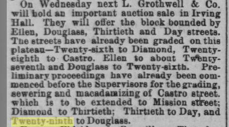
- Daily Alta California: 09/28/1884 (hydrants), 07/06/1887 (5c robbery), 08/28/1888 (sewers), 10/20/1889 (cow ordinance), 04/11/1891 (Mitchell cows), 05/25/1891 (real estate).
- San Francisco Call: 12/07/1890 (hoodlums), 05/11/1891 (horse accident), 06/04/1892 (Mitchell cows), 05/15/1893 (29th trolley), 09/18/1893 (29th widening),03/27/1894 (accident), 04/24/1894 (carbarn), 04/30/1894 (bombing), 07/27/1895 (Duncan bridge), 11/20/1895 (29th trolley), 11/24/1895 (29th trolley), 04/20/1896 (real estate, water), 04/30/1907 (Gray Bros.), 05/04/1907 (water), 07/21/1907 (shooting), 07/23/1907 (shooting), 02/21/1908 (paving), 08/31/1908 (road work), 09/01/1908 (Gray Bros.), 09/14/1908 (road work), 09/16/1908 (hydrants), 11/09/1911 (Clement School renamed), 08/23/1912 (Duncan bridge), 08/28/1913 (accident).
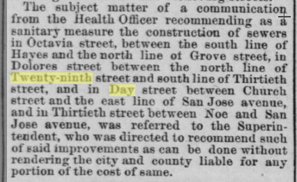
- San Francisco Chronicle: 12/24/1881 (29th tunnel), 12/10/1885 (cow ordinance), 05/23/1886 (accident), 02/03/1887 (untaxed Murray cows), 09/05/1889 (suicide), 10/04/1889 (tannery), 01/31/1890 (bridge), 05/04/1891 (SFSMRR), 05/11/1891 (horse killed), 06/04/1891 (child killed), 12/12/1891 (SFSMRR), 11/27/1893 (accident), 01/08/1894 (house), 01/29/1894 (accident), 04/07/1894 (carhouse), 05/10/1894 (29th trolley), 07/07/1894 (29th trolley), 04/30/1894 (bombing), 08/28/1894 (trolley accident), 08/29/1894 (accident), 09/16/1894 (29th trolley), 09/19/1894 (accident), 09/22/1894 (crossing danger), 09/14/1895 (Gray Bros.), 05/13/1901 (SFSMRR sale), 03/31/1902 (accident), 04/01/1902 (crossing danger), 07/04/1903 (accident), 05/24/1904 (real estate), 08/25/1904 (accident), 11/05/1905 (accident), 04/25/1907 (proposed park), 07/22/1907 (shooting), 08/25/1908 (Gray Bros./Clement School), 11/14/1908 (Mission), 04/23/1911 (fire), 03/10/1909 (Clement School site), 05/01/1909 (Clement School building), 02/01/1913 (Duncan bridge), 11/12/1914 (Gray murder), 08/18/1922 (Valley improvements), 07/03/1942 (bus accident), 11/17/1947 (Noe Valley dairies), 05/17/1949 (UNRec eminent domain), 12/29/1950 (UNRec funds), 02/01/1951 (UNRec house sales), 12/11/1953 (Upper Noe Rec), Chronicle)19550322 (UNRec bid rejected).
- Upper Noe Valley Neighborhood Council: Report of the History Committee, November 1959.
Maps:
- 1869
- 1895 (Rand McNally)
- 1898 (marked with 1900 census enumeration districts; includes many streets planned but never built)
- 1915 (with current satellite view overlay, try it!)
- 1927 (DPW, rev. 1929)
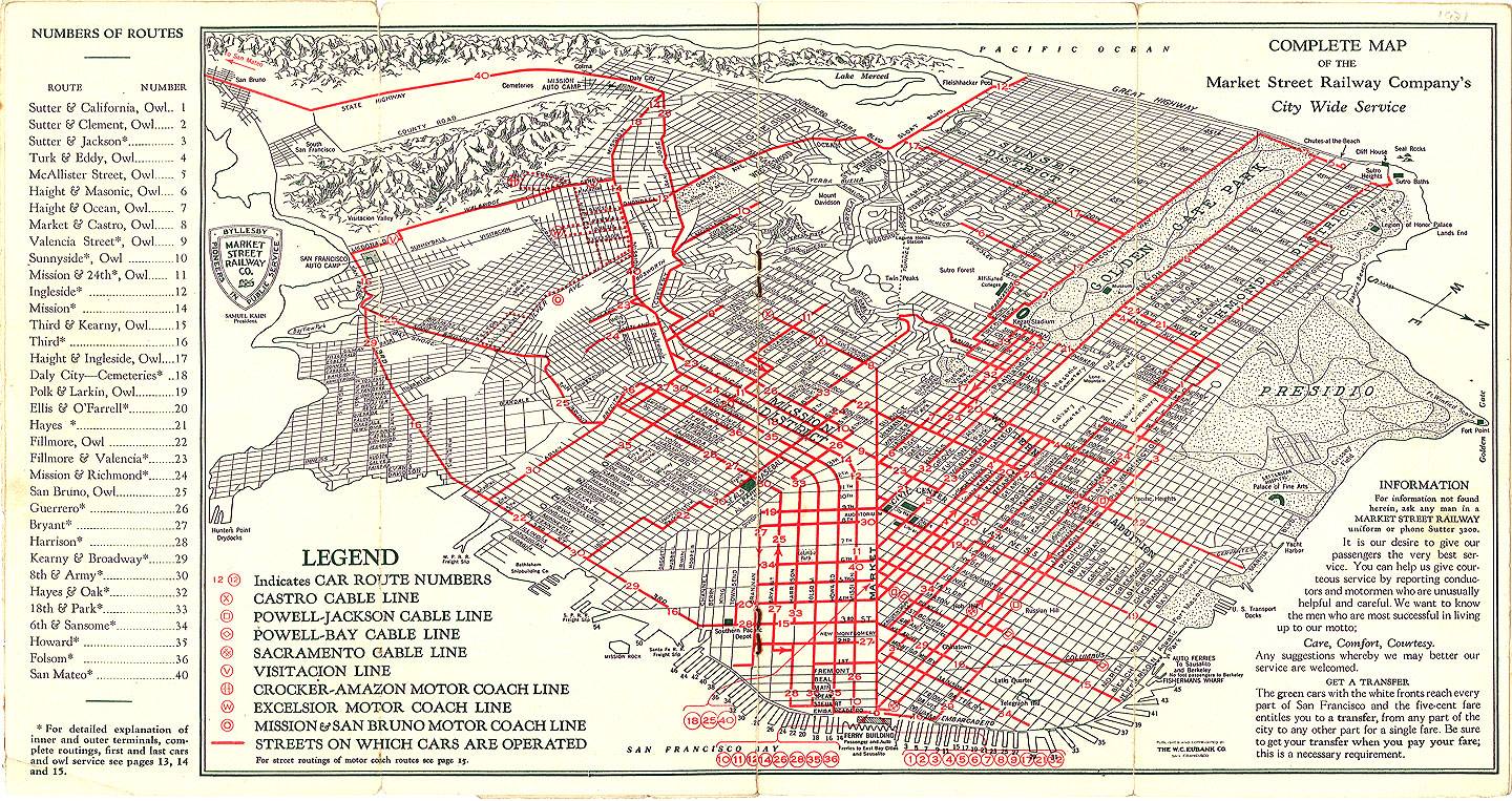
- 1934 (Market St. Railway)
- 1935 (Division of Highways)
- 1938 (amazing composite aerial view covering all of SF)