San Francisco Maps
This page contains a chronological list of San Francisco maps and birds-eye views, mostly hosted at davidrumsey.com. You can search all of the Rumsey San Francisco maps here; there are many many more.
| Year | Name | |
|---|---|---|
| 1849 | Eddy/Zakreski/Michelin | |
| 1851 | Eddy & Jones | |
| 1853 | Parker's | |
| 1853 | US Coast Survey | |
| 1853 | Williamson | Explorations and Surveys in CA [RRs] |
| 1854 | Butler | Horner's Addition |
| 1857 | US Coast Survey | |
| 1863 | Gensoul | |
| 1864 | Butler | |
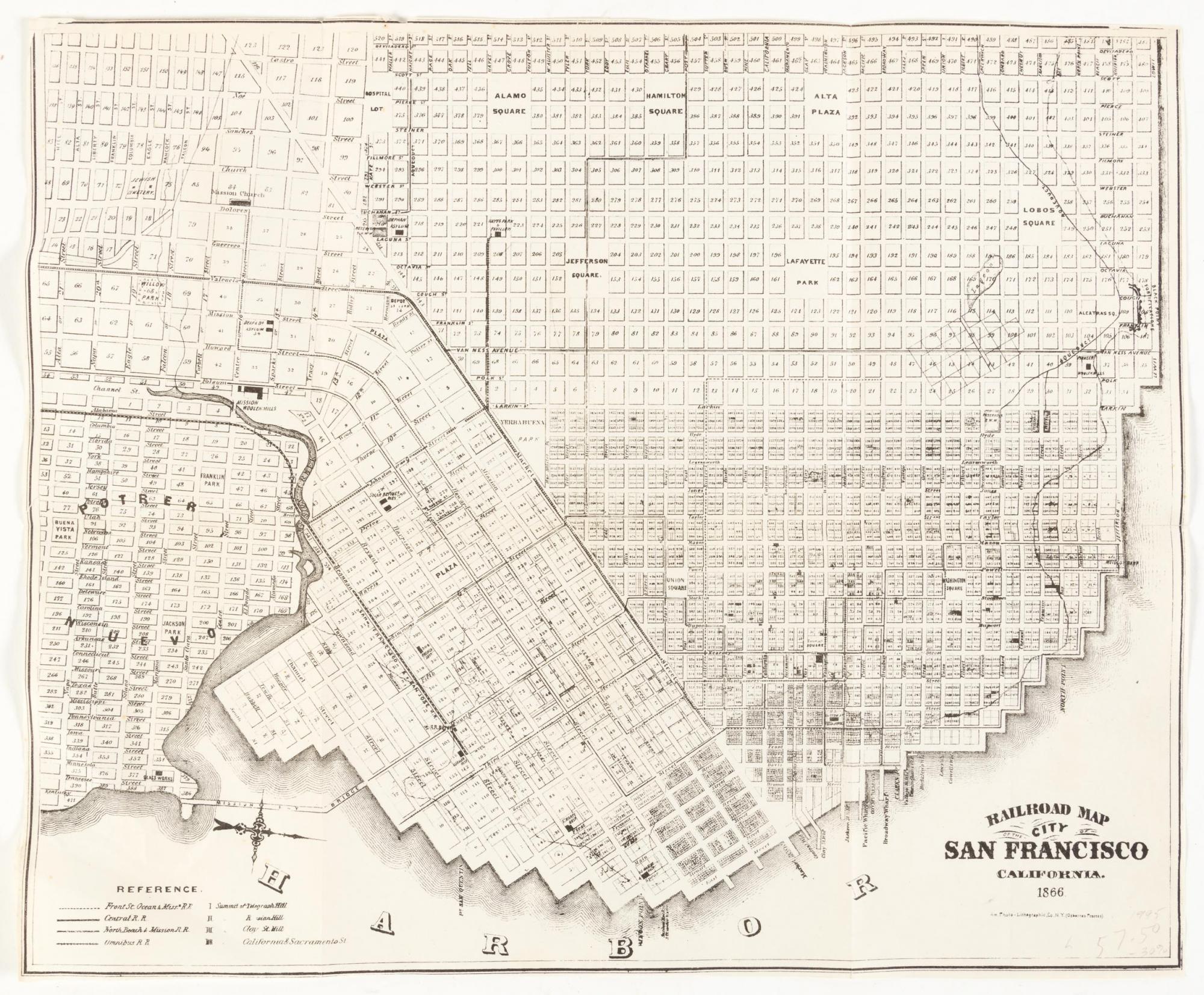
| 1866 | Railroad | Railroad Map of SF |
| 1868 | Goddard | birds-eye view |
| 1868 | Britton & Rey | Outside Lands |
| 1869 | Goddard | |
| 1869 | U.S. Coast Survey | |
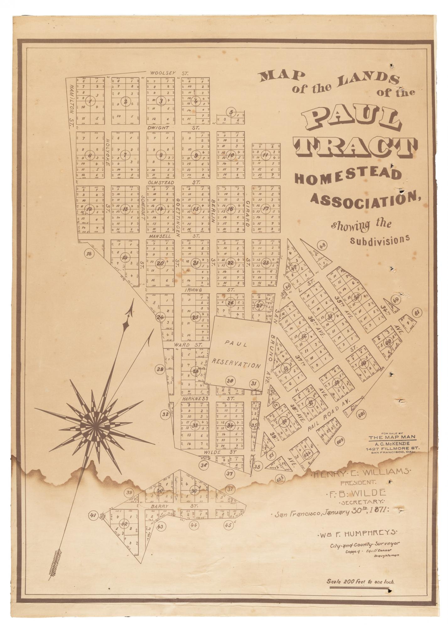
| 1871 | Paul | Paul Tract |
| 1873 | Bancroft | |
| 1873 | Gray & Gifford | birds-eye view |
| 1873 | Langley | |
| 1876 | Goddard | birds-eye view |
| 1877 | Jacoby | birds-eye view |
| 1878 | Gray | |
| 1878 | Currier & Ives | birds-eye view |
| 1884 | US Coast Survey | |
| 1885 | Farwell | Chinatown [LoC; cf. Bancroft @ Rumsey] |
| 1885 | Bancroft | Chinatown [Rumsey; cf. Farwell @ LoC] |
| 1886 | Mitchell | |
| 1887 | Britton & Rey | |
| 1890 | Langley | |
| 1891 | Appleton | |
| 1891 | Bancroft | |
| 1895 | Rand McNally | |
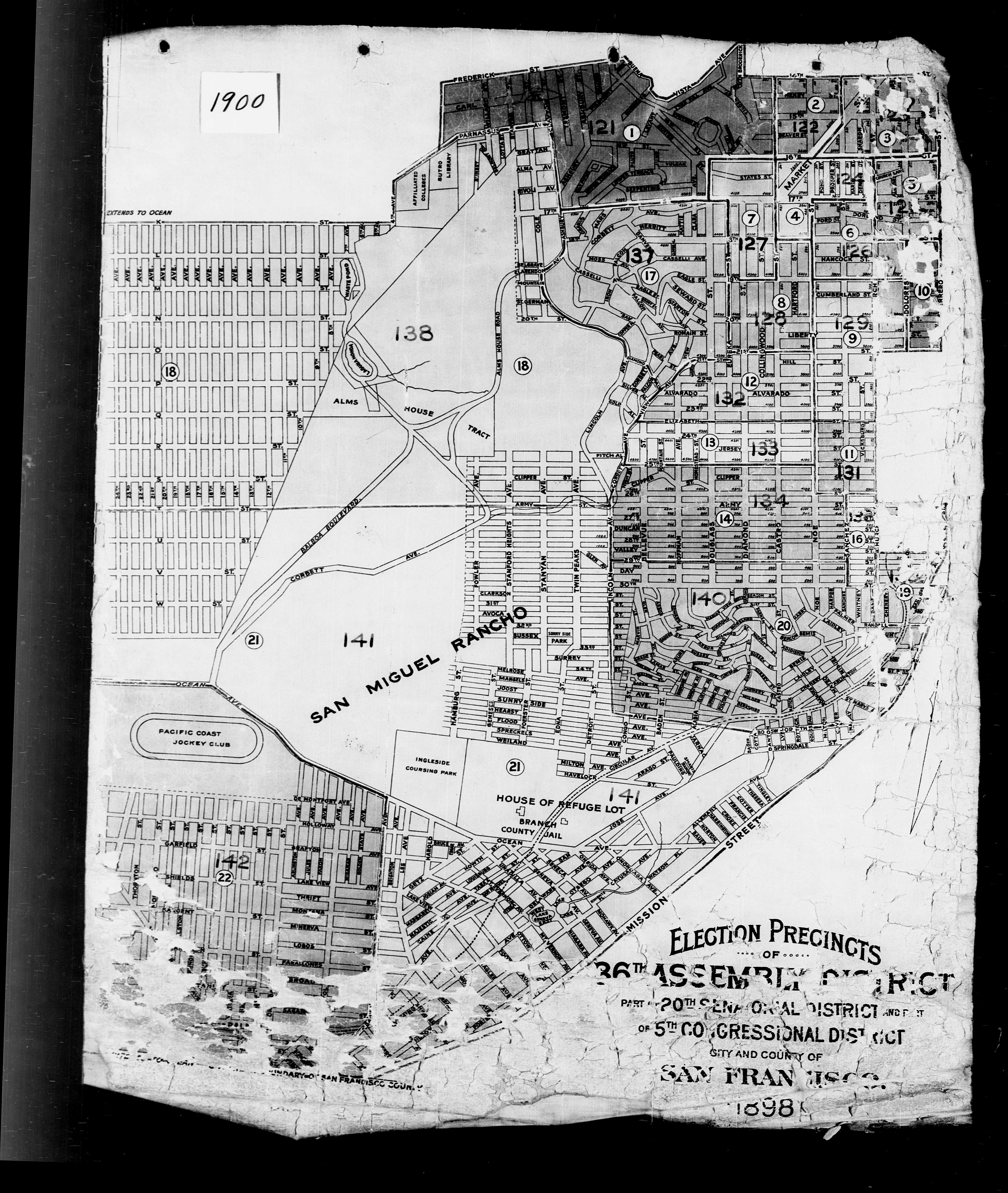
| 1898 | Election Precincts | marked with 1900 census enumeration districts; includes many streets planned but never built |
| 1901 | DeWitt | |
| 1901 | Cram | |
| 1905 | Sanborn | |
| 1908 | Punnett | Two Years After |
| 1912 | N.A. Press | The Exposition City |
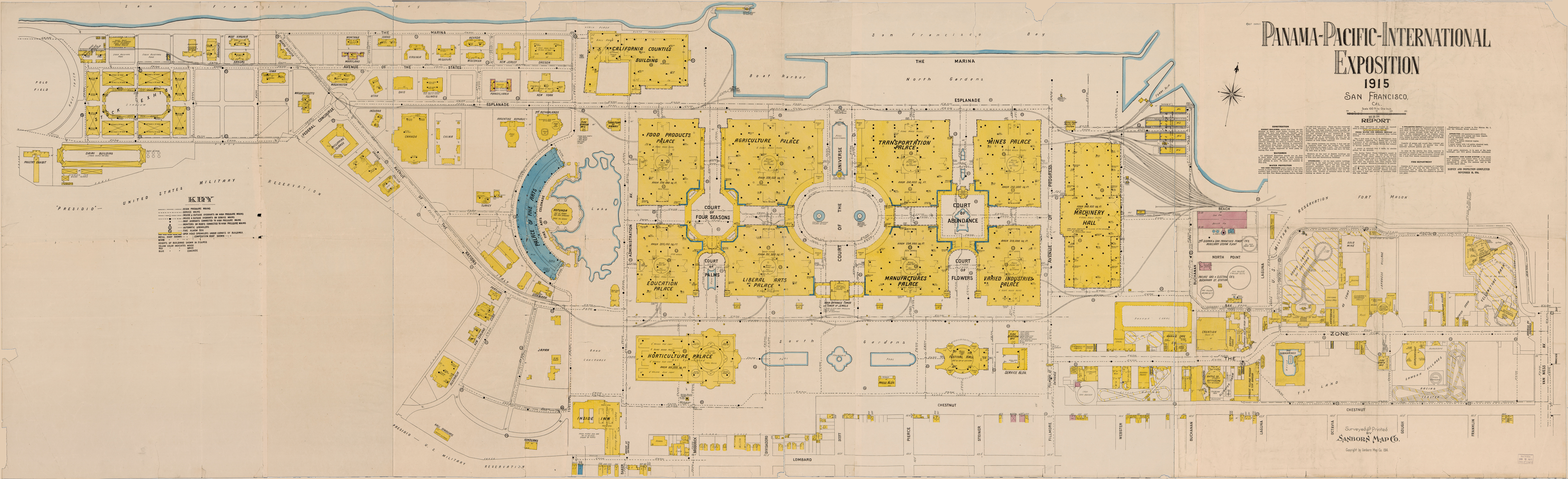
| 1914 | PPIE | Sanborn |
| 1914 | Southern Pacific | |
| 1915 | Chevalier | with current satellite view overlay |
| 1927 | DPW | rev. 1929 |
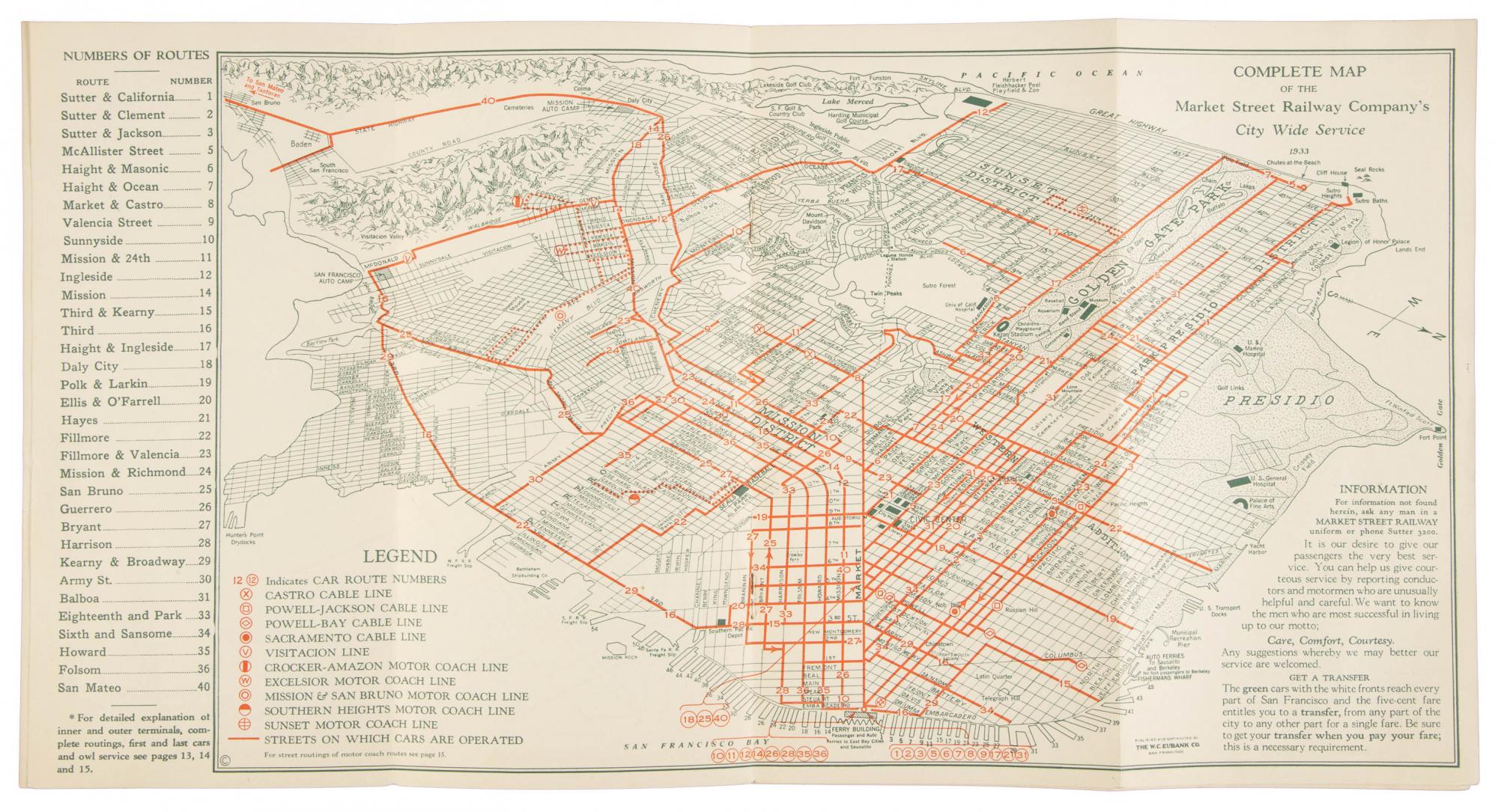
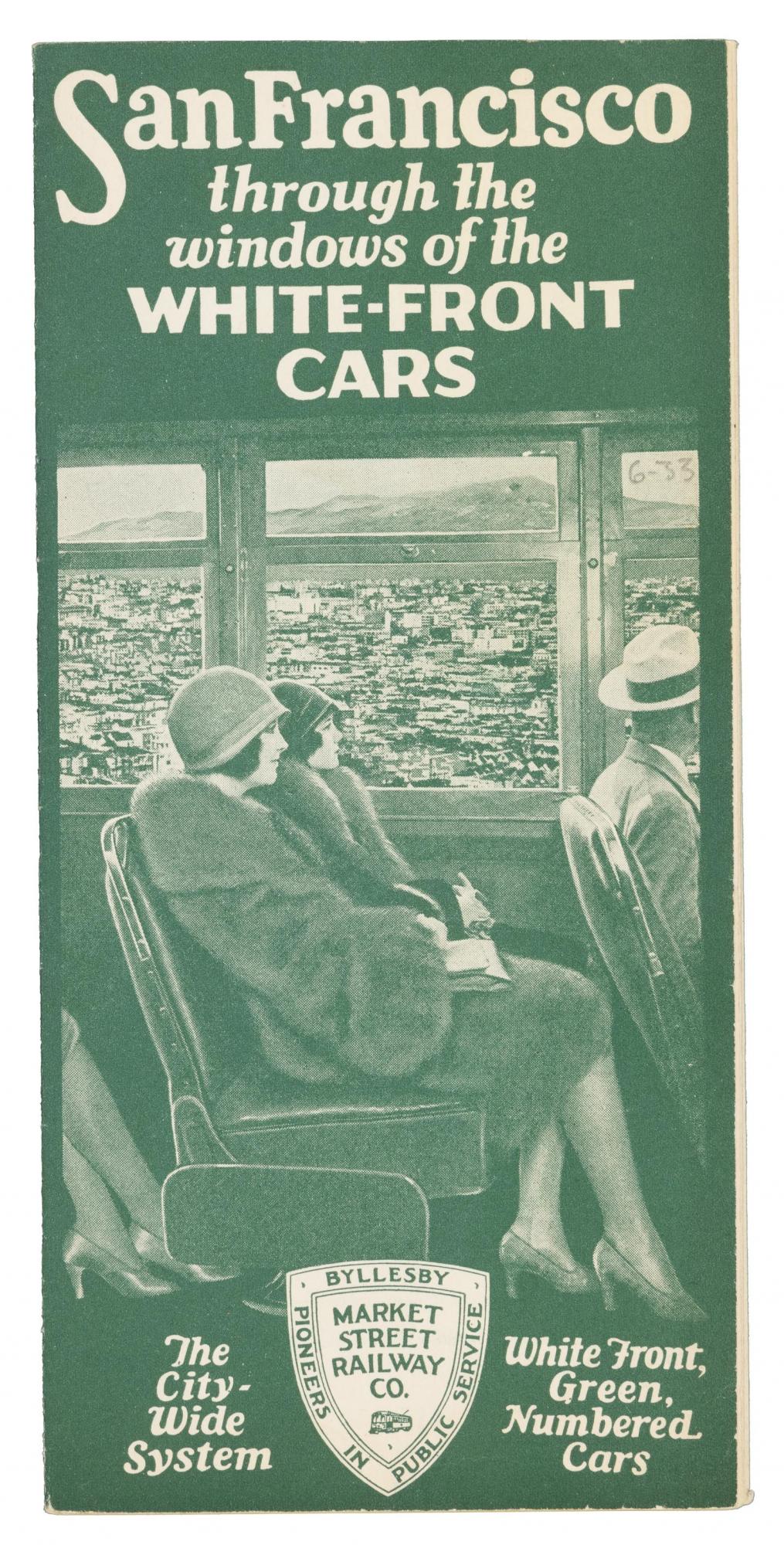
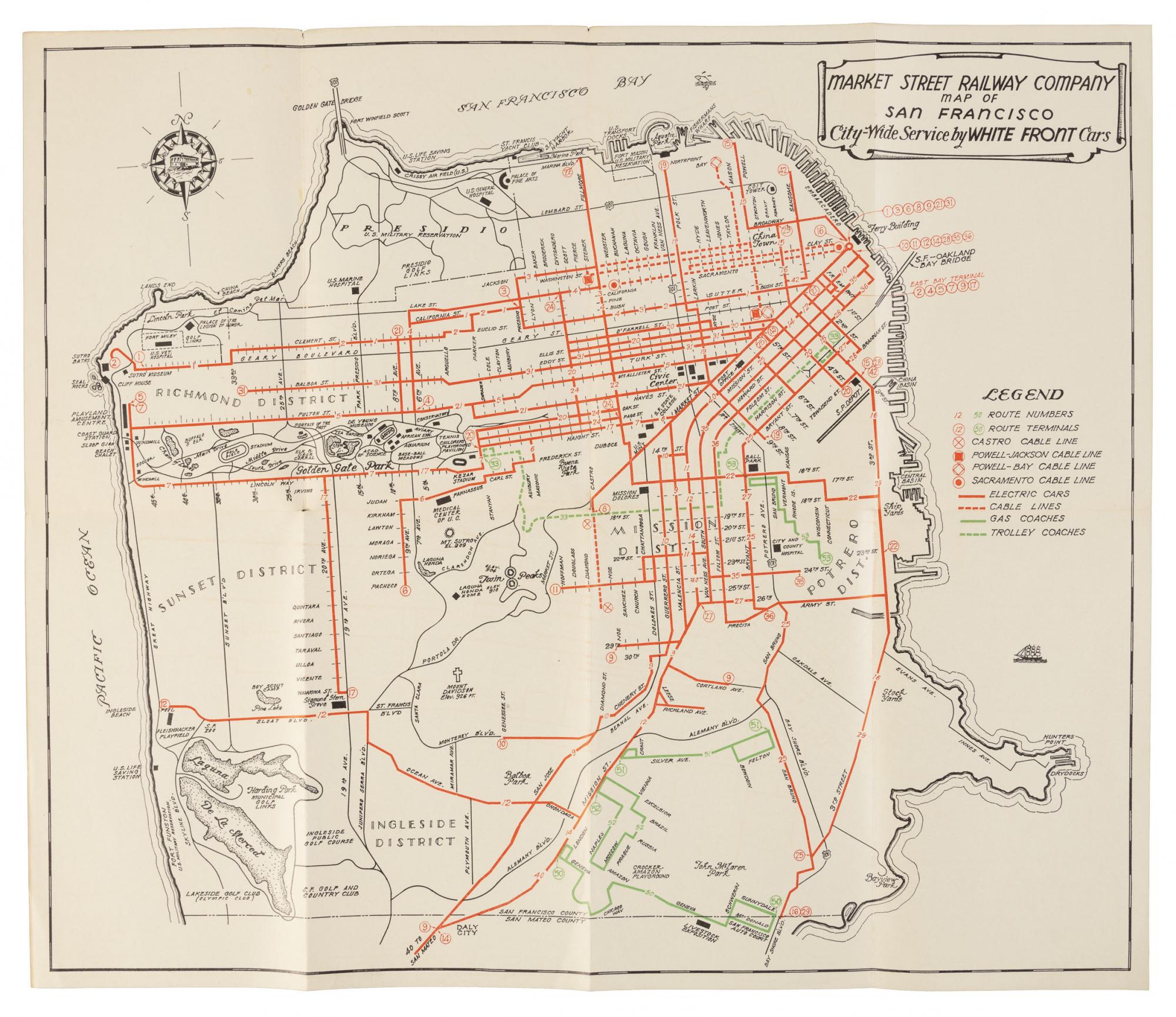
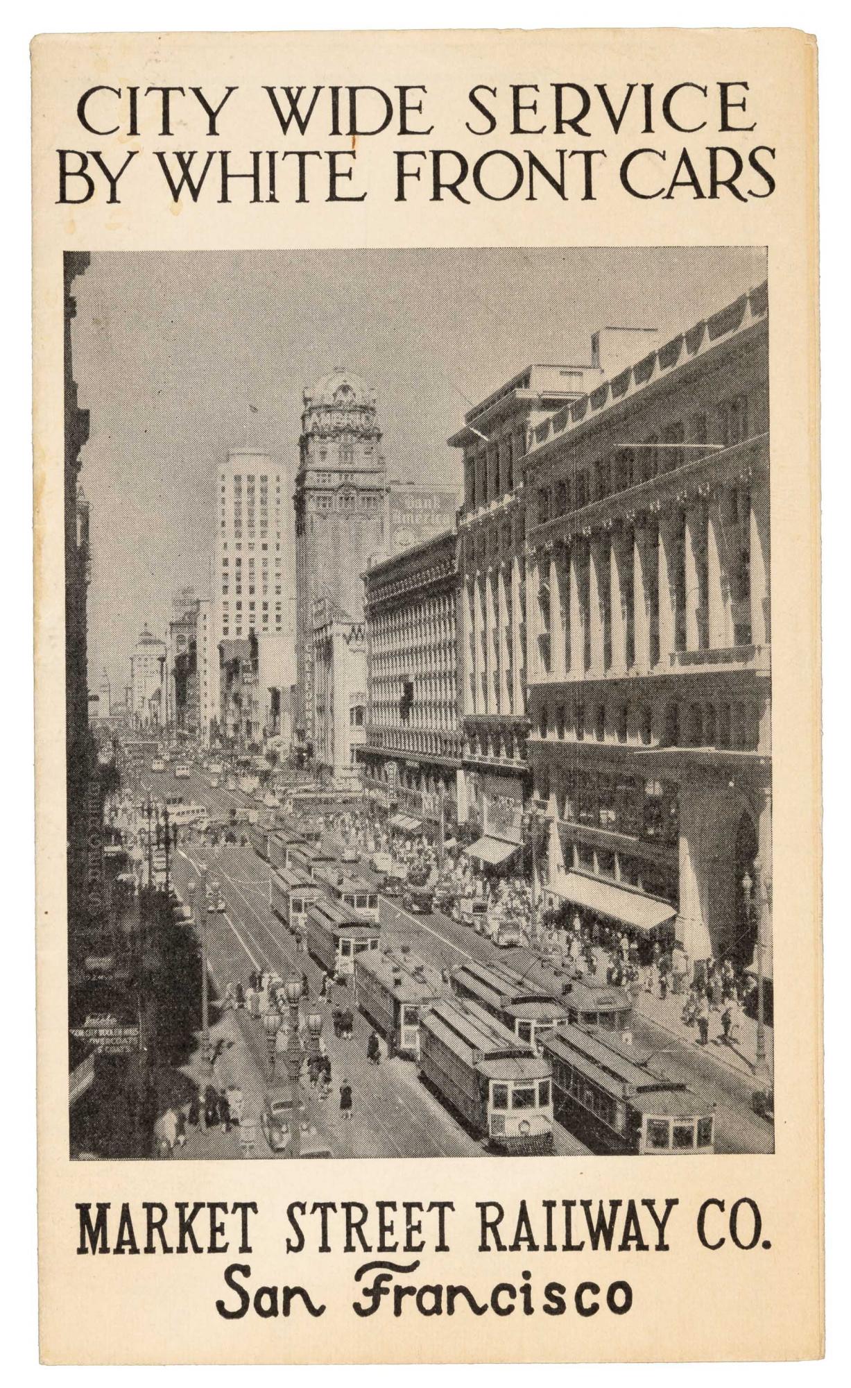
| 1933 | Market St. Railway | Market St. Railway [also cover and index] |
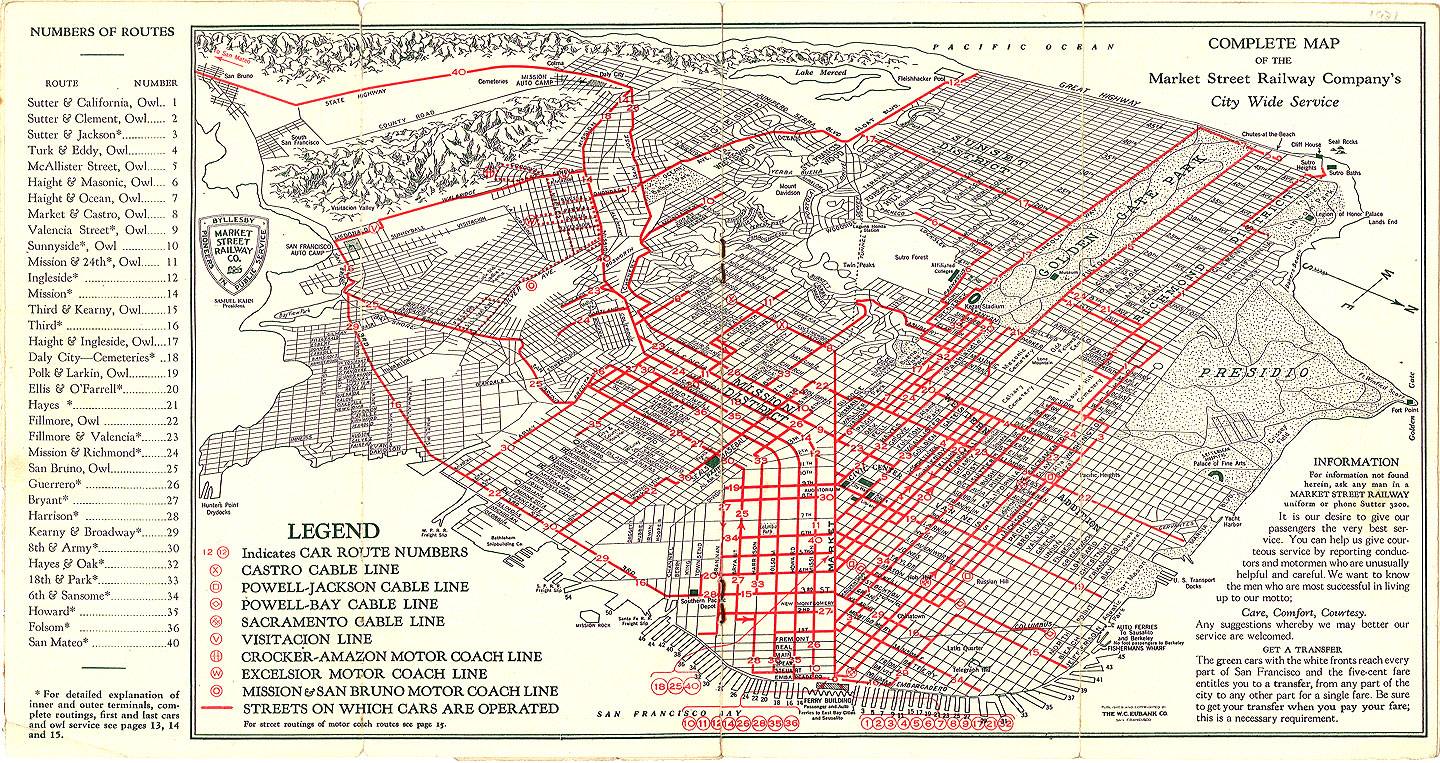
| 1934 | Market St. Railway | |
| 1935 | DPW | Division of Highways |
| 1938 | Ryker | amazing composite aerial view covering all of SF |
| 1939 | Market St. Railway | Market St. Railway [also cover] |
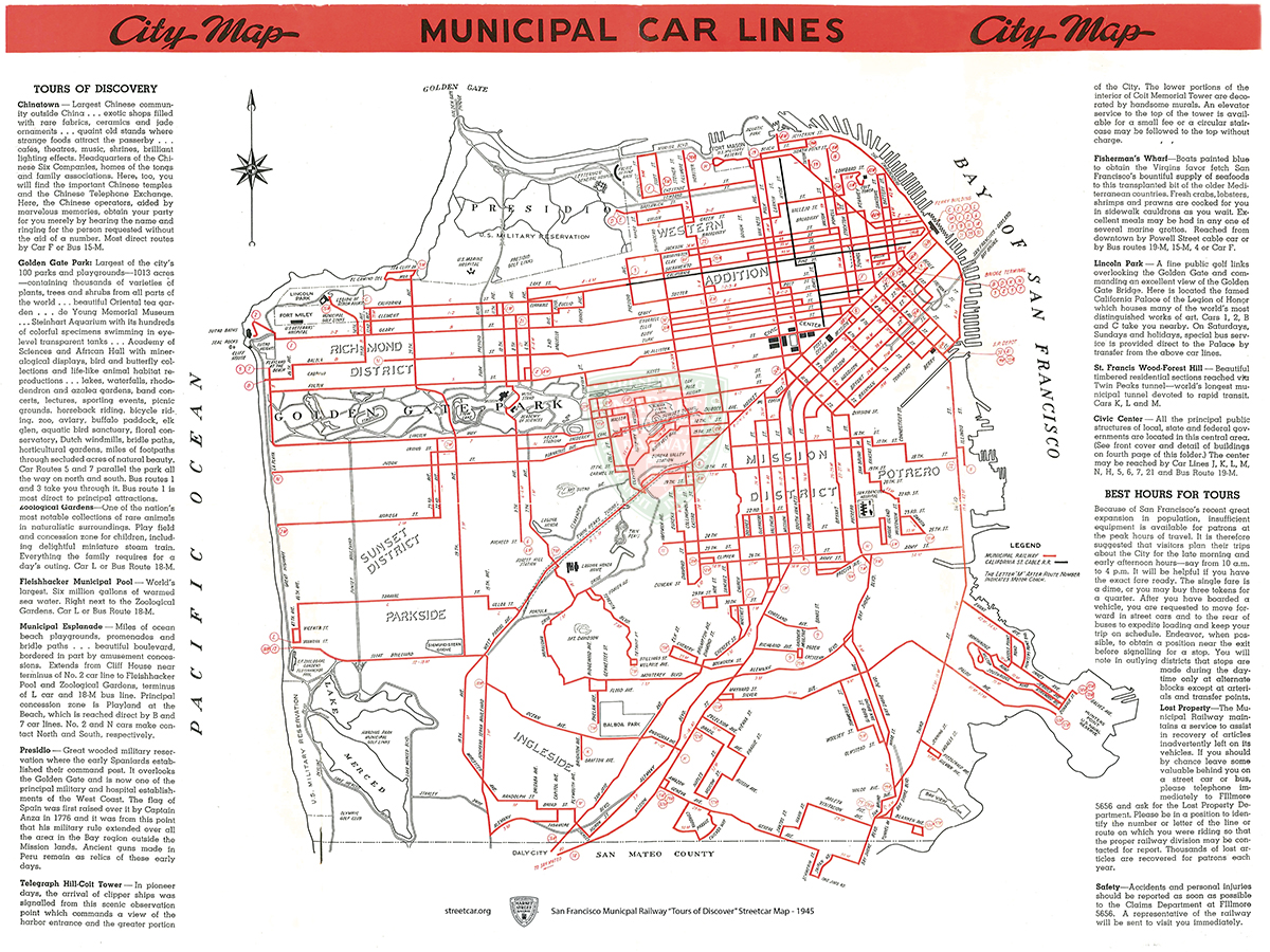
| 1945 | Municipal Railway | |
| 1948 | De Leuw | Trafficways plan |
| 1948 | LinOtype | SF Planning Commission |
| 1948 | Ryker | aerial view [no finder map yet; Upper Noe = 82] |
| 1953 | Standard Oil | [a.k.a. Gousha; also front] |
| 1956 | Shell | |
| 1957 | Municipal Railway |