Protestant Orphan Asylum
The San Francisco Orphan Asylum Society was founded in 1851 and opened an orphanage in Happy Valley on 3/19/1851. This page is about their subsequent location, near what we now call Mint Hill. Today (in 2025) the Edgewood Center for Children and Families is the successor of the Society.
Click on any image to enlarge, then use the Back button on your browser to return.
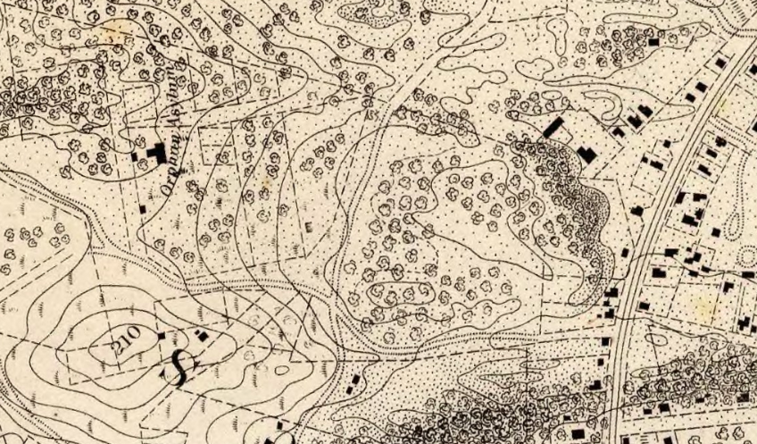
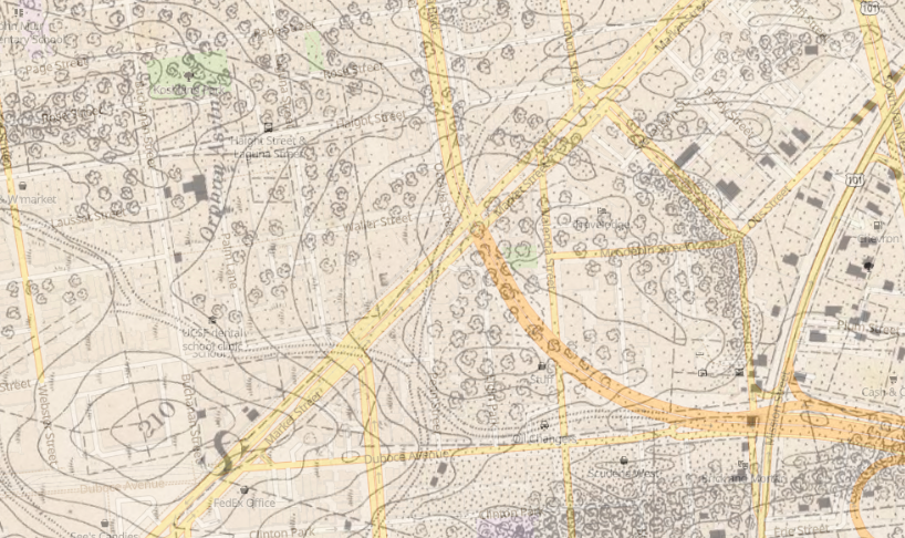
When the orphanage needed more space, the Society purchased for $100 a large parcel in a very remote location, now the two city blocks bounded by Laguna/Hermann/Buchanan/Haight. A new orphanage building opened on 3/22/1854. The 1857 U.S. Coastal Survey gives an enlightening picture of developing San Francisco: Market Street is blocked past 3rd and there are few buildings west of Yerba Buena Cemetery (now Civic Center), mostly along Mission. The map detail above (georeferenced version at right) shows the new Orphan Asylum at top left and Mission Street at right. The 210' rock directly south of the orphanage was then known as Clinton Mound or Rock Hill, now Mint Hill, since 1937 the site of the U.S. Mint (the "new Mint").
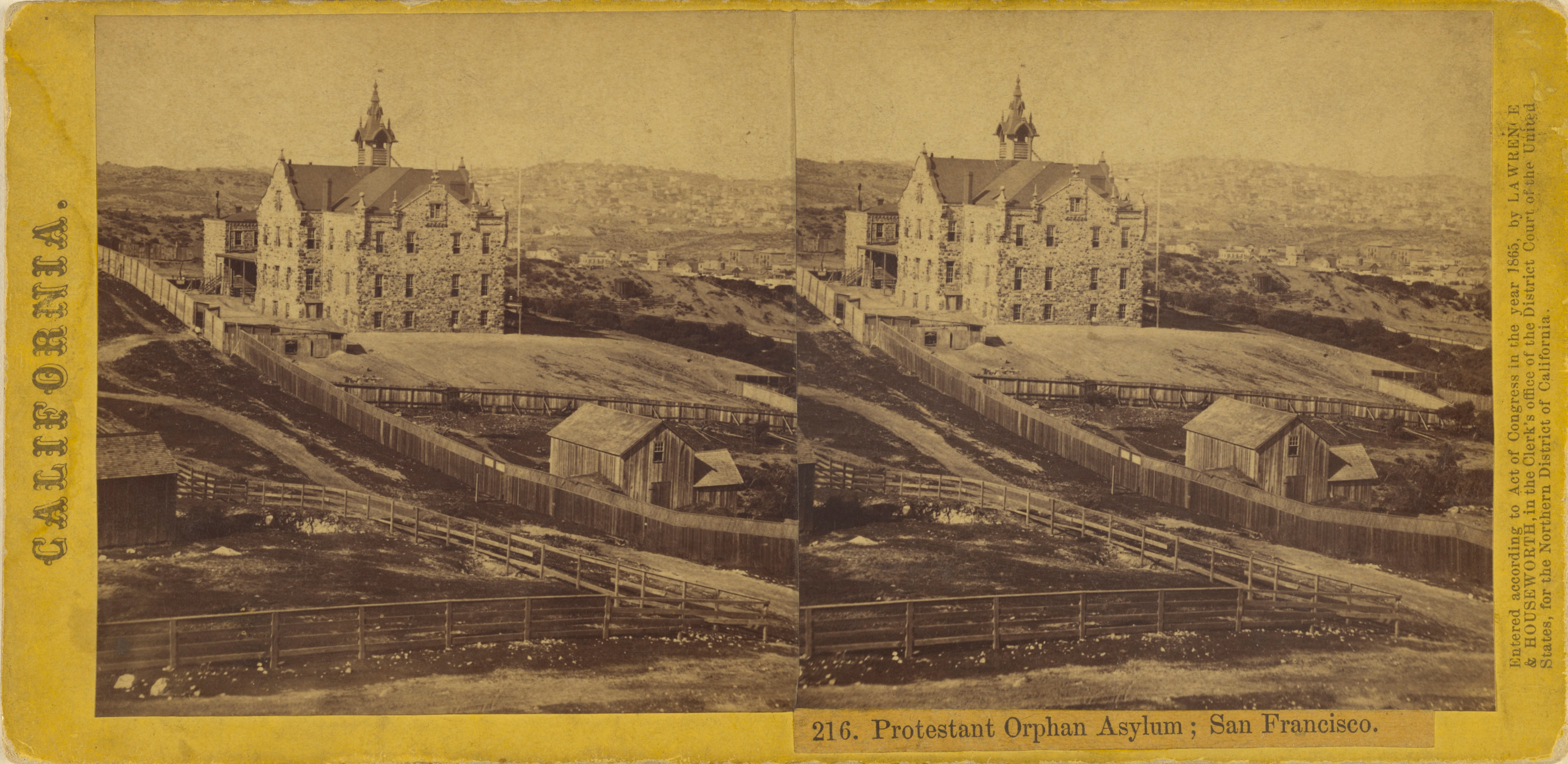
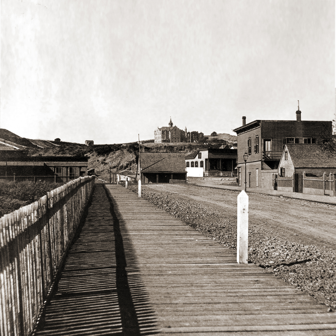
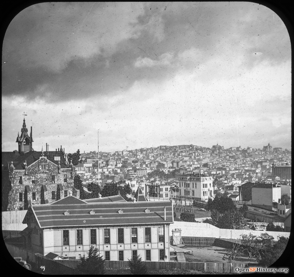
Houseworth stereoview 216 from 1865 (click here to display for cross-eyed viewing) looks north to the orphanage from Clinton Mound. The 1860s image at right looks west up Waller from just below Laguna.

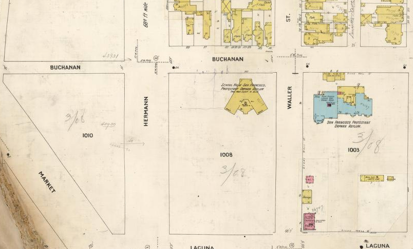
By 7/18/1900, the neighborhood was built up and the orphanage was ivy-covered. The society built a V-shaped school on Buchanan between Hermann/Waller, as seen ca. 1905 in the photo at center from Hermann/Buchanan and on the 1905 Sanborn map (detail from Vol. 3 sheets 283-284; north at right).
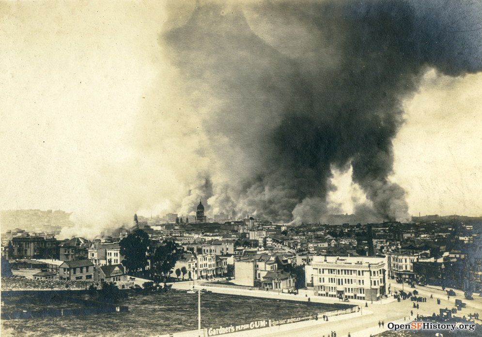
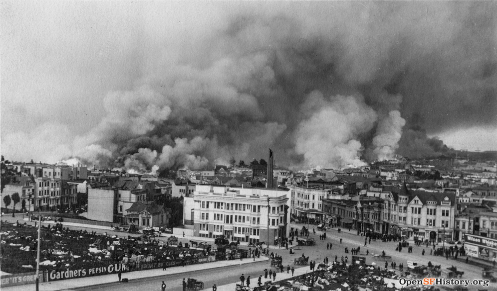
Earthquake day 4/18/1906, looking east from Clinton Mound; the fenced open space at lower left is the orphanage schoolyard block, and the three orphanage outbuildings (WC, storage, laundry) in the Sanborn map above are at the left edge (Waller/Laguna). The earlier photo at left shows a small smoke plume from the nearby "ham and eggs" fire that started about 9 AM at Hayes/Gough, but the earthquake-damaged dome of City Hall remains visible in front of the much larger plume from downtown. In the photo at right, the vacant schoolyard open space and the streets are filling with people, smoke obscures the City Hall dome, flames are much nearer. The buildings on Laguna and Waller in the foreground survived, but the buildings across Market at Guerrero did not. The Wilson Whiskey billboard at lower right is absent in the 4/19/19 picture below, a mysterious casualty of a tumultuous day. Mint Hill 1906 contains more views of the fire from Clinton Mound.
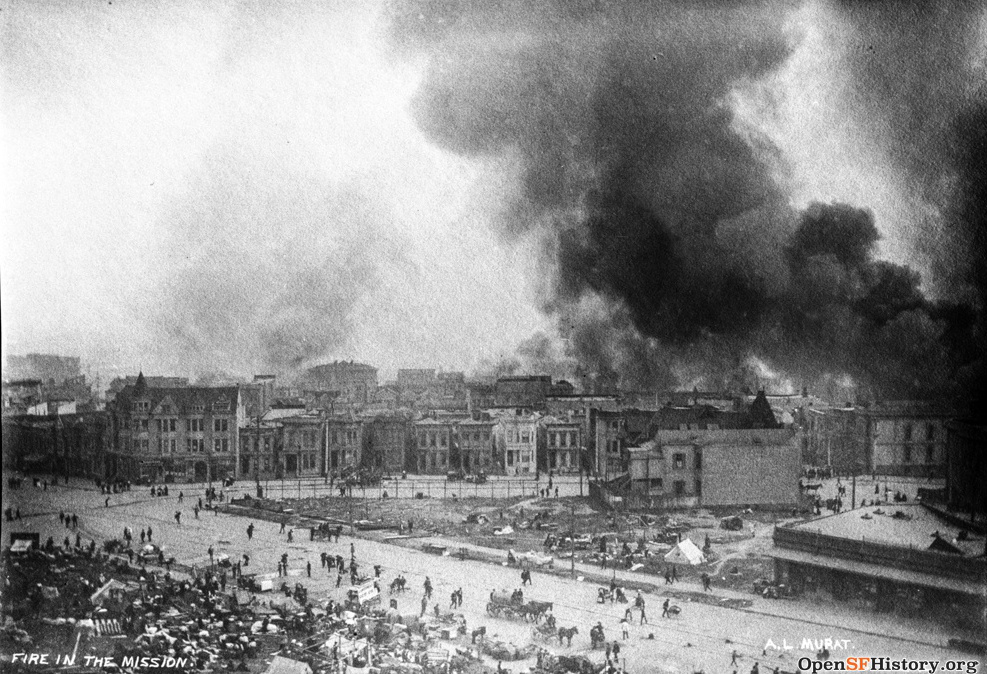
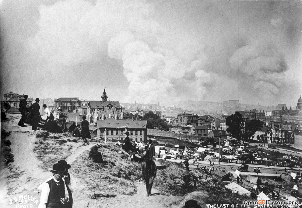
Kennedy's fire timeline describes the progress of the fire in detail. Left: looking east across Market at Guerrero on the second day (4/19/1906), captioned "Fire in the Mission". The fire directly threatens the houses on Guerrero, they will all burn very soon. Right: looking north past the school and orphanage from Clinton Mound on the third day (4/20/1906), captioned "The last of the San Francisco fire". Many more tents and refugees. Fires in the Mission and around City Hall are out, but fire continues east of Van Ness further north.

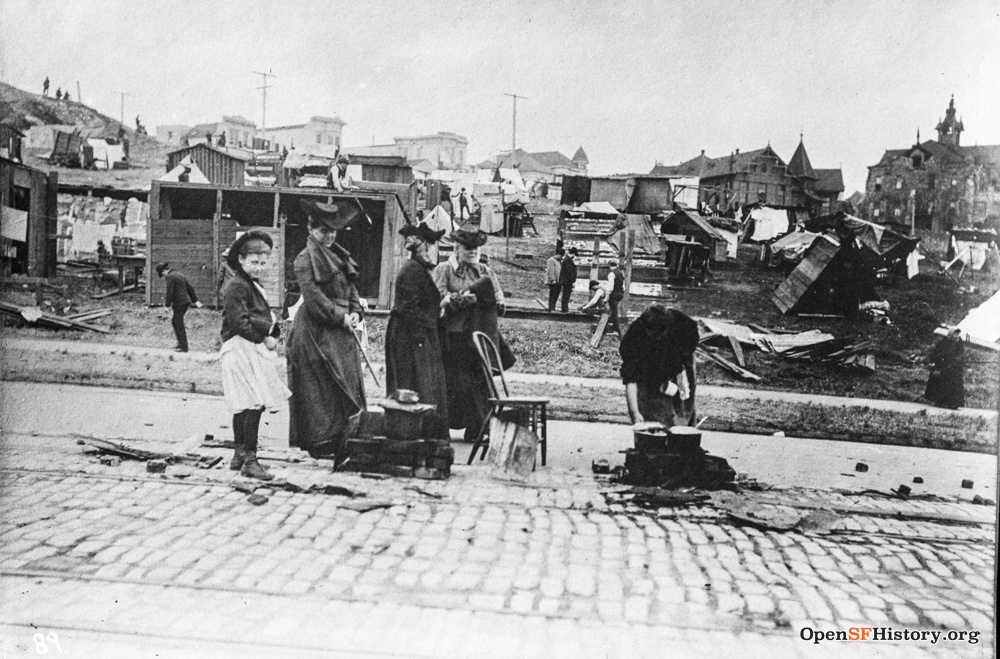
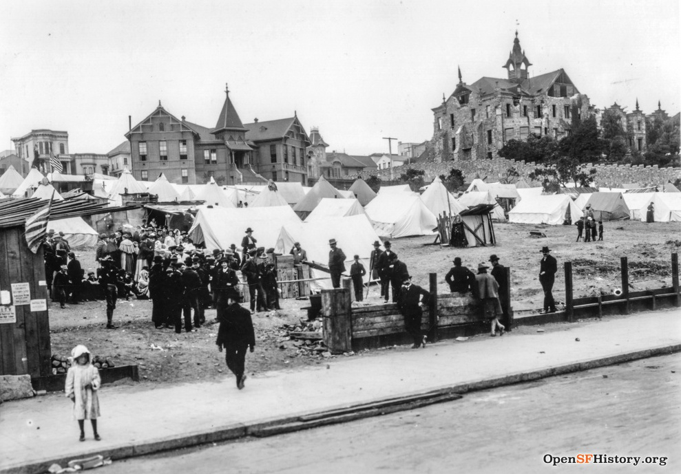
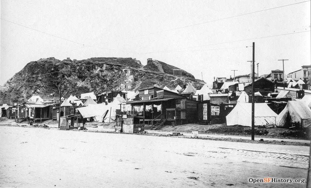
The schoolyard block and the Market/Buchanan/Hermann triangle open space became home to refugees after the fire. The postcard at left was mailed 5/07/1906, about three weeks after the earthquake. It shows many street kitchen stoves on Hermann, as in the photo at center. In the picture at right, no tents show over the wall around the orphanage block, so I'm guessing no refugees were housed on that block.
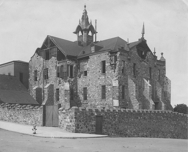
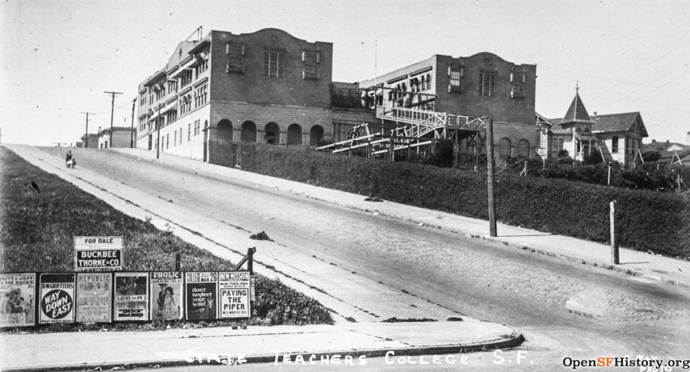
Damaged by the earthquake but left untouched by the fire, the orphanage was repaired and remained in use until its demolition in 1919. The 1908 photo at center shows the new post-earthquake building at the corner of Hermann/Buchanan housing the San Francisco Normal School, later called San Francisco State Teacher's College, with the ruins of old City Hall still standing two years after the earthquake/fire. At right, in 1920: the orphanage school still stands just north of the College and a billboard advertises D.W. Griffith's big hit Way Down East at the Curran.
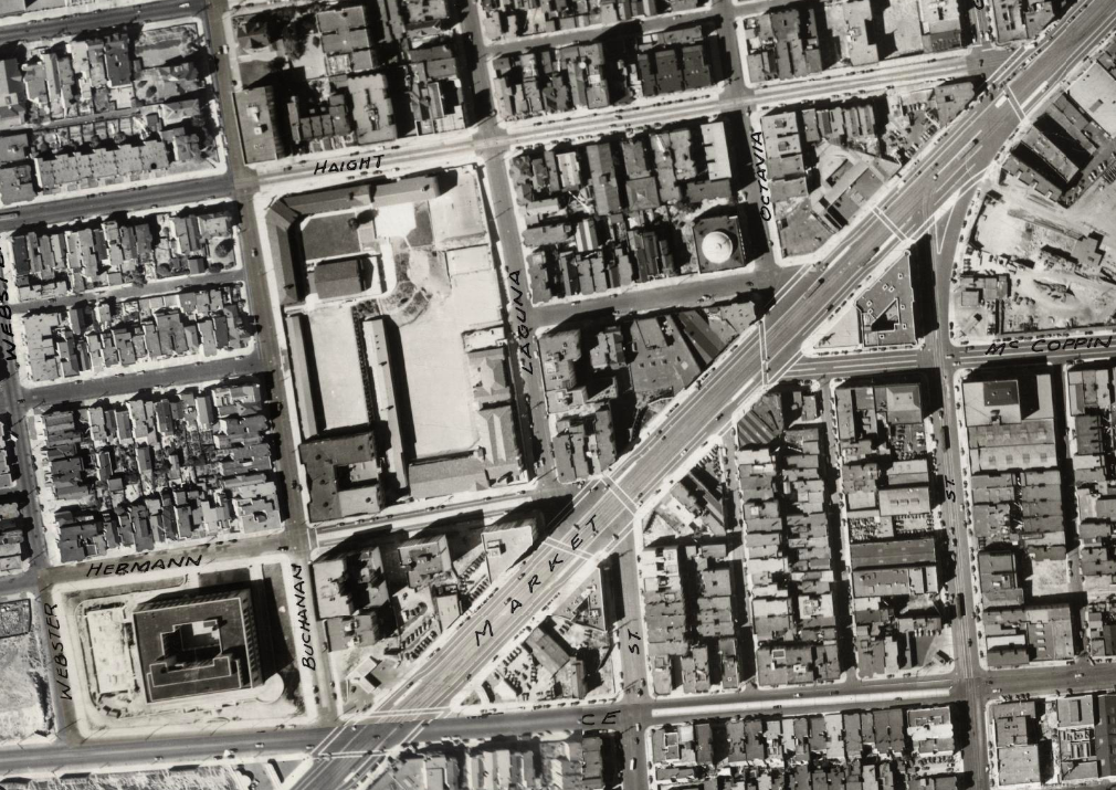
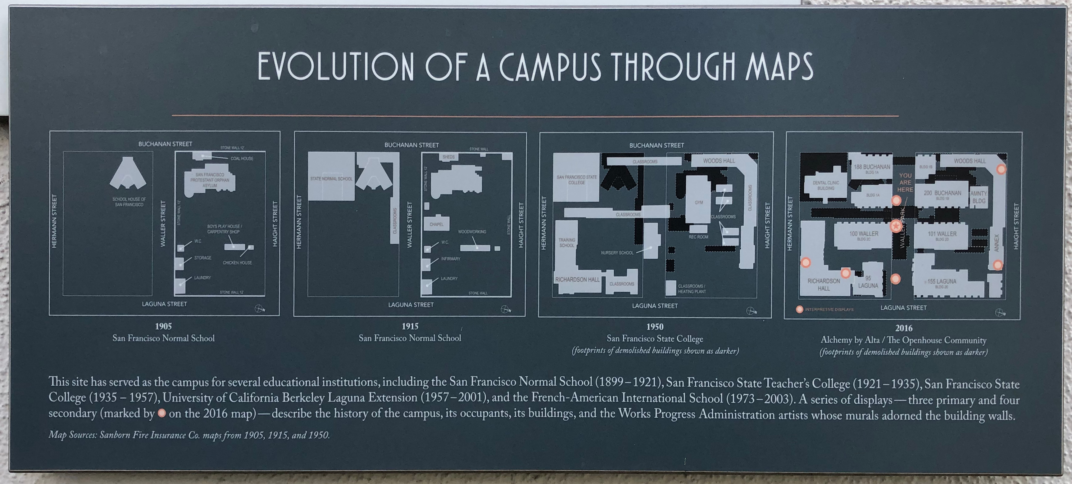
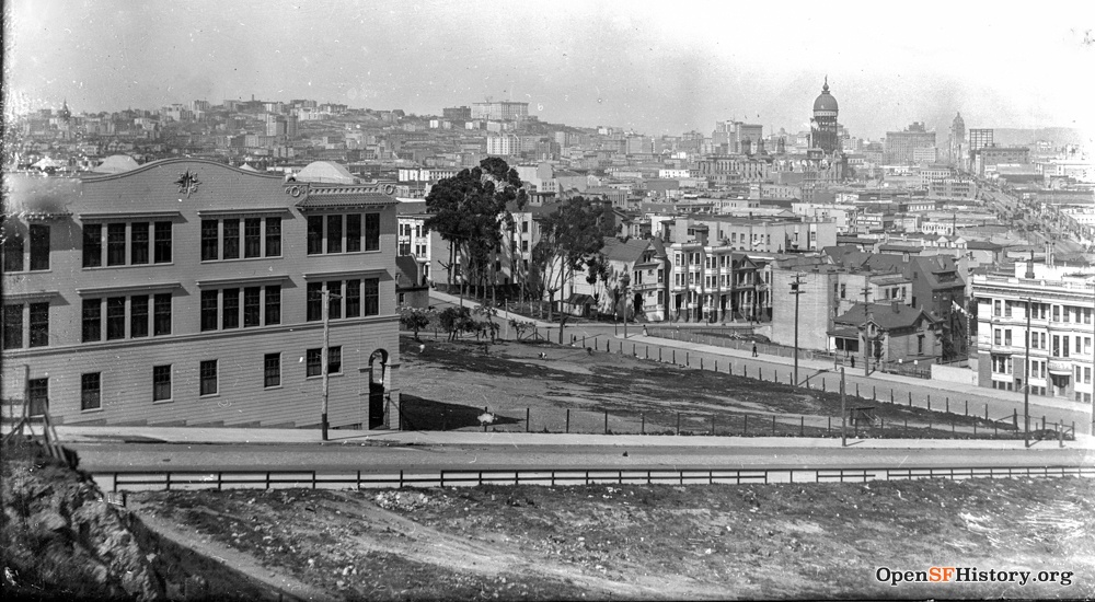
The Society became the San Francisco Protestant Orphanage Society in 1920 and opened a new campus on Vincente in 1924. The amazing 1939 Ryker aerial survey shows the new Mint and new San Francisco State Teacher's College buildings on the orphanage site. The college later became San Francisco State College (now San Francisco State University) and relocated to Lake Merced in the early 1950s. The buildings served as UC Berkeley Extension division until 2003. Today (in 2020) a sign shows the evolution of buildings on the site but gets it wrong: in 1905 the San Francisco Normal School was on Powell Street, not here.

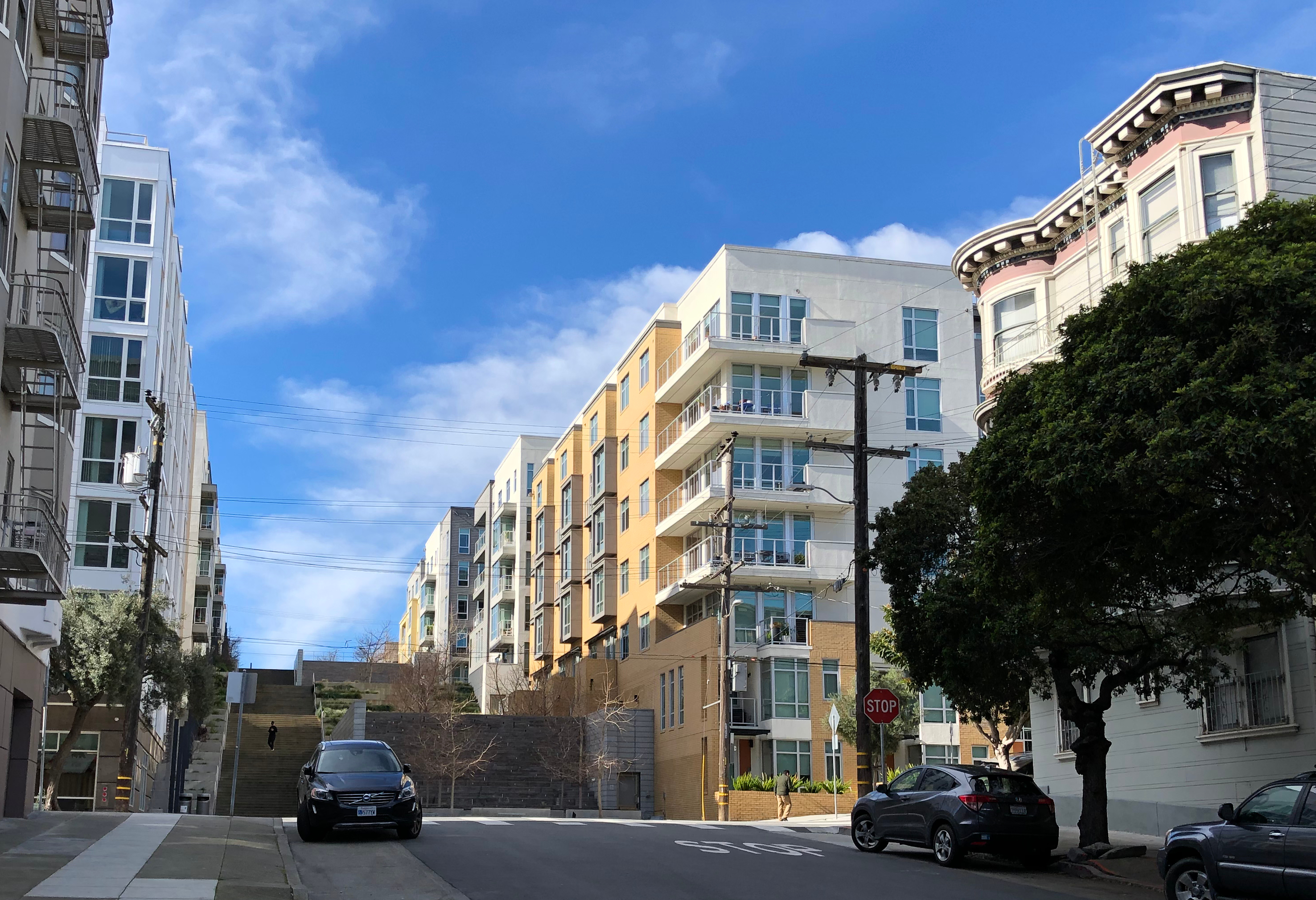

Two of the Teacher's College buildings (Richardson Hall and Woods Hall) remain in 2020, now joined by dense new housing surrounding Waller Park, an urban minipark consisting largely of uninviting concrete stairs and stone walls. In stark contrast, the lovely turreted Victorian at 80/82 Waller (clearly visible in most of the 1906 photos above) now sports a delightful paint job, and its neighbors down Waller remain largely unchanged.